Log in
All resources
Create a design
47 Free Artworks of 1721 Maps
maps in the rijksmuseum amsterdam
map of amsterdam by julius milheuser after daniël stalpaert, 1662
julius milheuser
covens en mortier
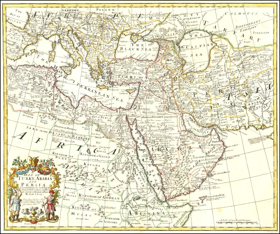
a description of the east, and some other countries (1743) knapton
bibliothèque nationale de france
internet archive document gri 33125009339611
etchings in the rijksmuseum amsterdam
lawrence h. slaughter collection of english maps, charts, globes, books and atlases
1721 maps of north america
carte de france by guillaume delisle (1721)
philippe buache
kaart van het baljuwschap kennemerland
maps in the rijksmuseum amsterdam
old maps of the ottoman empire
old maps of iran
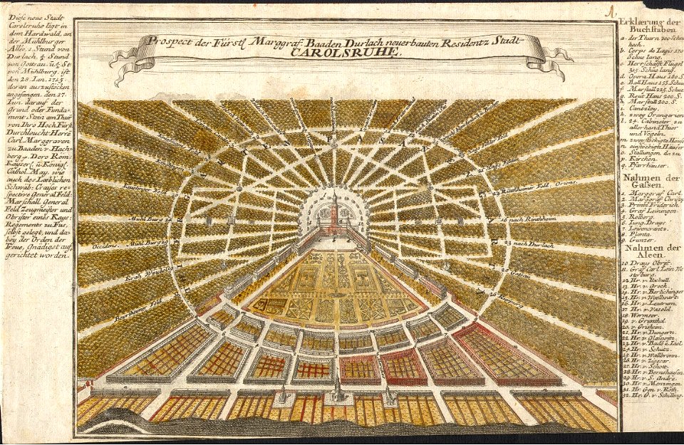
karlsruhe palace
gabriel bodenehr
lawrence h. slaughter collection of english maps, charts, globes, books and atlases
nypl lionel pincus and princess firyal map division
historisk atlas (stockholm, norstedt & söner, 1880)
maps of the history of scandinavia
lawrence h. slaughter collection of english maps, charts, globes, books and atlases
covens en mortier
lawrence h. slaughter collection of english maps, charts, globes, books and atlases
covens en mortier
maps in the library of congress
1721 maps
maps in the amsterdam museum
covens en mortier
maps of paris from the david rumsey historical map collection
map of paris by jouvin de rochefort (boutier 133)
old maps of hugli-chuchura
chinsurah
eran laor cartographic collection
romeyn de hooghe
bibliothèque nationale de france
maps by jakob van der schley
maps in the rijksmuseum amsterdam
18th-century maps showing history
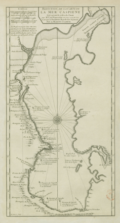
map of the caspian sea by guillaume delisle (1720s)
maps by gerard valck
18th-century maps of the caspian sea
claude auguste berey
maps by pieter mortier
indochina
18th-century maps of korea
nouvel atlas de la chine
map collection of leibniz-institut für länderkunde
1720s maps of the iberian peninsula
eran laor cartographic collection
baroque
maps of the iberian peninsula by guillaume delisle
maps in the rijksmuseum amsterdam
nouvel atlas de la chine
claas condet
danubius pannonico-mysicus
a description of the east, and some other countries (1743) knapton
old maps of turkey
a description of the east, and some other countries (1743) knapton
rococo
maps of the west-indische compagnie
1747
a description of the east, and some other countries (1743) knapton
18th-century maps of the aegean sea
maps in the rijksmuseum amsterdam
maps by carolus allard
maps in the rijksmuseum amsterdam
jacob van geelkercken
maps in the rijksmuseum amsterdam
maps by frederick de wit
maps in the rijksmuseum amsterdam
maps by frederick de wit
a description of the east, and some other countries (1743) knapton
cartouche (cartography)
a description of the east, and some other countries (1743) knapton
18th-century maps of the sea of marmara
etchings in the rijksmuseum amsterdam
johannes van den aveelen
etchings in the rijksmuseum amsterdam
johannes van den aveelen
etchings in the rijksmuseum amsterdam
maps in the rijksmuseum amsterdam
etchings in the rijksmuseum amsterdam
johannes van den aveelen
map of amsterdam by julius milheuser after daniël stalpaert, 1662
maps in the rijksmuseum amsterdam
map of amsterdam by julius milheuser after daniël stalpaert, 1662
maps in the rijksmuseum amsterdam
map of amsterdam by julius milheuser after daniël stalpaert, 1662
maps in the rijksmuseum amsterdam
map of amsterdam by julius milheuser after daniël stalpaert, 1662
maps in the rijksmuseum amsterdam
map of amsterdam by julius milheuser after daniël stalpaert, 1662
maps in the rijksmuseum amsterdam
prints of cartouches in the rijksmuseum amsterdam
maps in the rijksmuseum amsterdam
prints of cartouches in the rijksmuseum amsterdam
maps in the rijksmuseum amsterdam
maps in the rijksmuseum amsterdam
hendrik de leth
prints by pieter sluyter in the rijksmuseum amsterdam
maps in the rijksmuseum amsterdam
1 - 47 of 47
/ 1