Log in
All resources
Create a design
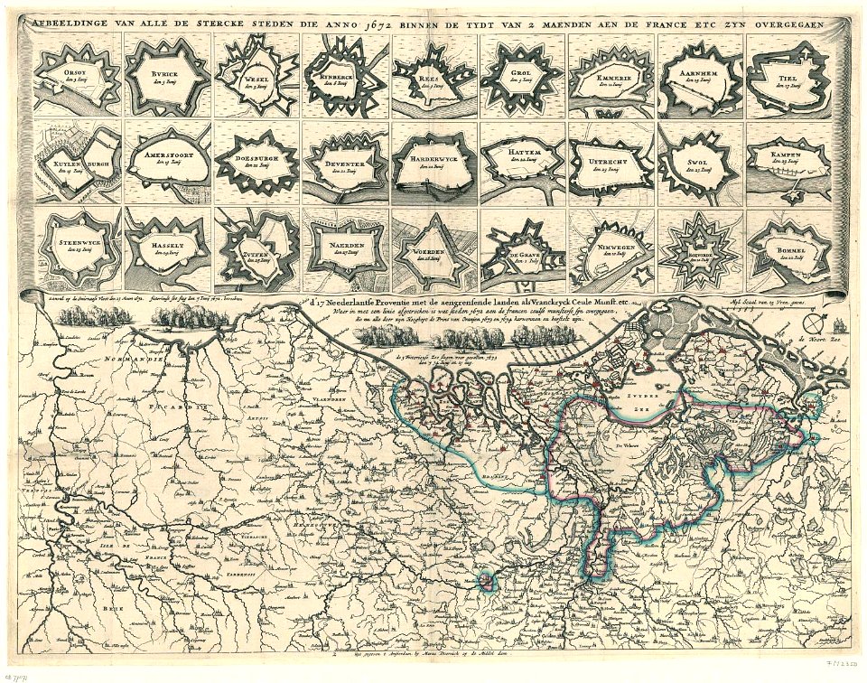
109 Free Artworks of 1672 Maps
maps in the rijksmuseum amsterdam
johannes janssonius waasbergen
prints of cartouches in the rijksmuseum amsterdam
map of paris by jouvin de rochefort (boutier 112)
maps by willem and johannes blaeu
bibliothèque nationale de france
18th-century maps of paris
prints by gaspar bouttats in the rijksmuseum amsterdam
gaspar bouttats
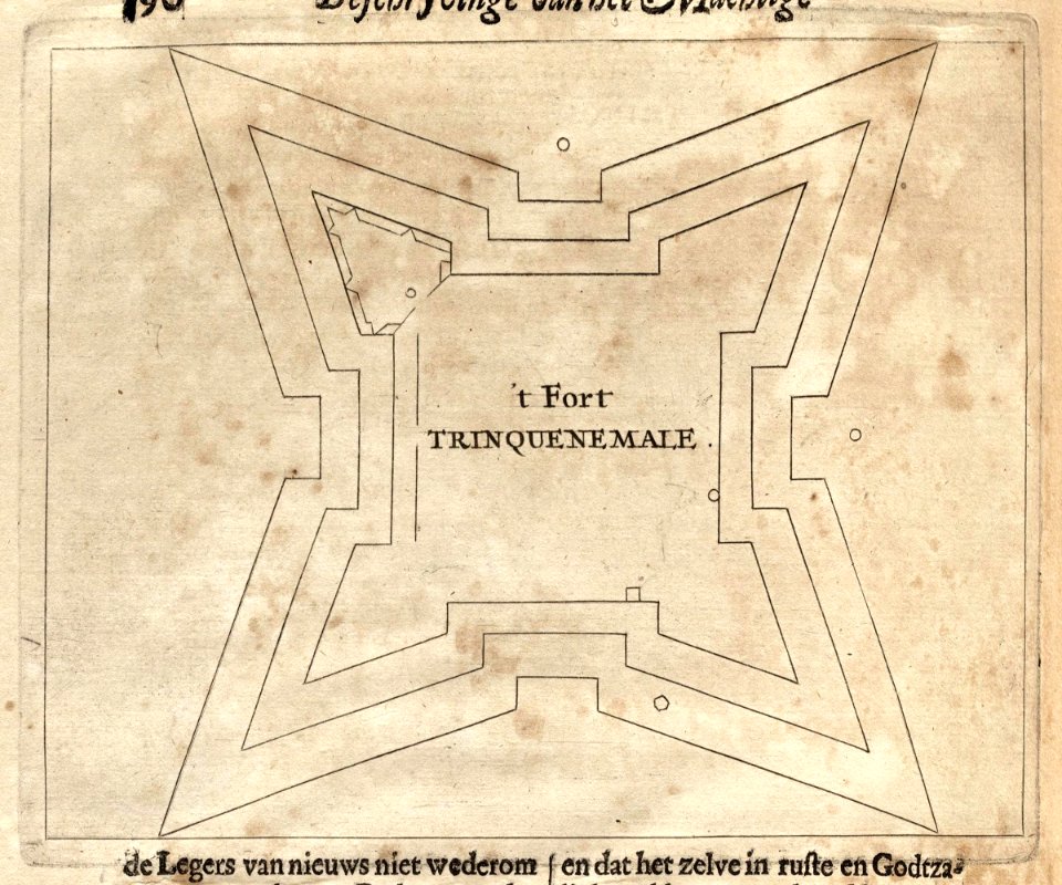
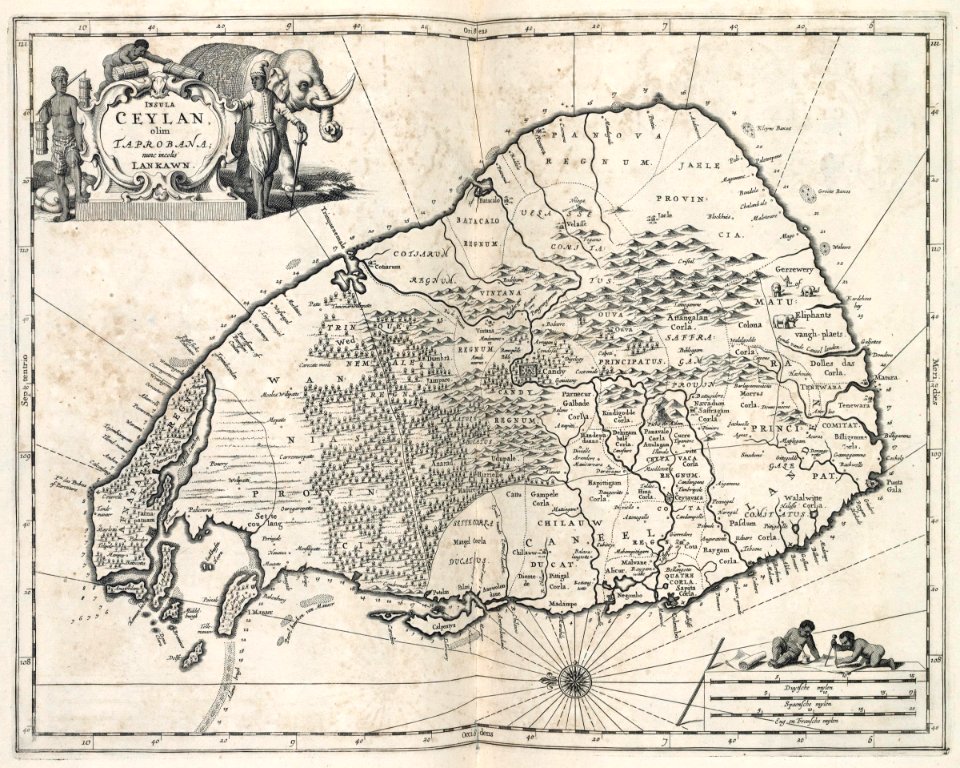
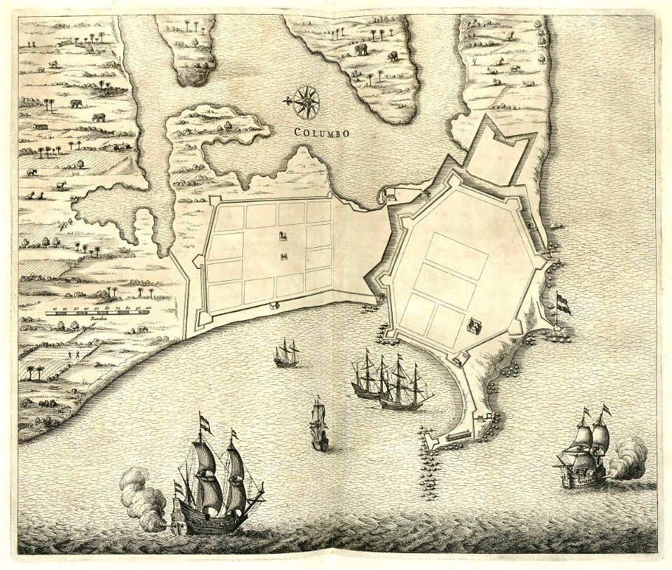
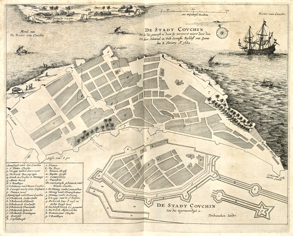
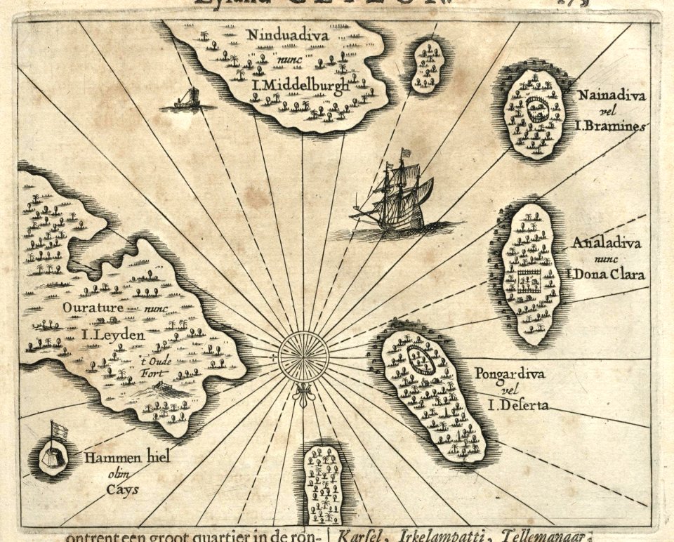
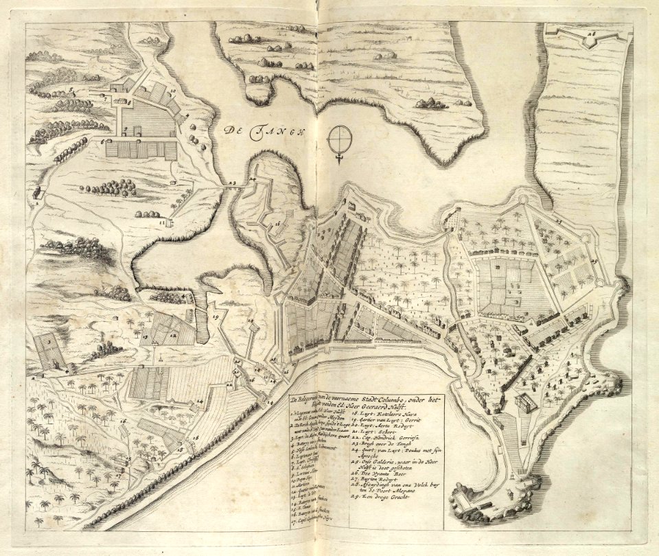
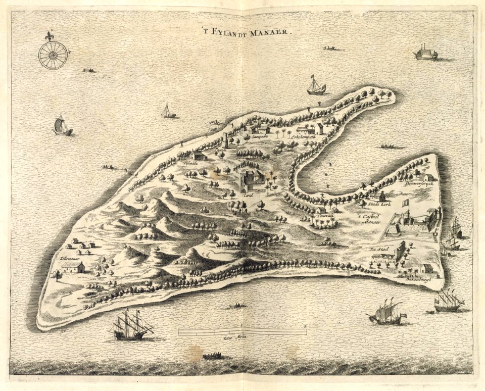
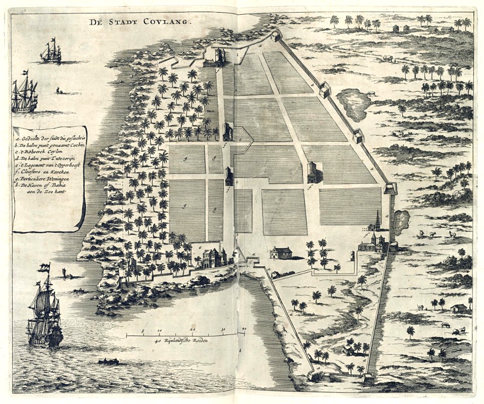
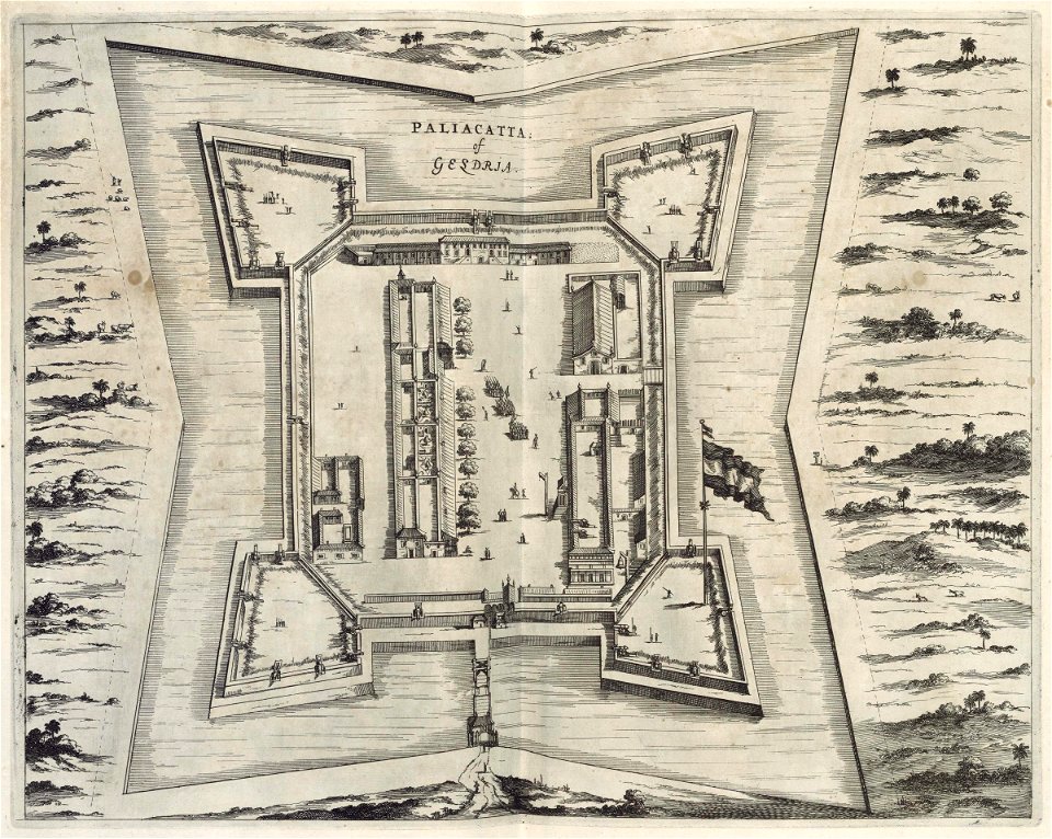
maps of the dutch east india company - sri lanka
matthäus merian
1672 maps
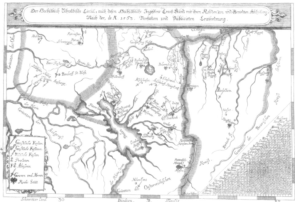
1670s maps of baden-württemberg
1672 maps
büderich (wesel)
netherlands
netherlands
the hague
old maps of the dutch east india company
1672
johannes janssonius waasbergen
1672
johannes janssonius waasbergen
1672
johannes janssonius waasbergen
1672
earth
maps
maps of the dutch east india company - india
1672
maps of the dutch east india company - india
1672
johannes janssonius waasbergen
1672
illustration
maps
johannes janssonius waasbergen
1672
maps of the dutch east india company - india
1672
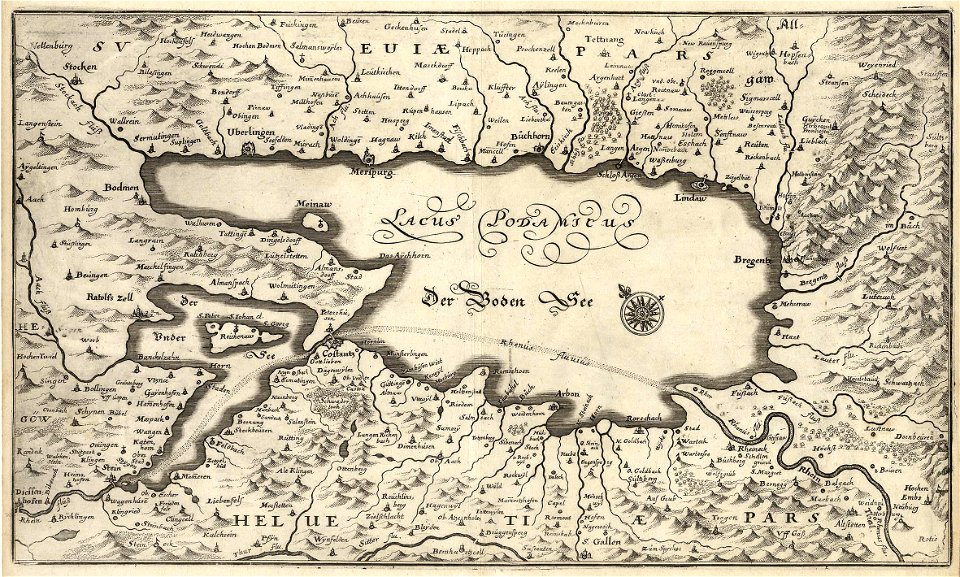
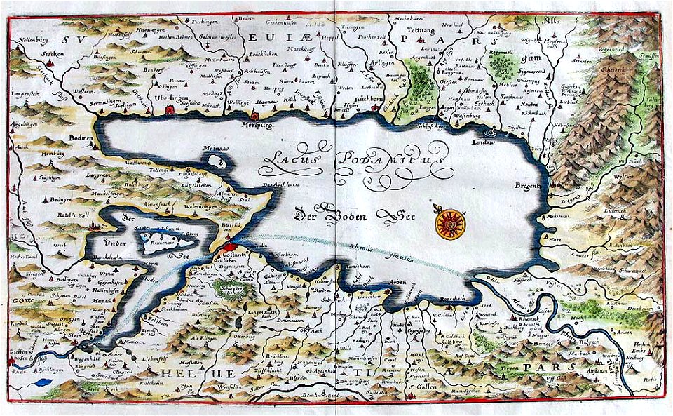
naval war on lake constance
old maps of lake constance
maps of the dutch east india company - india
1672
johannes janssonius waasbergen
1672
maps by willem and johannes blaeu
ravelins
maps of the dutch east india company - india
1672
conflicts in 1672
netherlands
johannes janssonius waasbergen
1672
johannes janssonius waasbergen
1672
johannes janssonius waasbergen
1672
maps of the dutch east india company - india
1672
pulicat
1672
engravings by matthäus merian
1672 engravings
salzkammergut in upper austria
maps of salzkammergut
17th-century paintings of soldiers
lambert de hondt (ii)
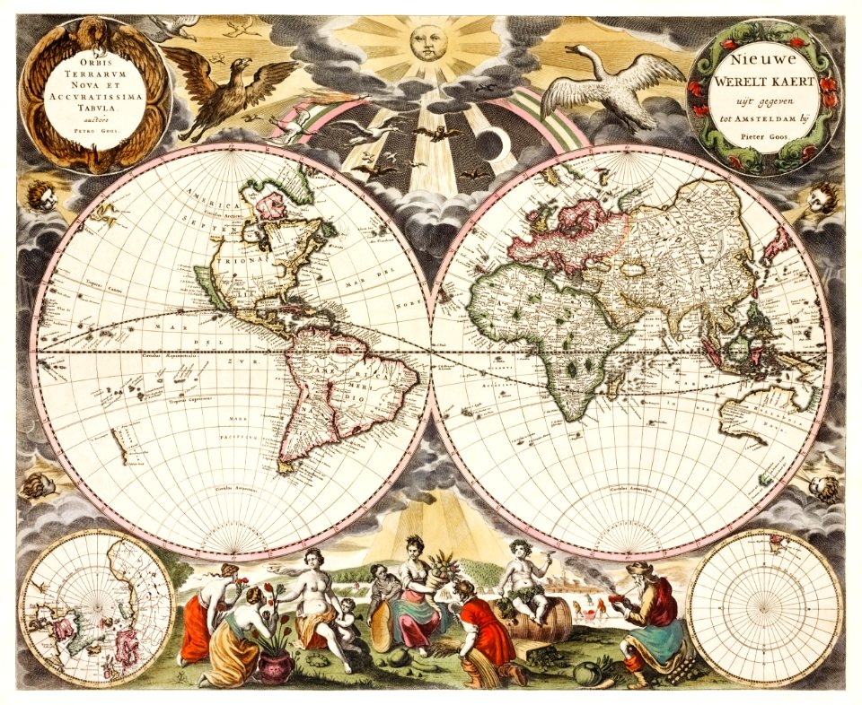
1690s maps of the world
copper engravings
old maps of lake constance
baroque
historical images of the jardin du luxembourg
maps of jardin du luxembourg
atlas des anciens plans de paris by imprimerie nationale, 1900 from the david rumsey historical map collection
maps of paris from the david rumsey historical map collection
atlas des anciens plans de paris by imprimerie nationale, 1900 from the david rumsey historical map collection
maps of paris from the david rumsey historical map collection
atlas des anciens plans de paris by imprimerie nationale, 1900 from the david rumsey historical map collection
maps of paris from the david rumsey historical map collection
atlas des anciens plans de paris by imprimerie nationale, 1900 from the david rumsey historical map collection
maps of paris from the david rumsey historical map collection
atlas des anciens plans de paris by imprimerie nationale, 1900 from the david rumsey historical map collection
maps of paris from the david rumsey historical map collection
map of paris by jouvin de rochefort (boutier 112)
pont de grammont
map of paris by jouvin de rochefort (boutier 112)
maps of paris by françois de la pointe
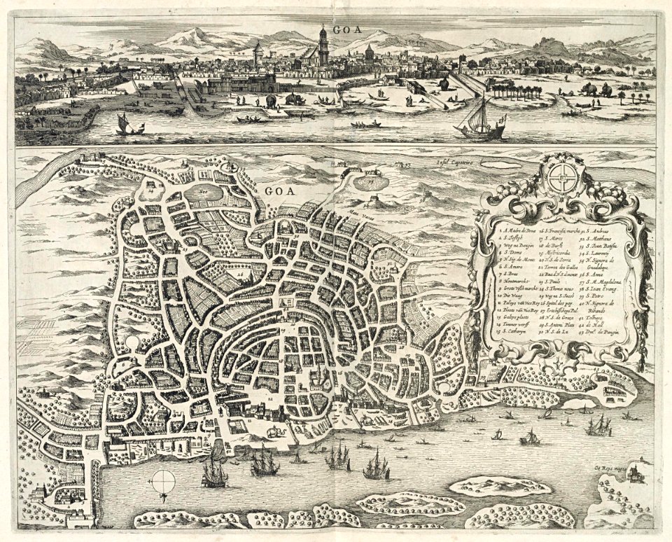
maps of goa by linschoten
philippus baldaeus
atlas des anciens plans de paris by imprimerie nationale, 1880 from bhvp
map of paris by jouvin de rochefort (boutier 112)
atlas des anciens plans de paris by imprimerie nationale, 1880 from bhvp
proletarian literature
atlas des anciens plans de paris by imprimerie nationale, 1880 from bhvp
18th-century maps of paris
atlas des anciens plans de paris by imprimerie nationale, 1880 from bhvp
map of paris by jouvin de rochefort (boutier 112)
atlas des anciens plans de paris by imprimerie nationale, 1880 from bhvp
map of paris by jouvin de rochefort (boutier 112)
map of paris by jouvin de rochefort (boutier 112)
historical images of hôtel de ville de paris
map of paris by jouvin de rochefort (boutier 112)
maps of paris by françois de la pointe
maps of the course of the rhine by guillaume sanson
bibliothèque nationale de france
maps of the dutch east india company - bengal
maps of the dutch east india company - india
sanson maps of the netherlands
1670s maps of the netherlands
maps of italy by sanson and cordier
bibliothèque nationale de france
maps of italy by sanson and cordier
bibliothèque nationale de france
prints of cartouches in the rijksmuseum amsterdam
maps in the rijksmuseum amsterdam
maps in the rijksmuseum amsterdam
groningen (city) in art
prints by gaspar bouttats in the rijksmuseum amsterdam
old maps of woerden
nypl collection of atlases, gazetteers, guidebooks and other books
nypl lionel pincus and princess firyal map division
maps in the rijksmuseum amsterdam
old maps of schenkenschanz
l'espagne divisée by guillaume sanson
1670s maps of the iberian peninsula
maps of the course of the rhine by guillaume sanson
bibliothèque nationale de france
maps of the course of the rhine by guillaume sanson
bibliothèque nationale de france
estats de l'empire des turqs en europe subdivisés suivant l'estendüe des beglerbeglicz ou gouvernements dans lesquels sont marquées les résidences des sangiacz qui en dépendent . tirés de plusieurs... - btv1b53081211n
guillaume sanson
estats de l'empire des turqs en europe subdivisés suivant l'estendüe des beglerbeglicz ou gouvernements dans lesquels sont marquées les résidences des sangiacz qui en dépendent . tirés de plusieurs... - btv1b53081211n
guillaume sanson
eran laor cartographic collection
jacob van meurs
prints of cartouches in the rijksmuseum amsterdam
maps in the rijksmuseum amsterdam
maps in the rijksmuseum amsterdam
maps by willem and johannes blaeu
prints of cartouches in the rijksmuseum amsterdam
maps in the rijksmuseum amsterdam
prints of cartouches in the rijksmuseum amsterdam
maps in the rijksmuseum amsterdam
prints of cartouches in the rijksmuseum amsterdam
maps in the rijksmuseum amsterdam
prints of cartouches in the rijksmuseum amsterdam
history prints in the rijksmuseum amsterdam
prints by gaspar bouttats in the rijksmuseum amsterdam
gaspar bouttats
maps in the rijksmuseum amsterdam
maps by willem and johannes blaeu
prints by gaspar bouttats in the rijksmuseum amsterdam
gaspar bouttats
prints by gaspar bouttats in the rijksmuseum amsterdam
gaspar bouttats
maps in the rijksmuseum amsterdam
maps by willem and johannes blaeu
prints by gaspar bouttats in the rijksmuseum amsterdam
gaspar bouttats
romeyn de hooghe
1672 etchings
etchings in the rijksmuseum amsterdam
isaac sorious
pieter verbiest (ii)
maps from gallica
prints by gaspar bouttats in the rijksmuseum amsterdam
gaspar bouttats
prints by gaspar bouttats in the rijksmuseum amsterdam
vestingwerken coevorden
maps of haarlem by braun & hogenberg
bibliothèque nationale de france
prints by gaspar bouttats in the rijksmuseum amsterdam
vestingwerken coevorden
etchings in the rijksmuseum amsterdam
isaac sorious
maps in the rijksmuseum amsterdam
maps by willem and johannes blaeu
collection drawings and prints from het utrechts archief
utrecht (city) in art
collection drawings and prints from het utrechts archief
utrecht (city) in art
maps in the rijksmuseum amsterdam
maps by carolus allard
pacific ocean in art
ships on maps
prints by gaspar bouttats in the rijksmuseum amsterdam
gaspar bouttats
maps in the rijksmuseum amsterdam
groningen (city) in art
maps in the rijksmuseum amsterdam
maps by willem and johannes blaeu
maps in the rijksmuseum amsterdam
maps by willem and johannes blaeu
prints by romeyn de hooghe in the rijksmuseum amsterdam
old maps of breda, netherlands
maps of fossa eugeniana by willem and johannes blaeu
maps of fossa eugeniana
maps in the rijksmuseum amsterdam
groningen (city) in art
flemish 17th-century prints in the rijksmuseum amsterdam
maps of fossa eugeniana by willem and johannes blaeu
prints by romeyn de hooghe in the rijksmuseum amsterdam
history prints in the rijksmuseum amsterdam
maps in the rijksmuseum amsterdam
maps by willem and johannes blaeu
prints by romeyn de hooghe in the rijksmuseum amsterdam
history prints in the rijksmuseum amsterdam
prints by giovanni battista falda in the rijksmuseum amsterdam
maps in the rijksmuseum amsterdam
1 - 100 of 109
Next page
/ 2