Log in
All resources
Create a design
27,441 Free Images of Maps
flag
bibliothèque nationale de france
victor levasseur - maps of france
fonds ancely - bibliothèque municipale de toulouse - maps
steel engraving print
bibliothèques de toulouse
raymond bonheur
baroque
maps by gerard valck
maps by pieter schenk (i)
chicago and the midwest, newberry library
1931 maps
maps
flag
maps
flag
maps
flag
maps
flag
maps
flag
maps
flag
maps
flag
maps
flag
maps
flag
maps
flag
maps
flag
maps
flag
maps
flag
maps
flag
maps
flag
maps
flag
maps
flag
maps
flag
maps
flag
maps
flag
maps
flag
maps
flag
maps
flag
maps
flag
maps
flag
maps
flag
maps
flag
maps
flag
maps
flag
maps
flag
maps
flag
maps
flag
maps
flag
maps
flag
maps
flag
maps
flag
maps
flag
maps
flag
maps
flag
maps
flag
maps
flag
maps
flag
maps
flag
maps
flag
maps
flag
maps
flag
maps
flag
maps
flag
maps
flag
maps
flag
maps
flag
maps
flag
maps
flag
maps
flag
maps
flag
maps
flag
maps
flag
maps
flag
maps
flag
maps
flag
maps
flag
clipping mask
africa map
amérique méridionale (1748, d'anville)
rococo
19th century maps of haute-vienne
coats of arms of haute-vienne
coats of arms of nîmes
baroque
coats of arms of chalon-sur-saône
alphonse de lamartine
coats of arms of saint-brieuc
old maps of côtes-d'armor
19th-century maps of indre-et-loire
coats of arms of tours
victor levasseur - maps of france
pierre-jean david
maps from university of amsterdam special collections
atlas der neederlanden
maps made in the 17th century
lazio
maps of haarlemmerhout
old maps of haarlem
the columbian magazine (1789)
pre-raphaelite brotherhood
terrae sanctae tabula by guillaume delisle (1763)
eran laor cartographic collection
maps by jakob van der schley
history of hormuz island
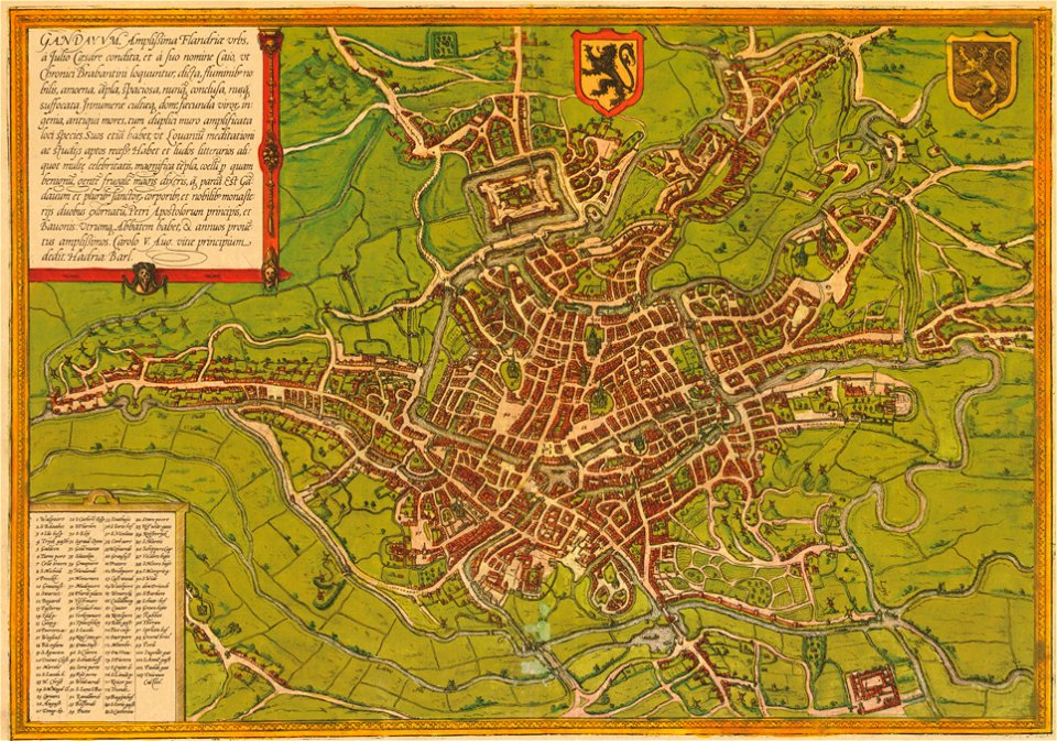
maps of ghent by braun & hogenberg
liber qvartvs contrafactur vnd beschreibung von den vornembsten stten der welt (zzk 0.32)
patrimonium 2 (project)
map of the circle of austria by sanson
1700s maps of austria
map of the circle of the rhineland by sanson
1730s maps of rhineland-palatinate
map of the circle of austria by sanson
1700s maps of austria
old maps of the republic of genoa
maps by alexis-hubert jaillot
eran laor cartographic collection
jean-claude richard de saint-non
maps in the library of congress
plaine de grenelle
maps of ports and fortresses of the mediterranean by marco boschini (1651)
old maps of souda (crete)
1640s maps of greece
marco boschini
18th-century maps of the iberian peninsula
maps in the rijksmuseum amsterdam
munich in the 17th century
baroque
nicolas-andré monsiau
neoclassicism
nova & accurata ducatuum slesvici et holsatiae tabula
2008 iowa election maps
demographics of iowa
17th-century maps of nord (department)
maps by gerard valck
17th-century maps of mexico
maps by gerard valck
maps by willem and johannes blaeu
siege of 's-hertogenbosch
maps of strasbourg in the 17th century
baroque
eran laor cartographic collection
guillaume sanson
maps of south asia by mercator-hondius
considérations géographiques et physiques sur les nouvelles découvertes au nord de la grande mer
old maps of the yellow sea
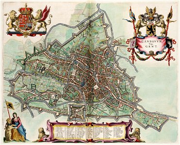
map of ghent by jan blaeu
atlas van loon
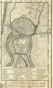
1698 map of evesché de meaux
6801 - 6900 of 27,441
Next page
/ 275