Log in
All resources
Create a design
27,441 Free Images of Maps
maps from university of amsterdam special collections
atlas der neederlanden
atlas der neederlanden deel v: holland 4. noord-holland
abraham deur
hendrik de leth
copperplate print
special collections of the university of amsterdam
map - museu antônio parreiras
antônio parreiras
maps in the library of congress
miniature speed atlas (1627) pieter van den keere
1620s maps of wales
miniature speed atlas (1627) pieter van den keere
old county maps of lancashire
maps of spain by tomas lopez
1769 maps of spain
old maps of the balearic islands
maps of spain by tomas lopez
den danske hærs historie til nutiden og den norske hærs historie indtil 1814
maps from the mechanical curator collection
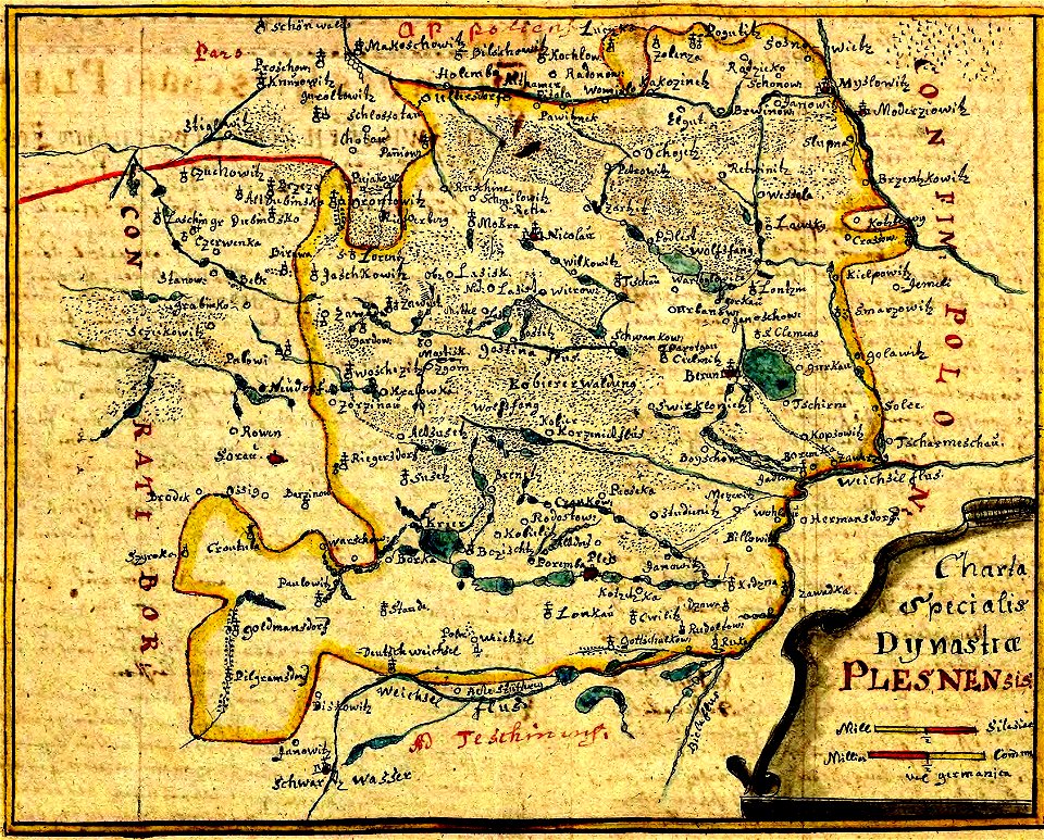
history of pszczyna
old maps of poland
maps of linden (hannover)
lindener berg (hannover)
cartes de franz schrader
maps of algeria by theme
maps of the province of ávila
1769 maps of spain
illustrations to jules verne's works
old maps of greece
media from regionaal archief alkmaar
maps of barsingerhorn
broomfields, bradford
robert dawson
guide joanne normandie-1912
1912 maps of france
palatinatus rheni (merian)
baroque
david rumsey historical map collection
1790s maps of the holy roman empire
1800s maps of czechia
maps by john cary
ducatus sleswicum sive justia australis
maps by johannes mejer
maps from the mechanical curator collection
australia (1873) by booth
maps from the earth and its inhabitants, vol. xii
africa in the 1890s
maps in the library of congress
1721 maps
maps in the library of congress
1791 maps
eran laor cartographic collection
romeyn de hooghe
greco-turkish war (1897)
hellenic army officers
brazilian paintings in the museu antônio parreiras
antônio rafael pinto bandeira
print room of the university of antwerp
plattegrond van antwerpen
paintings by antônio parreiras in the museu antônio parreiras
paintings of animals by antônio parreiras
paintings by antônio parreiras in the museu antônio parreiras
landscape paintings by antônio parreiras
paintings by antônio parreiras in the museu antônio parreiras
paintings of seascapes by antônio parreiras
lordship of mechelen
1645 maps of belgium
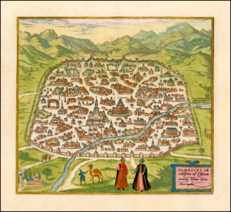
maps of damascus by braun & hogenberg
map of ghent by harrewijn
jacobus harrewijn
17th-century maps of southeast asia
maps by girolamo porro
maps by girolamo porro
1598 maps of asia
maps by willem and johannes blaeu
17th-century maps of india
maps from university of amsterdam special collections
atlas der neederlanden
maps from university of amsterdam special collections
atlas der neederlanden
maps from university of amsterdam special collections
atlas der neederlanden
maps from university of amsterdam special collections
atlas der neederlanden
maps from university of amsterdam special collections
atlas der neederlanden
maps from university of amsterdam special collections
atlas der neederlanden
maps from university of amsterdam special collections
atlas der neederlanden
maps from university of amsterdam special collections
atlas der neederlanden
maps from university of amsterdam special collections
atlas der neederlanden
maps from university of amsterdam special collections
atlas der neederlanden
maps from university of amsterdam special collections
atlas der neederlanden
maps from university of amsterdam special collections
atlas der neederlanden
maps from university of amsterdam special collections
atlas der neederlanden
maps from university of amsterdam special collections
atlas der neederlanden
maps from university of amsterdam special collections
atlas der neederlanden
maps from university of amsterdam special collections
atlas der neederlanden
old maps of île de la cité
old submaps of paris
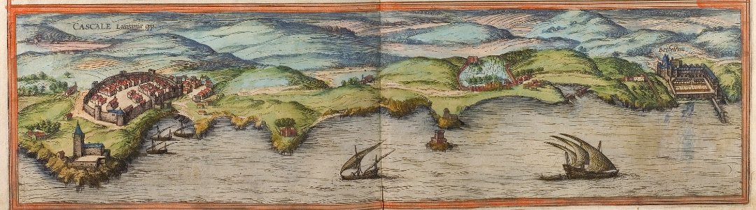
maps of cascais by braun & hogenberg
cidadela de cascais
pieter schenk (ii)
old maps of saxony
engravings of topographia braunschweig lüneburg
baroque
claes jansz. visscher (ii)
1650s maps of the world
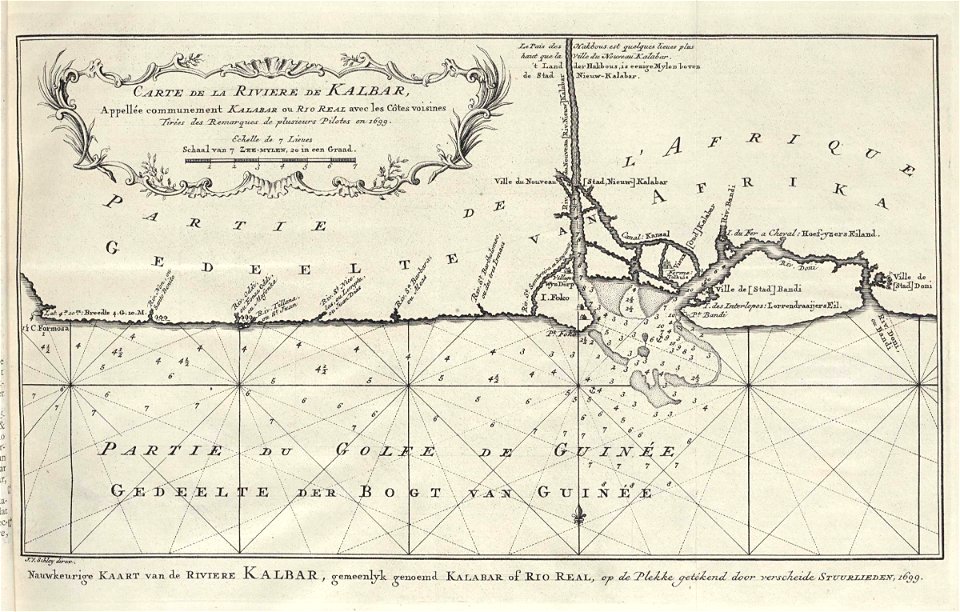
maps by jakob van der schley
1750 maps
maps by petrus schenk
1750s maps of saxony
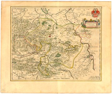
maps of the county of mansfeld
1645 maps
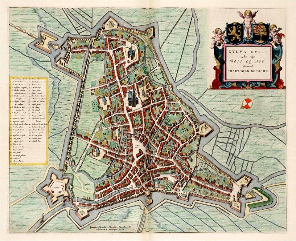
maps of 's-hertogenbosch by braun & hogenberg
atlas van loon
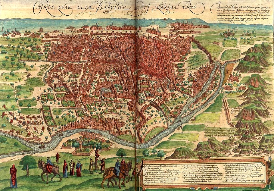
maps of ancient italy by philipp clüver
maps of ancient latium
le sénégal. la france dans l'afrique occidentale (1889)
orientalist painting
hamburgische elbkarte von melchior lorichs
historical maps of uetersen
allemagne – rhénanie-du-nord-westphalie
guillaume sanson
maps of bordeaux by braun & hogenberg
maps of nîmes by braun & hogenberg
old maps of cities in switzerland
maps of biel/bienne
maps by willem and johannes blaeu
old maps of leiden
maps of cairo by braun & hogenberg
timeline of cairo
william henry toms
henry popple
a map of the provinces of new york and new jersey, with a part of pennsylvania and the province of quebec
lawrence h. slaughter collection of english maps, charts, globes, books and atlases
a map of the provinces of new york and new jersey, with a part of pennsylvania and the province of quebec
lawrence h. slaughter collection of english maps, charts, globes, books and atlases
a map of the provinces of new york and new jersey, with a part of pennsylvania and the province of quebec
lawrence h. slaughter collection of english maps, charts, globes, books and atlases
johann christoph brotze
crossing of the düna
maps of liège by johannes blaeu - derivative files
seven collegiate churches of liège
19th-century maps of cairo
1888 in egypt
1790s maps of the world
rangaku
drawings in the museu antônio parreiras
paper and graphite
1570s maps of north rhine-westphalia
1570s maps of lower saxony
maps in the library of congress
brookside mills
turgot map of paris, kyoto university library – derivative files
historical images of palais bourbon
drawings in the museu antônio parreiras
paper and charcoal
paintings in the museu antônio parreiras
wood
topographischer atlas der schweiz
mur (dit) d'hannibal
eran laor cartographic collection
cartouches by joseph roux
drawings in the museu antônio parreiras
paper and graphite
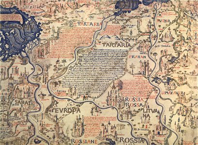
fra mauro map details
maps of isfahan
pascal coste
maps of ancona by braun & hogenberg
frans hogenberg
map of ghent by armand heins, 1911-1912
armand heins
atlas schoemaker-noord-holland, amsterdam
history of diemen
1870s maps of the caucasus
g. h. swanston
joseon dynasty
heo mok
map of paris by claes jansz. visscher - derivate files
17th-century people of paris
maps in the library of congress
1690s maps of the world
maps from the earth and its inhabitants, vol. vi
1891 maps of georgia
gemeente atlas van nederland - south holland
maps of alkemade
maps of paris by braun & hogenberg
maps of paris from paris musées
maps from the earth and its inhabitants, vol. xii
africa in the 1890s
gemeente atlas van nederland - south holland
maps of groot-ammers
maps from the earth and its inhabitants, vol. x
1890 maps of africa
maps from the earth and its inhabitants, vol. xii
africa in the 1890s
4901 - 5000 of 27,441
Next page
/ 275