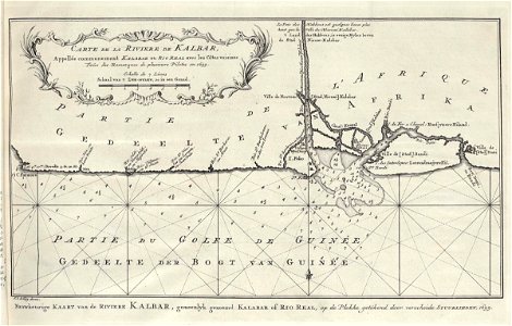
Map of the mouth of the Kalbar River, Jakob van der Schley, circa 1750
Map of the mouth of the kalbar river. Carte de la rivere de kalbar. Kaart van de riviere kalbar. Near the city of doni a flag (possibly dutch) is depicted. Date: circa 1750. Dimensions: height: 26.5 cm (10.4 in); width: 17 cm (6.6 in). Medium: engraving on paper. Collection: Koninklijke Bibliotheek. AMH-8099-KB Map of the mouth of the Kalbar River