Log in
All resources
Create a design
119 Free Images of 17th Century Maps Of The Netherlands
bibliothèque nationale de france
maps with cartouches
atlas van der hagen (volume 2)
baroque
maps by matthäus merian
matthäus merian
atlas van loon
maps by willem and johannes blaeu
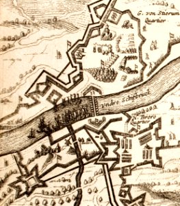
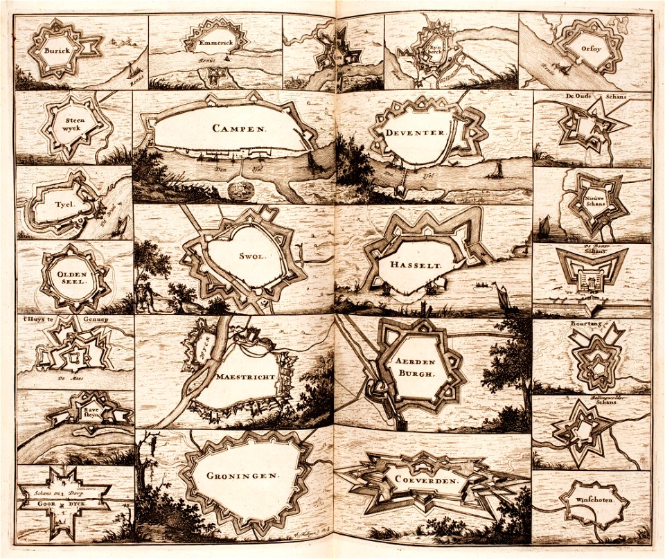
17th-century fortress plans
maps made in the 17th century
1639 maps
1670 maps
west-indische compagnie
image restoration
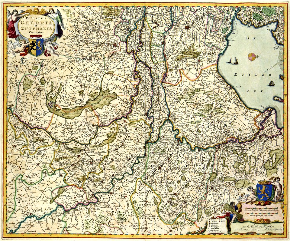
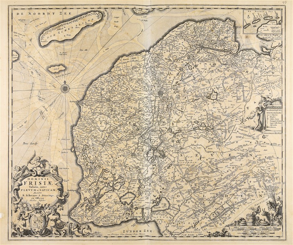
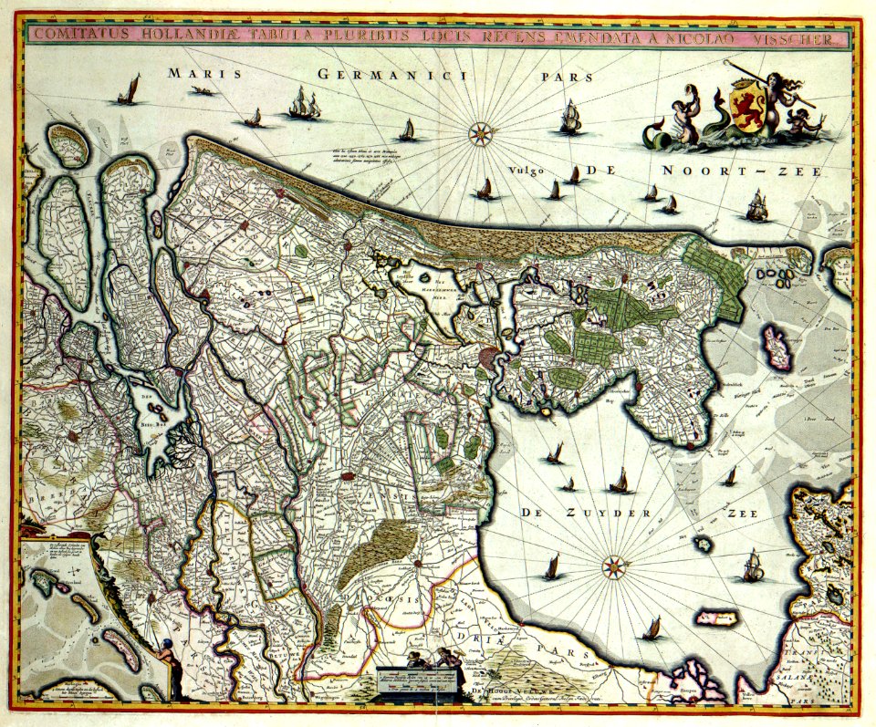
17th-century maps of the netherlands
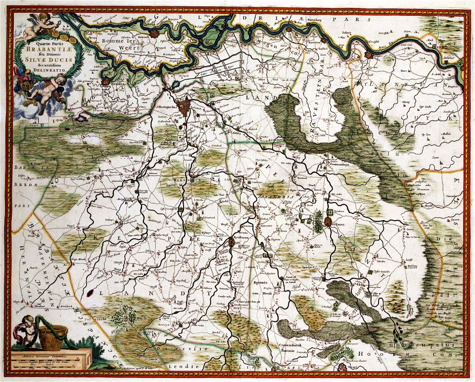
old maps of north brabant
pieter van der keere
ships on maps
maps by willem and johannes blaeu
hudson valley
printing in the netherlands
asia in the 17th century
maps of the dutch republic
nicolaes van geelkercken
büderich (wesel)
netherlands
netherlands
the hague
coat of arms of germany
1642 maps of croatia
maps with cartouches
netherlands
dutch 17th-century prints in the rijksmuseum amsterdam
netherlands
17th-century maps of the netherlands
maps with cartouches
17th-century maps of the netherlands
maps with cartouches
17th-century maps of the netherlands
maps with cartouches
prints from dankaerts historis at the peace palace library
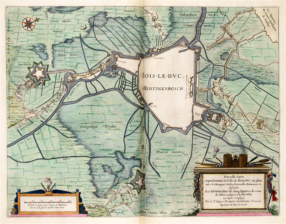
17th-century maps of maastricht
atlantis magni tomus secundus (biblioteca comunale di trento)
nicolaes visscher ii
17th-century maps of the netherlands
maps with cartouches
17th-century maps of the netherlands
maps with cartouches
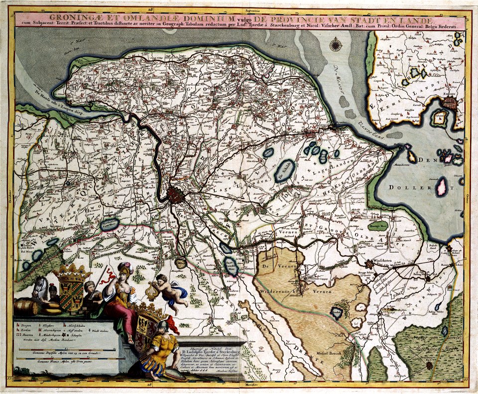
old maps of groningen (province)
maps with cartouches
maps made in the 17th century
netherlands
17th-century allegorical paintings
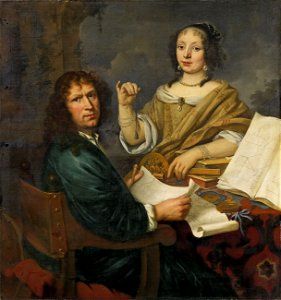
artist
maps with cartouches
atlas van der hagen
maps with cartouches
old maps of zeeland
animal shape
purmerend
floor plans of fortresses
coevorden
17th-century maps of maastricht
maastricht
topographical paintings in the amsterdam museum
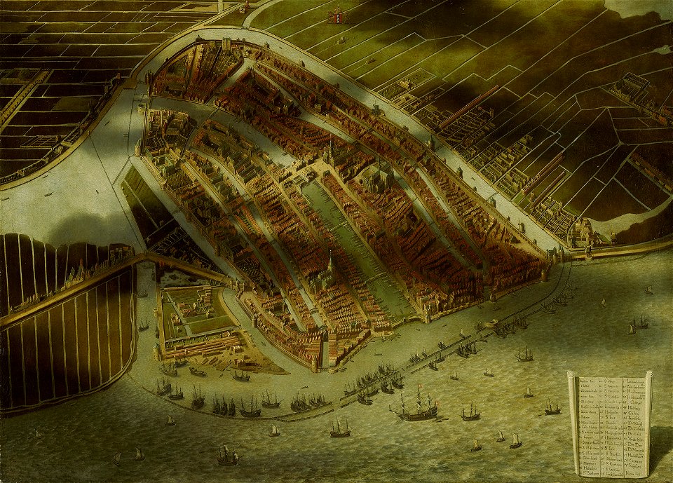
paintings of amsterdam
works by giovanni giacomo de rossi
sailing ships of the netherlands
maps by pieter schenk (i)
gerard valck
netherlands
gorredijk
works by giovanni giacomo de rossi
sailing ships of the netherlands
people with fire in art
people with dog
artworks without wikidata item
17th-century prints
17th-century fortress plans
cityscapes in art
17th-century oil paintings of standing women at full length
17th-century paintings of people with dogs
topographical paintings in the amsterdam museum
paintings of amsterdam
17th-century oil on canvas paintings in the netherlands
male fur clothing in art
maps by willem and johannes blaeu
17th-century fortress plans
17th-century maps of the netherlands
1609
old maps of the united states
copper engravings
maps of nieuwkoop
aarlanderveen
maps in the library of congress
adriaen van der donck
17th-century paintings of soldiers
lambert de hondt (ii)
nicolaas samuel crucquius
old maps of delfland
maps by pieter van der keere
maps by abraham ortelius
illustrated title pages
1645 books
maps by willem and johannes blaeu
atlas van loon
maps made in the 17th century
forts in the netherlands
maps of territories in the burgundian circle
17th-century maps of the north sea
old maps of westerwolde
maps of vlagtwedde
old maps of roermond
upper guelders
maps by pieter van der keere
maps by abraham ortelius
maps by pieter van der keere
old maps of north brabant
1645 maps of belgium
tournaisis
atlas maior, vol 4 (netherlands) - joan blaeu, 1667 - bl 114.h(star).4
1667 maps
maps of krimpenerwaard
atlas novus (blaeu)
maps made in the 17th century
old maps of drenthe
breda, netherlands in the 17th century
old maps of north brabant
maps of polders in south holland
17th-century maps of rotterdam
maps of steenbergen
fort henricus
17th-century celestial maps
bodleian maps collection
17th-century celestial maps
bodleian maps collection
koninklijk huisarchief collections
huis ter nieuwburg
maps of krimpenerwaard
atlas novus (blaeu)
old maps of leiden
baroque
maps by hendrik hondius the younger
old maps of overijssel
old maps of hindeloopen
baroque
atlas van der hagen (volume 2)
1680s maps of the netherlands
1668 maps of south america
maps by guillaume sanson
map of maastricht by willem and johannes blaeu (1649)
statenkwartier (maastricht)
cartouches by alexis-hubert jaillot
cartouches by sanson family
atlas van der hagen (volume 3)
atlas van der hagen
sanson maps of the netherlands
alexis-hubert jaillot
1600s maps of the netherlands
1609 maps of europe
17th-century maps of the netherlands
maps by pieter van der keere
17th-century maps of maastricht
baroque
maps of rotterdam by braun & hogenberg
maps of delft by braun & hogenberg
maps in the rijksmuseum amsterdam
maps by frederick de wit
17th-century maps of amsterdam
1620s maps of the netherlands
maps of amersfoort by braun & hogenberg
atlas de wit 1698
venezuela, cum parte australi novae andalusiae - btv1b53196851w
17th-century maps of venezuela
old maps of enkhuizen
baroque
old maps of zutphen
baroque
maps of the course of the rhine by guillaume sanson
bibliothèque nationale de france
maps of the course of the rhine by guillaume sanson
bibliothèque nationale de france
pieter verbiest (ii)
maps from gallica
17th-century maps of the strait of magellan
maps by willem and johannes blaeu
maps by matthäus merian
baroque
maps by matthäus merian
baroque
old maps of groningen (city)
baroque
paraguay, o prov. de rio de la plata cum regionibus adiacentibus tucuman et sta cruz de la sierra - (blaeu) - btv1b8596658x
1640s maps of south america
old maps of utrecht (city)
baroque
maps of rotterdam by berckenrode
baroque
17th-century paintings in the amsterdam museum
paintings by pieter isaacsz
1649 in maastricht
atlas beudeker
atlas van der hagen (volume 2)
atlas van der hagen
maps in the rijksmuseum amsterdam
gerard valck
utrecht (city) in the 17th century
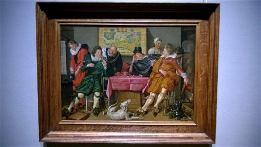
joost cornelisz. droochsloot
17th-century maps of venezuela
johannes leupenius
1 - 100 of 119
Next page
/ 2


![[Southern celestial hemisphere], 1700](https://cdn.creazilla.com/illustrations/10000701462/southern-celestial-hemisphere-1700-md.jpg)
![[Northern celestial hemisphere], 1700](https://cdn.creazilla.com/illustrations/10000985046/northern-celestial-hemisphere-1700-md.jpg)


![Paraguay, o prov. de Rio de La Plata cum regionibus adiacentibus Tucuman et Sta Cruz de la Sierra / [Blaeu], 1640s](https://cdn.creazilla.com/illustrations/10001055781/paraguay-o-prov-de-rio-de-la-plata-cum-regionibus-adiacentibus-tucuman-et-sta-cruz-de-la-sierra-blaeu-1640s-md.jpg)

![Rotterdam / [M. Merian], Matthäus Merian](https://cdn.creazilla.com/illustrations/10000529192/rotterdam-m-merian-matth-us-merian-md.jpg)


