Log in
All resources
Create a design
2,941 Free Artworks of Town Planning
drawing
digital library of university of wroclaw
civitates orbis terrarum. de praecipuis totius universi urbibus. liber secundus
baroque
dheulland map of paris
bibliothèque nationale de france
merian plan of paris
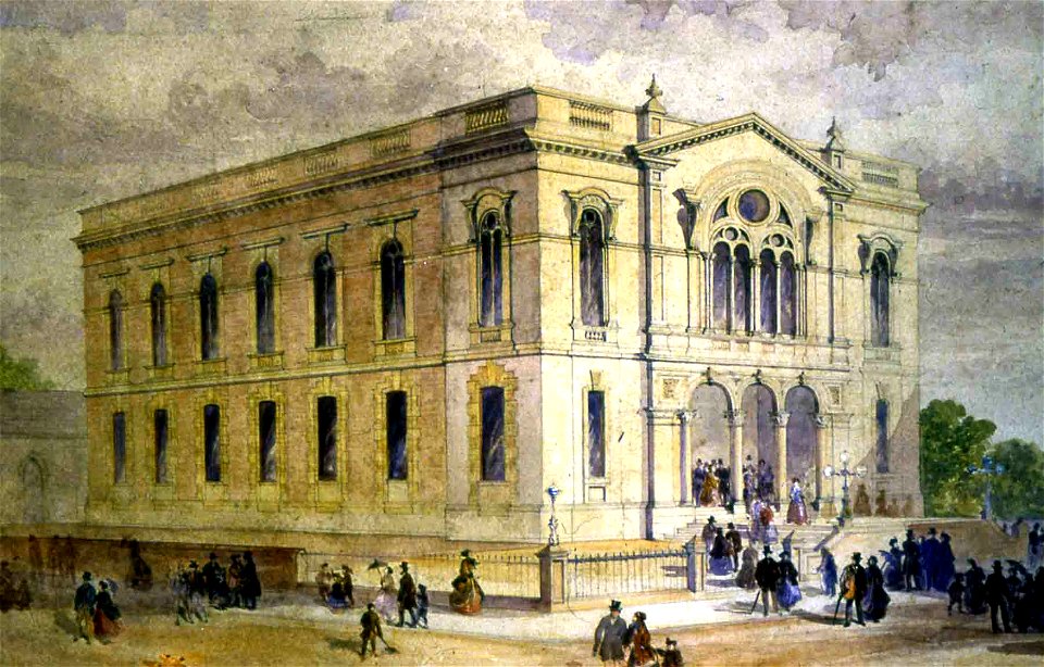
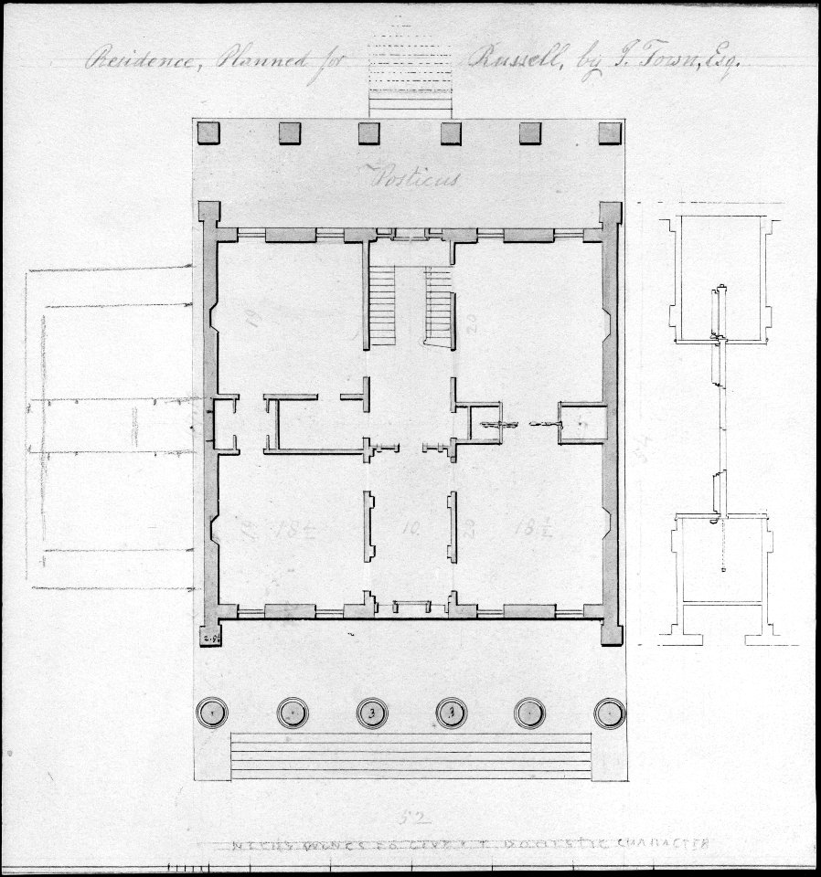
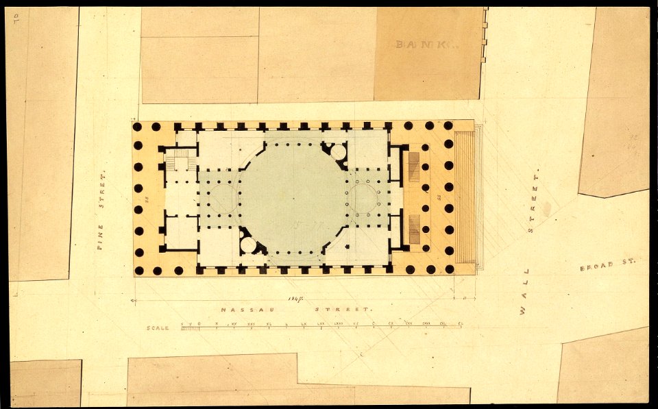
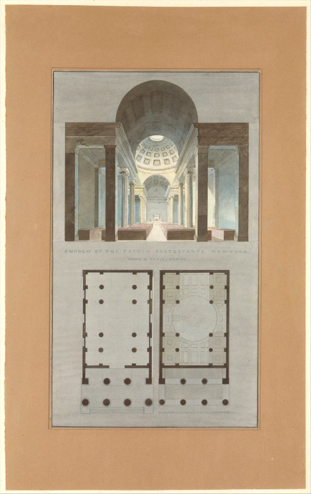
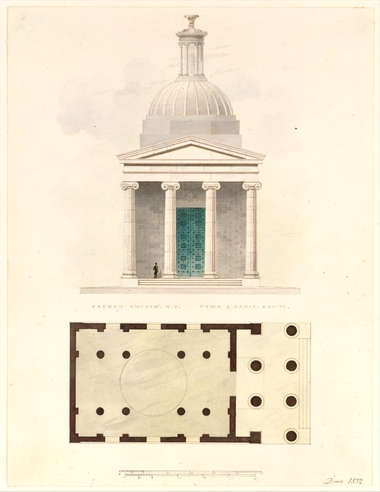
alexander jackson davis
artworks without wikidata item
artworks with known accession number
media needing categories as of 3 june 2021
media needing categories as of 3 june 2021
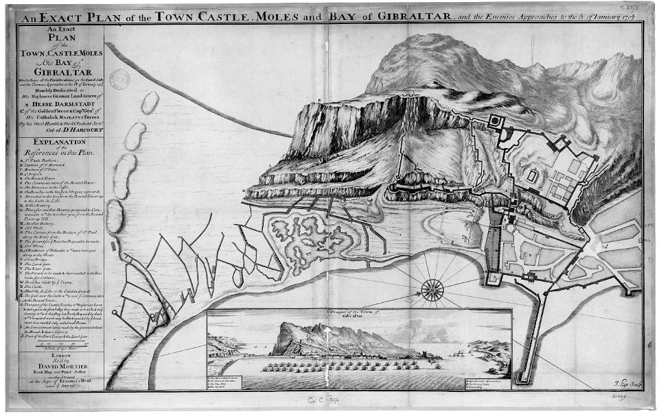
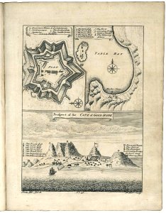
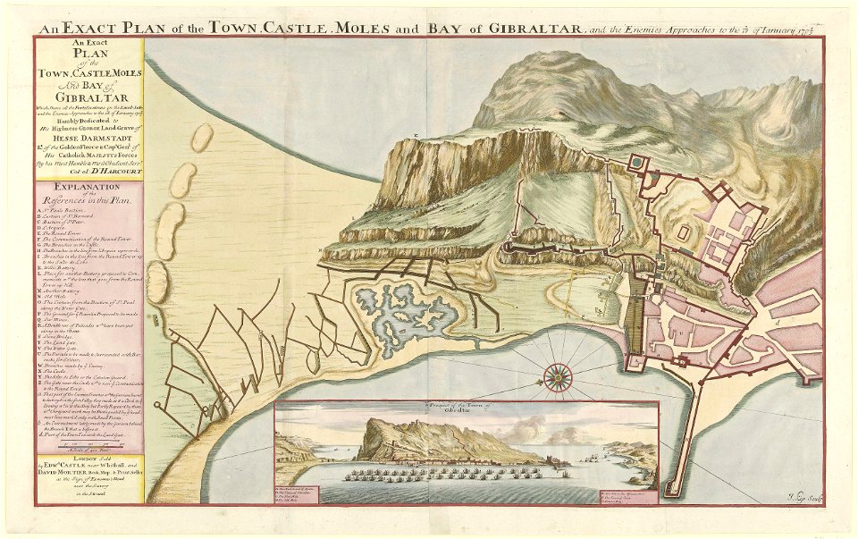
old maps of gibraltar
capture of gibraltar
cassell's illustrated history of england vol 1
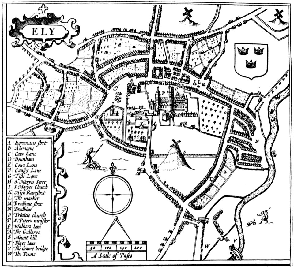
cambridgeshire
ely
methodist churches in cheshire
runcorn old town centre
science and inventions of leonardo da vinci
pencil drawing
old maps of cape town
1745
dutch 17th-century prints in the rijksmuseum amsterdam
old maps of gibraltar
artworks without wikidata item
alexander jackson davis
old maps of new york (state)
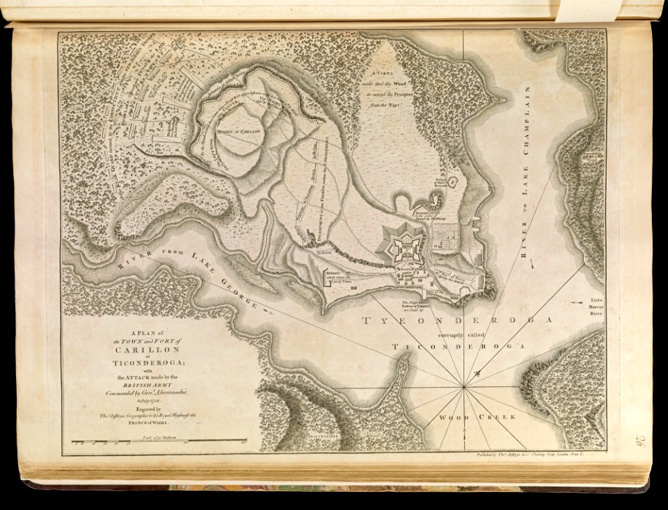
fort ticonderoga
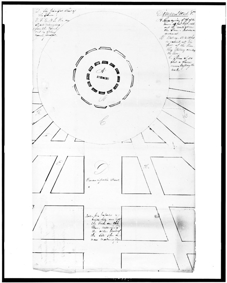
maps in the library of congress
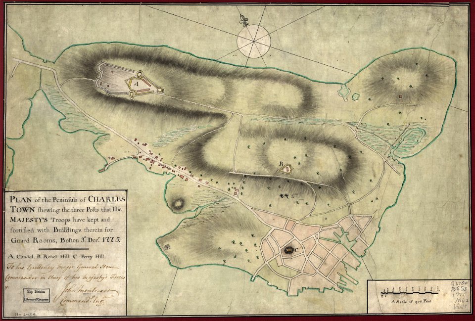
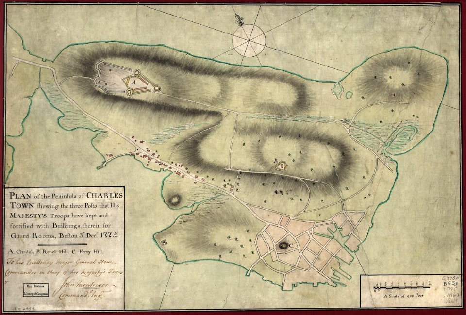
1775 maps of boston
maps in the library of congress
1775 maps of boston
artworks without wikidata item
alexander jackson davis
artworks without wikidata item
alexander jackson davis
artworks without wikidata item
alexander jackson davis
civitates orbis terrarum. de praecipuis totius universi urbibus. liber secundus
maps of tunis and la goleta by braun & hogenberg
eran laor cartographic collection
edward rooker
maps in the british museum
hitchin herts
maps of adelaide
william light
eran laor cartographic collection
louis-françois cassas
1780s maps of florida
maps of florida
erik palmstedt
tullhuset
charles william meredith van de velde
eran laor cartographic collection
stockholms rådhus
carl westman
maps of municipalities in the district of dielsdorf
historical images of regensberg zh
the crescent, birmingham
francis jukes
high renaissance,renaissance
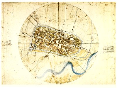
a map of imola (rcin 912284)
new town hall in mladá boleslav
drawings of theaters
landais & oberthur
maps from gallica
interior of brussels town hall
victor jamaer
turgot map of paris – derivative files
ville l'évêque (paris)
maps of paris from the university of wisconsin-milwaukee libraries
plan de roussel
narrative of a five years' expedition (1806)
romanticism,fairy painting
maps from traité de la police, bibliothèque nationale de france
third map of paris from traité de la police
church exteriors in sweden
slottskapellet, jönköping
atlas des anciens plans de paris by imprimerie nationale, 1880 from bhvp
dheulland map of paris
plan c (rotterdam)
baroque
ancien musée-bibliothèque de grenoble - interior
atlas des anciens plans de paris by imprimerie nationale, 1880 from bhvp
dheulland map of paris
old maps of portobelo
maps by emanuel bowen
atlas des anciens plans de paris by imprimerie nationale, 1880 from bhvp
dheulland map of paris
maps of paris from bibliothèque nationale de france
baroque
maps of paris from bibliothèque nationale de france
baroque
jan hus memorial (old town square)
vilém amort
engravings by matthäus merian
baroque
maps of paris from bibliothèque nationale de france
baroque
views of old town from letná
romantic music
maps in the library of congress
1750s maps of the americas
dutch baroque architecture
old town hall in amsterdam
etchings of buildings
samuel blesendorf
maps of wissembourg by braun & hogenberg
maps of rouffach by braun & hogenberg
maps of aire-sur-la-lys city walls
old maps of aire-sur-la-lys
kaufhaus mannheim
charles eugène perron
old maps of rijeka
maps from the bibliothèque historique de la ville de paris
baroque
a history of the town and parish of nantwich, or wich-malbank, in the county palatine of chester (1883)
st mary's church nantwich
frank leslie's illustrated newspaper, 1890
esopus, new york
maps from the bibliothèque historique de la ville de paris
baroque
historical images of bieraście
erik dahlbergh
kaufhaus mannheim
plan c (rotterdam)
baroque
kaufhaus mannheim
civitates orbis terrarum. de praecipuis totius universi urbibus. liber secundus
maps of algiers by braun & hogenberg
map of maastricht by willem and johannes blaeu (1649)
atlas beudeker
paintings in the royal museum of fine arts antwerp
paintings by nicaise de keyser
köllnischer fischmarkt (berlin-mitte)
cöllnisches rathaus
a history of the town and parish of nantwich, or wich-malbank, in the county palatine of chester (1883)
floor plans of churches in england
atlas des anciens plans de paris by imprimerie nationale, 1900 from the david rumsey historical map collection
maps of paris from the david rumsey historical map collection
atlas des anciens plans de paris by imprimerie nationale, 1900 from the david rumsey historical map collection
maps of paris from the david rumsey historical map collection
atlas des anciens plans de paris by imprimerie nationale, 1900 from the david rumsey historical map collection
maps of paris from the david rumsey historical map collection
atlas des anciens plans de paris by imprimerie nationale, 1900 from the david rumsey historical map collection
maps of paris from the david rumsey historical map collection
maps of hamburg by braun & hogenberg
bodleian maps collection
rhodes colossus
segu geschichte
atlas - voyage pittoresque à l'île-de-france, au cap de bonne-espérance et à l'île de ténériffe (1812) by milbert
cape town in the 1800s
rue du collège (charleroi)
charleroi on maps of popp
civitates orbis terrarum. de praecipuis totius universi urbibus. liber secundus
maps of kleve by braun & hogenberg
civitates orbis terrarum. de praecipuis totius universi urbibus. liber secundus
maps of neuss by braun & hogenberg
civitates orbis terrarum. de praecipuis totius universi urbibus. liber secundus
maps of wissembourg by braun & hogenberg
omar the tentmaker (play)
the town crier, 1915
maps by jakob van der schley
old maps of southeast asia
civitates orbis terrarum. de praecipuis totius universi urbibus. liber secundus
maps of emmerich by braun & hogenberg
civitates orbis terrarum. de praecipuis totius universi urbibus. liber secundus
maps of pozzuoli by braun & hogenberg
civitates orbis terrarum. de praecipuis totius universi urbibus. liber secundus
maps of kleve by braun & hogenberg
palais rothschild (bockenheimer landstraße)
bockenheimer landstraße (frankfurt am main)
civitates orbis terrarum. urbium praecipuarum totius mundi. liber quartus
maps of malmö by braun & hogenberg
civitates orbis terrarum. urbium praecipuarum totius mundi. liber quartus
maps of lund by braun & hogenberg
male conductors from the united states
the town crier, 1915
civitates orbis terrarum. de praecipuis totius universi urbibus. liber secundus
drawing
civitates orbis terrarum. de praecipuis totius universi urbibus. liber secundus
drawing
civitates orbis terrarum. de praecipuis totius universi urbibus. liber secundus
drawing
civitates orbis terrarum. de praecipuis totius universi urbibus. liber secundus
drawing
civitates orbis terrarum. de praecipuis totius universi urbibus. liber secundus
drawing
civitates orbis terrarum. de praecipuis totius universi urbibus. liber secundus
drawing
civitates orbis terrarum. de praecipuis totius universi urbibus. liber secundus
drawing
civitates orbis terrarum. de praecipuis totius universi urbibus. liber secundus
drawing
civitates orbis terrarum. de praecipuis totius universi urbibus. liber secundus
drawing
civitates orbis terrarum. de praecipuis totius universi urbibus. liber secundus
drawing
civitates orbis terrarum. de praecipuis totius universi urbibus. liber secundus
drawing
civitates orbis terrarum. de praecipuis totius universi urbibus. liber secundus
drawing
1 - 100 of 2,941
Next page
/ 30


![Third plan of the city of Paris, its extent and the towns which surrounded it under the reign of Louis the Young VII of the name [Digitized still image] / By MLCDLM, Antoine Coquart](https://cdn.creazilla.com/illustrations/10000255194/third-plan-of-the-city-of-paris-its-extent-and-the-towns-which-surrounded-it-under-the-reign-of-louis-the-young-vii-of-the-name-digitized-still-image-by-mlcdlm-antoine-coquart-sm.webp)


![The plan of the city, town, university and suburbs of Paris, with a description of its antiquity and singularities: large print in two plates: [print], 1615](https://cdn.creazilla.com/illustrations/10000327205/the-plan-of-the-city-town-university-and-suburbs-of-paris-with-a-description-of-its-antiquity-and-singularities-large-print-in-two-plates-print-1615-sm.webp)
![The plan of the city, town, university and suburbs of Paris, with a description of its antiquity and singularities: large print in two plates: [print], 1615](https://cdn.creazilla.com/illustrations/10001117523/the-plan-of-the-city-town-university-and-suburbs-of-paris-with-a-description-of-its-antiquity-and-singularities-large-print-in-two-plates-print-1615-sm.webp)


![The plan of the city, town, university and suburbs of Paris, with a description of its antiquity and singularities: large print in two plates: [print], 1615](https://cdn.creazilla.com/illustrations/10000839032/the-plan-of-the-city-town-university-and-suburbs-of-paris-with-a-description-of-its-antiquity-and-singularities-large-print-in-two-plates-print-1615-md.jpg)


![[Map of Hamburg as Georg Braun and Franz Hogenberg's Hamburgum], 1572](https://cdn.creazilla.com/illustrations/10000270249/map-of-hamburg-as-georg-braun-and-franz-hogenbergs-hamburgum-1572-md.jpg)