Log in
All resources
Create a design
103 Free Artworks of Topographic Maps Of France
bibliothèque nationale de france
topographic map of france, 1864
lemercier & cie.
topographisch, oeconomisch und militaerische charte von mecklenburg, schwerin und ratzeburg
topographisch, oeconomisch und militaerische charte des herzogthums mecklenburg schwerin and des fürstenthums ratzeburg - schmettau
tranquillo mollo
mappa geographica novissima regni hungariae, - divisi in suos comitatus cum districtibus jazygum et cumanorum banatus temesiensis ejusque districtuum nec non regnorum croatiae sclavoniae dalmatiae magni... - btv1b532332906
cartes de franz schrader
franz schrader
maps from gallica
17th-century paintings of soldiers
lambert de hondt (ii)
architectonographie des théâtres de paris
maps of paris in the 1830s
topographic map of france, 1864
lemercier & cie.
topographic map of france, 1864
lemercier & cie.
topographic map of france, 1864
lemercier & cie.
topographic map of france, 1864
lemercier & cie.
topographic map of france, 1864
lemercier & cie.
topographic map of france, 1864
lemercier & cie.
topographic map of france, 1864
lemercier & cie.
topographic map of france, 1864
lemercier & cie.
topographic map of france, 1864
lemercier & cie.
topographic map of france, 1864
lemercier & cie.
topographic map of france, 1864
lemercier & cie.
topographic map of france, 1864
lemercier & cie.
topographic map of france, 1864
lemercier & cie.
topographic map of france, 1864
lemercier & cie.
topographic map of france, 1864
lemercier & cie.
topographic map of france, 1864
lemercier & cie.
topographic map of france, 1864
lemercier & cie.
topographic map of france, 1864
lemercier & cie.
topographic map of france, 1864
lemercier & cie.
topographic map of france, 1864
lemercier & cie.
topographic map of france, 1864
lemercier & cie.
topographic map of france, 1864
lemercier & cie.
topographic map of france, 1864
lemercier & cie.
topographic map of france, 1864
lemercier & cie.
topographic map of france, 1864
lemercier & cie.
topographic map of france, 1864
lemercier & cie.
topographic map of france, 1864
lemercier & cie.
topographic map of france, 1864
lemercier & cie.
topographic map of france, 1864
lemercier & cie.
topographic map of france, 1864
lemercier & cie.
topographic map of france, 1864
lemercier & cie.
topographic map of france, 1864
lemercier & cie.
topographic map of france, 1864
lemercier & cie.
topographic map of france, 1864
lemercier & cie.
19th-century maps of seine-et-marne
maps of the forest of fontainebleau
maps of mountains of cantal
cartes de franz schrader
architectonographie des théâtres de paris
maps of paris in the 1830s
old maps of the strait of gibraltar
1762 maps of spain
old maps of former departments of france
maps from gallica
old maps of former departments of france
maps from gallica
mappa geographica novissima regni hungariae, - divisi in suos comitatus cum districtibus jazygum et cumanorum banatus temesiensis ejusque districtuum nec non regnorum croatiae sclavoniae dalmatiae magni... - btv1b532332906
tranquillo mollo
mappa geographica novissima regni hungariae, - divisi in suos comitatus cum districtibus jazygum et cumanorum banatus temesiensis ejusque districtuum nec non regnorum croatiae sclavoniae dalmatiae magni... - btv1b532332906
tranquillo mollo
mappa geographica novissima regni hungariae, - divisi in suos comitatus cum districtibus jazygum et cumanorum banatus temesiensis ejusque districtuum nec non regnorum croatiae sclavoniae dalmatiae magni... - btv1b532332906
tranquillo mollo
mappa geographica novissima regni hungariae, - divisi in suos comitatus cum districtibus jazygum et cumanorum banatus temesiensis ejusque districtuum nec non regnorum croatiae sclavoniae dalmatiae magni... - btv1b532332906
tranquillo mollo
mappa geographica novissima regni hungariae, - divisi in suos comitatus cum districtibus jazygum et cumanorum banatus temesiensis ejusque districtuum nec non regnorum croatiae sclavoniae dalmatiae magni... - btv1b532332906
tranquillo mollo
mappa geographica novissima regni hungariae, - divisi in suos comitatus cum districtibus jazygum et cumanorum banatus temesiensis ejusque districtuum nec non regnorum croatiae sclavoniae dalmatiae magni... - btv1b532332906
tranquillo mollo
mappa geographica novissima regni hungariae, - divisi in suos comitatus cum districtibus jazygum et cumanorum banatus temesiensis ejusque districtuum nec non regnorum croatiae sclavoniae dalmatiae magni... - btv1b532332906
tranquillo mollo
mappa geographica novissima regni hungariae, - divisi in suos comitatus cum districtibus jazygum et cumanorum banatus temesiensis ejusque districtuum nec non regnorum croatiae sclavoniae dalmatiae magni... - btv1b532332906
tranquillo mollo
mappa geographica novissima regni hungariae, - divisi in suos comitatus cum districtibus jazygum et cumanorum banatus temesiensis ejusque districtuum nec non regnorum croatiae sclavoniae dalmatiae magni... - btv1b532332906
tranquillo mollo
mappa geographica novissima regni hungariae, - divisi in suos comitatus cum districtibus jazygum et cumanorum banatus temesiensis ejusque districtuum nec non regnorum croatiae sclavoniae dalmatiae magni... - btv1b532332906
tranquillo mollo
mappa geographica novissima regni hungariae, - divisi in suos comitatus cum districtibus jazygum et cumanorum banatus temesiensis ejusque districtuum nec non regnorum croatiae sclavoniae dalmatiae magni... - btv1b532332906
tranquillo mollo
cartes de franz schrader
gavarnie
landais & oberthur
maps from gallica
barcelona in the 1800s
maps by juan lopez
landais & oberthur
maps from gallica
maps of county armagh
1760s maps of ireland
maps by juan lopez
1835 maps of spain
istanbul in the 1780s
maps by tomas lopez
bibliothèque nationale de france
noviciat des jésuites (paris)
a topographical map of the county of berks (1761)
bibliothèque nationale de france
a topographical map of the county of berks (1761)
bibliothèque nationale de france
a topographical map of the county of berks (1761)
bibliothèque nationale de france
atlas topographique des environs de paris (1780)
old index maps of europe
topographic maps of alsace
cartes de franz schrader
old maps of genoa
nicolò armanino
old maps of genoa
nicolò armanino
old maps of genoa
nicolò armanino
old maps of toledo, spain
1580s maps of spain
maps and topographical views by joris hoefnagel
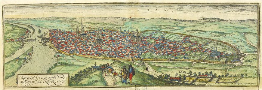
maps of rouen by braun & hogenberg
cartes de franz schrader
crêt de la neige
encyclopédie méthodique - géographie physique
ambroise tardieu
1777 maps of new york (state)
1777 maps of new jersey
nouveau cours d'instruction primaire de géographie (1886)
topographic maps of france
cartouche (cartography)
jean-claude dezauche
maps of hunsrück
jean hardy
cartouche (cartography)
maps by john rocque
maps and topographical views by joris hoefnagel
1580s maps of spain
maps and topographical views by joris hoefnagel
maps of orléans by braun & hogenberg
topographisch, oeconomisch und militaerische charte des herzogthums mecklenburg schwerin and des fürstenthums ratzeburg - schmettau
topographisch, oeconomisch und militaerische charte von mecklenburg, schwerin und ratzeburg
topographisch, oeconomisch und militaerische charte des herzogthums mecklenburg schwerin and des fürstenthums ratzeburg - schmettau
topographisch, oeconomisch und militaerische charte von mecklenburg, schwerin und ratzeburg
topographisch, oeconomisch und militaerische charte des herzogthums mecklenburg schwerin and des fürstenthums ratzeburg - schmettau
topographisch, oeconomisch und militaerische charte von mecklenburg, schwerin und ratzeburg
topographisch, oeconomisch und militaerische charte des herzogthums mecklenburg schwerin and des fürstenthums ratzeburg - schmettau
topographisch, oeconomisch und militaerische charte von mecklenburg, schwerin und ratzeburg
topographisch, oeconomisch und militaerische charte des herzogthums mecklenburg schwerin and des fürstenthums ratzeburg - schmettau
topographisch, oeconomisch und militaerische charte von mecklenburg, schwerin und ratzeburg
topographisch, oeconomisch und militaerische charte des herzogthums mecklenburg schwerin and des fürstenthums ratzeburg - schmettau
topographisch, oeconomisch und militaerische charte von mecklenburg, schwerin und ratzeburg
topographisch, oeconomisch und militaerische charte des herzogthums mecklenburg schwerin and des fürstenthums ratzeburg - schmettau
topographisch, oeconomisch und militaerische charte von mecklenburg, schwerin und ratzeburg
topographisch, oeconomisch und militaerische charte des herzogthums mecklenburg schwerin and des fürstenthums ratzeburg - schmettau
topographisch, oeconomisch und militaerische charte von mecklenburg, schwerin und ratzeburg
topographisch, oeconomisch und militaerische charte des herzogthums mecklenburg schwerin and des fürstenthums ratzeburg - schmettau
topographisch, oeconomisch und militaerische charte von mecklenburg, schwerin und ratzeburg
topographisch, oeconomisch und militaerische charte des herzogthums mecklenburg schwerin and des fürstenthums ratzeburg - schmettau
topographisch, oeconomisch und militaerische charte von mecklenburg, schwerin und ratzeburg
topographisch, oeconomisch und militaerische charte des herzogthums mecklenburg schwerin and des fürstenthums ratzeburg - schmettau
topographisch, oeconomisch und militaerische charte von mecklenburg, schwerin und ratzeburg
topographisch, oeconomisch und militaerische charte des herzogthums mecklenburg schwerin and des fürstenthums ratzeburg - schmettau
topographisch, oeconomisch und militaerische charte von mecklenburg, schwerin und ratzeburg
topographisch, oeconomisch und militaerische charte des herzogthums mecklenburg schwerin and des fürstenthums ratzeburg - schmettau
topographisch, oeconomisch und militaerische charte von mecklenburg, schwerin und ratzeburg
topographische karte der gegenden wiens... - m. ragginger, del... - btv1b530275792
tranquillo mollo
topographisch, oeconomisch und militaerische charte des herzogthums mecklenburg schwerin and des fürstenthums ratzeburg - schmettau
topographisch, oeconomisch und militaerische charte von mecklenburg, schwerin und ratzeburg
topographisch, oeconomisch und militaerische charte des herzogthums mecklenburg schwerin and des fürstenthums ratzeburg - schmettau
topographisch, oeconomisch und militaerische charte von mecklenburg, schwerin und ratzeburg
topographisch, oeconomisch und militaerische charte des herzogthums mecklenburg schwerin and des fürstenthums ratzeburg - schmettau
topographisch, oeconomisch und militaerische charte von mecklenburg, schwerin und ratzeburg
topographischer atlas der schweiz
old maps of geneva
topographischer atlas der schweiz
old maps of geneva
british library king's topographical collection
map of paris by françois van hoey
1 - 100 of 103
Next page
/ 2