Log in
All resources
Create a design
1,877 Free Artworks of South Holland
gemeente atlas van nederland - south holland
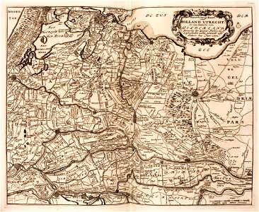
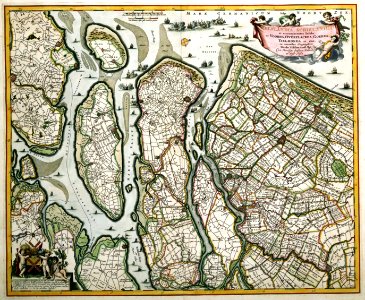
1860s maps of south holland
old maps of south holland
19th-century maps of rotterdam
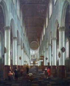
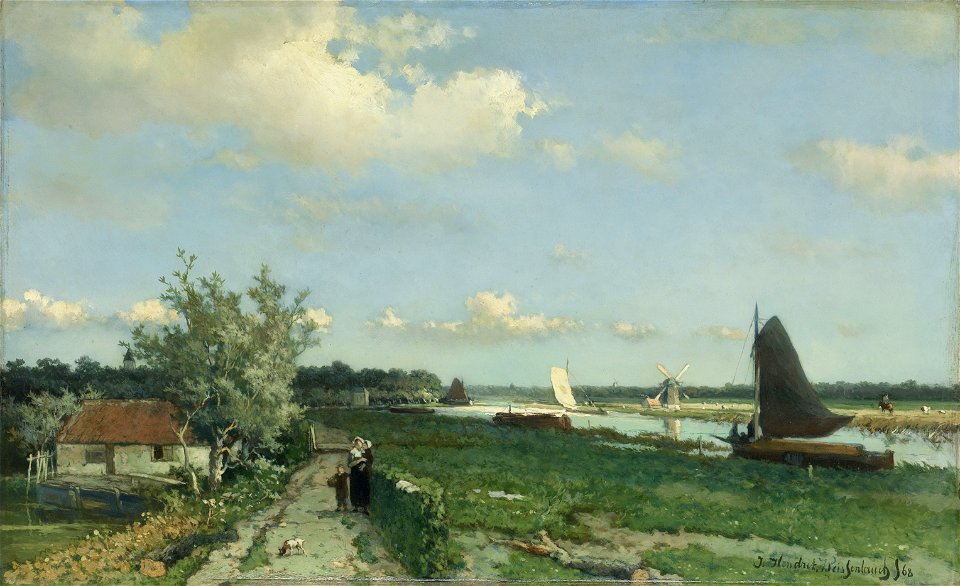
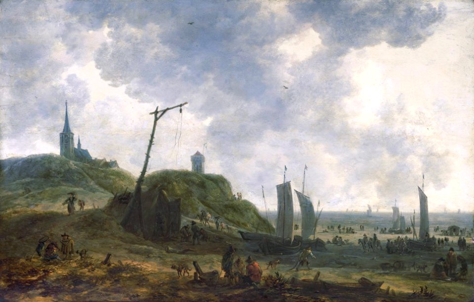
oil on canvas
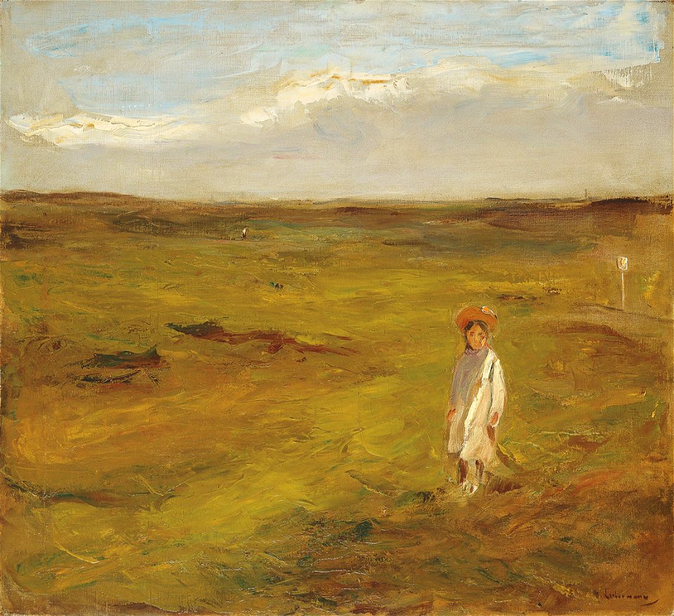
south holland
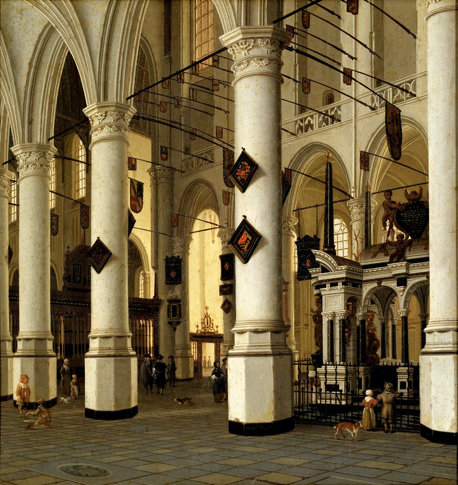
oil on panel
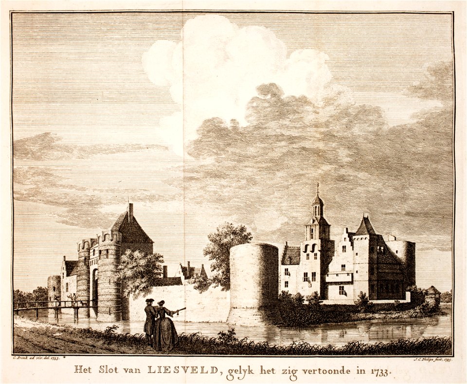
prints from isaak tirion hedendaegsche historie at the peace palace library
netherlands in the 1860s
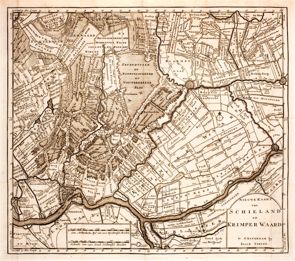
maps of polders in south holland
18th-century portrait paintings in the national portrait gallery, london
realism
paintings by jan hendrik weissenbruch in the rijksmuseum amsterdam
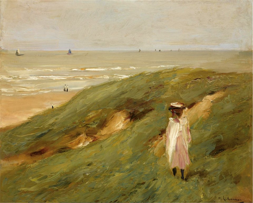
hague school
paintings of the seine in paris
cityscape paintings of paris
people at the beach in art
south holland
prints from isaak tirion hedendaegsche historie at the peace palace library
castles in south holland
prints from isaak tirion hedendaegsche historie at the peace palace library
old maps of south holland
south holland
noordwijk
old maps of north brabant
old maps of south holland
old maps of south holland
merwede
beaux-arts museum
nîmes
amelisweerd
zuiderzee
drawings in the cleveland museum of art
castles in south holland
paintings of church interiors in the nationalmuseum stockholm
paintings of praalgraf willem van oranje
prints from the peace palace library
south holland
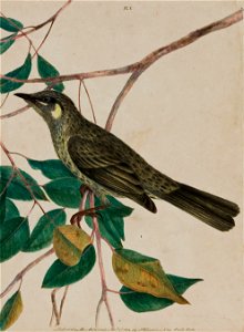
etchings of birds
colored etchings
prints from lambert van den bos schauplatz des krieges at the peace palace library
fortifications in the netherlands
south holland
the hague
maps with cartouches
old maps of zeeland
london
1716
paintings by otto van veen in the rijksmuseum amsterdam
leidens ontzet
jan hendrik weissenbruch
laakmolen
1760s maps of the netherlands
old maps of south holland
1880s paintings by max liebermann
impressionism
department of image collections, national gallery of art library, washington, dc
barbizon school
gemeente atlas van nederland - south holland
old maps of katwijk, south holland
gemeente atlas van nederland - south holland
1860s maps of south holland
gemeente atlas van nederland - south holland
1860s maps of south holland
gemeente atlas van nederland - south holland
1860s maps of south holland
gemeente atlas van nederland - south holland
1860s maps of south holland
19th-century maps of south holland
maps of veur
gemeente atlas van nederland - south holland
maps of alblasserdam
castles in rijswijk, south holland
sion, quarter of rijswijk
gemeente atlas van nederland - south holland
1860s maps of south holland
katwijk, south holland in art
emil neumann
gemeente atlas van nederland - south holland
19th-century maps of rotterdam
gemeente atlas van nederland - south holland
1860s maps of south holland
maps of nieuwpoort, south-holland
vestingwerken nieuwpoort
gemeente atlas van nederland - south holland
1860s maps of south holland
gemeente atlas van nederland - south holland
1860s maps of south holland
gemeente atlas van nederland - south holland
old maps of brielle
gemeente atlas van nederland - south holland
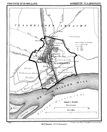
old maps of vlaardingen
gemeente atlas van nederland - south holland
1860s maps of south holland
gemeente atlas van nederland - south holland
1860s maps of south holland
gemeente atlas van nederland - south holland
maps of 's-gravenzande
gemeente atlas van nederland - south holland
1860s maps of south holland
gemeente atlas van nederland - south holland
strevelshoek
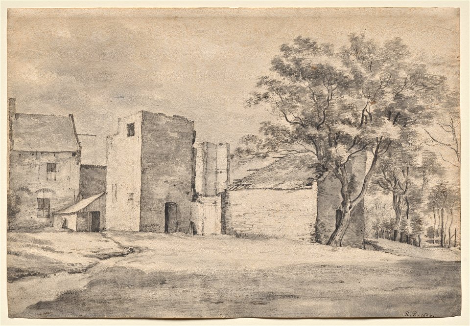
17th-century drawings from the netherlands
drawings in the cleveland museum of art
gemeente atlas van nederland - south holland
1860s maps of south holland
gemeente atlas van nederland - south holland
1860s maps of south holland
gemeente atlas van nederland - south holland
1860s maps of south holland
gemeente atlas van nederland - south holland
1860s maps of south holland
gemeente atlas van nederland - south holland
19th-century maps of rotterdam
gemeente atlas van nederland - south holland
maps of heerjansdam
gemeente atlas van nederland - south holland
1860s maps of south holland
gemeente atlas van nederland - south holland
1860s maps of south holland
gemeente atlas van nederland - south holland
1860s maps of south holland
gemeente atlas van nederland - south holland
1860s maps of south holland
gemeente atlas van nederland - south holland
1860s maps of south holland
gemeente atlas van nederland - south holland
1860s maps of south holland
katwijk, south holland in art
salomon leonardus verveer
gemeente atlas van nederland - south holland
1860s maps of south holland
nicolaas samuel crucquius
old maps of delfland
gemeente atlas van nederland - south holland
maps of ameide
gemeente atlas van nederland - south holland
maps of haastrecht
gemeente atlas van nederland - south holland
1860s maps of south holland
gemeente atlas van nederland - south holland
1860s maps of south holland
gemeente atlas van nederland - south holland
maps of westmaas
gemeente atlas van nederland - south holland
1860s maps of south holland
gemeente atlas van nederland - south holland
1860s maps of south holland
gemeente atlas van nederland - south holland
maps of noordeloos
gemeente atlas van nederland - south holland
hugo suringar
gemeente atlas van nederland - south holland
1860s maps of south holland
gemeente atlas van nederland - south holland
1860s maps of south holland
gemeente atlas van nederland - south holland
1860s maps of south holland
gemeente atlas van nederland - south holland
giessen (river south-holland)
gemeente atlas van nederland - south holland
giessen (river south-holland)
gemeente atlas van nederland - south holland
1860s maps of south holland
gemeente atlas van nederland - south holland
1860s maps of south holland
gemeente atlas van nederland - south holland
1860s maps of south holland
gemeente atlas van nederland - south holland
maps of heenvliet
gemeente atlas van nederland - south holland
19th-century maps of rotterdam
gemeente atlas van nederland - south holland
maps of zoeterwoude
gemeente atlas van nederland - south holland
1860s maps of south holland
gemeente atlas van nederland - south holland
1860s maps of south holland
gemeente atlas van nederland - south holland
1860s maps of south holland
gemeente atlas van nederland - south holland
maps of abbenbroek
gemeente atlas van nederland - south holland
maps of zoetermeer
gemeente atlas van nederland - south holland
1860s maps of south holland
paintings by claude monet in the musée d'orsay
impressionism
gemeente atlas van nederland - south holland
maps of groot-ammers
gemeente atlas van nederland - south holland
maps of alkemade
gemeente atlas van nederland - south holland
1860s maps of south holland
gemeente atlas van nederland - south holland
maps of krimpen aan den ijssel
gemeente atlas van nederland - south holland
maps of hillegom
paintings by adriaen van der kabel
katwijk, south holland in art
gemeente atlas van nederland - south holland
maps of hellevoetsluis
gemeente atlas van nederland - south holland
1860s maps of south holland
gemeente atlas van nederland - south holland
1860s maps of south holland
gemeente atlas van nederland - south holland
1860s maps of south holland
gemeente atlas van nederland - south holland
1860s maps of south holland
1 - 100 of 1,877
Next page
/ 19