Log in
All resources
Create a design
60 Free Artworks of Prime Meridian
maps in the library of congress
maps using ferro prime meridian
david rumsey historical map collection
andrew dury
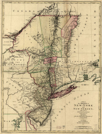
a map of the provinces of new york and new jersey, with a part of pennsylvania and the province of quebec
lawrence h. slaughter collection of english maps, charts, globes, books and atlases
maps by thomas kitchin
map collection of leibniz-institut für länderkunde
multilingual maps
thomas kitchin
old maps of europe
1789 maps
prime meridian
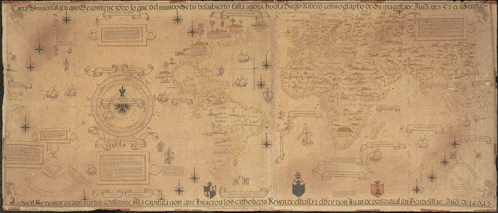
new world
maps from gallica
propaganda map
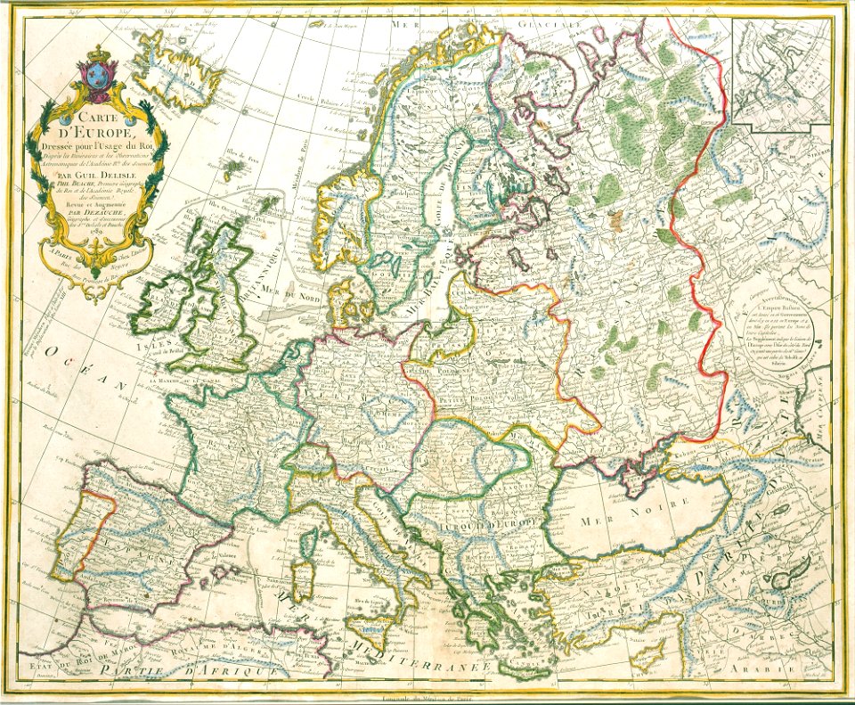
map of europe by guillaume delisle (1700)
1789 maps of europe
maps by thomas kitchin
andrew dury
maps by thomas kitchin
andrew dury
maps by thomas kitchin
andrew dury
maps by thomas kitchin
andrew dury
maps in the library of congress
1792 maps of africa
1771 maps of asia
andrew dury
maps of barbary coast
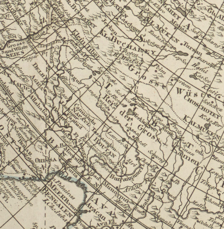
old maps of tartary
david rumsey historical map collection
andrew dury
1800s maps of the world
old maps of the world
maps in the library of congress
18th-century maps of jamaica
old maps of castilla la nueva
1765 maps of spain
french-language maps of asia
1750s maps of asia
1809 maps of saxony-anhalt
1809 maps of saxony
maps by emanuel bowen
1747 maps of africa
a map of the provinces of new york and new jersey, with a part of pennsylvania and the province of quebec
maps in the library of congress
a map of the provinces of new york and new jersey, with a part of pennsylvania and the province of quebec
lawrence h. slaughter collection of english maps, charts, globes, books and atlases
maps by emanuel bowen
1747 maps of africa
a map of the provinces of new york and new jersey, with a part of pennsylvania and the province of quebec
lawrence h. slaughter collection of english maps, charts, globes, books and atlases
a map of the provinces of new york and new jersey, with a part of pennsylvania and the province of quebec
lawrence h. slaughter collection of english maps, charts, globes, books and atlases
maps in the library of congress
1760s maps of china
a map of the provinces of new york and new jersey, with a part of pennsylvania and the province of quebec
maps in the library of congress
1800 maps of the atlantic ocean
1800s maps of the americas
old hemisphere world maps (partner files)
1800s maps of the world
map collection of leibniz-institut für länderkunde
1800s maps of the world
maps in the library of congress
1718 maps of north america
maps in the library of congress
1718 maps
lawrence h. slaughter collection of english maps, charts, globes, books and atlases
nypl lionel pincus and princess firyal map division
lawrence h. slaughter collection of english maps, charts, globes, books and atlases
nypl lionel pincus and princess firyal map division
old maps of the northern hemisphere
1800s maps of the world
maps in the library of congress
1755 maps
maps in the library of congress
1744 maps
lawrence h. slaughter collection of english maps, charts, globes, books and atlases
nypl lionel pincus and princess firyal map division
maps of the world with orthographic projection
maps of the world without antarctica
a map of the provinces of new york and new jersey, with a part of pennsylvania and the province of quebec
maps in the library of congress
map collection of leibniz-institut für länderkunde
maps of spain by tomas lopez
maps in the library of congress
1791 maps
david rumsey historical map collection
1790s maps of the holy roman empire
maps in the library of congress
1755 maps of north america
everett d. graff collection of western americana
maps by g. w. & c. b. colton & co.
everett d. graff collection of western americana
maps by g. w. & c. b. colton & co.
maps in the library of congress
1744 maps of north america
david rumsey historical map collection
1790s maps of the holy roman empire
a map of the provinces of new york and new jersey, with a part of pennsylvania and the province of quebec
lawrence h. slaughter collection of english maps, charts, globes, books and atlases
everett d. graff collection of western americana
maps by g. w. & c. b. colton & co.
maps in the library of congress
1838 maps
maps by richard william seale
1740s maps of south america
maps in the library of congress
1778 maps of new jersey
maps in the library of congress
1776 maps of new jersey
maps in the library of congress
1779 maps of new york (state)
david rumsey historical map collection
1790s maps of the holy roman empire
maps in the library of congress
1849 maps
david rumsey historical map collection
1790s maps of the holy roman empire
atlas to accompany the official records of the union and confederate armies
everett d. graff collection of western americana
carte de l'afrique françoise par guillaume delisle (1726)
philippe buache
carte de barbarie, nigritie, guinée par guillaume delisle (1707)
university of washington
1740s maps of the world
maps by emanuel bowen
1 - 60 of 60
/ 1