Log in
All resources
Create a design
46 Free Artworks of Portolan Charts
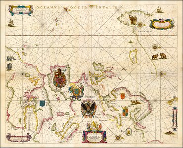
portolan charts by willem and johannes blaeu
les forces de l'europe, asie, afrique et amerique, ou description des principales villes, avec leurs fortifications
portolan charts made in the 18th century
maps in the rijksmuseum amsterdam
portolan charts made in the 17th century
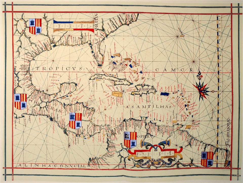
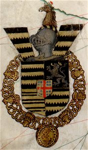
coats of arms on maps
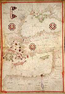
17th-century maps of the mediterranean sea
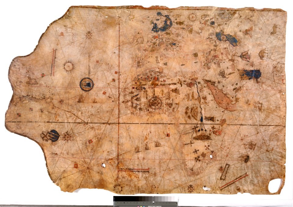
luxoro atlas
portolan charts made in the 16th century
nuevo atlas o teatro mundo
16th-century maps of the black sea
maps in the library of congress
portolan charts by willem and johannes blaeu
17th-century maps of europe
1510s maps of the world
coats of arms on maps
portolan charts by willem and johannes blaeu
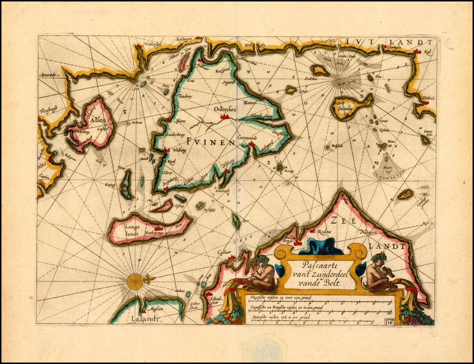
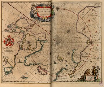
old maps of scandinavia
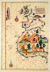
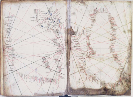
portolan charts
1575
latin-language maps
1630 maps
old maps of the arctic
copper engraving
birds in art of france
lions in art
old maps of the british isles
coats of arms on maps
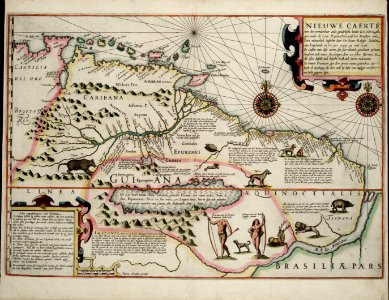
old maps of guyana
el dorado
european exploration of africa
portuguese empire
16th-century maps of guyana
old maps of french guiana
maps in the museo correr
francesco de cesanis
portolan charts made in the 17th century
maps by willem and johannes blaeu
galicia (spain) in the 1390s
galicia in portolan charts
portolan charts by willem and johannes blaeu
old maps of holland
portolan charts by willem and johannes blaeu
old maps of holland
maps of the republic of venice
17th-century maps of istria
portolan charts by willem and johannes blaeu
copper engravings
1670s maps of the iberian peninsula
hugo allardt
portolan charts by willem and johannes blaeu
old maps of friesland
portolan charts by willem and johannes blaeu
dutch east india company
1620s maps of the iberian peninsula
maps by willem and johannes blaeu
portolan charts made in the 17th century
maps by willem and johannes blaeu
portolan charts by willem and johannes blaeu
1620s maps of the atlantic ocean
17th-century maps of the mediterranean sea
1610 maps of europe
nuevo atlas o teatro mundo
old maps of the arctic
luxoro atlas
media from atlas of mutual heritage on dutch east india company
portolan charts by willem and johannes blaeu
luxoro atlas
luxoro atlas
luxoro atlas
17th-century maps of the mediterranean sea
portolan charts made in the 17th century
maps of ven (oresund)
old maps of skåne
17th-century maps of the mediterranean sea
portolan charts made in the 17th century
old maps of french guiana
1630s maps of brazil
les forces de l'europe, asie, afrique et amerique, ou description des principales villes, avec leurs fortifications
maps of the history of poitou
les forces de l'europe, asie, afrique et amerique, ou description des principales villes, avec leurs fortifications
portolan charts made in the 18th century
les forces de l'europe, asie, afrique et amerique, ou description des principales villes, avec leurs fortifications
portolan charts made in the 18th century
les forces de l'europe, asie, afrique et amerique, ou description des principales villes, avec leurs fortifications
portolan charts made in the 18th century
les forces de l'europe, asie, afrique et amerique, ou description des principales villes, avec leurs fortifications
portolan charts made in the 18th century
les forces de l'europe, asie, afrique et amerique, ou description des principales villes, avec leurs fortifications
portolan charts made in the 18th century
les forces de l'europe, asie, afrique et amerique, ou description des principales villes, avec leurs fortifications
portolan charts made in the 18th century
les forces de l'europe, asie, afrique et amerique, ou description des principales villes, avec leurs fortifications
portolan charts made in the 18th century
les forces de l'europe, asie, afrique et amerique, ou description des principales villes, avec leurs fortifications
portolan charts made in the 18th century
les forces de l'europe, asie, afrique et amerique, ou description des principales villes, avec leurs fortifications
portolan charts made in the 18th century
1 - 46 of 46
/ 1