Log in
All resources
Create a design
154 Free Artworks of Meridians
classicism
collections of the helsinki observatory
december 2012 in helsinki
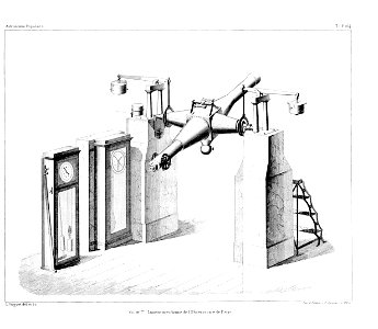
illustrations for arago's astronomie populaire
utzschneider und fraunhofer
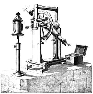
meridian instruments
historical astronomical instruments
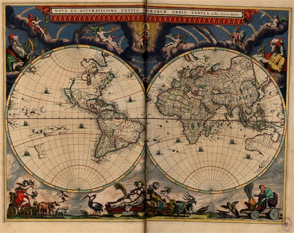
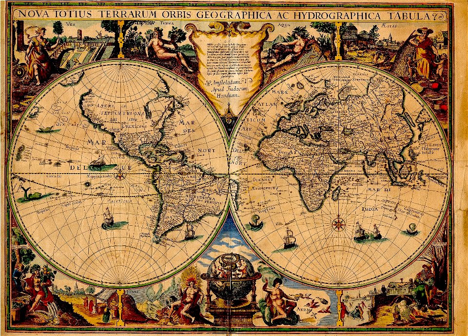
17th-century double hemisphere world maps
maps using ferro prime meridian
andrew dury
135th meridian east
tasman map
l'antiquité expliquée et représentée en figures
1719 illustrations
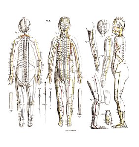
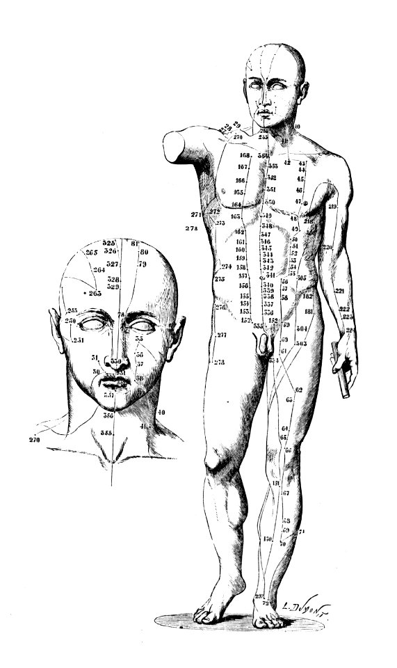
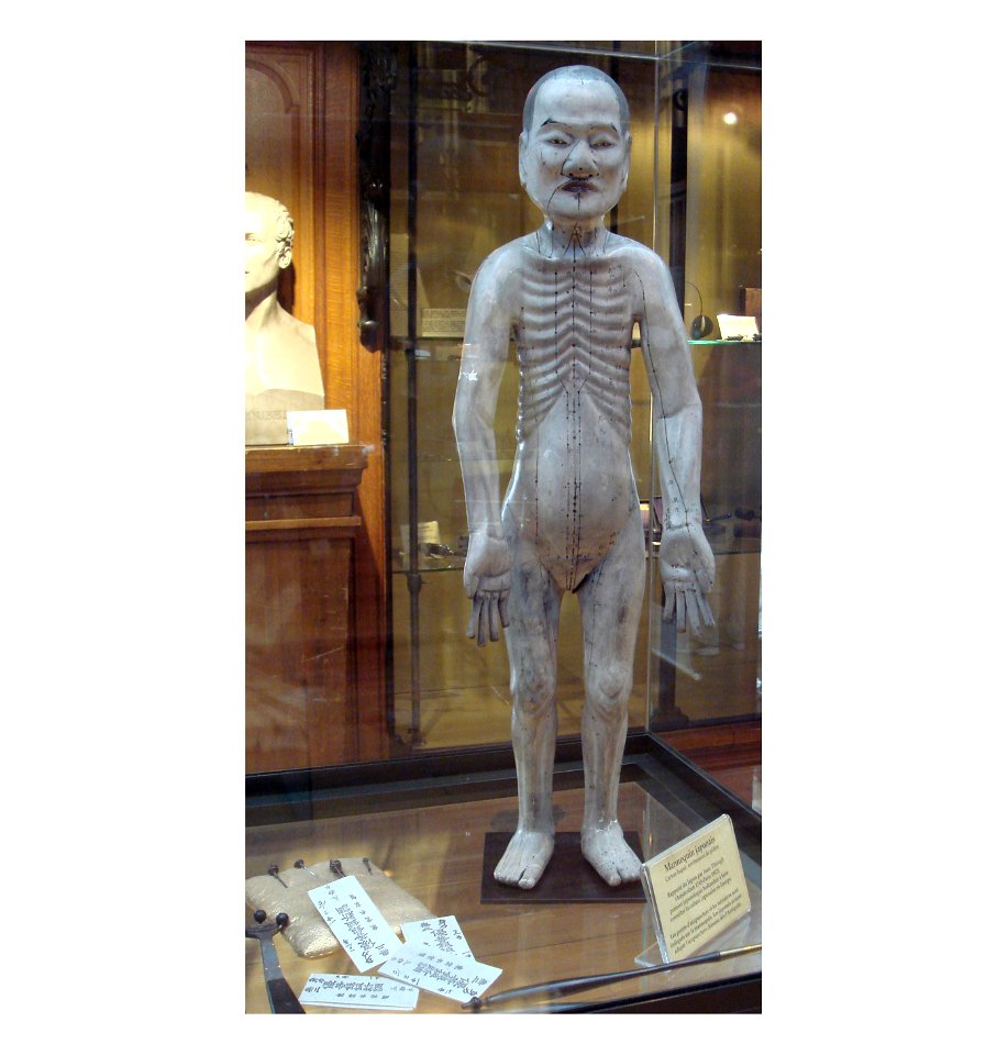
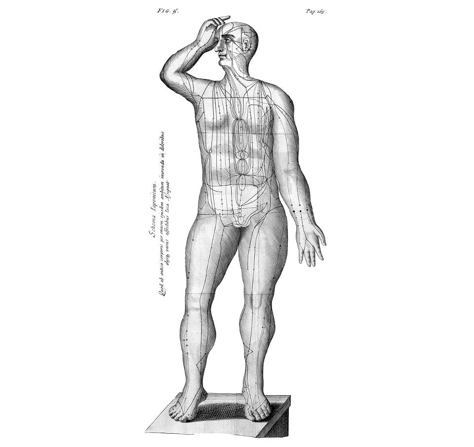
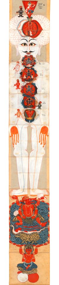
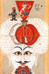
meridian (chinese medicine)
acupuncture
meridian (chinese medicine)
acupuncture
meridian (chinese medicine)
acupuncture
meridian (chinese medicine)
acupuncture
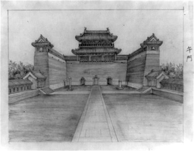
forbidden city in art
history of beijing
drawings (documentary) collection in the library of congress
drawings (documentary) collection in the library of congress
meridians
flower
maps by willem and johannes blaeu
atlas van loon
americans by philip alexius de lászló
irwin b. laughlin
female portraits by philip alexius de lászló
americans by philip alexius de lászló
illustrated title pages
1645 books
collections of the helsinki observatory
classicism
collections of the helsinki observatory
classicism
collections of the helsinki observatory
classicism
collections of the helsinki observatory
classicism
collections of the helsinki observatory
classicism
collections of the helsinki observatory
classicism
collections of the helsinki observatory
classicism
collections of the helsinki observatory
classicism
map of europe by guillaume delisle (1700)
1789 maps of europe
male portraits by philip alexius de lászló
irwin b. laughlin
interior of the helsinki observatory
classicism
collections of the helsinki observatory
classicism
maps by willem and johannes blaeu
1660s maps of the world
collections of the helsinki observatory
classicism
collections of the helsinki observatory
classicism
maps by thomas kitchin
willow palisade
historical images of hammerfest (town)
photographs by marthinius skøien
statue of dante alighieri (washington, d.c.)
meridian hill
cosmic
man
cosmic
man
maps by edward wright
molyneux globes
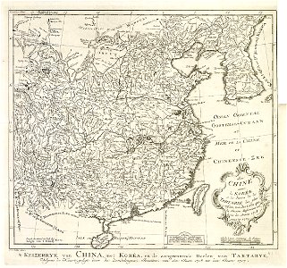
maps of the dutch east india company - korea
maps of the dutch east india company - china
jean jules jusserand
tomás le breton
illustrations for arago's astronomie populaire
illustrations for arago's astronomie populaire
illustrations for arago's astronomie populaire
maps by willem and johannes blaeu
old maps with mercator projection
collections of the helsinki observatory
classicism
collections of the helsinki observatory
classicism
illustrations for arago's astronomie populaire
illustrations for arago's astronomie populaire
collections of the helsinki observatory
classicism
collections of the helsinki observatory
classicism
illustrations for arago's astronomie populaire
illustrations for arago's astronomie populaire
illustrations for arago's astronomie populaire
illustrations for arago's astronomie populaire
illustrations for arago's astronomie populaire
collections of the helsinki observatory
classicism
illustrations for arago's astronomie populaire
illustrations for arago's astronomie populaire
le lyon de nos pères (vingtrinier, drevet, 1901) from numelyo
le lyon de nos pères (vingtrinier, drevet, 1901)
illustrations for arago's astronomie populaire
illustrations for arago's astronomie populaire
edward wright (mathematician)
maps by jodocus hondius
illustrations for arago's astronomie populaire
collections of the helsinki observatory
classicism
collections of the helsinki observatory
classicism
maps by thomas kitchin
andrew dury
1877 maps of the united states
1870s maps of utah
academic art,impressionism,realism,post-impressionism,divisionism,symbolism,arta română society,tinerimea artistică,art nouveau,primitivism,synthetism,fauvism,cubism,byzantine revival architecture,poporanism,gândirea,fine arts union,official salon of painting and sculpture
drawings by ion theodorescu-sion
maps by thomas kitchin
andrew dury
patrimonium 2 (project)
le ciel (1923)
postcards of indianapolis
1936 in indianapolis
collections of the helsinki observatory
classicism
indigenous peoples of north america
peter s. duval
photographs by lluís llagostera i pasqual
meridianstøtten, fuglenes
maps in the library of congress
1792 maps of africa
engravings by romeyn de hooghe
engravings by jan luyken
1771 maps of asia
andrew dury
colorado river
john e. weyss
colorado river
john e. weyss
old maps of yosemite valley
john e. weyss
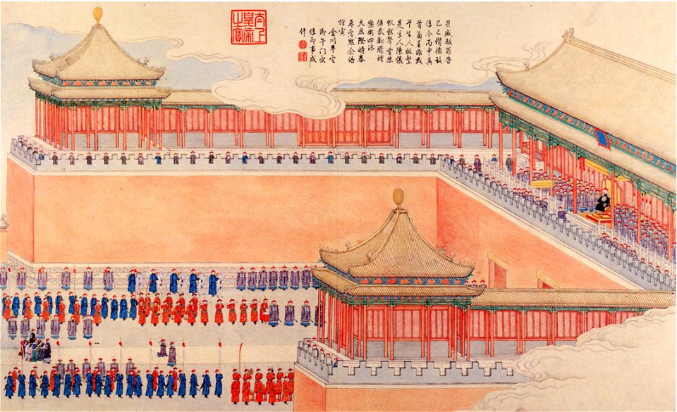
presenting to the emperor prisoners taken during the subjugation of the muslim tribes
revolt of the altishahr khojas
maps of barbary coast
old maps of tartary
david rumsey historical map collection
andrew dury
17th-century double hemisphere world maps
nuevo atlas o teatro mundo
cañon de chelly (edward s. curtis)
photogravure
maps by willem and johannes blaeu
novus atlas blaeu
copper engravings
1625 maps
1800s maps of the world
old maps of the world
maps in the library of congress
18th-century maps of jamaica
expressionism,post-impressionism,q18540617,tinerimea artistică,arta română society,q61085156,q56782388,fine arts union
oil on cardboard paintings by nicolae tonitza
french-language maps of asia
1750s maps of asia
prints in the stadsarchief amsterdam
daniël veelwaard (i)
1809 maps of saxony-anhalt
1809 maps of saxony
old maps of castilla la nueva
1765 maps of spain
maps by emanuel bowen
1747 maps of africa
a map of the provinces of new york and new jersey, with a part of pennsylvania and the province of quebec
maps in the library of congress
bibliothèque nationale de france
maps by tomas lopez
maps in the library of congress
1760s maps of china
a map of the provinces of new york and new jersey, with a part of pennsylvania and the province of quebec
lawrence h. slaughter collection of english maps, charts, globes, books and atlases
a map of the provinces of new york and new jersey, with a part of pennsylvania and the province of quebec
lawrence h. slaughter collection of english maps, charts, globes, books and atlases
a map of the provinces of new york and new jersey, with a part of pennsylvania and the province of quebec
lawrence h. slaughter collection of english maps, charts, globes, books and atlases
maps by emanuel bowen
1747 maps of africa
geography
measuring
1 - 100 of 154
Next page
/ 2