Log in
All resources
Create a design
113 Free Artworks of Maps Of The Atlantic Ocean
bibliothèque nationale de france
cartography
engraving
chalcography
grabados
fondo antiguo
calcografía
cartografía
libros del siglo xvii
17th century books
old maps of the atlantic ocean
maps of the north atlantic
english-language maps
maps of voyages
16th-century maps of brazil
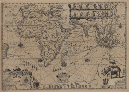
old maps of africa
atlante veneto (raremaps.com) volume 1
old maps of the atlantic ocean
atlante veneto (raremaps.com) volume 1
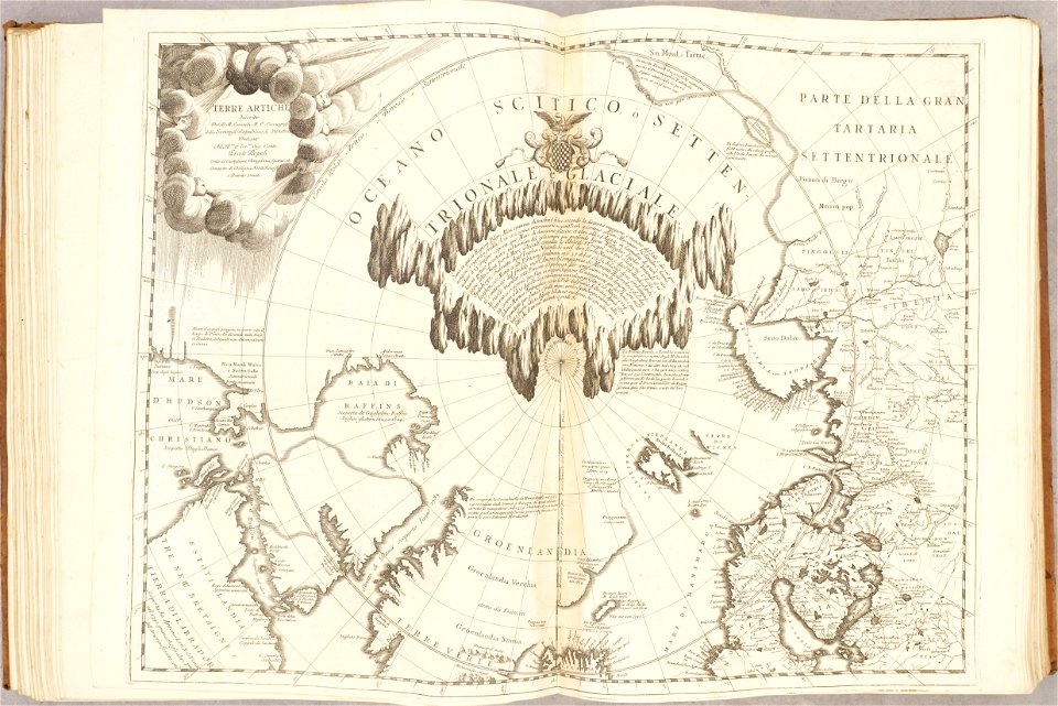
maps of the arctic ocean
atlante veneto (raremaps.com) volume 1
old maps of the pacific ocean
maps of the west-indische compagnie
1746
maps of the west-indische compagnie
1747)
old maps of the dutch east india company
1763
old maps of the dutch east india company
1730s
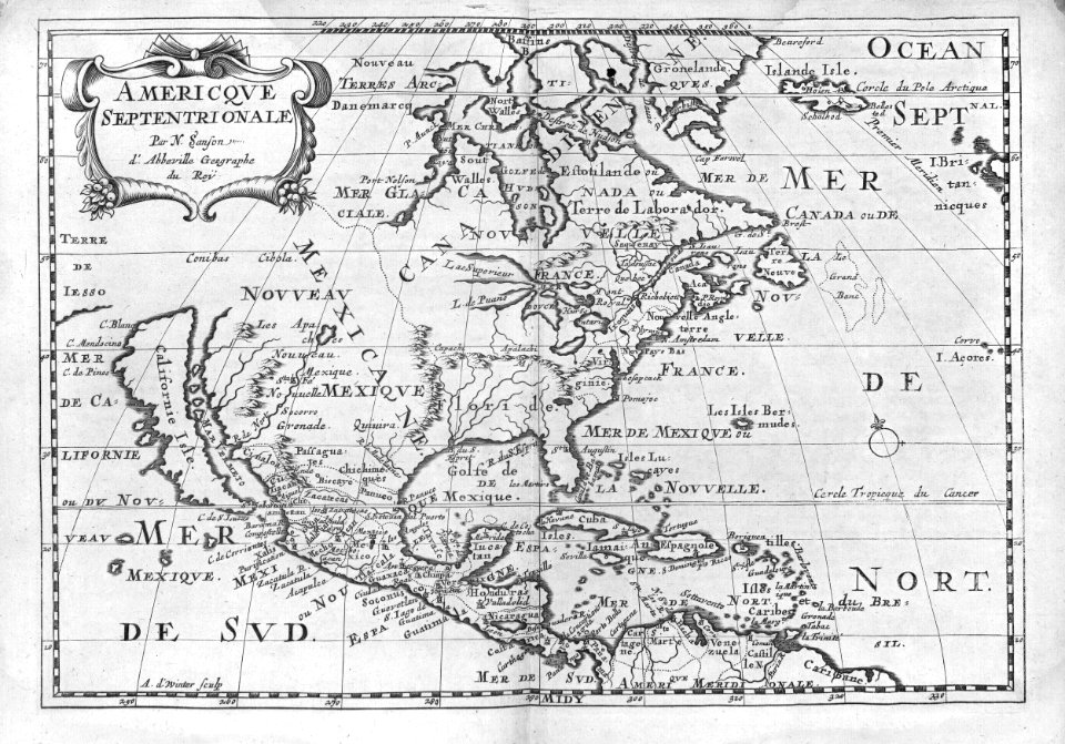
16th-century maps of the americas
maps by martin waldseemüller
brazil
maps
hatched coats of arms
atlantic ocean
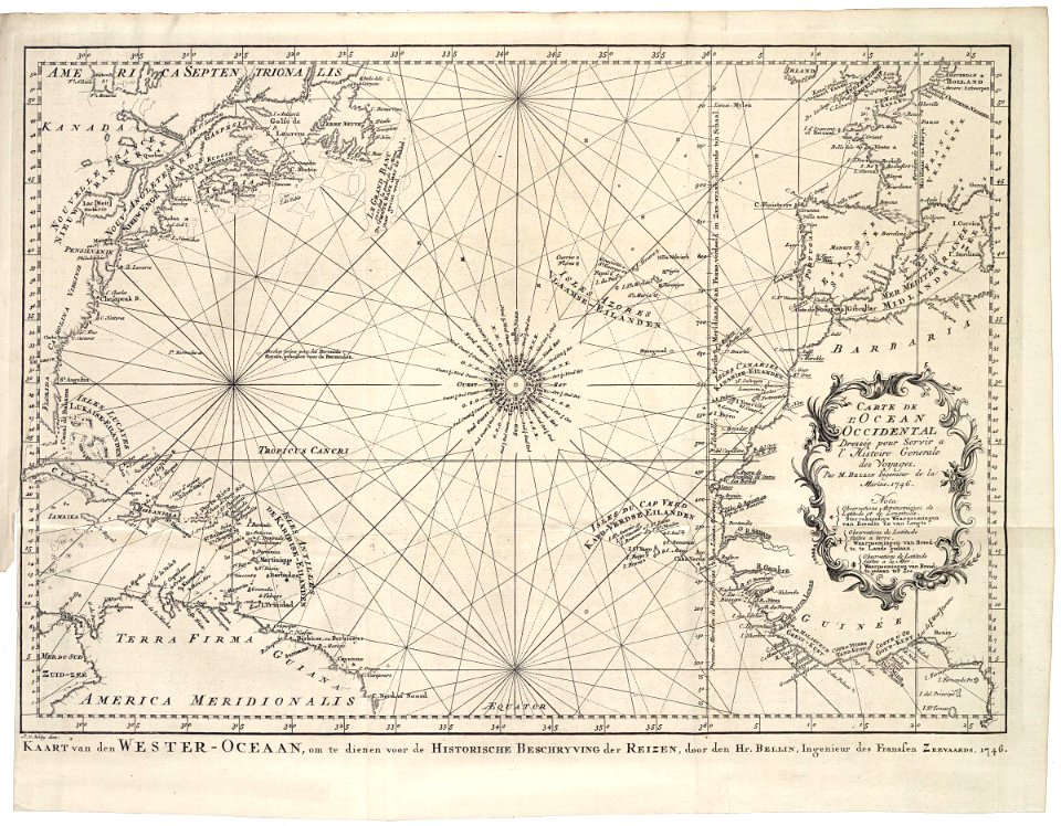
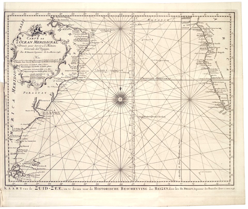
maps by jacques-nicolas bellin
19th-century maps of africa
maps of voyages by christopher columbus
atlantic ocean
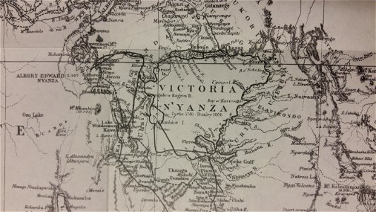
through the dark continent
lake victoria
old maps of the democratic republic of the congo
lake tanganyika
charts and maps of the royal museums greenwich
old maps of the democratic republic of the congo
through the dark continent
joannes van doetecum (i)
petrus plancius
maps by willem and johannes blaeu
dutch-language maps
cartouches by willem and johannes blaeu
dutch-language maps
1870s maps of the atlantic ocean
the bottom of the sea (1870)
the bottom of the sea (1870)
distance
17th-century maps of the black sea
maps by willem and johannes blaeu
jean-fréderic phélypeaux
guillaume dheulland
jean-fréderic phélypeaux
guillaume dheulland
17th-century maps of the black sea
maps by willem and johannes blaeu
lawrence h. slaughter collection of english maps, charts, globes, books and atlases
1700 maps of the atlantic ocean
18th-century maps of the atlantic ocean
maps by emanuel bowen
lawrence h. slaughter collection of english maps, charts, globes, books and atlases
1700 maps of the atlantic ocean
maps of the south atlantic
guillaume dheulland
from edinburgh to the antarctic. an artist's notes and sketches during the dundee antarctic expedition of 1892-93
expedition maps
maps by guillaume delisle
philippe buache
maps by pieter mortier
maps from gallica
16th-century maps of the western mediterranean
lucas janszoon waghenaer
cartouches by willem and johannes blaeu
old maps of the falkland islands
1901 maps of south america
1670 maps of europe
hugo allardt
cartouches by willem and johannes blaeu
pieter goos
1650s maps of the atlantic ocean
joan blaeu
1690s maps of the caribbean
1690s maps of the americas
maps from the mechanical curator collection available to georeference
maps from the mechanical curator collection
maps by willem and johannes blaeu
17th-century maps of europe
jean-baptiste-henri delahaye
philippe buache
old maps of the chesapeake bay
sir walter raleigh
ghosts & ghoulish scenes
the atlantic islands as resorts of health and pleasure (1878)
1870s maps of the atlantic ocean
jan huygen van linschoten
baptista van doetecum
chicago and the midwest, newberry library
maps by rand mcnally
1800 maps of the atlantic ocean
1800s maps of the americas
portolan charts made in the 17th century
maps by willem and johannes blaeu
maps of crossings of the atlantic ocean
1890s maps of the atlantic ocean
ambroise tardieu
j. p. besançon
arnold van langren map of southwest africa
1600 maps of africa
maps of crossings of the atlantic ocean
physical geography (1899) by davis
maps in the british museum
1780s maps of france
maps from the earth and its inhabitants, vol. xii
maps of icebergs
1600 maps of africa
benjamin wright
géographie générale; physique, politique et économique (1876)
1870s maps of the atlantic ocean
17th-century maps of the mediterranean sea
portolan charts made in the 17th century
the generall historie of virginia (john smith)
1624 books from london
1640s maps of ireland
baroque
1890s maps of the atlantic ocean
cavite e santiago (1898)
cartography
maps
17th-century maps of the mediterranean sea
portolan charts made in the 17th century
portolan charts by willem and johannes blaeu
1620s maps of the atlantic ocean
context files from gallica
lucas janszoon waghenaer
context files from gallica
lucas janszoon waghenaer
1580s maps of the americas
frans hogenberg
africa
maps
africa
maps
maps by willem and johannes blaeu
17th-century maps of bermuda
cartography
maps
cartography
maps
old maps of the russian empire
1790s maps of alaska
cartography
maps
africa
maps
17th-century maps of the strait of magellan
maps by willem and johannes blaeu
cartography
maps
cartography
maps
cartography
maps
maps from the earth and its inhabitants, vol. iv
1880s maps of the atlantic ocean
arnold van langren map of southwest africa
1596 maps of africa
cartography
maps
lucas janszoon waghenaer
1580s maps of spain
africa
maps
maps from the earth and its inhabitants, vol. xii
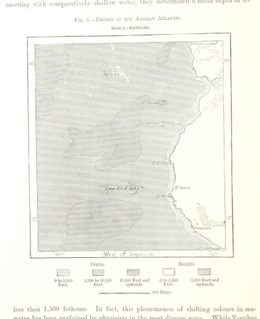
bathymetric maps of the atlantic ocean
maps from the earth and its inhabitants, vol. xii
bathymetric maps of the atlantic ocean
cartography
maps
cartography
maps
andalusia in the 1590s
1590s maps of spain
arnold van langren map of southwest africa
renaissance
16th-century maps of lisbon
1580s maps of portugal
arnold van langren map of southwest africa
bibliothèque nationale de france
cartography
maps
arnold van langren map of southwest africa
renaissance
1806 maps of the united states
maps by john cary
maps by john cary
1799 maps
die zee caerte van portugal; tusschen camino en montego, alsoe dat landt all daer in sijn ghedaente is, met alle sijne haeven enn ondiepten, met groeter naersticheijt en vliedt ghecorrigeert - btv1b531945351
bibliothèque nationale de france
1 - 100 of 113
Next page
/ 2


![Atlantic Ocean or North Sea Where the Route from Europe [sic] to the East Indies and from the West Indies to Europe are exactly observed, Drawn up on the most recent Relations, 1700](https://cdn.creazilla.com/illustrations/10001005747/atlantic-ocean-or-north-sea-where-the-route-from-europe-sic-to-the-east-indies-and-from-the-west-indies-to-europe-are-exactly-observed-drawn-up-on-the-most-recent-relations-1700-sm.jpg)


!["Descriptio Vorticis Noruegiae et Bodniae eorumq[ue] mirab…](https://cdn.creazilla.com/illustrations/5593800/descriptio-vorticis-noruegiae-et-bodniae-eorumq-ue-mirab-illustration-sm.jpeg)