Log in
All resources
Create a design
76 Free Artworks of Maps Of Scandinavia
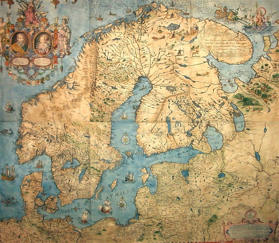
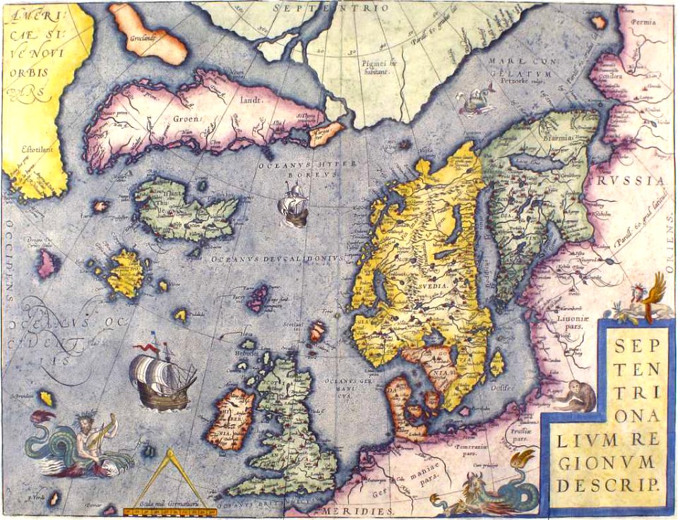
old maps of scandinavia
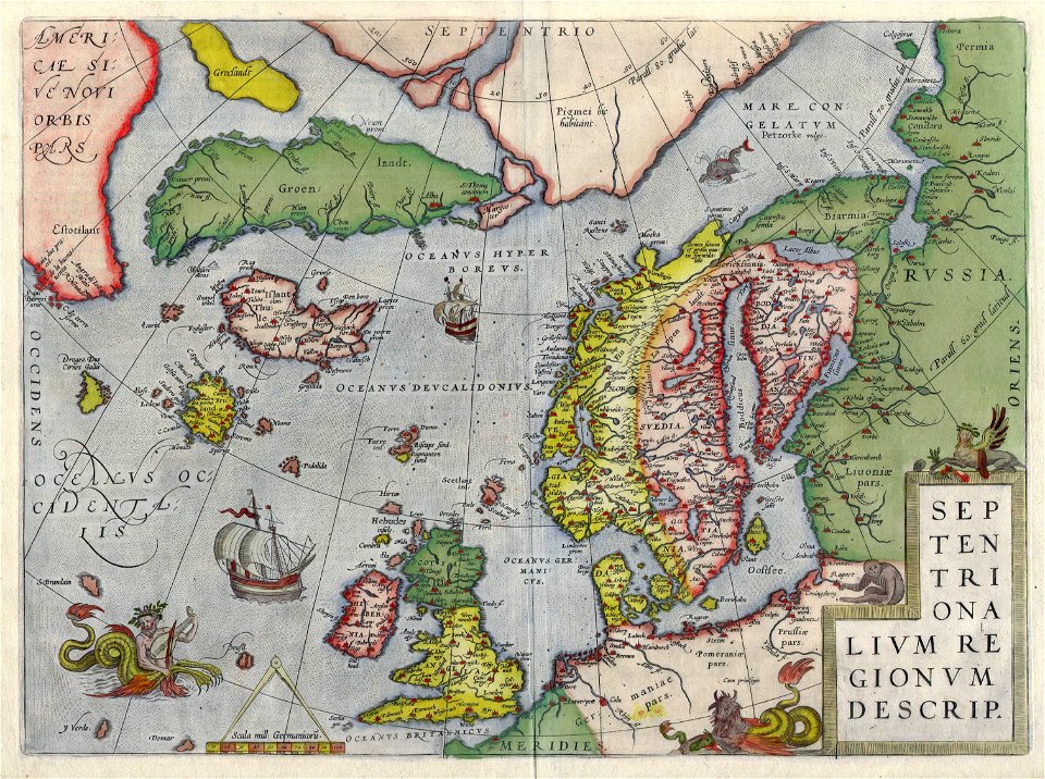
latin-language maps
dutch-language maps
baptista van doetecum
old maps of the white sea
maps of the barents sea
northern sea route
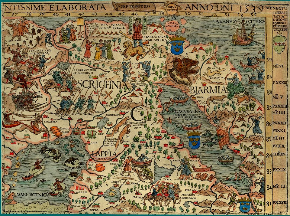
1590s maps of finland
old maps of the arctic
1590s maps of norway
third voyage of willem barentsz
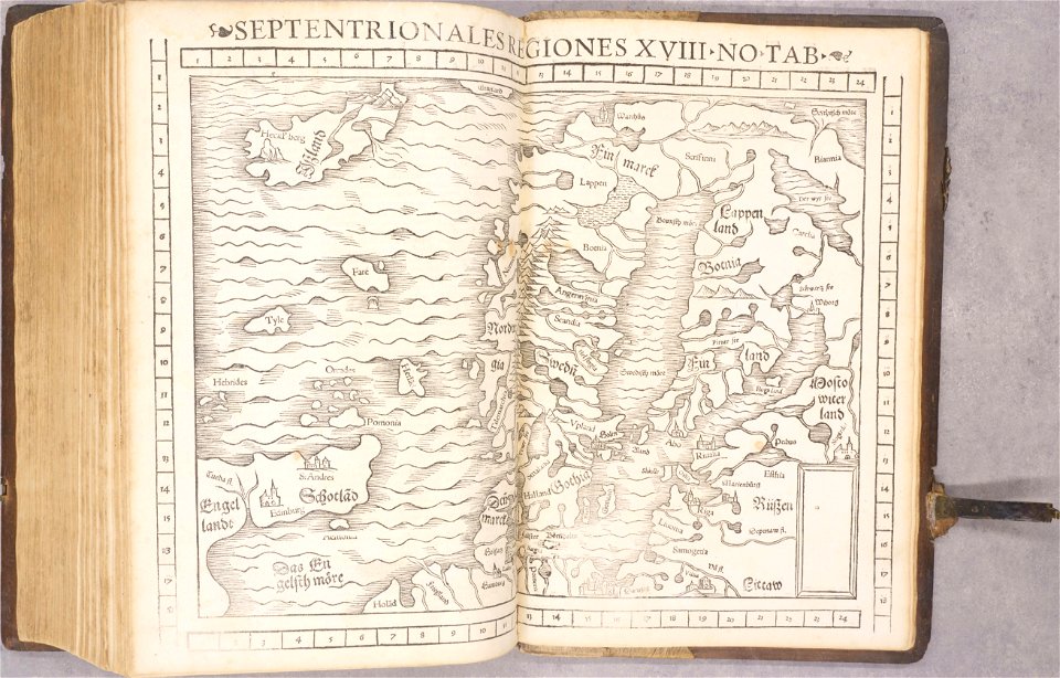
16th-century maps of the arctic
third voyage of willem barentsz
history of dutch sea fisheries
third voyage of willem barentsz
history of dutch sea fisheries
third voyage of willem barentsz
16th-century maps of the arctic
third voyage of willem barentsz
16th-century maps of the arctic
the voyage of the vega round asia and europe
third voyage of willem barentsz
overwintering on nova zembla by willem barentsz, 1596-1597
maps in the rijksmuseum amsterdam
itinerario (jan huygen van linschoten)
latin-language maps
overwintering on nova zembla by willem barentsz, 1596-1597
maps in the rijksmuseum amsterdam
old maps of scandinavia
johannes ratelband
extra-ptolemaic maps of scandinavia
latin-language maps
extra-ptolemaic maps of scandinavia
latin-language maps
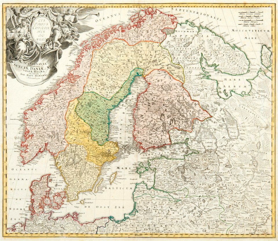
old maps of scandinavia
johann baptist homann
old maps of scandinavia
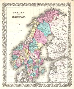
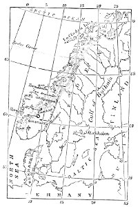
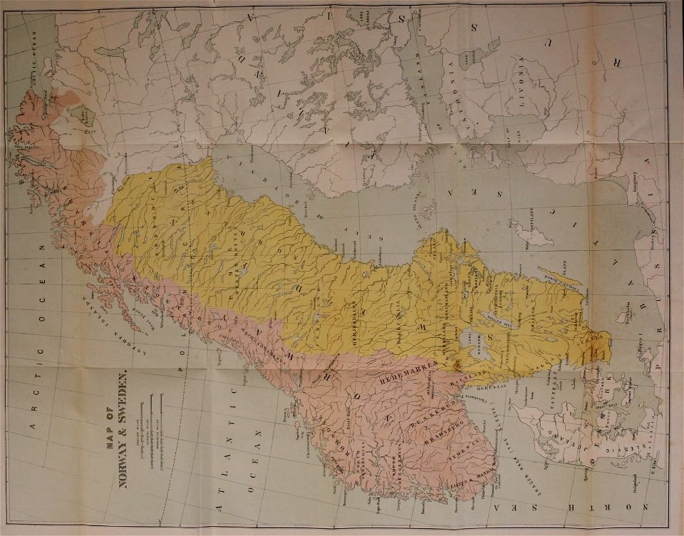
1855 maps
old maps of scandinavia
1680 maps
extra-ptolemaic maps of scandinavia
latin-language maps
old maps of scandinavia
1750 maps
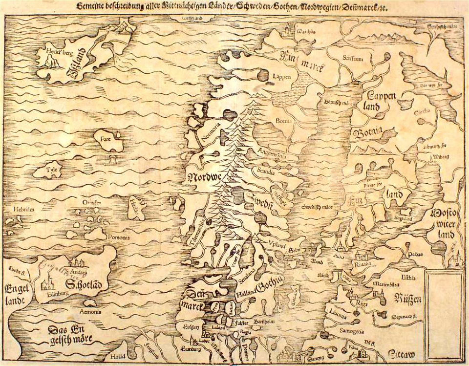
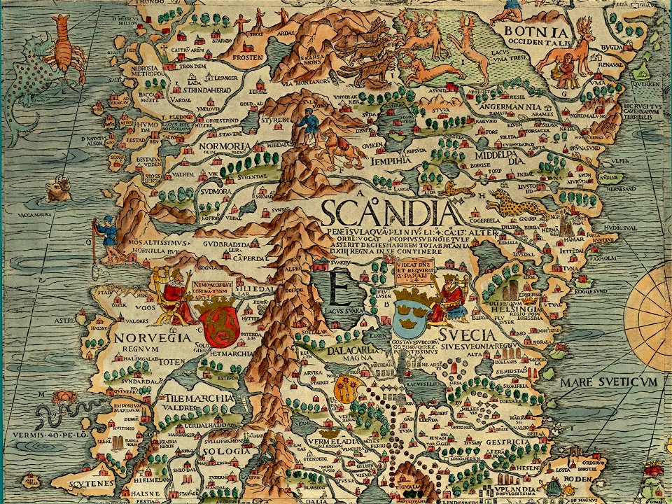
illustrations of cosmographia (münster)
extra-ptolemaic maps of scandinavia
german-language maps
latin-language maps
old maps of scandinavia
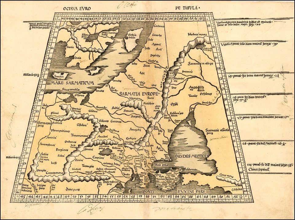
maps by martin waldseemüller
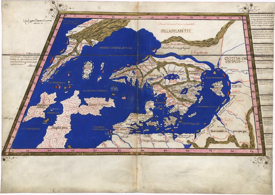
ptolemy's 8th european map
old maps of scandinavia
maps by anders bure
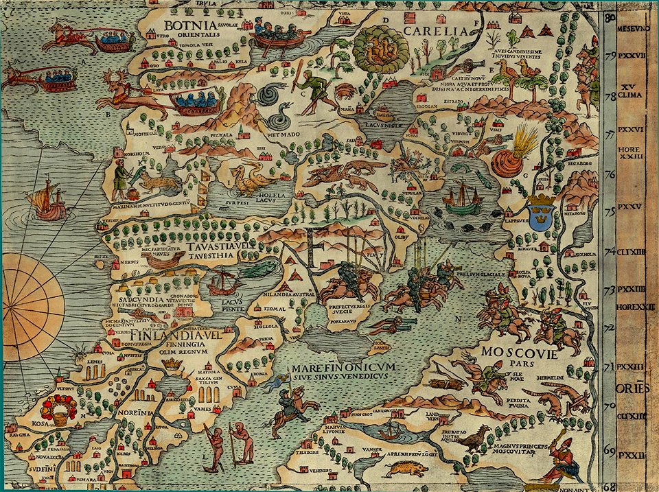
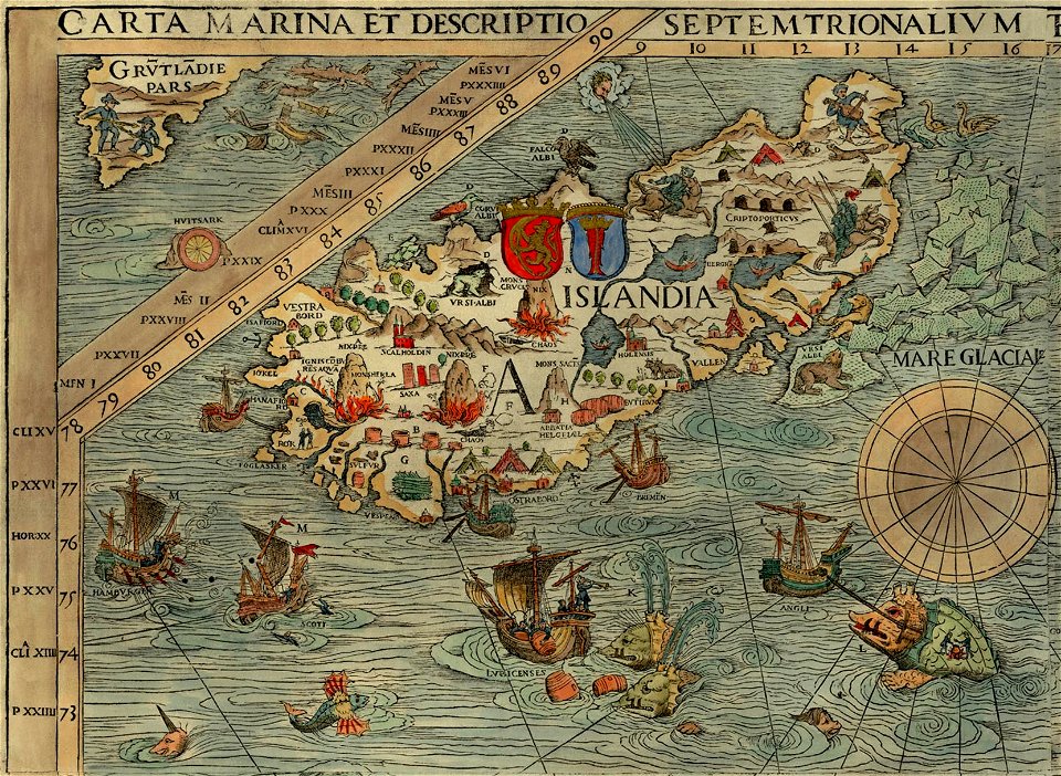
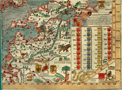
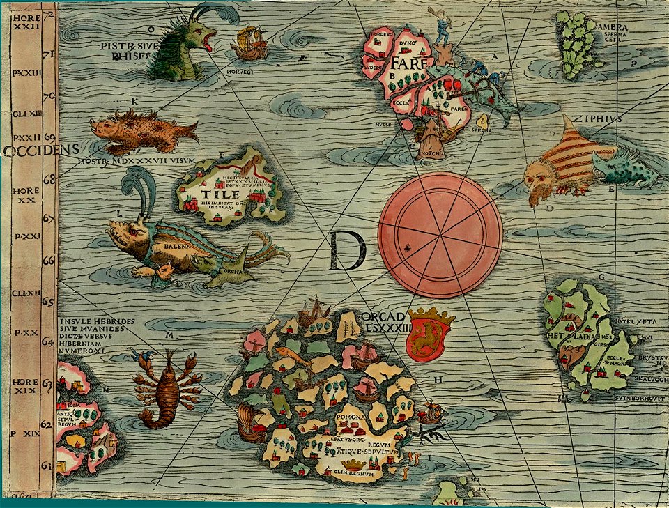
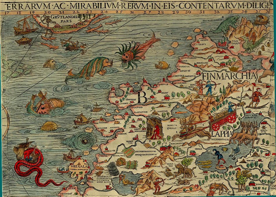
carta marina (details)
maps of vyborg
carta marina (details)
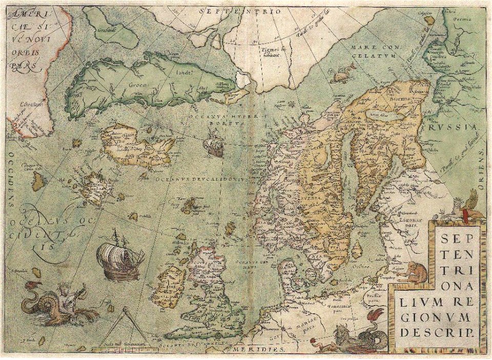
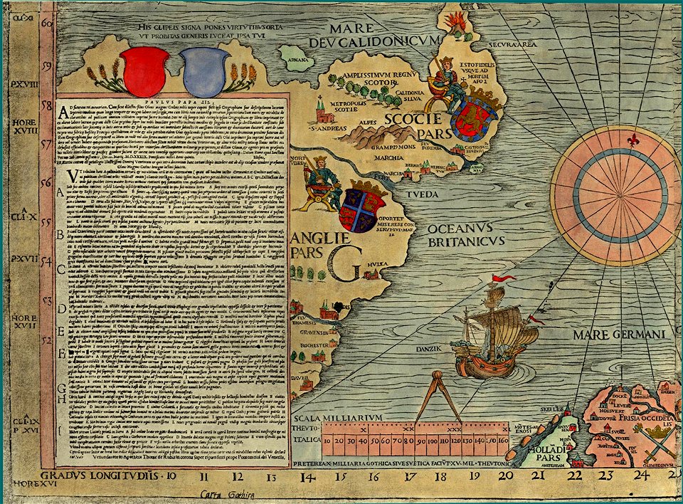
old maps of the british isles
old maps of scandinavia
carta marina (details)
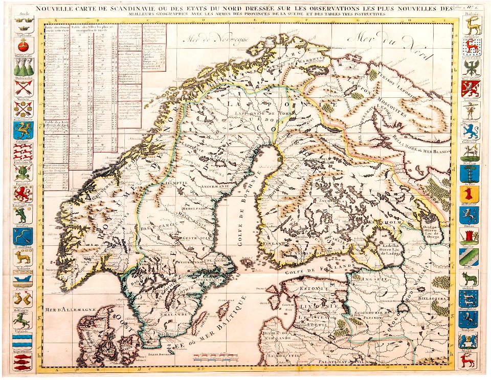
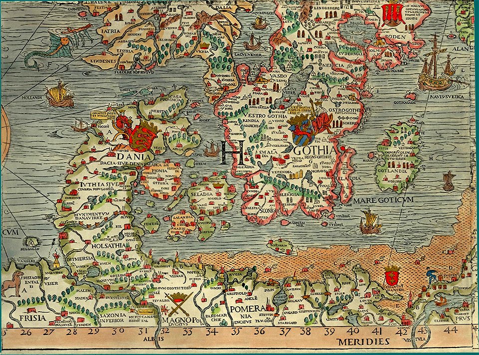
maps of scandinavia
1877 maps
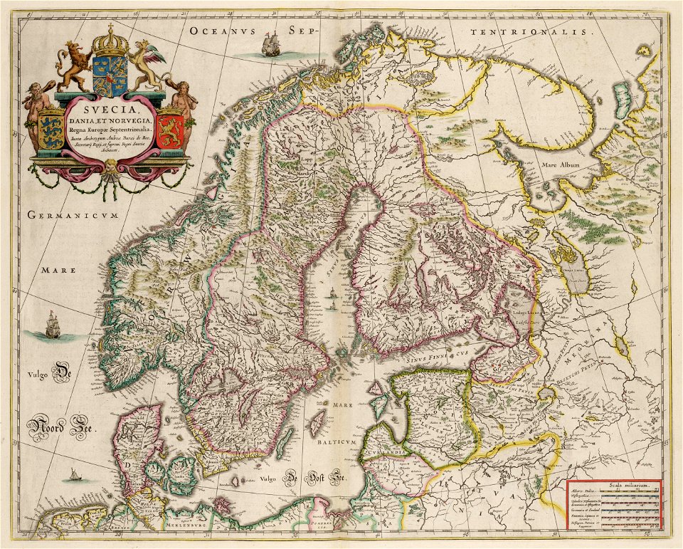
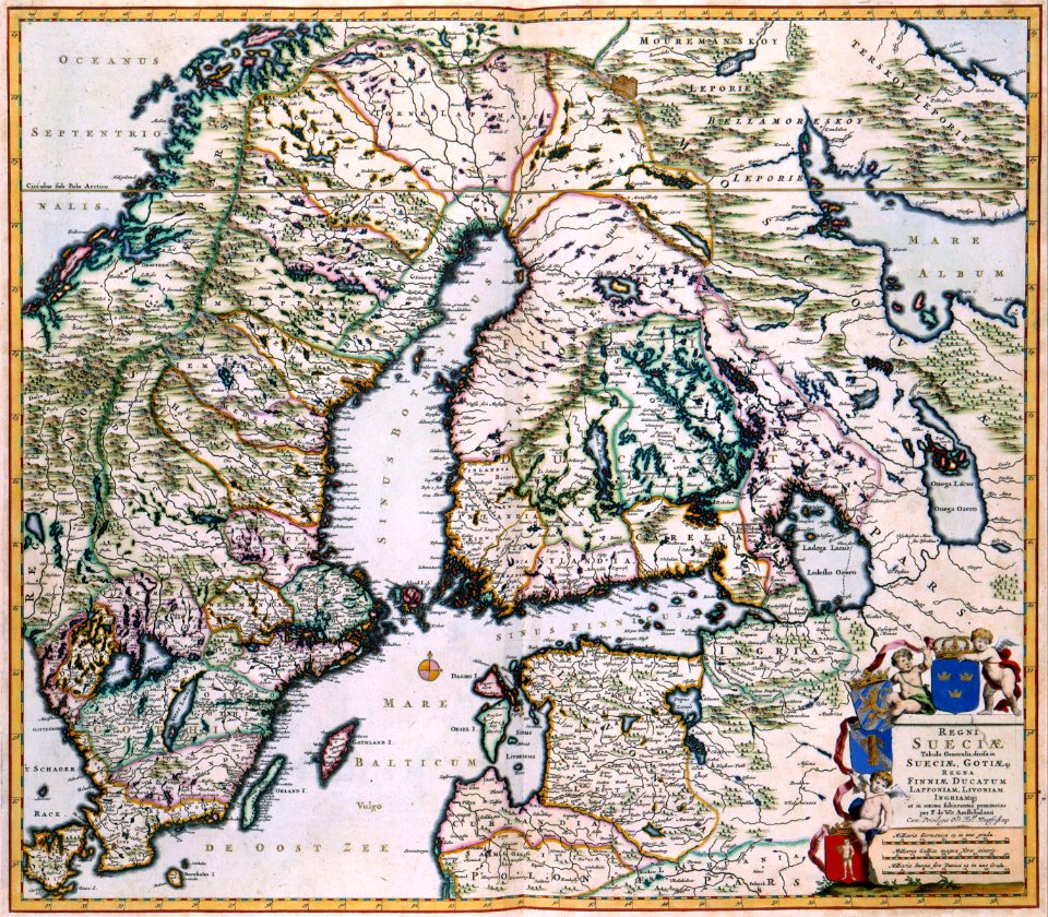
maps by willem and johannes blaeu
copper engraving
carta marina (details)
carta marina (details)
carta marina (details)
carta marina (details)
carta marina (details)
old maps of scandinavia
old maps of iceland
itinerario (jan huygen van linschoten)
latin-language maps
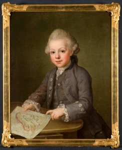
portrait paintings in the nationalmuseum stockholm
ulrika pasch
portolan charts by willem and johannes blaeu
old maps of scandinavia
maps made in the 17th century
old maps of scandinavia
old maps of scandinavia
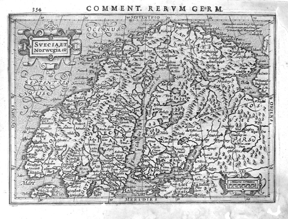
1552
old maps of greenland
old maps of iceland
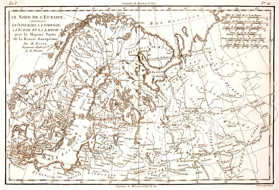
1780 maps of finland
1780 maps of norway
carta marina (details)
history of skiing
old maps of scandinavia
maps with cartouches
itinerario (jan huygen van linschoten)
latin-language maps
historisk atlas (stockholm, norstedt & söner, 1880)
maps of the history of scandinavia
old maps of the nordic region
1840 maps
maps by cornelis anthonisz.
1560 maps of europe
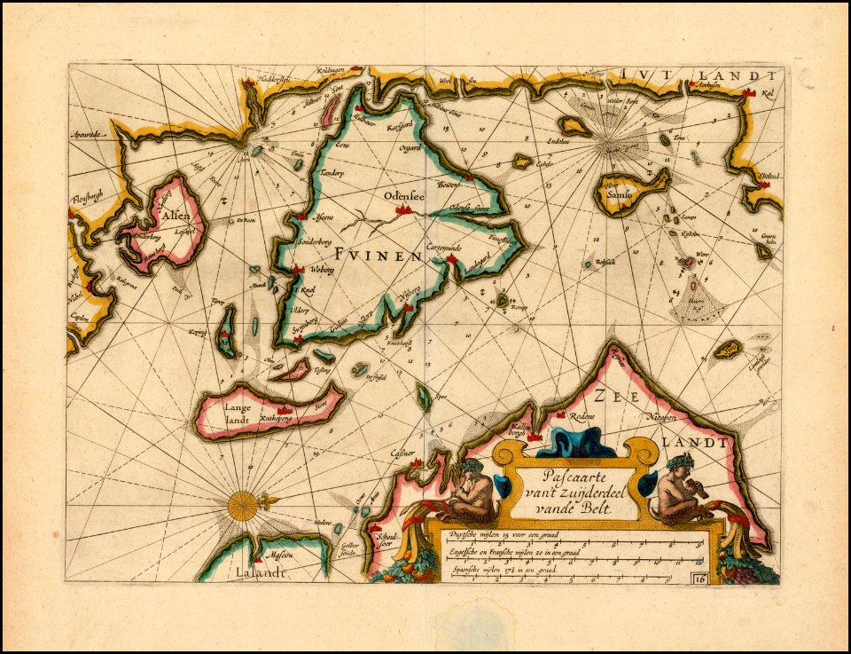
17th-century maps of the baltic sea
17th-century maps of scandinavia
classicism
1482 maps
maps of the history of denmark
old maps of scandinavia
17th-century maps of scandinavia
description de l'universe
ice-bound on kolguev (1895) by trevor-battye
maps from the mechanical curator collection
itinerario (jan huygen van linschoten)
renaissance
maps of the history of sweden
old maps of scandinavia
sweden
maps
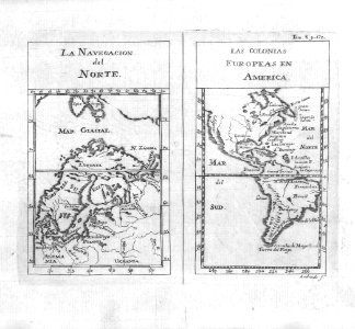
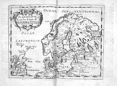
tresor des cartes geographiques (1659)
17th-century maps of scandinavia
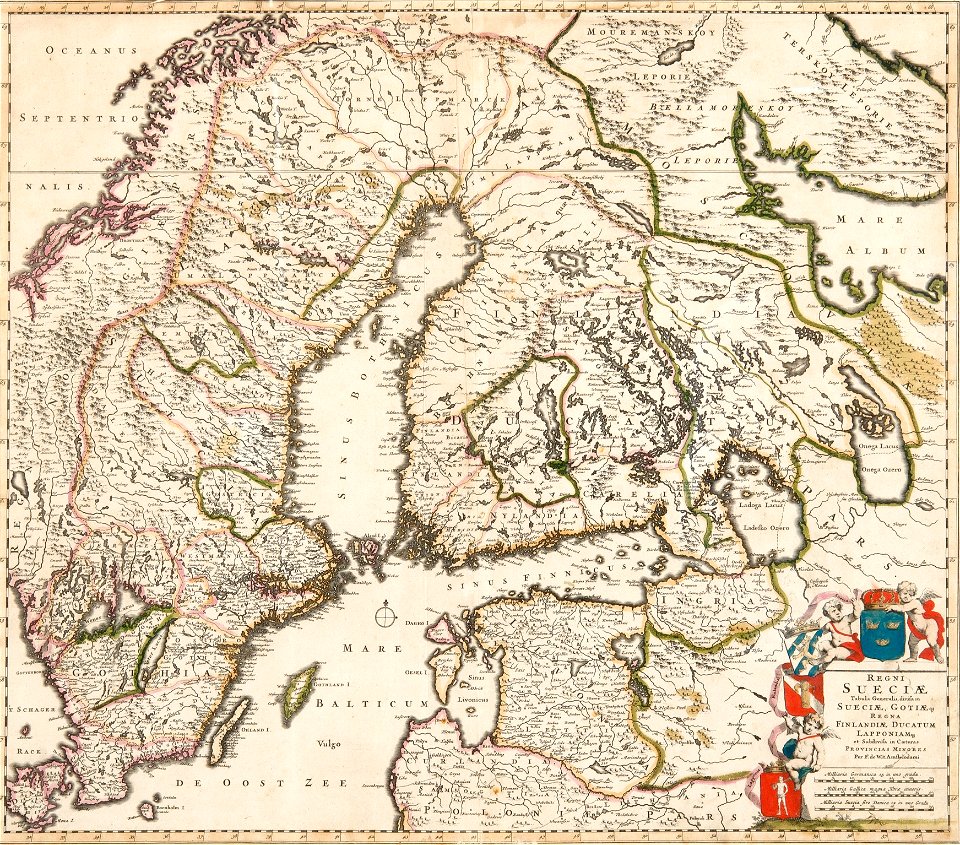
atlas maior, vol 2 (sweden, russia, poland, eastern europe, and greece) - joan blaeu, 1667 - bl 114.h(star).2
17th-century maps of scandinavia
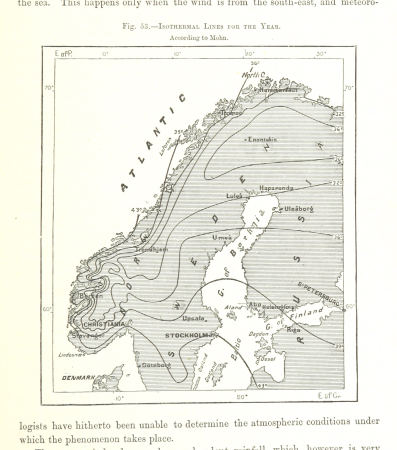
maps from the earth and its inhabitants, vol. v
19th-century maps of scandinavia
maps of the history of scandinavia
the history of lapland (1674)
cartography
maps
cartography
maps
atlas maior, vol 2 (sweden, russia, poland, eastern europe, and greece) - joan blaeu, 1667 - bl 114.h(star).2
17th-century maps of scandinavia
arnold's geographical handbook (1899)
19th-century maps of scandinavia
1700s maps of the tsardom of russia
1700s maps of eastern europe
cartography
maps
atlas sive cosmographicae (gerardus mercator, 1623)
maps of scandinavia by gerardus mercator
maps from the earth and its inhabitants, vol. v
maps of scandinavia
maps from the earth and its inhabitants, vol. v
maps of scandinavia
maps from the earth and its inhabitants, vol. v
maps of scandinavia
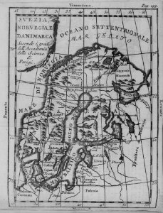
atlas ou representation du monde universel t. 1 (1633)
17th-century maps of scandinavia
atlas sive cosmographicae (gerardus mercator, 1630)
maps of scandinavia by gerardus mercator
africa
maps
maps from the earth and its inhabitants, vol. v
19th-century maps of scandinavia
cartography
maps
atlas géographique des quatre parties du monde (delisle)
map of scandinavia by guillaume de l'isle (1706)
atlas géographique des quatre parties du monde (delisle)
map of scandinavia by guillaume de l'isle (1706)
1 - 76 of 76
/ 1


![Treasure of geographical maps of the main states of the universe [...], 1659](https://cdn.creazilla.com/illustrations/10000436833/treasure-of-geographical-maps-of-the-main-states-of-the-universe-1659-md.jpg)


![Gerardi Mercatoris and I. Hondii Atlas or Representation of the Universal World, and of the Parts of It, Made in Tables and Descriptions Very Ample, and Exact: Divided into Two Volumes [...]. [t. 1].](https://cdn.creazilla.com/illustrations/10001541341/gerardi-mercatoris-and-i-hondii-atlas-or-representation-of-the-universal-world-and-of-the-parts-of-it-made-in-tables-and-descriptions-very-ample-and-exact-divided-into-two-volumes-t-1-md.jpg)