Log in
All resources
Create a design
163 Free Artworks of Maps Of Norway
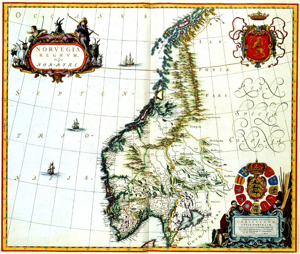
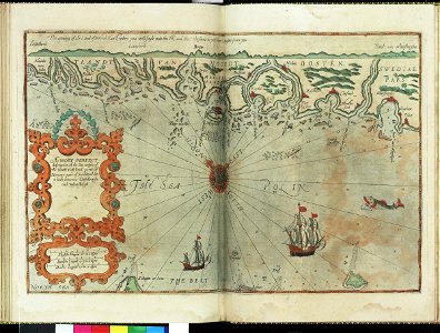
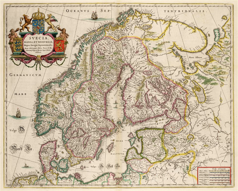
joan blaeu
copper engraving print
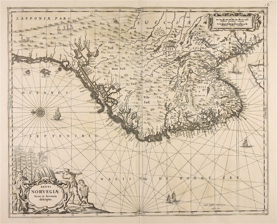
atlas maior, vol 1 (northern europe, norway, and denmark) - joan blaeu, 1667 - bl 114.h(star).1
british library
1667 maps
old maps of scandinavia
maps of the barents sea
dutch-language maps
old maps of the white sea
baptista van doetecum
third voyage of willem barentsz
16th-century maps of the arctic
third voyage of willem barentsz
16th-century maps of the arctic
third voyage of willem barentsz
history of dutch sea fisheries
third voyage of willem barentsz
history of dutch sea fisheries
third voyage of willem barentsz
16th-century maps of the arctic
itinerario (jan huygen van linschoten)
latin-language maps
the voyage of the vega round asia and europe
third voyage of willem barentsz
overwintering on nova zembla by willem barentsz, 1596-1597
maps in the rijksmuseum amsterdam
overwintering on nova zembla by willem barentsz, 1596-1597
maps in the rijksmuseum amsterdam
17th-century maps of finland
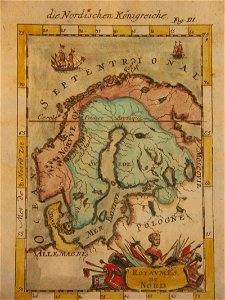
description de l'universe
historical coats of arms of denmark
royal coats of arms of sweden
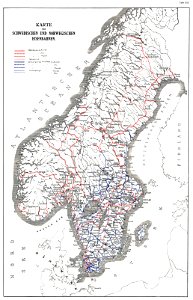
history of rail transport in norway
rail transport maps of norway
maps with cartouches
joan blaeu
charts and maps of the royal museums greenwich
lucas janszoon waghenaer
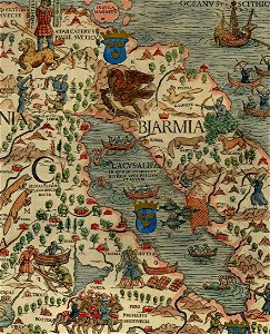
maps of the republic of novgorod
1539 maps of russia
old maps of scandinavia
1855 maps
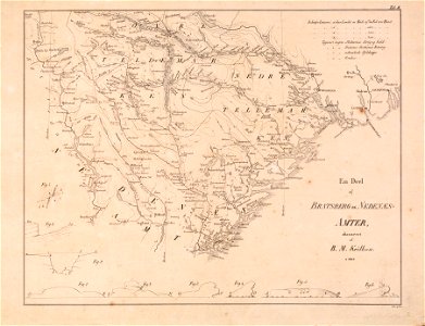
old maps of aust-agder
old maps of telemark
maps by willem and johannes blaeu
copper engraving
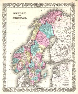
19th-century maps of sweden
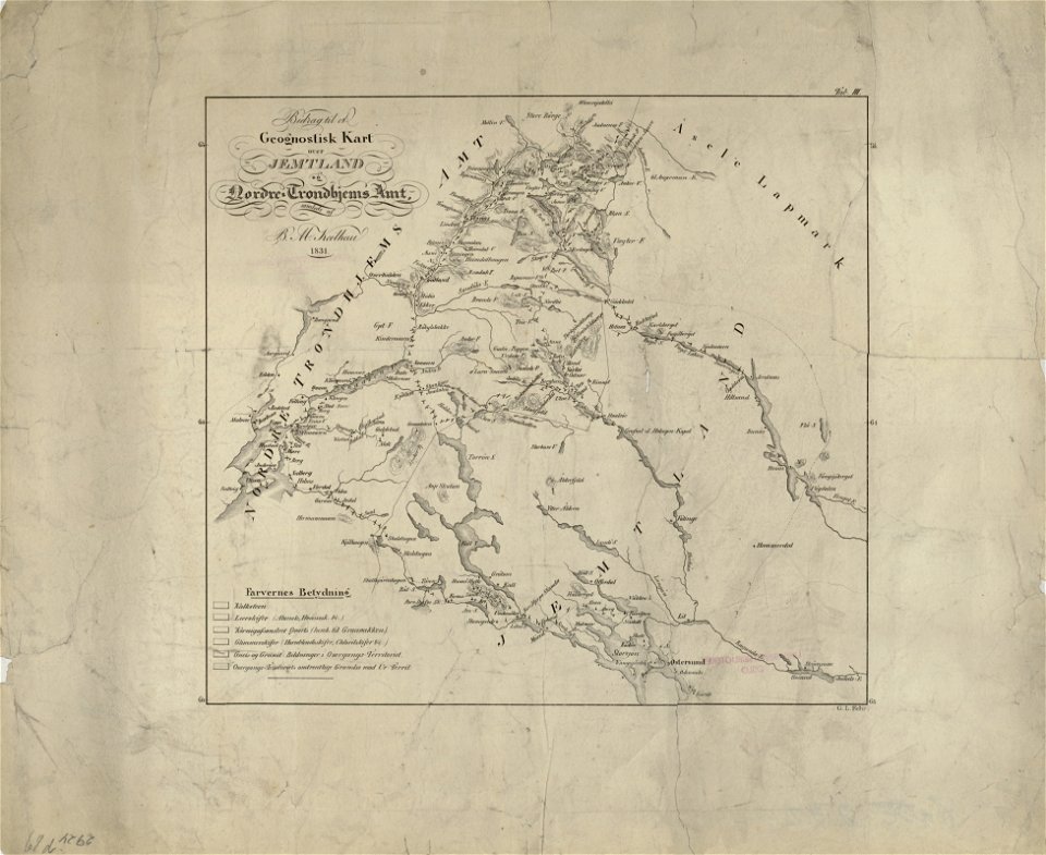
old maps of jämtland county
old maps of scandinavia
johannes ratelband
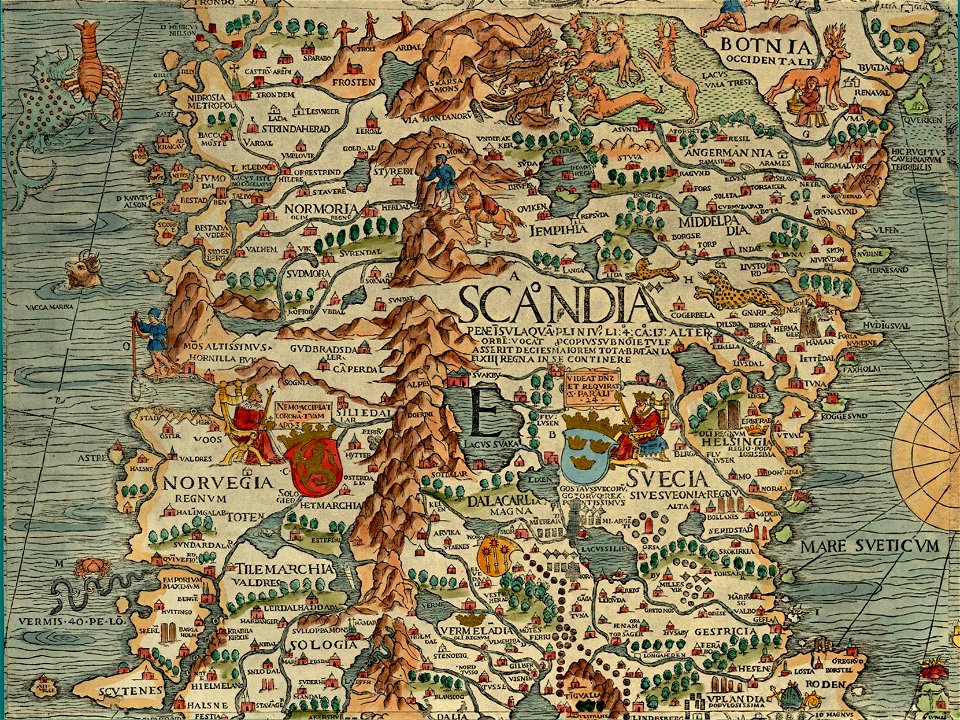
carta marina (details)
maps with cartouches
atlas van der hagen
atlantis magni tomus primus (biblioteca comunale di trento)
maps made in the 17th century
1780 maps of finland
1780 maps of norway
nicolaes visscher ii
abraham goos
19th-century satirical maps
1899 maps of europe
atlantis magni tomus primus (biblioteca comunale di trento)
maps made in the 17th century
norway, sweden, and denmark- with excursions to iceland and spitzbergen; handbook for travellers (1909)
maps of skansen
maps made in the 17th century
cornelis danckerts (i)
charts and maps of the royal museums greenwich
lucas janszoon waghenaer
itinerario (jan huygen van linschoten)
latin-language maps
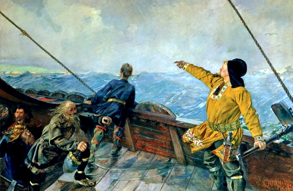
thorfinn karlsefni
norwegian
itinerario (jan huygen van linschoten)
latin-language maps
old maps of finnmark
old maps of troms
1900 maps of russia
1900 maps of china
maps by pieter van der keere
maps with cartouches
maps by cornelis anthonisz.
1560 maps of europe
maps of bergen (norway) by braun & hogenberg
hieronymus scholeus
royal coats of arms of norway
hieronymus scholeus
maps of bergen (norway) by braun & hogenberg
1580s engravings
coats of arms on maps
ships on maps
atlas maior, vol 1 (northern europe, norway, and denmark) - joan blaeu, 1667 - bl 114.h(star).1
1667 maps
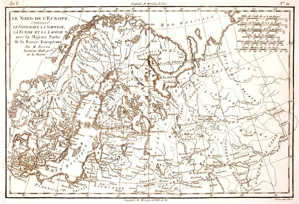
maps from the earth and its inhabitants, vol. v
maps of railway lines in norway
lucas janszoon waghenaer
1610s maps of norway
old maps of the nordic region
1840 maps
maps by willem and johannes blaeu
1662 maps of norway
maps from the mechanical curator collection available to georeference
maps from the mechanical curator collection
atlas maior, vol 1 (northern europe, norway, and denmark) - joan blaeu, 1667 - bl 114.h(star).1
17th-century double hemisphere world maps
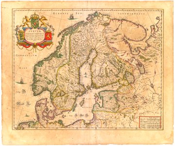
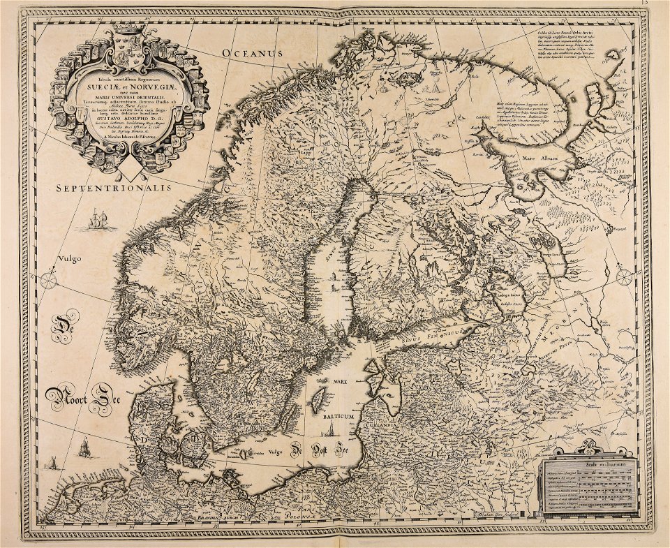
suecia antiqua et hodierna, volume 1
17th-century maps of sweden
sweden
maps
den danske hærs historie til nutiden og den norske hærs historie indtil 1814
maps from the mechanical curator collection
maps by pieter van der keere
1600s maps of norway
maps from the mechanical curator collection available to georeference
maps from the mechanical curator collection
17th-century maps of sweden
1660s maps of norway
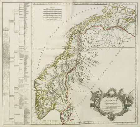
old maps of norway
guillaume sanson
old maps of norway
guillaume sanson
old maps of norway
guillaume sanson
atlas maior, vol 1 (northern europe, norway, and denmark) - joan blaeu, 1667 - bl 114.h(star).1
1660s maps of norway
voyages de la commission scientifique du nord, en scandinavie, en laponie, au spitzberg et aux feröe
maps of bossekop
lucas janszoon waghenaer
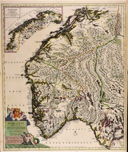
1584 maps of norway
maps of oslofjorden
1584 maps of norway
maps of bergen (norway) by braun & hogenberg
hieronymus scholeus
old maps of norway
guillaume sanson
maps of denmark by gerardus mercator
historical coats of arms of denmark
maps of bergen (norway) by braun & hogenberg
churches in bergenhus
historical images of håkonshallen
bergenhus festning in art
19th-century oil paintings of landscapes in norway
catharine hermine kølle
atlas maior, vol 1 (northern europe, norway, and denmark) - joan blaeu, 1667 - bl 114.h(star).1
1667 maps
maps of bergen (norway) by braun & hogenberg
hieronymus scholeus
maps by wilhelm maximilian carpelan
1826 maps of norway
old maps of norway
guillaume sanson
old maps of norway
guillaume sanson
atlas maior, vol 1 (northern europe, norway, and denmark) - joan blaeu, 1667 - bl 114.h(star).1
17th-century maps of iceland
christmas and winter scenes from the british library mechanical curator collection
christmas in norway
17th-century portraits of men at bust length
jodocus hondius
maps from the earth and its inhabitants, vol. v
1870s maps of norway
maps from the earth and its inhabitants, vol. v
19th-century maps of scandinavia
atlas maior, vol 1 (northern europe, norway, and denmark) - joan blaeu, 1667 - bl 114.h(star).1
1667 maps
atlas maior, vol 1 (northern europe, norway, and denmark) - joan blaeu, 1667 - bl 114.h(star).1
1667 maps
atlas maior, vol 1 (northern europe, norway, and denmark) - joan blaeu, 1667 - bl 114.h(star).1
1667 maps
atlas maior, vol 1 (northern europe, norway, and denmark) - joan blaeu, 1667 - bl 114.h(star).1
1667 maps
atlas maior, vol 1 (northern europe, norway, and denmark) - joan blaeu, 1667 - bl 114.h(star).1
1667 maps
atlas maior, vol 1 (northern europe, norway, and denmark) - joan blaeu, 1667 - bl 114.h(star).1
1667 maps
atlas maior, vol 1 (northern europe, norway, and denmark) - joan blaeu, 1667 - bl 114.h(star).1
1667 maps
atlas maior, vol 1 (northern europe, norway, and denmark) - joan blaeu, 1667 - bl 114.h(star).1
1667 maps
atlas maior, vol 1 (northern europe, norway, and denmark) - joan blaeu, 1667 - bl 114.h(star).1
1667 maps
atlas maior, vol 1 (northern europe, norway, and denmark) - joan blaeu, 1667 - bl 114.h(star).1
1667 maps
atlas maior, vol 1 (northern europe, norway, and denmark) - joan blaeu, 1667 - bl 114.h(star).1
1667 maps
atlas maior, vol 1 (northern europe, norway, and denmark) - joan blaeu, 1667 - bl 114.h(star).1
1667 maps
atlas maior, vol 1 (northern europe, norway, and denmark) - joan blaeu, 1667 - bl 114.h(star).1
1667 maps
atlas maior, vol 1 (northern europe, norway, and denmark) - joan blaeu, 1667 - bl 114.h(star).1
1667 maps
atlas maior, vol 1 (northern europe, norway, and denmark) - joan blaeu, 1667 - bl 114.h(star).1
1667 maps
atlas maior, vol 1 (northern europe, norway, and denmark) - joan blaeu, 1667 - bl 114.h(star).1
1667 maps
atlas maior, vol 1 (northern europe, norway, and denmark) - joan blaeu, 1667 - bl 114.h(star).1
1667 maps
atlas maior, vol 1 (northern europe, norway, and denmark) - joan blaeu, 1667 - bl 114.h(star).1
1667 maps
atlas maior, vol 1 (northern europe, norway, and denmark) - joan blaeu, 1667 - bl 114.h(star).1
1667 maps
atlas maior, vol 1 (northern europe, norway, and denmark) - joan blaeu, 1667 - bl 114.h(star).1
1667 maps
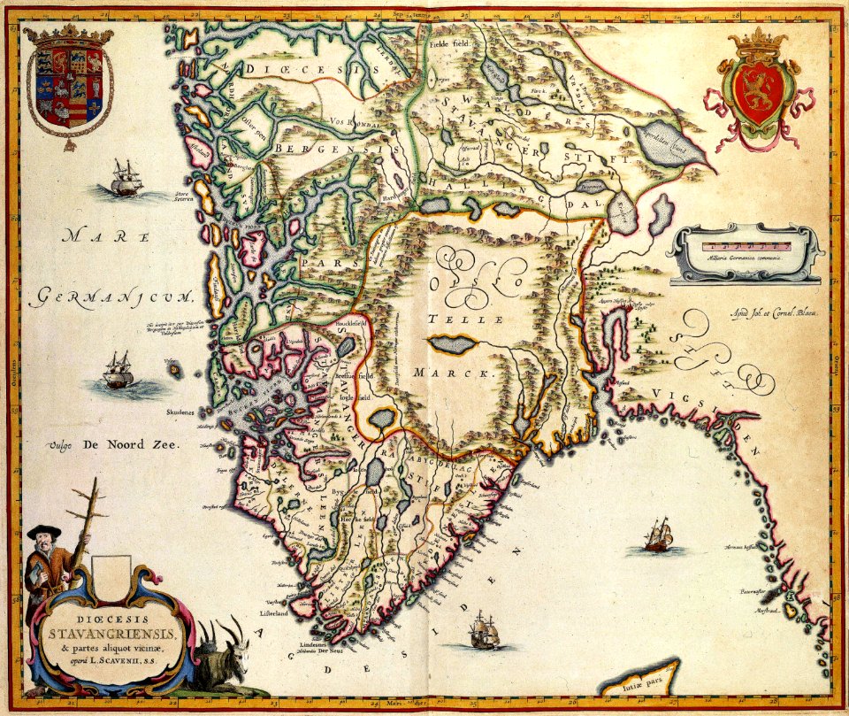
old maps of rogaland
history of stavanger
atlas maior, vol 1 (northern europe, norway, and denmark) - joan blaeu, 1667 - bl 114.h(star).1
1667 maps of europe
atlas maior, vol 1 (northern europe, norway, and denmark) - joan blaeu, 1667 - bl 114.h(star).1
1667 maps
1 - 100 of 163
Next page
/ 2