Log in
All resources
Create a design
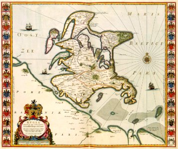
15 Free Artworks of Maps Of Islands Of Sweden
third voyage of willem barentsz
16th-century maps of the arctic
history of dutch sea fisheries
old maps of spitsbergen
old maps of scandinavia
maps of novaya zemlya
old maps of the arctic
old maps of the white sea
maps of the barents sea
maps of the greenland sea
third voyage of willem barentsz
16th-century maps of the arctic
third voyage of willem barentsz
history of dutch sea fisheries
third voyage of willem barentsz
history of dutch sea fisheries
third voyage of willem barentsz
16th-century maps of the arctic
third voyage of willem barentsz
16th-century maps of the arctic
the voyage of the vega round asia and europe
third voyage of willem barentsz
overwintering on nova zembla by willem barentsz, 1596-1597
maps in the rijksmuseum amsterdam
overwintering on nova zembla by willem barentsz, 1596-1597
maps in the rijksmuseum amsterdam
maps of islands of sweden
björkö
maps of ven (oresund)
old maps of skåne
atlas van der hagen (volume 1)
atlas van der hagen
maps of islands of sweden
björkö
zee custe van sweeden, ontrent de westerwijck, ende tgatt vann stockholm, beginnende van kalmar tot den wigsteen en rookoe gelegen bynnen tgatt van stockholm alsoe hem tlandt daer verthoont - doer lucas... - btv1b53235860x
bibliothèque nationale de france
zee custe van sweeden, ontrent de westerwijck, ende tgatt vann stockholm, beginnende van kalmar tot den wigsteen en rookoe gelegen bynnen tgatt van stockholm alsoe hem tlandt daer verthoont - doer lucas... - btv1b53235860x
bibliothèque nationale de france
zee custe van sweeden, ontrent de westerwijck, ende tgatt vann stockholm, beginnende van kalmar tot den wigsteen en rookoe gelegen bynnen tgatt van stockholm alsoe hem tlandt daer verthoont - doer lucas... - btv1b53235860x
bibliothèque nationale de france
1 - 15 of 15
/ 1