Log in
All resources
Create a design
299 Free Artworks of Maps Of Ireland
1685 maps
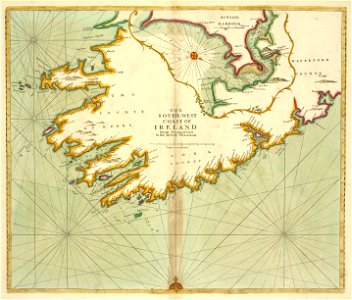
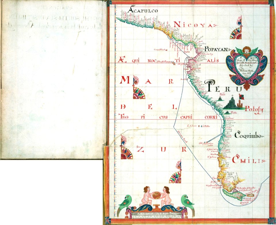
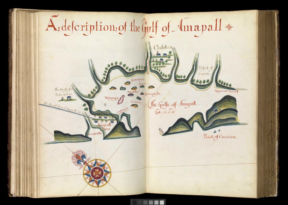
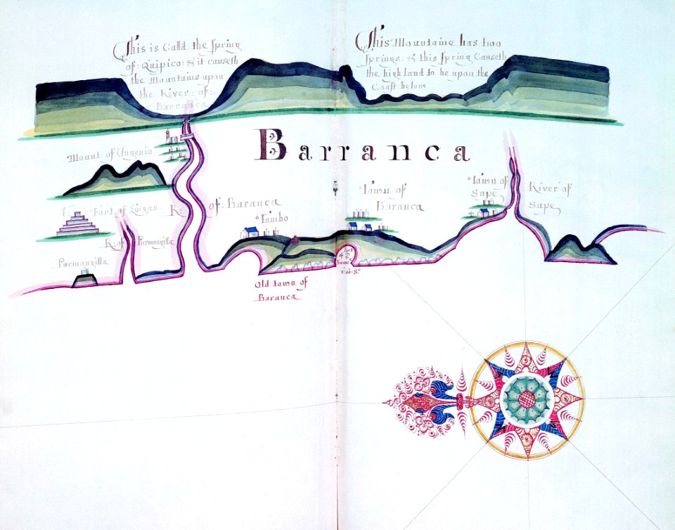
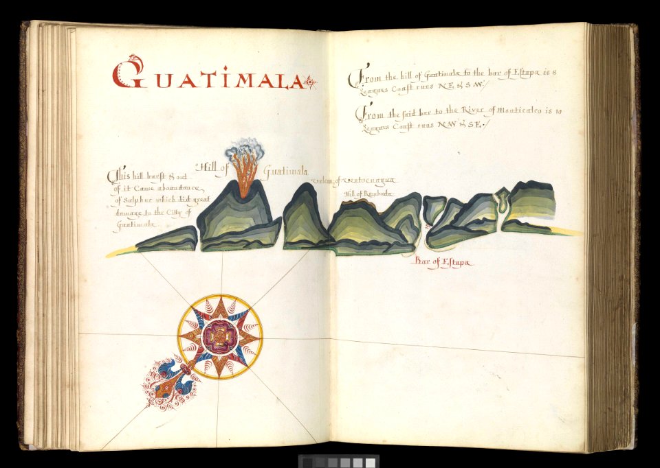
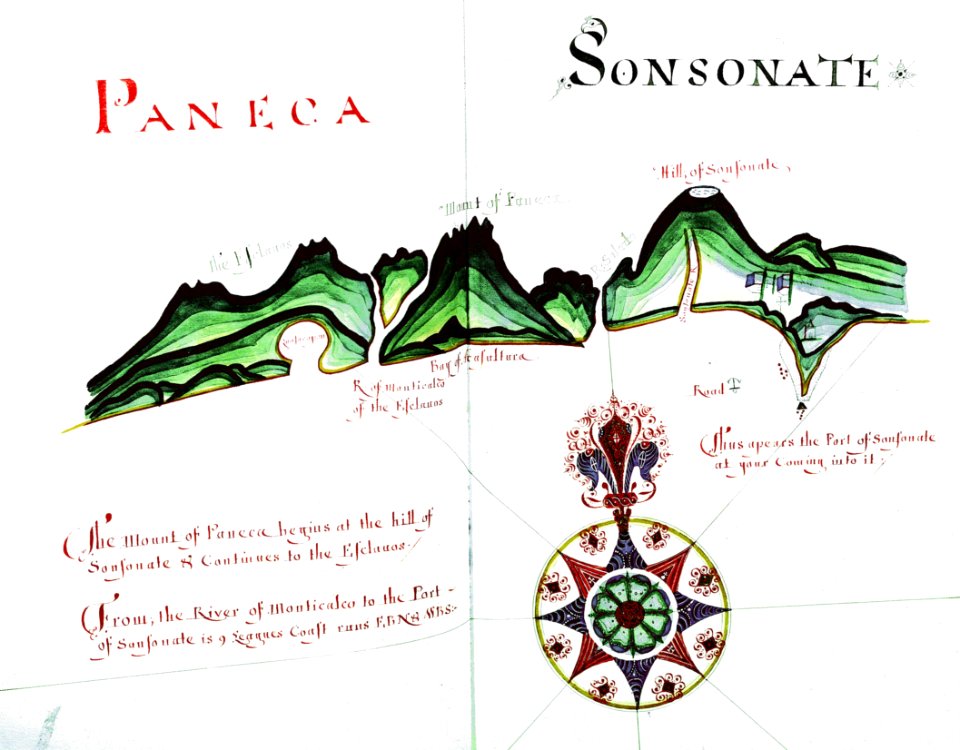
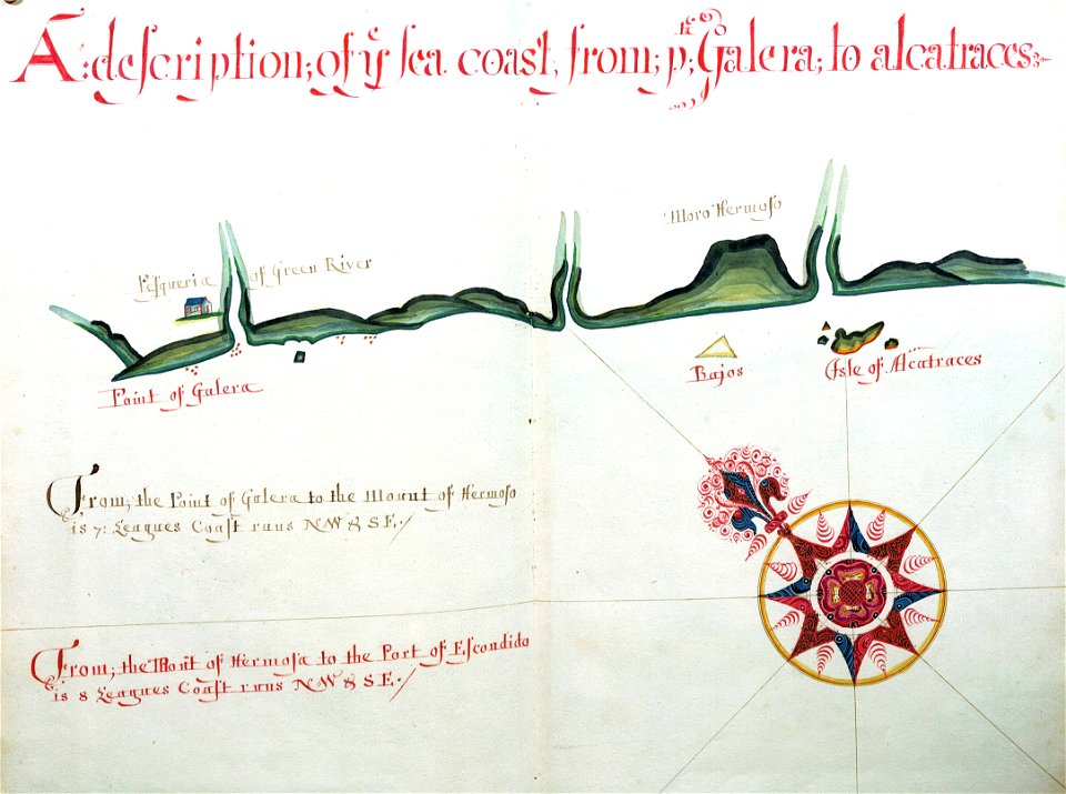
a waggoner of the south sea describing the sea coast from acapulco to albermarle isle
made by william hack at the signe of great britaine and ireland in wapping. anno 1685 (rmg)
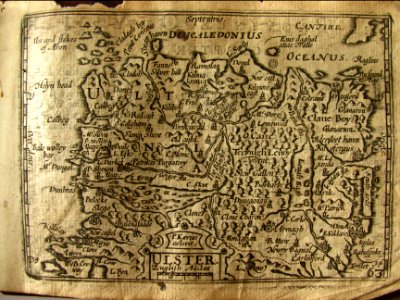
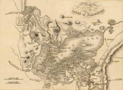
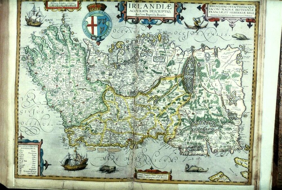
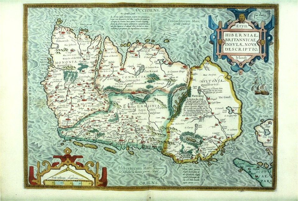
old maps of ireland
historical national coats of arms of ireland
latin-language maps
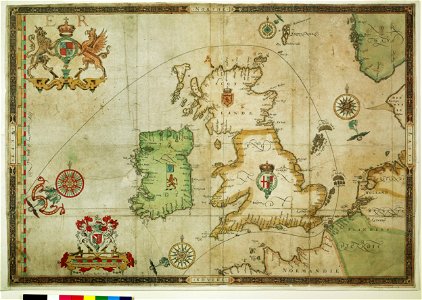
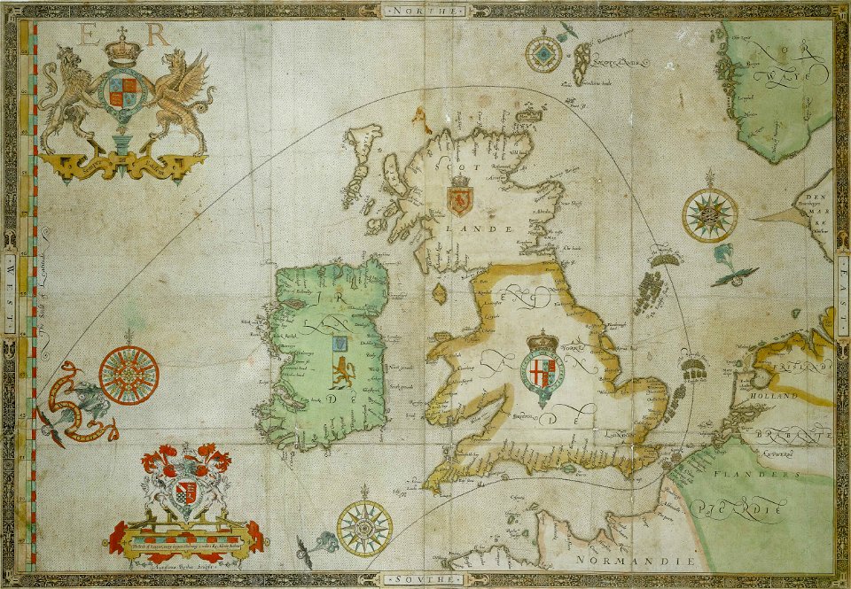
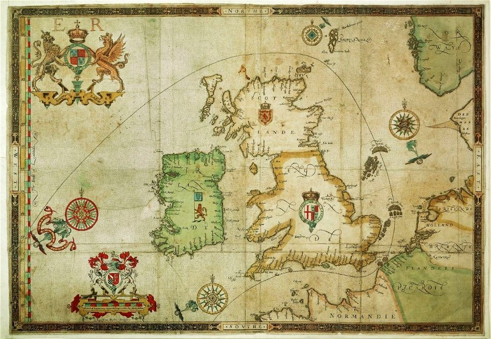
the track of the armada around britain and ireland
charts and maps of the royal museums greenwich
maps of the spanish armada
augustine ryther
maps from the mechanical curator collection
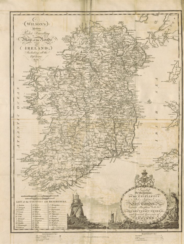
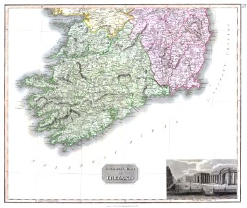
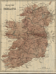
19th-century maps of ireland
hatched coats of arms
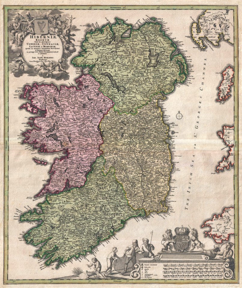
johann baptist homann
1814 maps
dublin
university of toronto wenceslas hollar digital collection
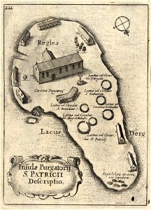
old maps of ireland
images from the new york public library
old maps of ireland
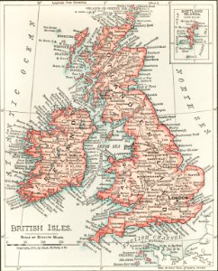
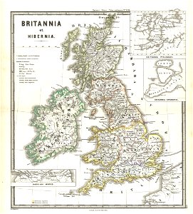
maps of the united kingdom of great britain and ireland
ireland in the 1900s
maps
sea
the track of the armada around britain and ireland
charts and maps of the royal museums greenwich
the track of the armada around britain and ireland
charts and maps of the royal museums greenwich
old maps of ireland
ireland
illustrations from letters from england
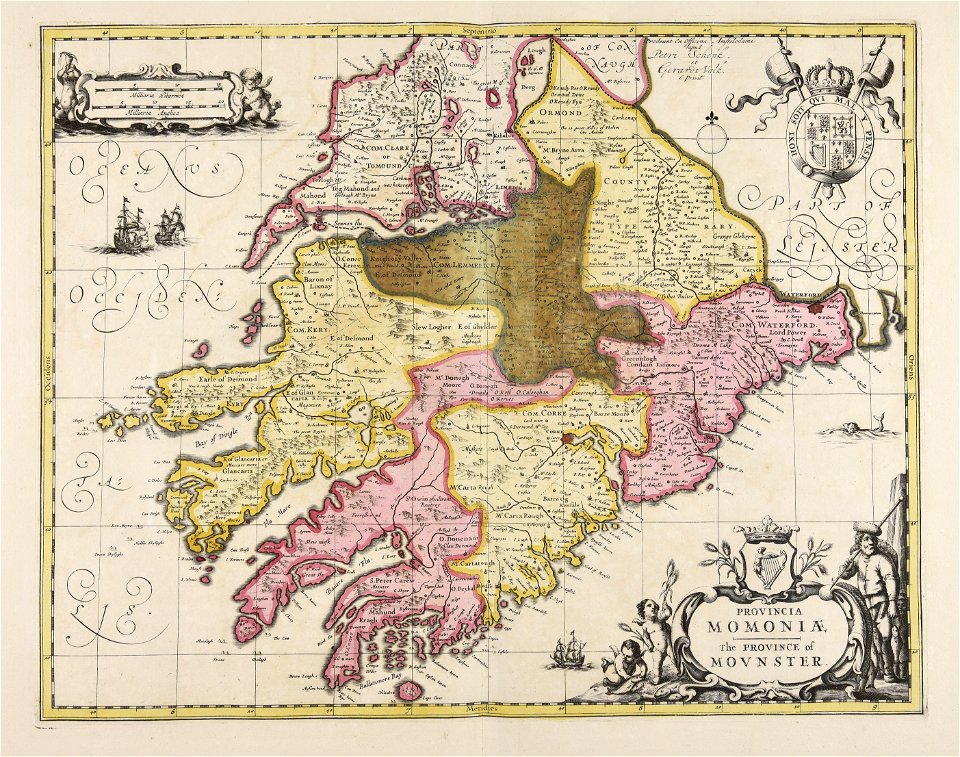
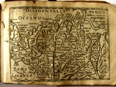
maps of ireland
old maps of ireland
gerard valck
rail transport maps
cc-zero
old maps of ireland
gerard valck
1665
hatched coats of arms
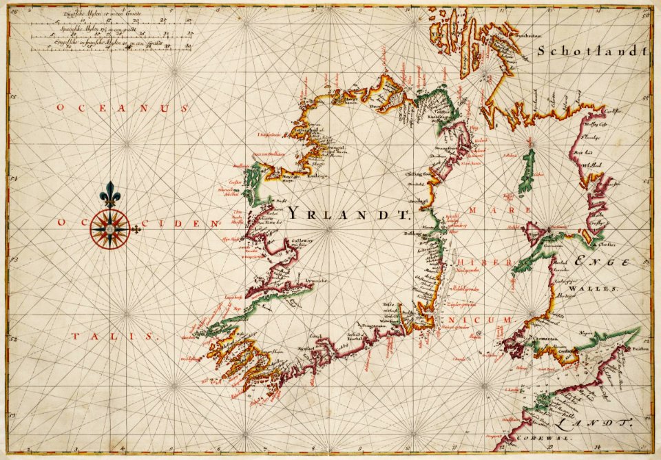
old maps of ireland
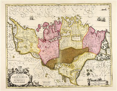
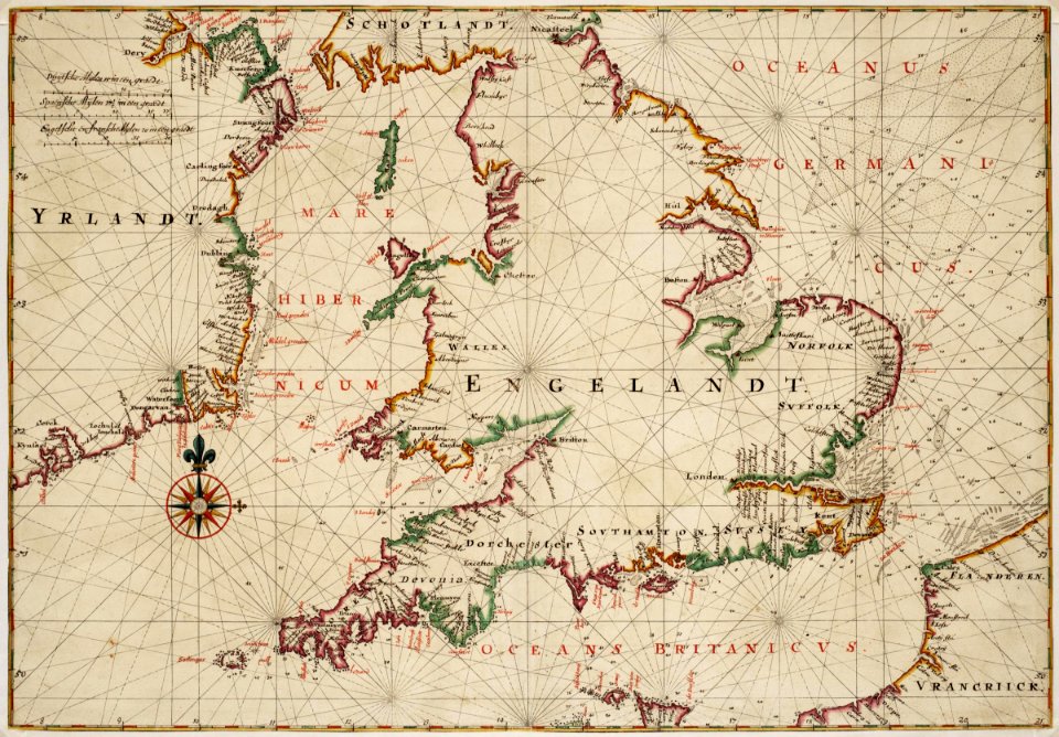
maps by willem and johannes blaeu
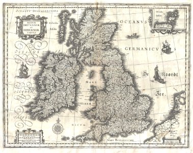
old maps of the british isles
cornell university library
1888 maps
history of rail transport in ireland
enzyklopädie des eisenbahnwesens
maps
war
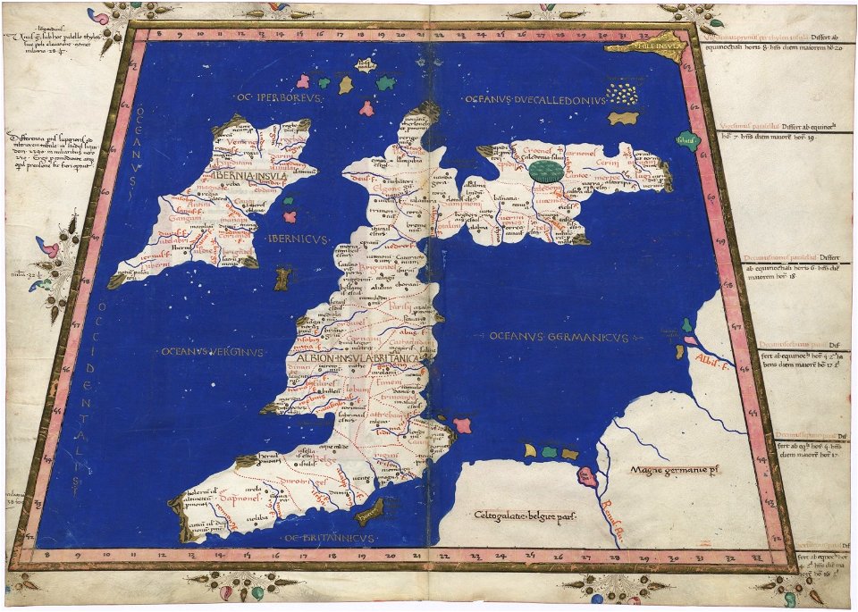
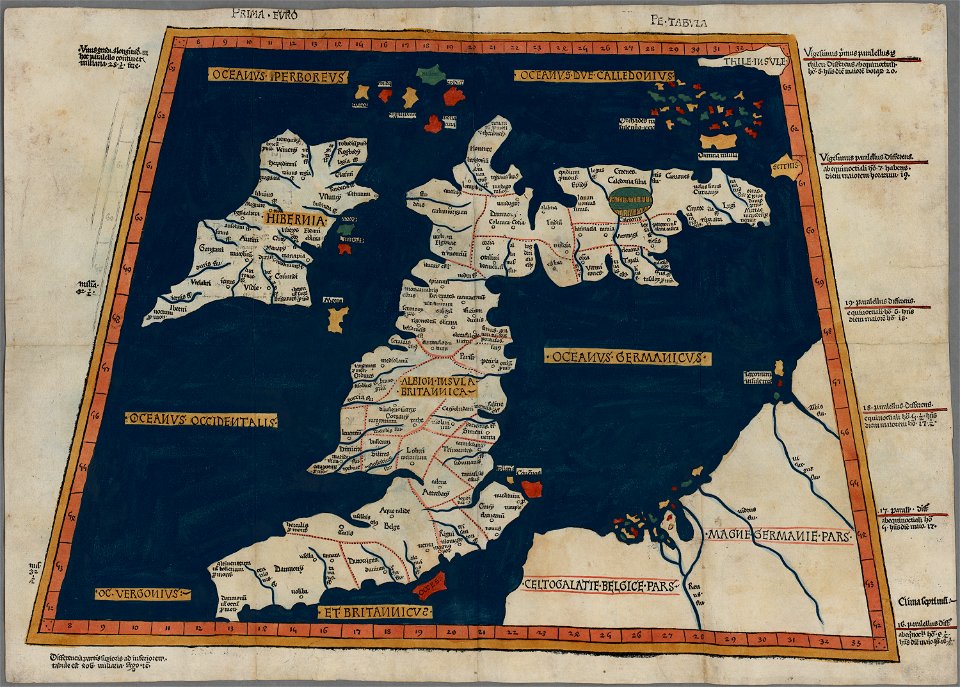
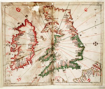
cosmographia claudii ptolomaei alexandrini
latin-language maps
great britain
north sea
old maps of the british isles
karl spruner von merz
charts and maps of the royal museums greenwich
joan martines
1665
miniature speed atlas (1627) pieter van den keere
pieter van der keere
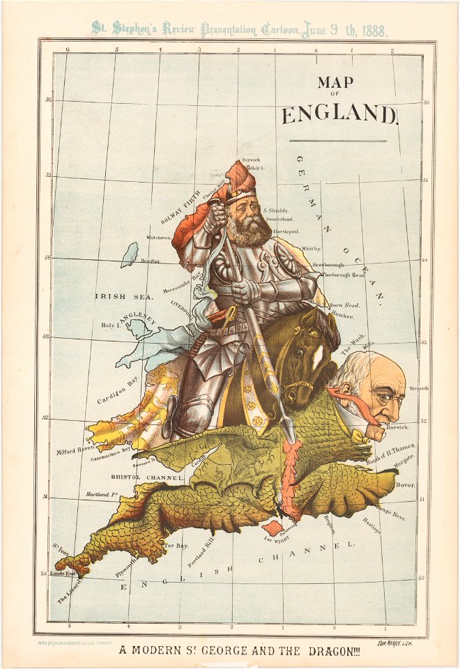
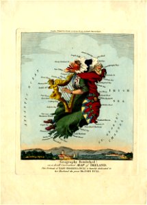
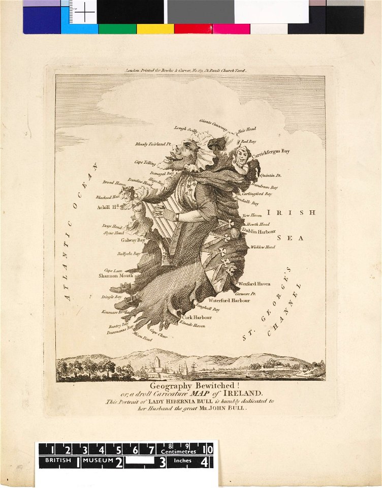
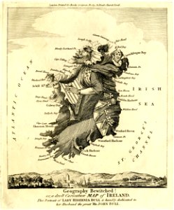
satirical prints in the british museum
miniature speed atlas (1627) pieter van den keere
pieter van der keere
university of toronto wenceslas hollar digital collection
old maps of ireland
satirical prints in the british museum
the track of the armada around britain and ireland
london
images uploaded as part of nlw - wmuk collaboration
cc-zero
satirical prints in the british museum
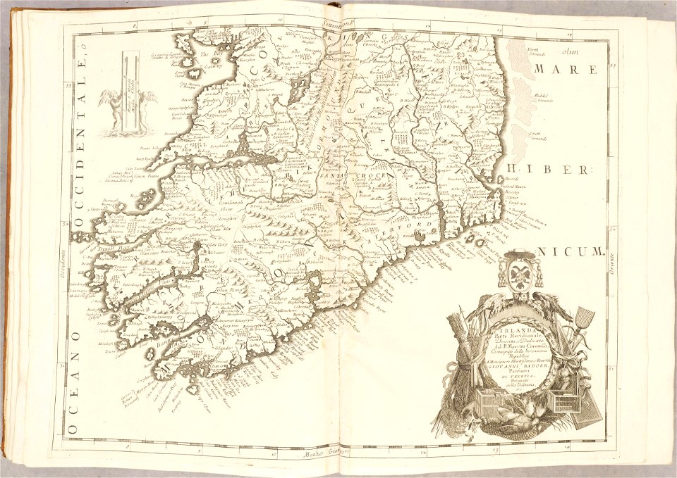
atlante veneto (raremaps.com) volume 2
old maps of ireland
atlante veneto (raremaps.com) volume 2
old maps of ireland
details of the ambassadors (holbein)
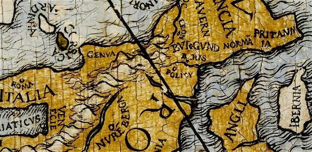
ptolemaic britain
files from the bodleian libraries
old maps of ireland
files from the bodleian libraries
old maps of ireland
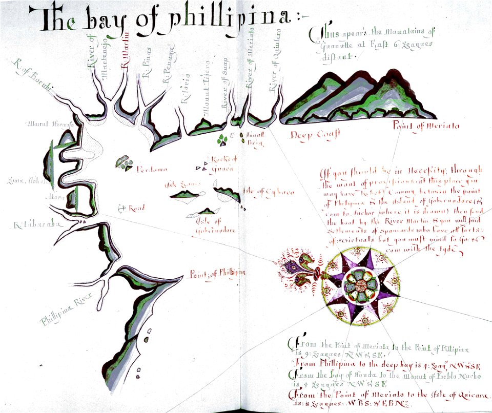
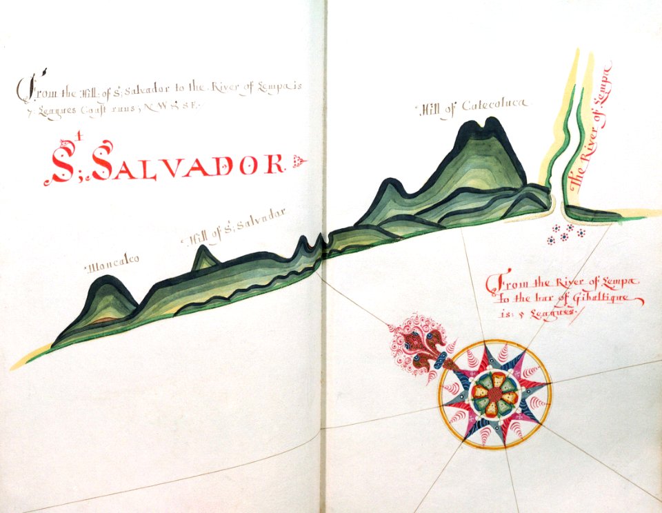
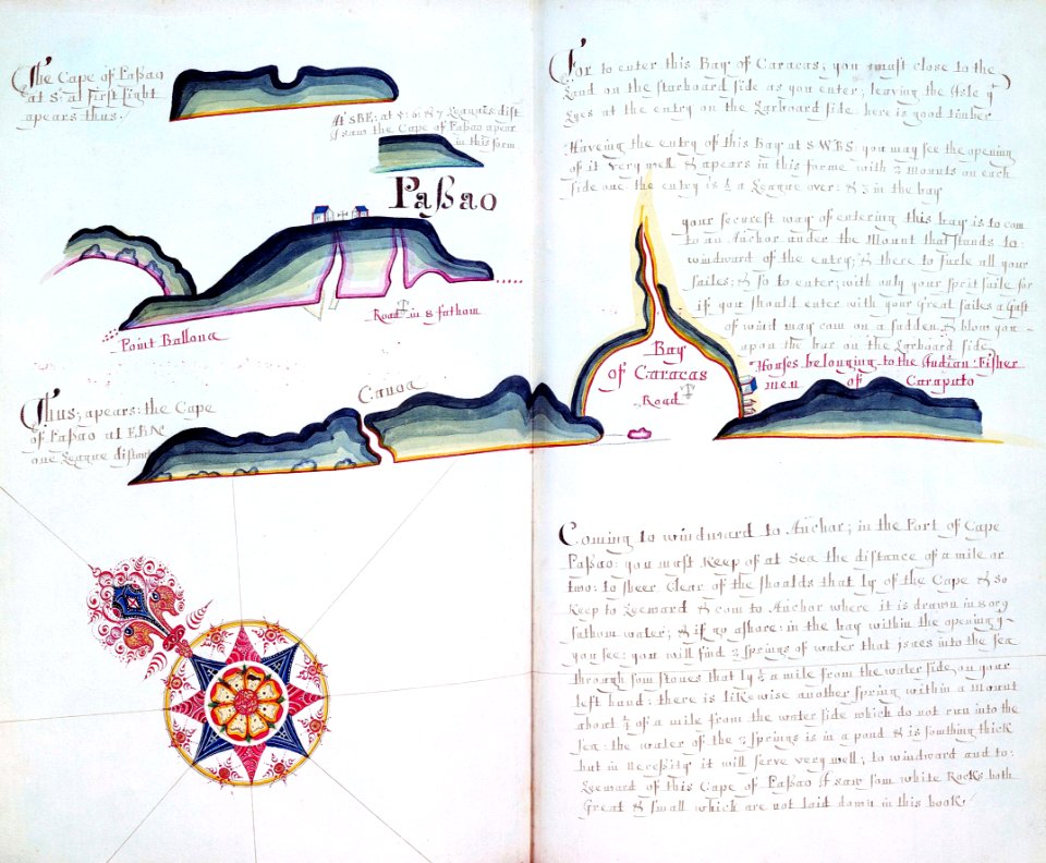
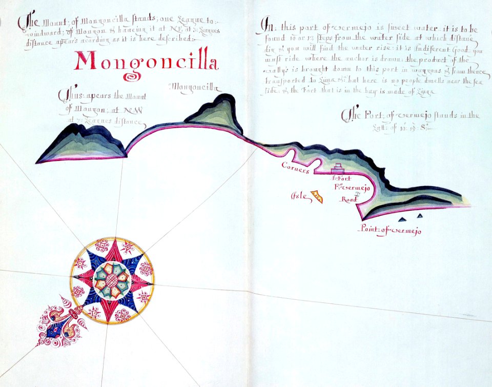
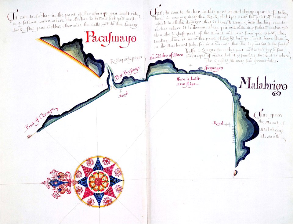
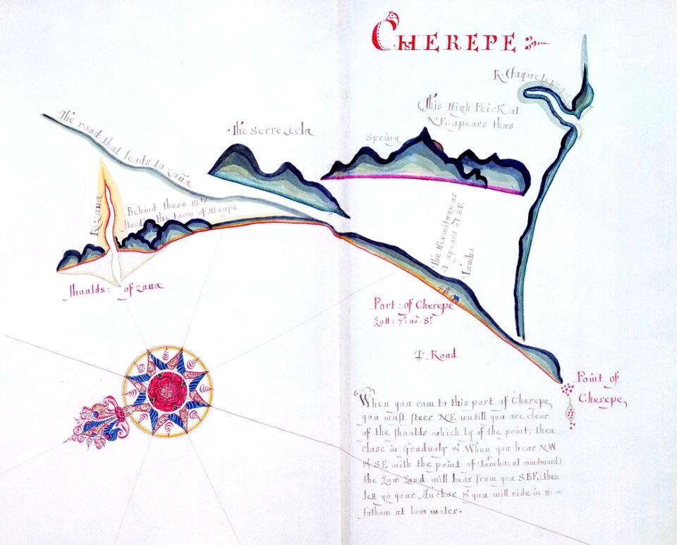
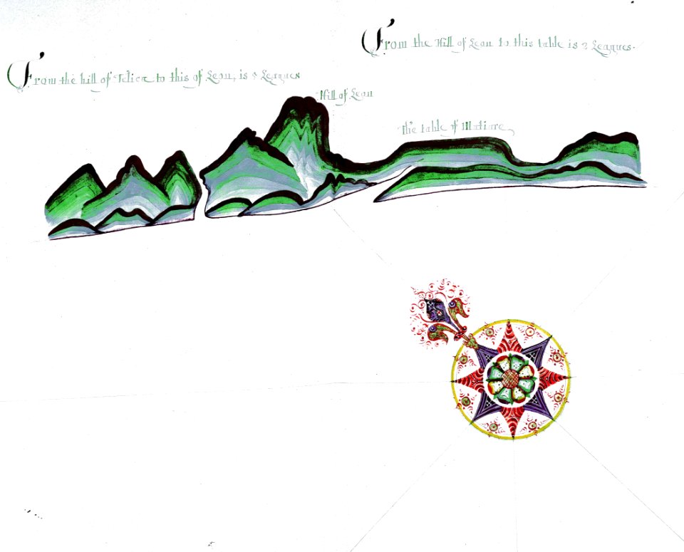
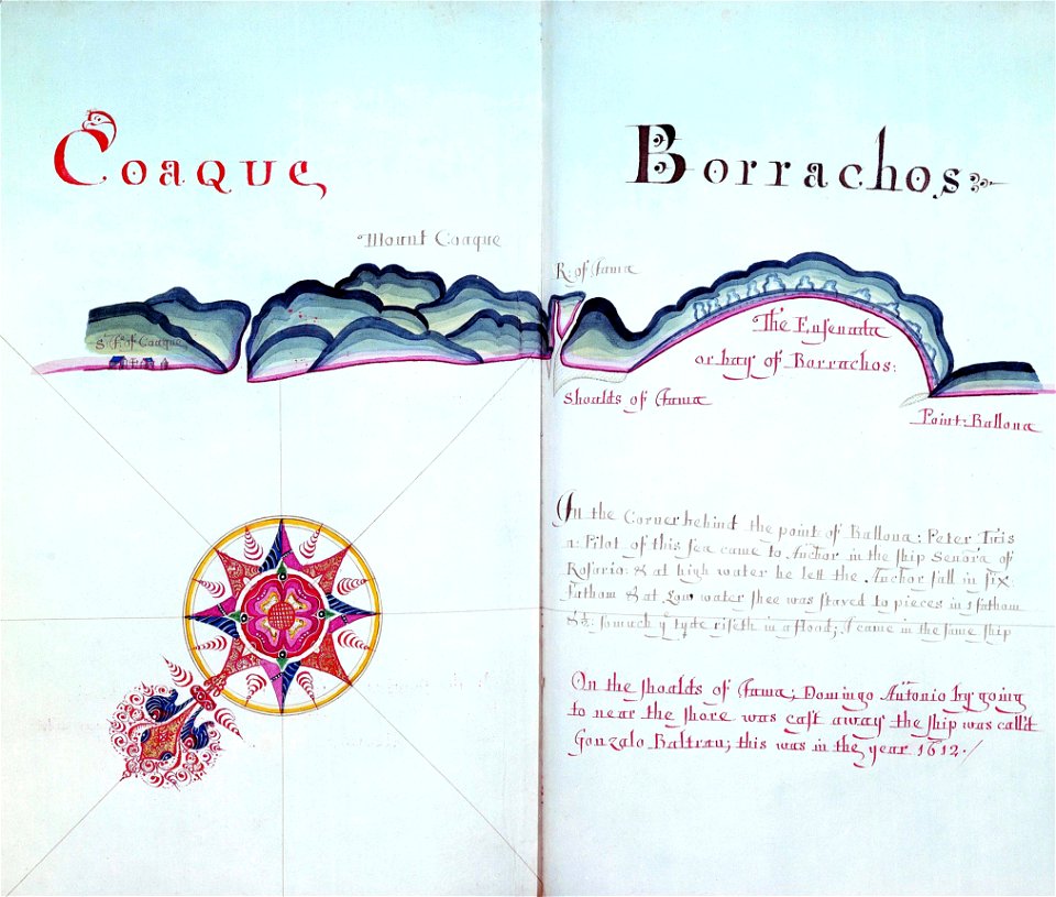
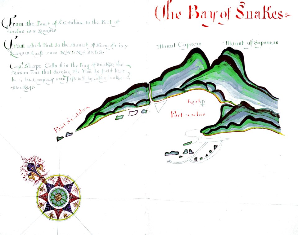
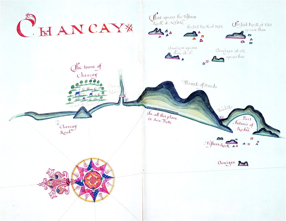
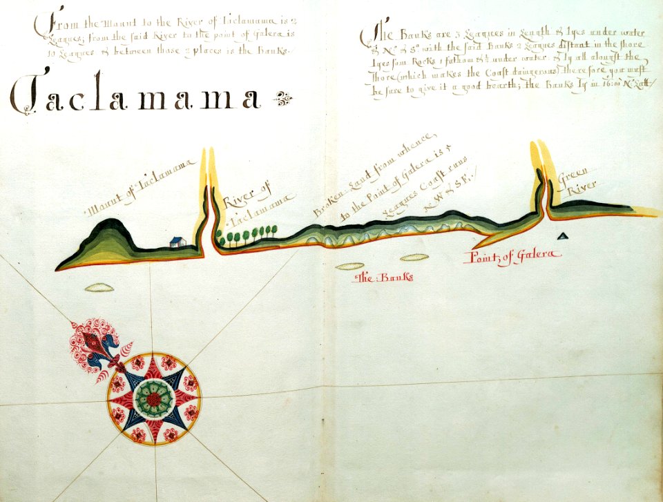
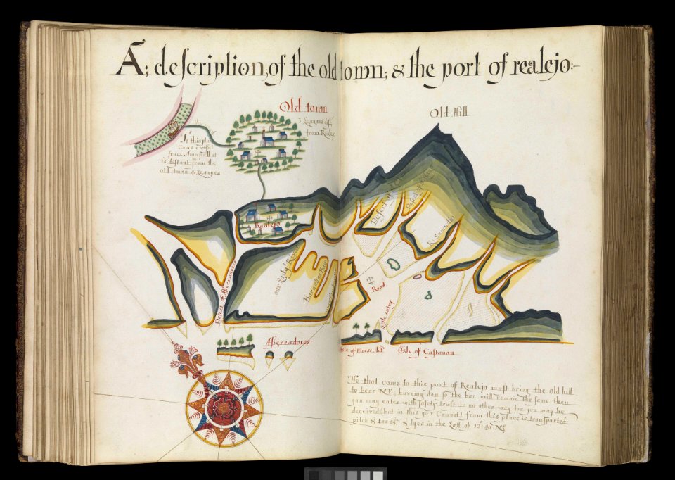
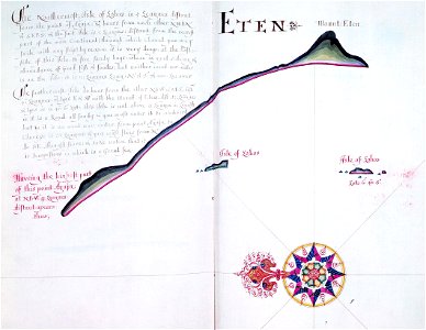
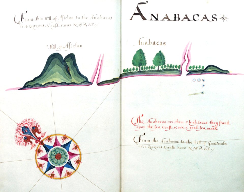
a waggoner of the south sea describing the sea coast from acapulco to albermarle isle
1685 maps
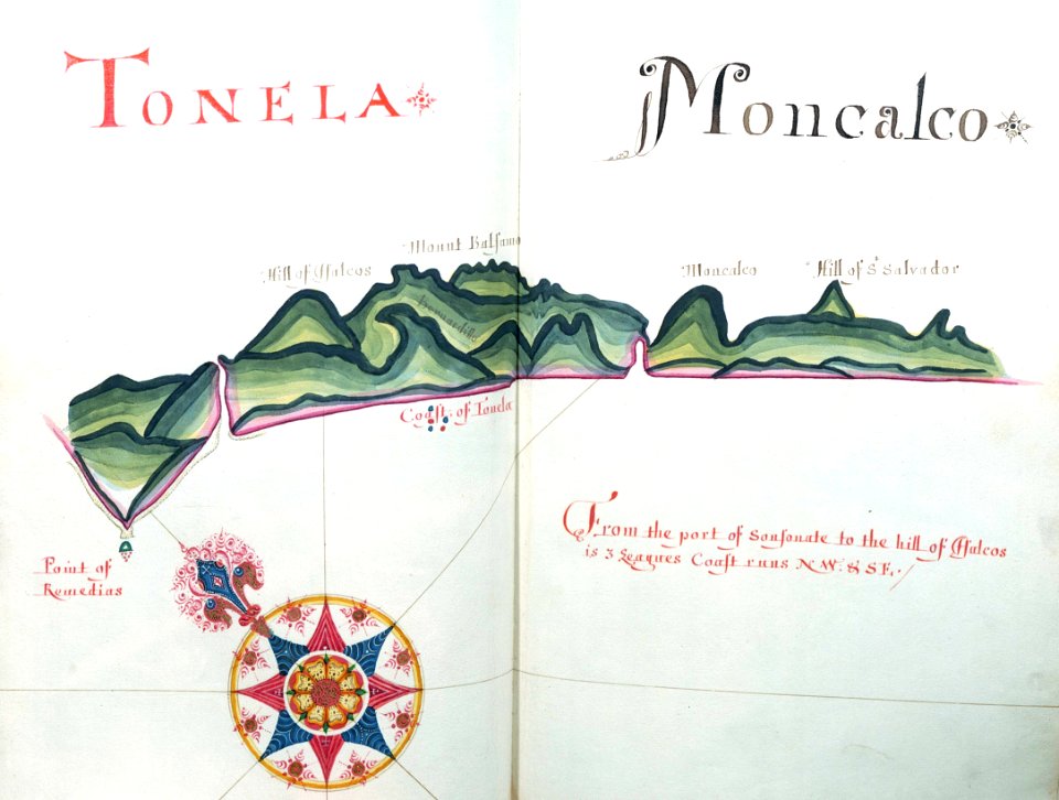
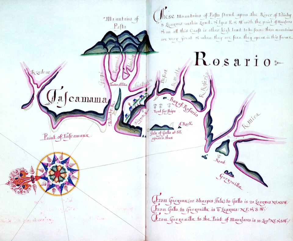
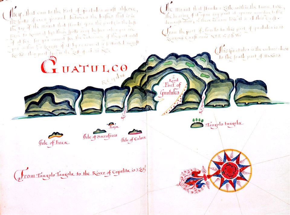
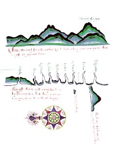
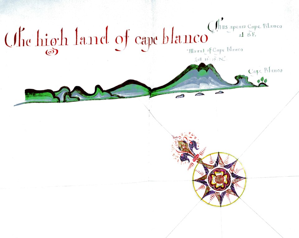
a waggoner of the south sea describing the sea coast from acapulco to albermarle isle
1685 maps
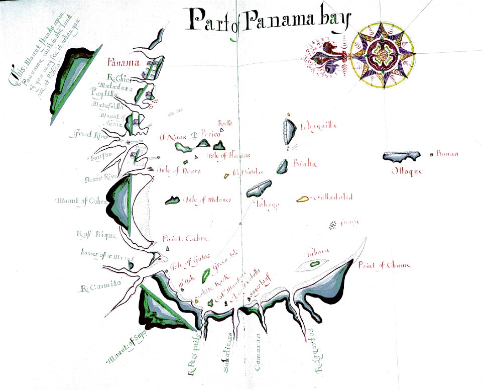
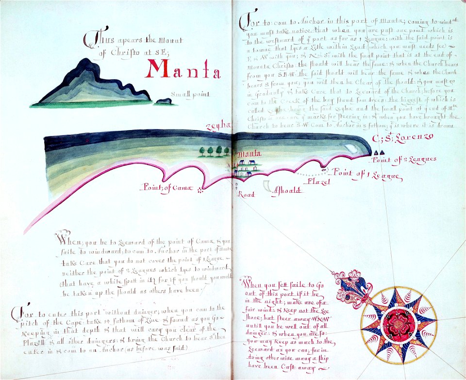
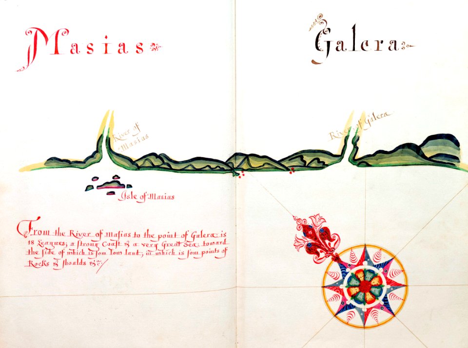
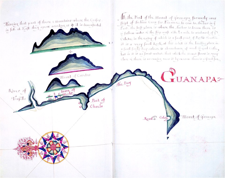
a waggoner of the south sea describing the sea coast from acapulco to albermarle isle
1685 maps
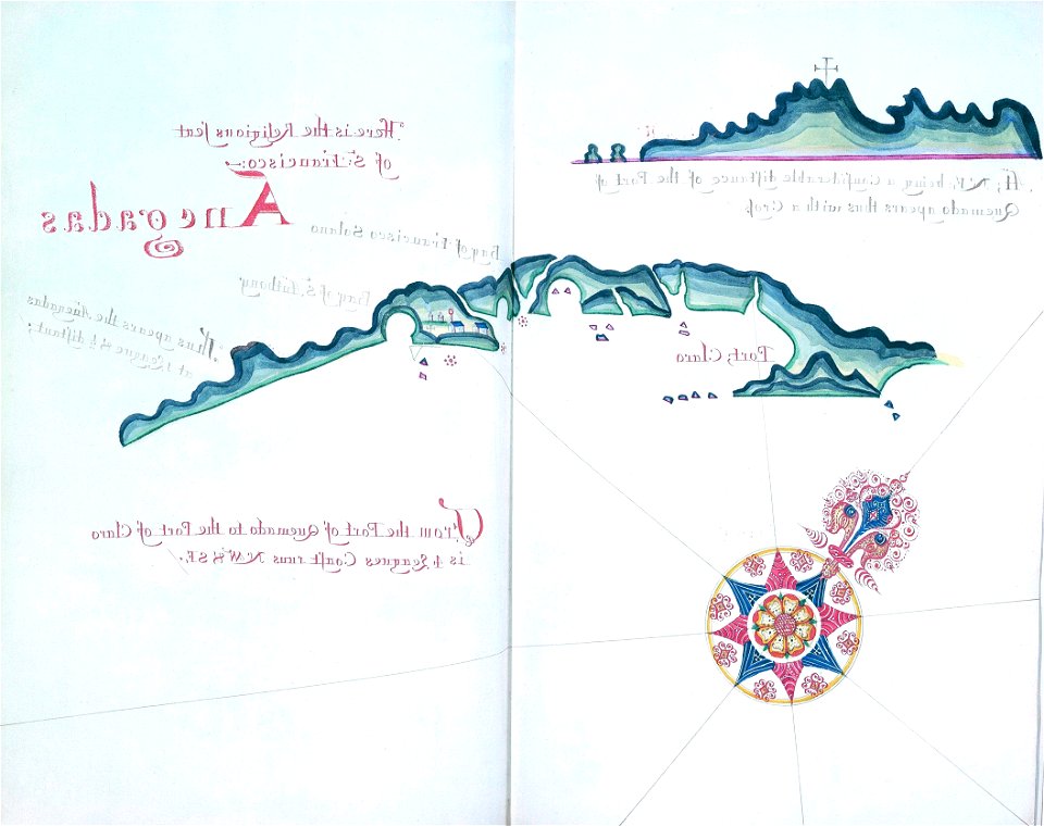
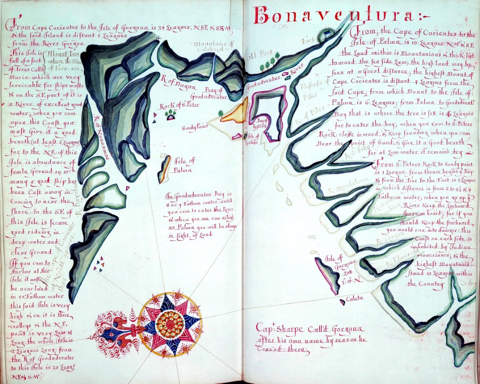
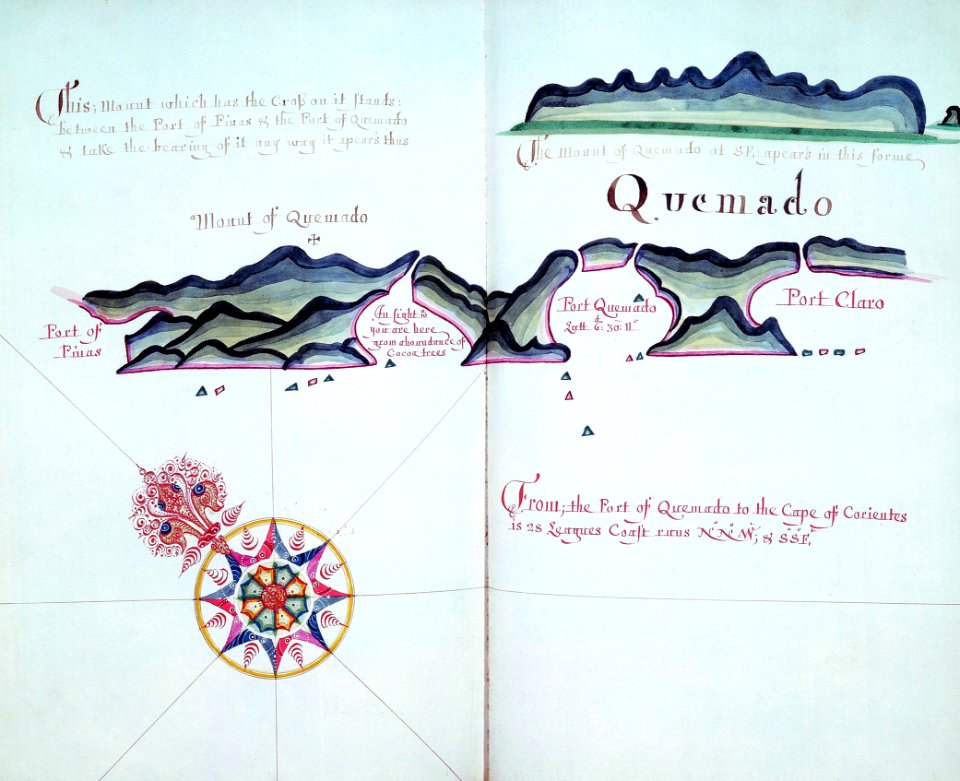
a waggoner of the south sea describing the sea coast from acapulco to albermarle isle
1685 maps
a waggoner of the south sea describing the sea coast from acapulco to albermarle isle
1685 maps
a waggoner of the south sea describing the sea coast from acapulco to albermarle isle
1685 maps
a waggoner of the south sea describing the sea coast from acapulco to albermarle isle
1685 maps
a waggoner of the south sea describing the sea coast from acapulco to albermarle isle
1685 maps
a waggoner of the south sea describing the sea coast from acapulco to albermarle isle
1685 maps
a waggoner of the south sea describing the sea coast from acapulco to albermarle isle
1685 maps
a waggoner of the south sea describing the sea coast from acapulco to albermarle isle
1685 maps
a waggoner of the south sea describing the sea coast from acapulco to albermarle isle
1685 maps
a waggoner of the south sea describing the sea coast from acapulco to albermarle isle
1685 maps
a waggoner of the south sea describing the sea coast from acapulco to albermarle isle
1685 maps
a waggoner of the south sea describing the sea coast from acapulco to albermarle isle
1685 maps
a waggoner of the south sea describing the sea coast from acapulco to albermarle isle
1685 maps
a waggoner of the south sea describing the sea coast from acapulco to albermarle isle
1685 maps
a waggoner of the south sea describing the sea coast from acapulco to albermarle isle
1685 maps
a waggoner of the south sea describing the sea coast from acapulco to albermarle isle
1685 maps
a waggoner of the south sea describing the sea coast from acapulco to albermarle isle
1685 maps
a waggoner of the south sea describing the sea coast from acapulco to albermarle isle
1685 maps
a waggoner of the south sea describing the sea coast from acapulco to albermarle isle
1685 maps
a waggoner of the south sea describing the sea coast from acapulco to albermarle isle
1685 maps
a waggoner of the south sea describing the sea coast from acapulco to albermarle isle
1685 maps
a waggoner of the south sea describing the sea coast from acapulco to albermarle isle
1685 maps
a waggoner of the south sea describing the sea coast from acapulco to albermarle isle
1685 maps
a waggoner of the south sea describing the sea coast from acapulco to albermarle isle
1685 maps
a waggoner of the south sea describing the sea coast from acapulco to albermarle isle
1685 maps
a waggoner of the south sea describing the sea coast from acapulco to albermarle isle
1685 maps
a waggoner of the south sea describing the sea coast from acapulco to albermarle isle
1685 maps
a waggoner of the south sea describing the sea coast from acapulco to albermarle isle
1685 maps
a waggoner of the south sea describing the sea coast from acapulco to albermarle isle
1685 maps
a waggoner of the south sea describing the sea coast from acapulco to albermarle isle
1685 maps
a waggoner of the south sea describing the sea coast from acapulco to albermarle isle
1685 maps
a waggoner of the south sea describing the sea coast from acapulco to albermarle isle
1685 maps
a waggoner of the south sea describing the sea coast from acapulco to albermarle isle
1685 maps
a waggoner of the south sea describing the sea coast from acapulco to albermarle isle
1685 maps
a waggoner of the south sea describing the sea coast from acapulco to albermarle isle
1685 maps
a waggoner of the south sea describing the sea coast from acapulco to albermarle isle
1685 maps
a waggoner of the south sea describing the sea coast from acapulco to albermarle isle
1685 maps
a waggoner of the south sea describing the sea coast from acapulco to albermarle isle
1685 maps
a waggoner of the south sea describing the sea coast from acapulco to albermarle isle
1685 maps
a waggoner of the south sea describing the sea coast from acapulco to albermarle isle
1685 maps
a waggoner of the south sea describing the sea coast from acapulco to albermarle isle
1685 maps
a waggoner of the south sea describing the sea coast from acapulco to albermarle isle
1685 maps
a waggoner of the south sea describing the sea coast from acapulco to albermarle isle
1685 maps
a waggoner of the south sea describing the sea coast from acapulco to albermarle isle
1685 maps
a waggoner of the south sea describing the sea coast from acapulco to albermarle isle
1685 maps
a waggoner of the south sea describing the sea coast from acapulco to albermarle isle
1685 maps
a waggoner of the south sea describing the sea coast from acapulco to albermarle isle
1685 maps
a waggoner of the south sea describing the sea coast from acapulco to albermarle isle
1685 maps
a waggoner of the south sea describing the sea coast from acapulco to albermarle isle
1685 maps
a waggoner of the south sea describing the sea coast from acapulco to albermarle isle
1685 maps
a waggoner of the south sea describing the sea coast from acapulco to albermarle isle
1685 maps
a waggoner of the south sea describing the sea coast from acapulco to albermarle isle
1685 maps
a waggoner of the south sea describing the sea coast from acapulco to albermarle isle
1685 maps
a waggoner of the south sea describing the sea coast from acapulco to albermarle isle
1685 maps
a waggoner of the south sea describing the sea coast from acapulco to albermarle isle
1685 maps
a waggoner of the south sea describing the sea coast from acapulco to albermarle isle
1685 maps
a waggoner of the south sea describing the sea coast from acapulco to albermarle isle
1685 maps
a waggoner of the south sea describing the sea coast from acapulco to albermarle isle
1685 maps
a waggoner of the south sea describing the sea coast from acapulco to albermarle isle
1685 maps
1 - 100 of 299
Next page
/ 3