Log in
All resources
Create a design
1,378 Free Artworks of Duchy
bibliothèque nationale de france
topographia ducatus stiriae
georg matthäus vischer
topographisch, oeconomisch und militaerische charte von mecklenburg, schwerin und ratzeburg
topographisch, oeconomisch und militaerische charte des herzogthums mecklenburg schwerin and des fürstenthums ratzeburg - schmettau
theatre de la guerre en italie ou carte nouvelle des principauté de piémont, republique de genes, duchés de milan, plaisance et confins, assujettie aux observations astronomiques de latitude et de... - btv1b5971924d
maps by willem and johannes blaeu
engravings of castles in styria
maps of limburg by aegidius martini
engravings of castles in slovenia
maps from university of amsterdam special collections
atlas der neederlanden
topographia ducatus stiriae
cpb-scan from slovenia
topographia ducatus stiriae
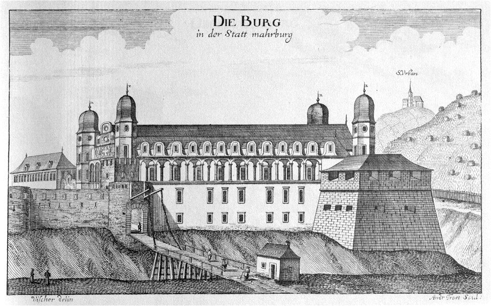
maribor castle
1680s maps of rhineland-palatinate
maps of vangiones by sanson
bibliothèque nationale de france
guillaume sanson
carte de partie de lithuanie (west belarus, brest) by nicolas sanson
cartouches by sanson family
coats of arms of podlaskie voivodeship (1513–1795)
coat of arms extracted from starzyński's volumes
maps by pieter van der keere
old maps of gelderland
1660s maps of france
old maps of nevers
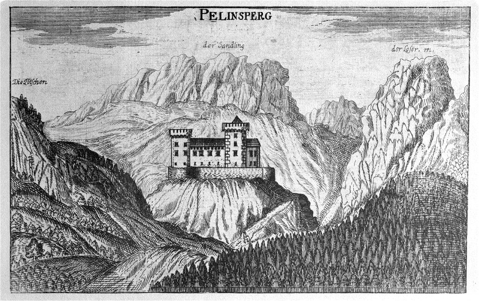
sandling (totes gebirge)
loser (totes gebirge)
topographia ducatus stiriae
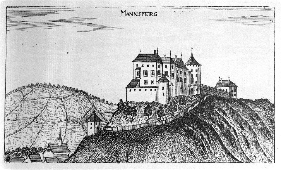
majšperk castle
bourbonnais in the 17th century
pierre mariette i
art works by barthélémy lauvergne
historical images of dubroŭna
antoine-françois tardieu
maps from gallica
early netherlandish painting,northern renaissance
works after the ecce homo by hieronymus bosch
svg historical coats of arms of municipalities in north rhine-westphalia
lion of jülich in civic heraldry
coat of arms of knights of order of the golden fleece in sint baafskathedraal
coats of arms of the house of fernández de córdoba
topographia ducatus stiriae
rabenwald
1610s maps of the holy roman empire
jacques surhon
topographia ducatus stiriae
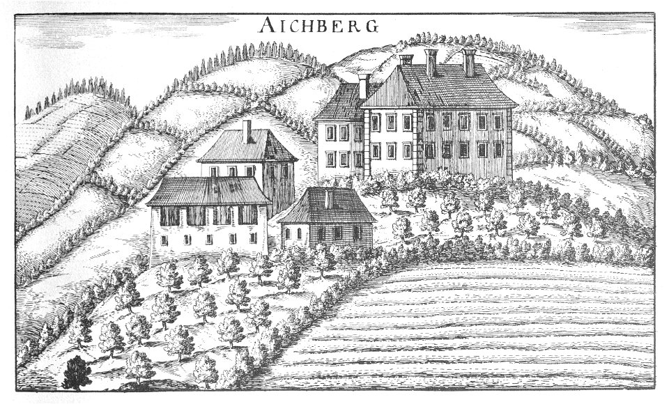
eibiswald
maps by willem and johannes blaeu
17th-century maps of lorraine
maps by willem and johannes blaeu
17th-century maps of bourgogne
maps of limburg by aegidius martini
bibliothèque nationale de france
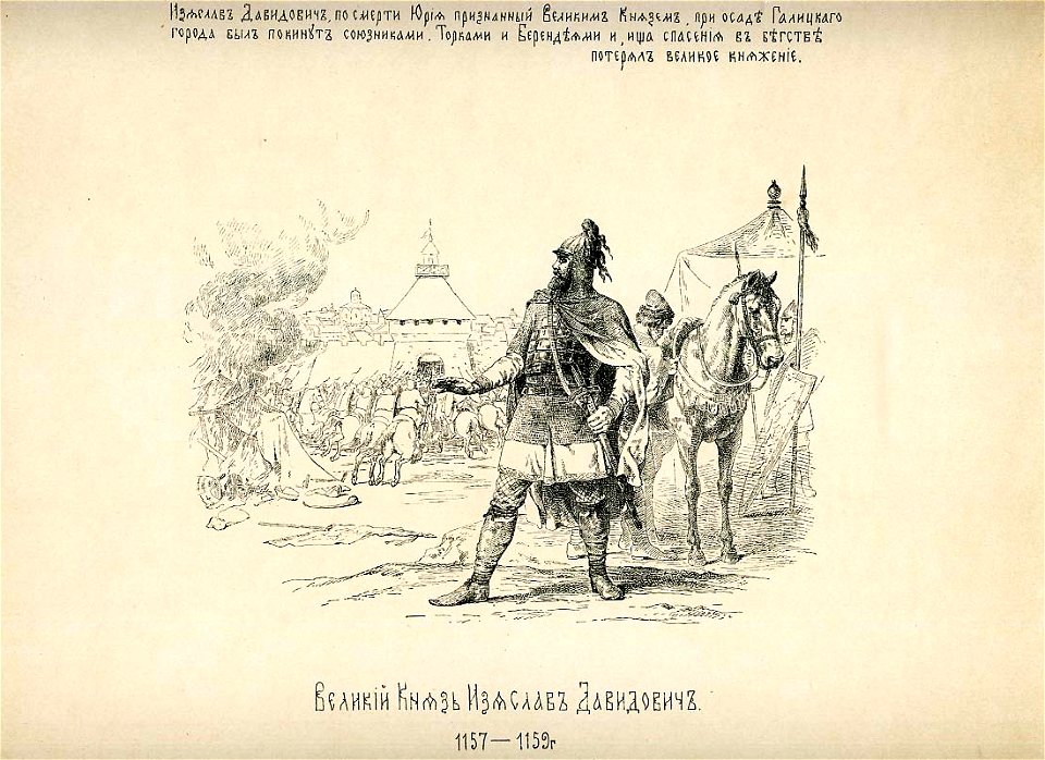
history of the russian state in the image of its sovereign rulers - full
iziaslav iii of kiev in engravings
atlas sive cosmographicae (gerardus mercator, 1623)
maps of bourgogne (duchy) by gerardus mercator
topographia ducatus stiriae
cmurek castle
topographia ducatus stiriae
burgruine hohenwang
theatre de la guerre en italie ou carte nouvelle des principauté de piémont, republique de genes, duchés de milan, plaisance et confins, assujettie aux observations astronomiques de latitude et de... - btv1b5971924d
bibliothèque nationale de france
theatre de la guerre en italie ou carte nouvelle des principauté de piémont, republique de genes, duchés de milan, plaisance et confins, assujettie aux observations astronomiques de latitude et de... - btv1b5971924d
bibliothèque nationale de france
theatre de la guerre en italie ou carte nouvelle des principauté de piémont, republique de genes, duchés de milan, plaisance et confins, assujettie aux observations astronomiques de latitude et de... - btv1b5971924d
bibliothèque nationale de france
theatre de la guerre en italie ou carte nouvelle des principauté de piémont, republique de genes, duchés de milan, plaisance et confins, assujettie aux observations astronomiques de latitude et de... - btv1b5971924d
bibliothèque nationale de france
theatre de la guerre en italie ou carte nouvelle des principauté de piémont, republique de genes, duchés de milan, plaisance et confins, assujettie aux observations astronomiques de latitude et de... - btv1b5971924d
bibliothèque nationale de france
theatre de la guerre en italie ou carte nouvelle des principauté de piémont, republique de genes, duchés de milan, plaisance et confins, assujettie aux observations astronomiques de latitude et de... - btv1b5971924d
bibliothèque nationale de france
theatre de la guerre en italie ou carte nouvelle des principauté de piémont, republique de genes, duchés de milan, plaisance et confins, assujettie aux observations astronomiques de latitude et de... - btv1b5971924d
bibliothèque nationale de france
theatre de la guerre en italie ou carte nouvelle des principauté de piémont, republique de genes, duchés de milan, plaisance et confins, assujettie aux observations astronomiques de latitude et de... - btv1b5971924d
bibliothèque nationale de france
theatre de la guerre en italie ou carte nouvelle des principauté de piémont, republique de genes, duchés de milan, plaisance et confins, assujettie aux observations astronomiques de latitude et de... - btv1b5971924d
bibliothèque nationale de france
maps by pieter van der keere
old maps of north brabant
topographia ducatus stiriae
vrbovec castle
magni ducatus lithuaniae
maps facing west
1730s oil on canvas paintings
baroque
arrival in venice of dukes ercole i and afonso i from ferrara by lazzaro bastiani
may 2023 in venice
1799 maps of italy
maps by john cary
topographisch, oeconomisch und militaerische charte des herzogthums mecklenburg schwerin and des fürstenthums ratzeburg - schmettau
topographisch, oeconomisch und militaerische charte von mecklenburg, schwerin und ratzeburg
topographisch, oeconomisch und militaerische charte des herzogthums mecklenburg schwerin and des fürstenthums ratzeburg - schmettau
topographisch, oeconomisch und militaerische charte von mecklenburg, schwerin und ratzeburg
topographisch, oeconomisch und militaerische charte des herzogthums mecklenburg schwerin and des fürstenthums ratzeburg - schmettau
topographisch, oeconomisch und militaerische charte von mecklenburg, schwerin und ratzeburg
1660s maps of rhineland-palatinate
maps of vangiones by sanson
topographisch, oeconomisch und militaerische charte des herzogthums mecklenburg schwerin and des fürstenthums ratzeburg - schmettau
topographisch, oeconomisch und militaerische charte von mecklenburg, schwerin und ratzeburg
topographisch, oeconomisch und militaerische charte des herzogthums mecklenburg schwerin and des fürstenthums ratzeburg - schmettau
topographisch, oeconomisch und militaerische charte von mecklenburg, schwerin und ratzeburg
topographisch, oeconomisch und militaerische charte des herzogthums mecklenburg schwerin and des fürstenthums ratzeburg - schmettau
topographisch, oeconomisch und militaerische charte von mecklenburg, schwerin und ratzeburg
topographisch, oeconomisch und militaerische charte des herzogthums mecklenburg schwerin and des fürstenthums ratzeburg - schmettau
topographisch, oeconomisch und militaerische charte von mecklenburg, schwerin und ratzeburg
topographisch, oeconomisch und militaerische charte des herzogthums mecklenburg schwerin and des fürstenthums ratzeburg - schmettau
topographisch, oeconomisch und militaerische charte von mecklenburg, schwerin und ratzeburg
topographisch, oeconomisch und militaerische charte des herzogthums mecklenburg schwerin and des fürstenthums ratzeburg - schmettau
topographisch, oeconomisch und militaerische charte von mecklenburg, schwerin und ratzeburg
topographisch, oeconomisch und militaerische charte des herzogthums mecklenburg schwerin and des fürstenthums ratzeburg - schmettau
topographisch, oeconomisch und militaerische charte von mecklenburg, schwerin und ratzeburg
topographisch, oeconomisch und militaerische charte des herzogthums mecklenburg schwerin and des fürstenthums ratzeburg - schmettau
topographisch, oeconomisch und militaerische charte von mecklenburg, schwerin und ratzeburg
jan piotr sapieha
baroque
topographisch, oeconomisch und militaerische charte des herzogthums mecklenburg schwerin and des fürstenthums ratzeburg - schmettau
topographisch, oeconomisch und militaerische charte von mecklenburg, schwerin und ratzeburg
topographisch, oeconomisch und militaerische charte des herzogthums mecklenburg schwerin and des fürstenthums ratzeburg - schmettau
topographisch, oeconomisch und militaerische charte von mecklenburg, schwerin und ratzeburg
cartouche (cartography)
pierre mariette i
topographisch, oeconomisch und militaerische charte des herzogthums mecklenburg schwerin and des fürstenthums ratzeburg - schmettau
topographisch, oeconomisch und militaerische charte von mecklenburg, schwerin und ratzeburg
topographisch, oeconomisch und militaerische charte des herzogthums mecklenburg schwerin and des fürstenthums ratzeburg - schmettau
topographisch, oeconomisch und militaerische charte von mecklenburg, schwerin und ratzeburg
topographisch, oeconomisch und militaerische charte des herzogthums mecklenburg schwerin and des fürstenthums ratzeburg - schmettau
topographisch, oeconomisch und militaerische charte von mecklenburg, schwerin und ratzeburg
bibliothèque nationale de france
guillaume sanson
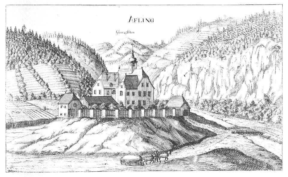
topographia ducatus stiriae
kozje castle
topographia ducatus stiriae
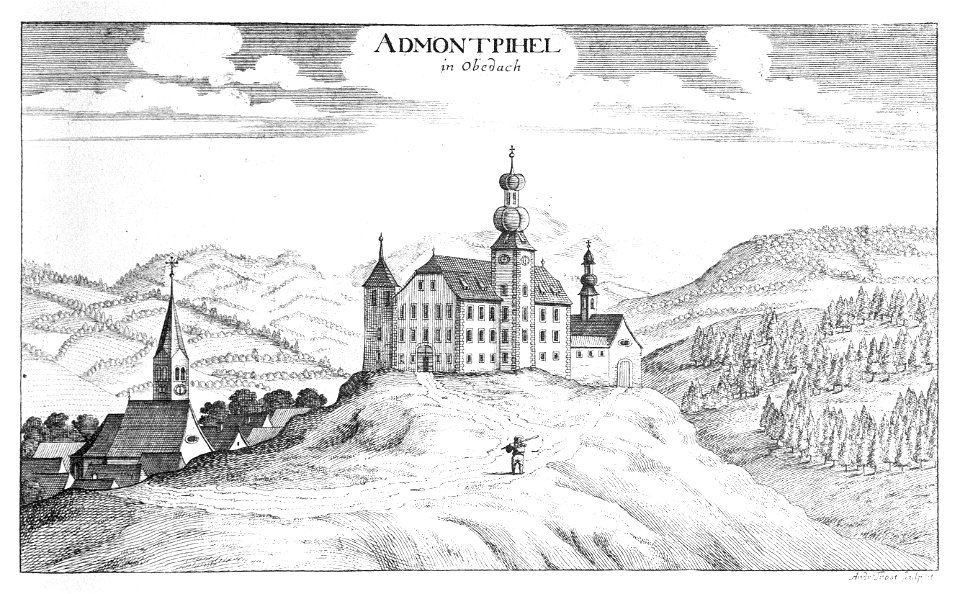
schloss admontbichl
old maps of auvergne
1660s maps of france
magni ducatus lithuaniae
maps facing west
atlas maior, vol 2 (sweden, russia, poland, eastern europe, and greece) - joan blaeu, 1667 - bl 114.h(star).2
magni ducatus lithuaniae
topographia ducatus stiriae
kammern im liesingtal
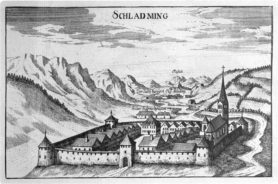
historical images of schladming
topographia ducatus stiriae
topographia ducatus stiriae
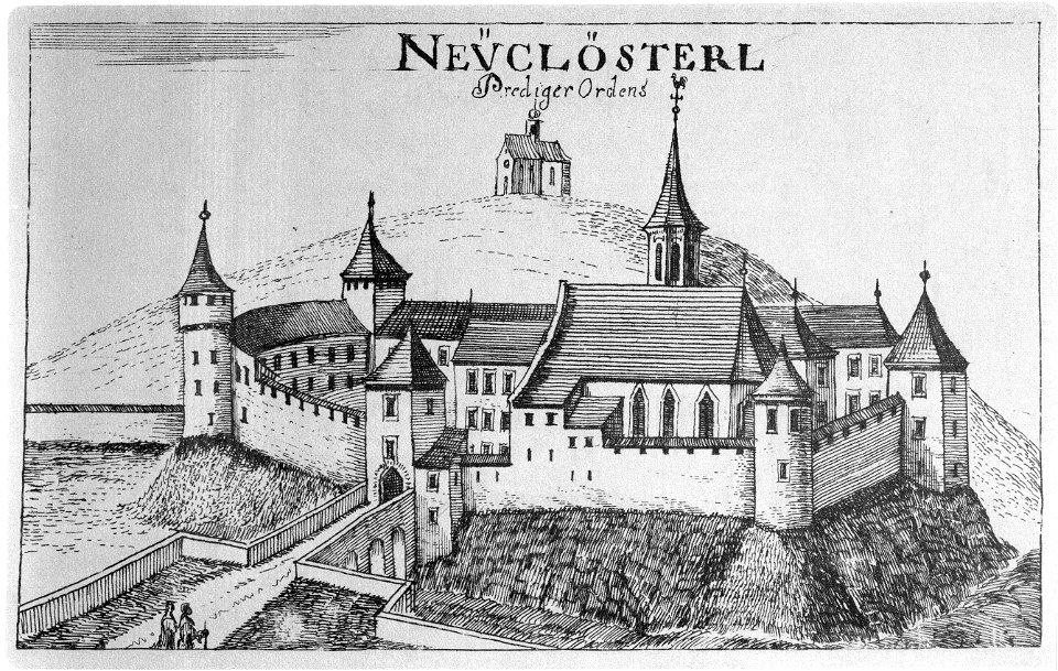
novi klošter
topographia ducatus stiriae
ojstrica castle
topographia ducatus stiriae
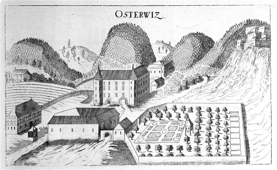
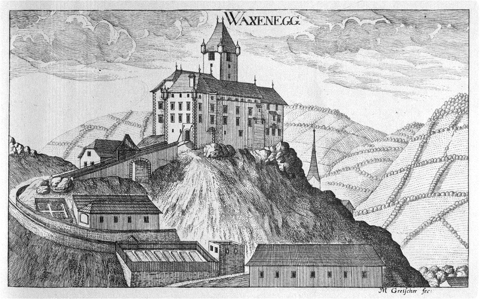
waxenegg castle
faustino anderloni
antoni radziwiłł
diptych of federico da montefeltro and battista sforza by piero della francesca
early renaissance
bridges over the mur river in austria
topographia ducatus stiriae
portrait of cosimo i de' medici in armour (bronzino's workshop - galleria palatina)
mannerism
topographia ducatus stiriae
cpb-scan from slovenia
topographia ducatus stiriae
storchenschlössel
maps of limburg by aegidius martini
bibliothèque nationale de france
magni ducatus lithuaniae
1710s maps of lithuania
maps of limburg by aegidius martini
bibliothèque nationale de france
maps of limburg by aegidius martini
bibliothèque nationale de france
maps by pieter van der keere
17th-century maps of silesia
maps of limburg by aegidius martini
bibliothèque nationale de france
engravings of castles in styria
topographia ducatus stiriae
atlas maior, vol 1 (northern europe, norway, and denmark) - joan blaeu, 1667 - bl 114.h(star).1
1667 maps
album widoków przedstawiających miejsca historyczne księstwa poznańskiego i prus zachodnich (1880)
gołuchów castle
die kunstdenkmäler des kreises konstanz (1887)
salemer altar
die kunstdenkmäler des kreises konstanz (1887)
schloss kirchberg (immenstaad am bodensee)
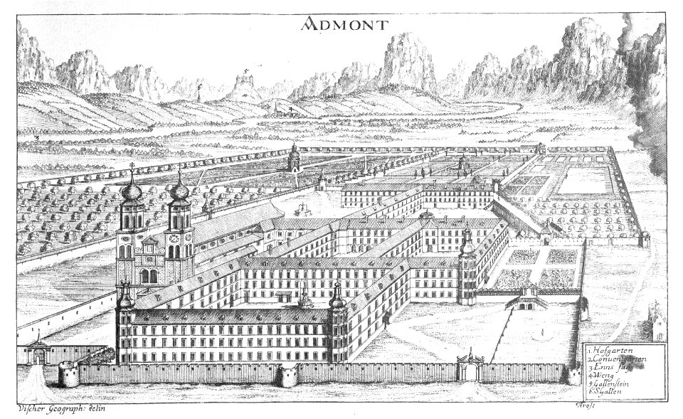
topographia ducatus stiriae
stift admont
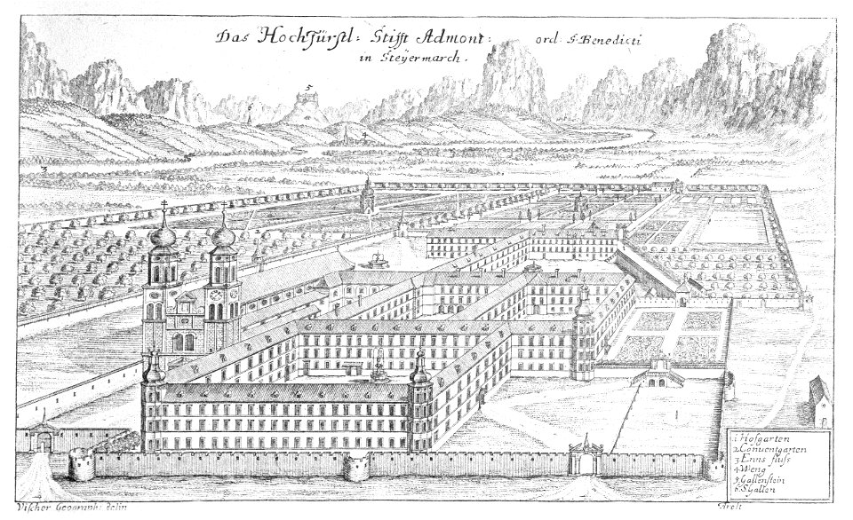
topographia ducatus stiriae
stift admont
uniforms of the army of großherzogtum baden (1843)
heinrich ambros eckert
die kunstdenkmäler des kreises konstanz (1887)
rother altar
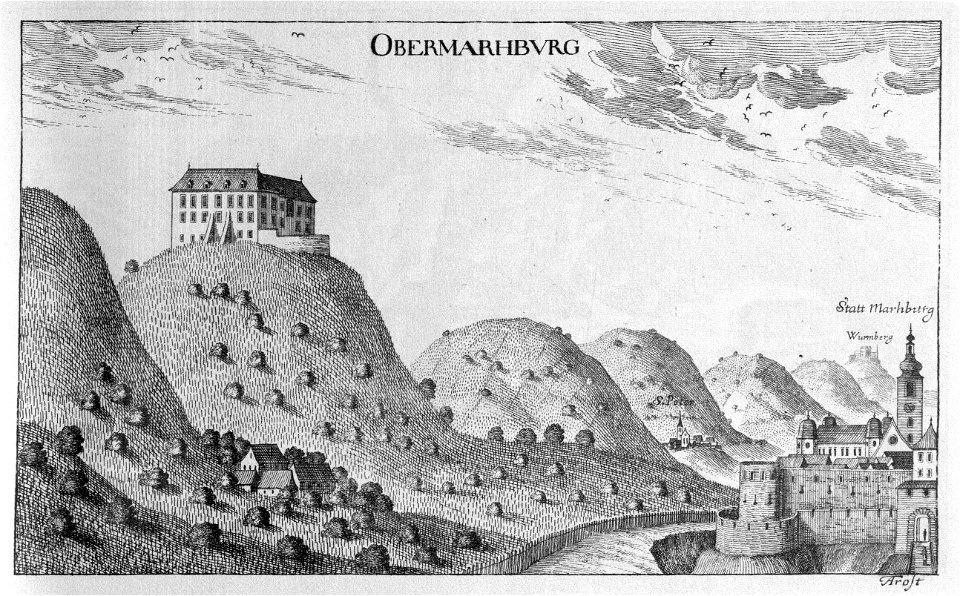
topographia ducatus stiriae
maribor castle (pyramid)
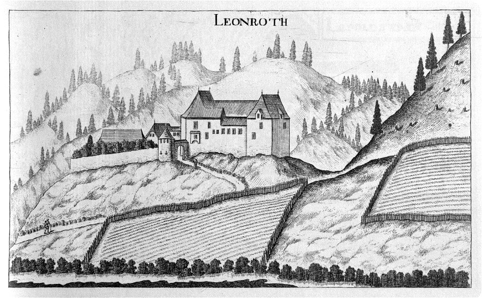
topographia ducatus stiriae
burg neu-leonroth
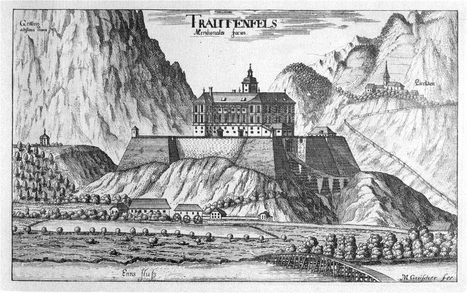
topographia ducatus stiriae
trautenfels castle
topographia ducatus stiriae
buildings in donawitz
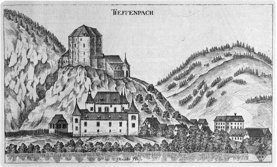
schloss teufenbach (bezirk murau)
topographia ducatus stiriae
pieter van der keere
history of brabant
old maps of milan
antoine aveline
801 - 900 of 1,378
Next page
/ 14