Log in
All resources
Create a design
18 Free Artworks of 1880 Maps Of France
bibliothèque nationale de france
historisk atlas (stockholm, norstedt & söner, 1880)
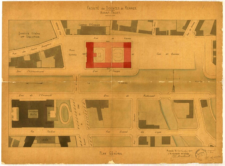
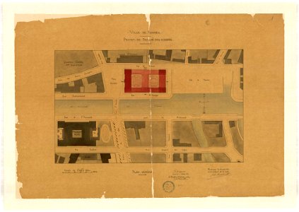
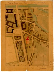
jean-baptiste martenot
rennes in the 1880s
1880s maps of france
maps from gallica
guides joanne
1880s maps of czechia
19th-century maps of bohemia
maps by jan eduard wagner
1880 maps of france
auguste logerot
jean-baptiste martenot
1888 in bretagne
jean-baptiste martenot
1888 in bretagne
jean-baptiste martenot
1880 maps
old maps of the kingdom of france (987-1792)
19th-century maps of the british isles
maps of paris from bibliothèque nationale de france
old maps of the paris metro
historisk atlas (stockholm, norstedt & söner, 1880)
old maps of the polish-lithuanian commonwealth
maps showing history of the early middle ages
charles the bald
historisk atlas (stockholm, norstedt & söner, 1880)
old maps of the carolingian empire
rudolf leuzinger
maps of france
old maps of algiers
maps from gallica
maps from gallica
old maps of genoa
19th-century maps of bohemia
1880s maps of czechia
maps by jan eduard wagner
františek kytka
1880s maps of tunisia
maps from gallica
maps by jan eduard wagner
františek kytka
old maps of the franco-prussian war
alfred quesnay de beaurepaire
carte de l'afrique françoise par guillaume delisle (1726)
philippe buache
1 - 18 of 18
/ 1