Log in
All resources
Create a design
206 Free Artworks of 1833 Maps
maps from the earth and its inhabitants, vol. iv
maps from the earth and its inhabitants, vol. xviii
maps from the earth and its inhabitants, vol. xiv
maps from the earth and its inhabitants, vol. x
1880s maps of egypt
maps from the earth and its inhabitants, vol. iii
maps by frederick william beechey
frederick william beechey
1894 in peru
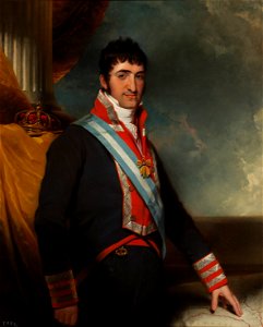
maps in portrait paintings
portrait paintings of ferdinand vii of spain
william collins
18th-century portrait paintings in the national maritime museum, london
john francis rigaud
portrait paintings of ferdinand vii of spain
romanticism
print room of the university of antwerp
kaarten van vlaanderen (prentenkabinet)
media contributed by university of illinois urbana-champaign university library
1833 maps of africa
st thomas' hospital (southwark)
guy's hospital
old maps of the tuamotus
old maps of polynesia
maps by daniel lizars
1830s maps of belize
admiralty charts 1001-1200
avacha bay
eran laor cartographic collection
thomas starling
18th-century portrait paintings in the national maritime museum, london
john francis rigaud
maps from the earth and its inhabitants, vol. x
zagazig
maps from the earth and its inhabitants, vol. v
maps of skaftafell
maps of israel
józsef farkas
admiralty charts region r: usa and mexico west coasts
admiralty charts 401-600
the history and antiquities of the parish of lambeth, and the archiepiscopal palace (1827)
soil science maps
maps by daniel lizars
1831 maps of mexico
maps from the earth and its inhabitants, vol. iv
bathymetric maps of the united kingdom
maps of san francisco bay
admiralty map details
great tenpō famine
watanabe kazan
james meadows tract
james meadows
maps from the earth and its inhabitants, vol. xviii
maps of the ancash region
narrative of the arctic land expedition to the mouth of the great fish river - and along the shores of the arctic ocean, in the years, 1833, 1834, and 1835 (1836)
maps from the earth and its inhabitants, vol. iv
geological maps of the united kingdom
maps from the earth and its inhabitants, vol. iv
1880s maps of england
maps from the earth and its inhabitants, vol. v
19th-century maps of scandinavia
1880s maps of the netherlands
1880s maps of belgium
maps from the earth and its inhabitants, vol. xiv
blitar
maps from the earth and its inhabitants, vol. xviii
llanquihue
japanese paintings in the rijksmuseum amsterdam
kawahara keiga
maps from the earth and its inhabitants, vol. iv
old maps of kingston upon hull
maps from the earth and its inhabitants, vol. iv
old maps of the east riding of yorkshire
maps from the earth and its inhabitants, vol. iv
topographic maps of scotland
maps from the earth and its inhabitants, vol. iv
faversham creek
maps from the earth and its inhabitants, vol. iv
ragstone
the history and antiquities of the parish of lambeth, and the archiepiscopal palace (1827)
1820s maps of london
maps from the earth and its inhabitants, vol. iv
1880s maps of ireland
maps from the earth and its inhabitants, vol. iv
turlough
the fifty-three stations of the tōkaidō (hoeidō edition, metropolitan museum of art)
utagawa school,kasei culture,ukiyo-e
maps from the earth and its inhabitants, vol. xviii
1890s maps of peru
maps from the earth and its inhabitants, vol. iv
kingsmead, bath
maps from the earth and its inhabitants, vol. xviii
old maps of lima
maps from the earth and its inhabitants, vol. xiv
maps of sumbawa
maps from the earth and its inhabitants, vol. xviii
1894 in peru
maps from the earth and its inhabitants, vol. iii
old maps of bonn
maps from the earth and its inhabitants, vol. iv
ragstone
maps from the earth and its inhabitants, vol. xvi
1890s maps of belize
maps from the earth and its inhabitants, vol. iv
amesbury
maps from the earth and its inhabitants, vol. x
19th-century maps of cairo
maps from the earth and its inhabitants, vol. xiv
catbalogan
maps from the earth and its inhabitants, vol. iv
old maps of cardiff
maps from the earth and its inhabitants, vol. x
1880s maps of egypt
maps from the earth and its inhabitants, vol. iv
19th-century maps of surrey
maps from the earth and its inhabitants, vol. iv
maps of penzance
maps from the earth and its inhabitants, vol. x
1880s maps of egypt
maps from the earth and its inhabitants, vol. iv
1880s maps of london
maps from the earth and its inhabitants, vol. x
1880s maps of egypt
maps from the earth and its inhabitants, vol. x
1886 maps of africa
maps from the earth and its inhabitants, vol. iv
maps of balmoral castle
maps from the earth and its inhabitants, vol. iv
maritime maps of the united kingdom
maps from the earth and its inhabitants, vol. iv
1880s maps of ireland
maps from the earth and its inhabitants, vol. xiv
1890s maps of indonesia
maps from the earth and its inhabitants, vol. xiv
1890s maps of australia
maps from the earth and its inhabitants, vol. xiv
1890s maps of new zealand
maps from the earth and its inhabitants, vol. iv
maps of balmoral castle
maps from the earth and its inhabitants, vol. x
1880s maps of egypt
maps from the earth and its inhabitants, vol. xiv
1890 maps of africa
maps from the earth and its inhabitants, vol. xiv
old maps of adelaide
maps from the earth and its inhabitants, vol. iv
old maps of hastings, england
maps from the earth and its inhabitants, vol. iv
old maps of cardiff
maps from the earth and its inhabitants, vol. iii
1880s maps of vienna
maps by daniel lizars
1831 maps of mexico
the history and antiquities of london, westminster, southwark and parts adjacent
old maps of the london borough of southwark
maps from the earth and its inhabitants, vol. iv
severn estuary
maps from the earth and its inhabitants, vol. iv
mount merrick
too late for gordon and khartoum (1887) by macdonald
maps of the mahdist war
too late for gordon and khartoum (1887) by macdonald
maps of the mahdist war
maps of the mexican-american war
maps by joseph warren revere
maps from the earth and its inhabitants, vol. iv
falmouth bay
maps from the earth and its inhabitants, vol. iii
old maps of hungary
19th-century maps of maastricht
maps in hcl (maastricht)
19th-century maps of maastricht
maps in hcl (maastricht)
utagawa school,kasei culture,ukiyo-e
joseph pulitzer bequest
maps from the earth and its inhabitants, vol. v
1880s maps of iceland
maps from the earth and its inhabitants, vol. iv
montrose, angus
maps from the earth and its inhabitants, vol. xiv
magelang
maps from the earth and its inhabitants, vol. xviii
1894 in peru
maps from the earth and its inhabitants, vol. xviii
old maps of bogotá
maps from the earth and its inhabitants, vol. xviii
1894 in chile
maps from the earth and its inhabitants, vol. xviii
1894 in chile
maps from the earth and its inhabitants, vol. xviii
1894 in chile
maps from the earth and its inhabitants, vol. iv
milford haven
maps from the earth and its inhabitants, vol. x
kassala
maps from the earth and its inhabitants, vol. iv
dublin bay
maps from the earth and its inhabitants, vol. iii
old maps of denmark
maps from the earth and its inhabitants, vol. xiv
maps of batangas
maps from the earth and its inhabitants, vol. iii
maps of blankenberge
too late for gordon and khartoum (1887) by macdonald
maps of the mahdist war
maps in the rijksmuseum amsterdam
evert maaskamp
maps from the earth and its inhabitants, vol. iv
1880s maps of london
1 - 100 of 206
Next page
/ 3