Log in
All resources
Create a design
23 Free Artworks of 17th Century Maps Of Austria
maps made in the 17th century
17th-century maps of vienna
bibliothèque nationale de france
maps by nicolaes visscher i
atlantis magni tomus tertius (biblioteca comunale di trento)
old maps of upper austria
bartholomeo camuccio
domenico rossetti
leander aguissola
old maps of the danube
old maps of upper austria
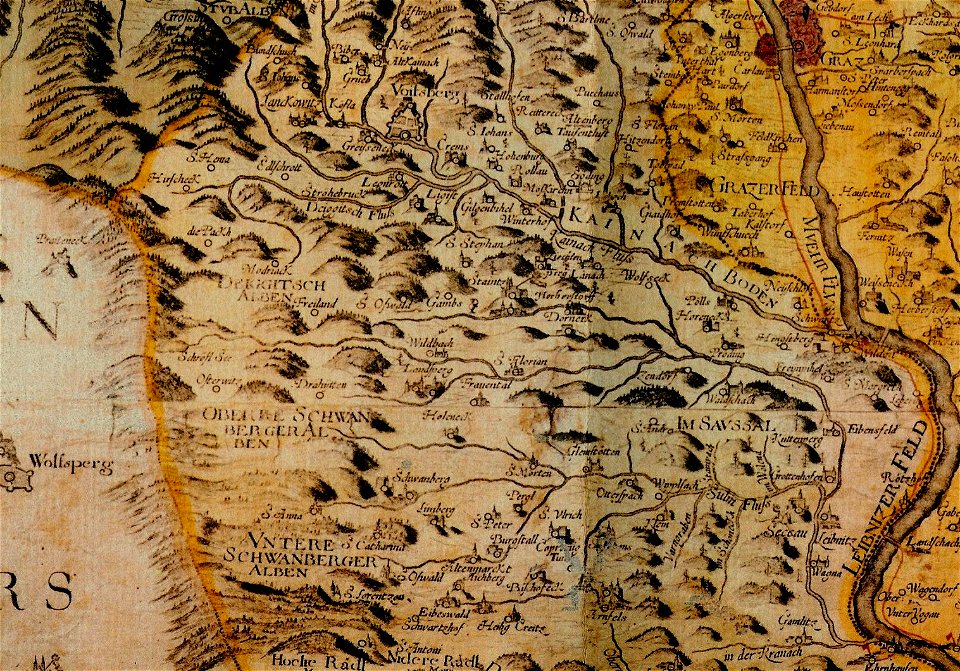
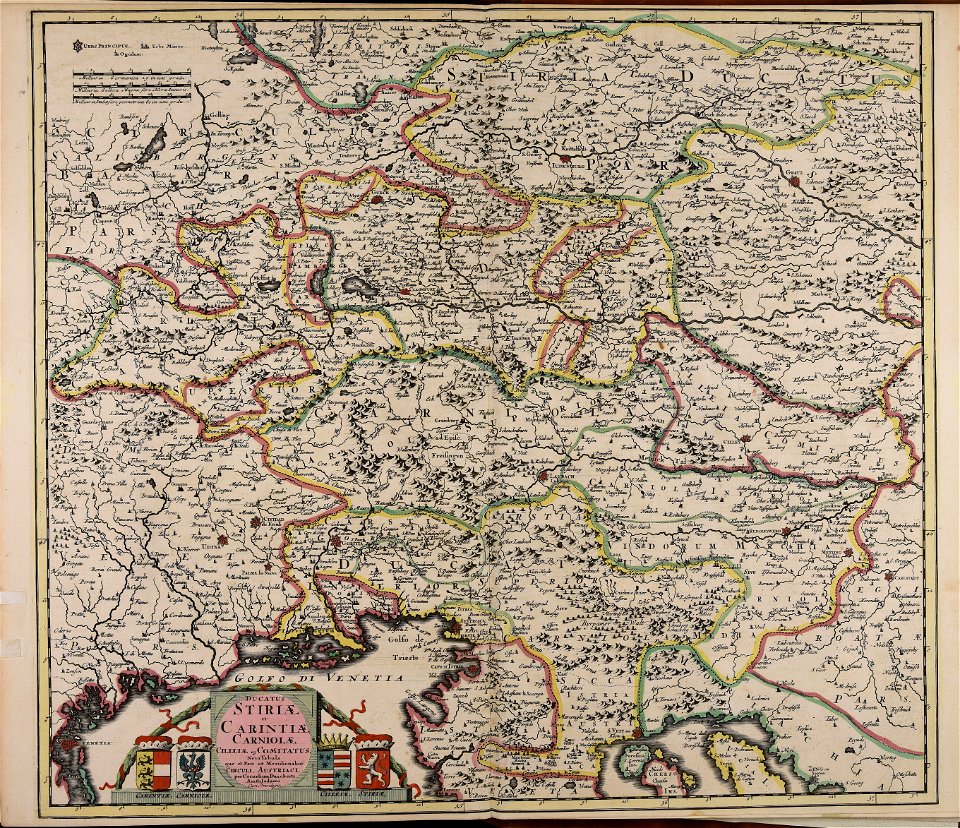
old maps of styria
maps made in the 17th century
maps by nicolaes visscher i
maps by nicolaes visscher i
old maps of upper austria
coat of arms of germany
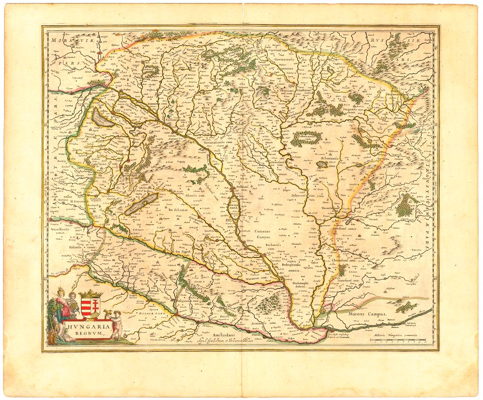
1642 maps of croatia
works by georg matthäus vischer
maps made in the 17th century
maps made in the 17th century
cornelis danckerts (ii)
derivatives of the coats of arms of the árpád family
historical national coats of arms of hungary
works by georg matthäus vischer
1678 maps
17th-century maps of bohemia
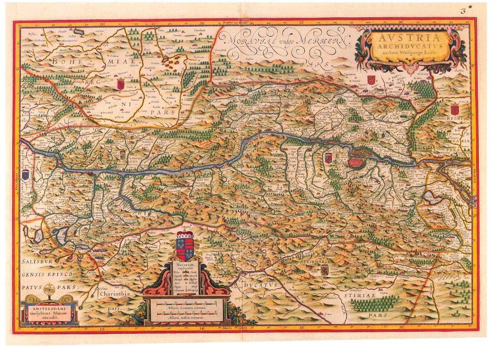
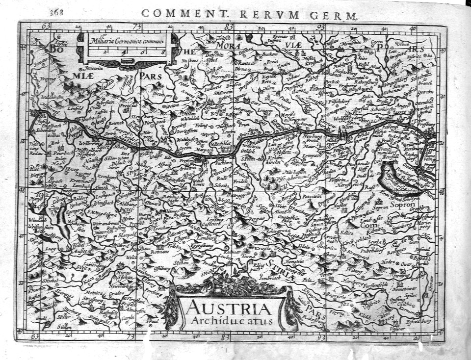
1645 maps of austria
french-language maps from ios map collection
old maps of carinthia
library of the university of vienna
map of vienna by jacob hoefnagel
maps made in the 17th century
old maps of upper austria
17th-century maps of vienna
dancker danckerts
topographia austriacarum (merian)
baroque
cartography
maps
cartography
maps
17th-century maps of vienna
maps by nicolaes visscher i
maps of innsbruck by braun & hogenberg
innsbruck in the 17th century
17th-century maps of vienna
bartholomeo camuccio
17th-century maps of vienna
bartholomeo camuccio
atlas ou representation du monde universel t. 2 (1633)
17th-century maps of austria
17th-century maps of vienna
bartholomeo camuccio
dutch 17th-century prints in the rijksmuseum amsterdam
war of the jülich-kleve succession
1 - 23 of 23
/ 1


![Vienna à Turcis obsessa & Deo Dante A Christianis eliberata. Scala Perticarum Rynlandicarum 100 [=Om. 064; 1: 25 000 environ]. Cum Privilegio Coesareo Sumptibus Authoris Dommeco. Rosetti scul, Domenico Rossetti, 1683](https://cdn.creazilla.com/illustrations/10001270042/vienna-turcis-obsessa-deo-dante-a-christianis-eliberata-scala-perticarum-rynlandicarum-100-om-064-1-25-000-environ-cum-privilegio-coesareo-sumptibus-authoris-dommeco-rosetti-scul-domenico-rossetti-1683-sm.webp)
![Vienna a Turcis obsessa, & Des dante a Christianis diberata. Scala Perticarum Rynlandicarum 100 [=Om; 062; 1: 6 000 environ]. Cum Privilegio Caesarea Sumptibus Authoris, Dome[ni]co Rossetti scul, Domenico Rossetti, 1692](https://cdn.creazilla.com/illustrations/10000857324/vienna-a-turcis-obsessa-des-dante-a-christianis-diberata-scala-perticarum-rynlandicarum-100-om-062-1-6-000-environ-cum-privilegio-caesarea-sumptibus-authoris-domenico-rossetti-scul-domenico-rossetti-1692-sm.webp)
![Gerardi Mercatoris and I. Hondii Atlas or Representation of the Universal World, and of the Parts of It, Made in Tables and Very Ample Descriptions. [t. 2].](https://cdn.creazilla.com/illustrations/10001210086/gerardi-mercatoris-and-i-hondii-atlas-or-representation-of-the-universal-world-and-of-the-parts-of-it-made-in-tables-and-very-ample-descriptions-t-2-sm.webp)

