Log in
All resources
Create a design
87 Free Artworks of 1742 Maps
bibliothèque nationale de france
chorographia britanniae (1741-1742)
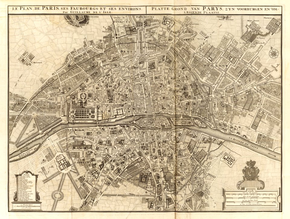
maps of paris from bibliothèque nationale de france
environs de paris levés géométriquement by jean delagrive (1731-1742)
french
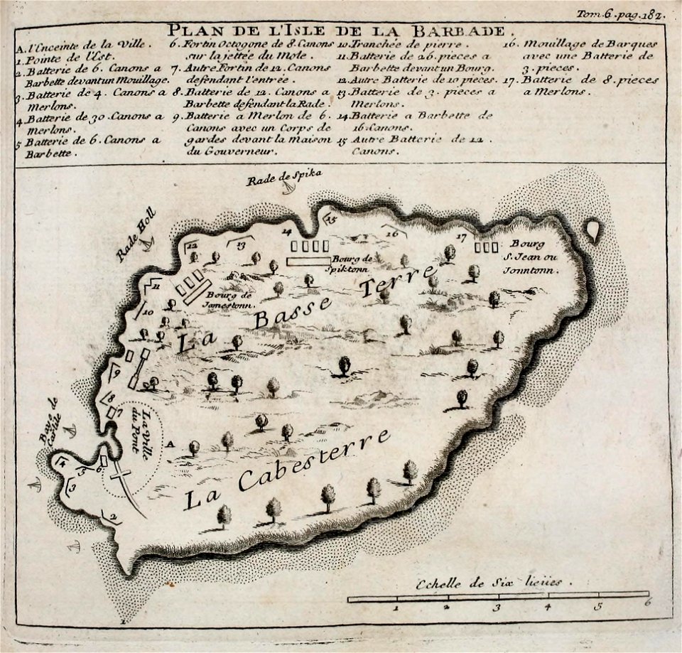
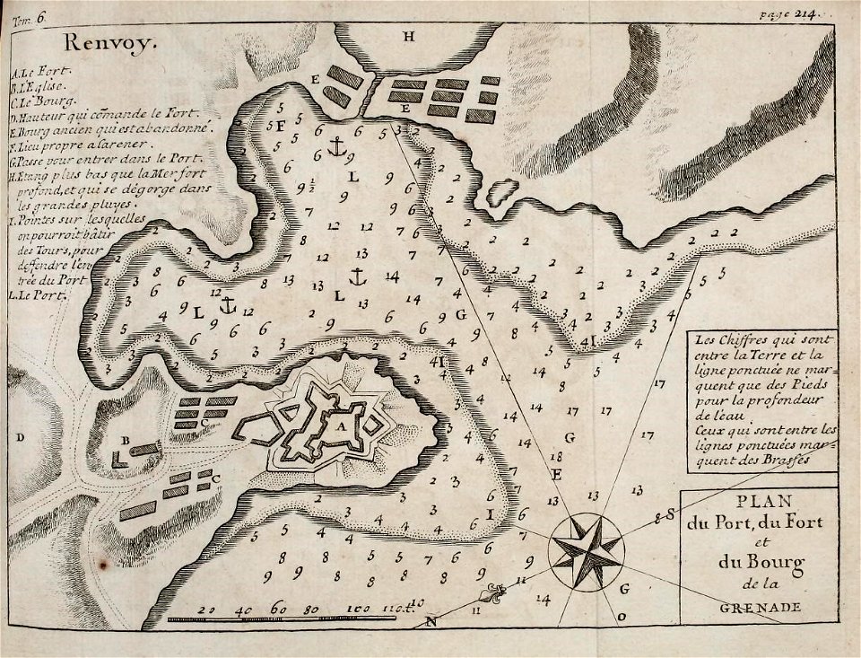
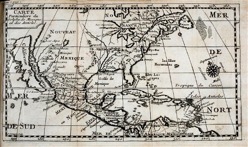
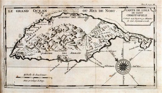
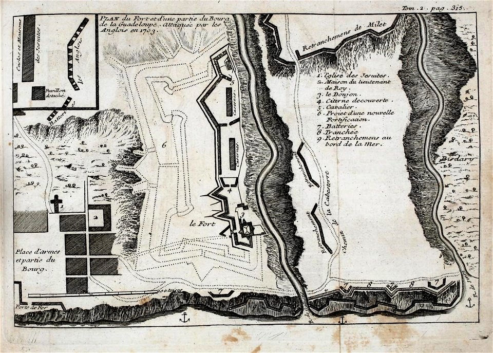
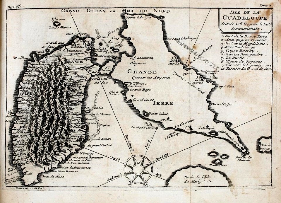
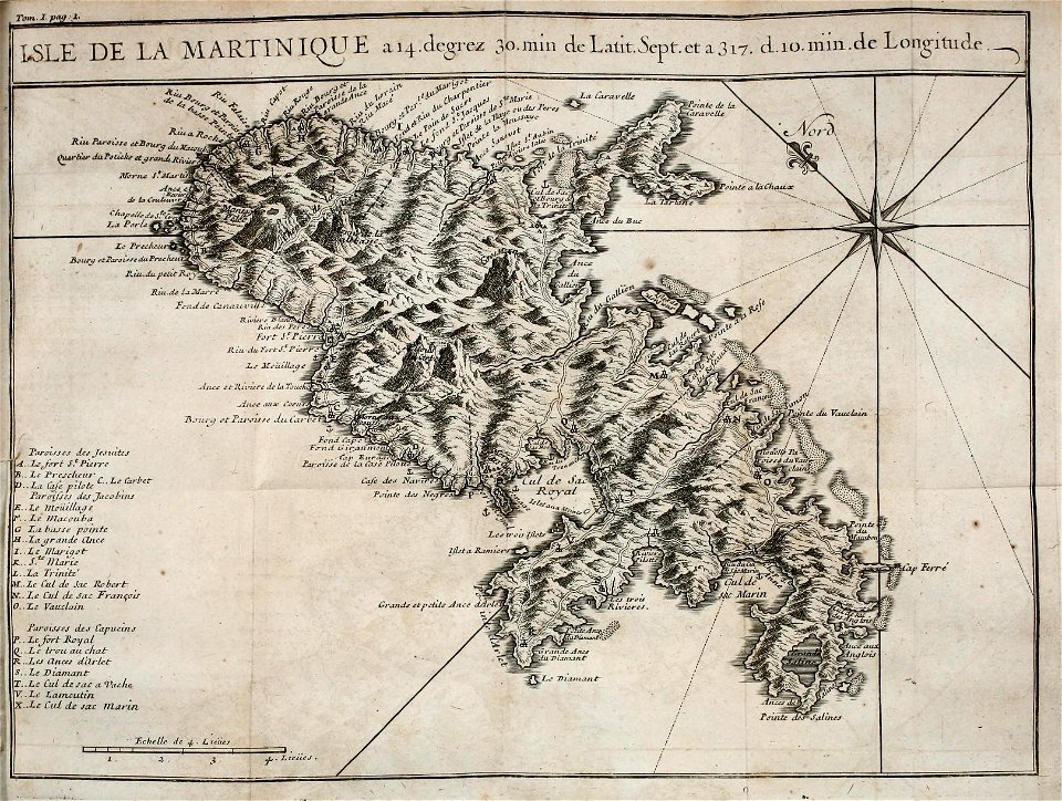
west indies
natural history
smithsonian libraries
pre-linnean works
early works to 1800
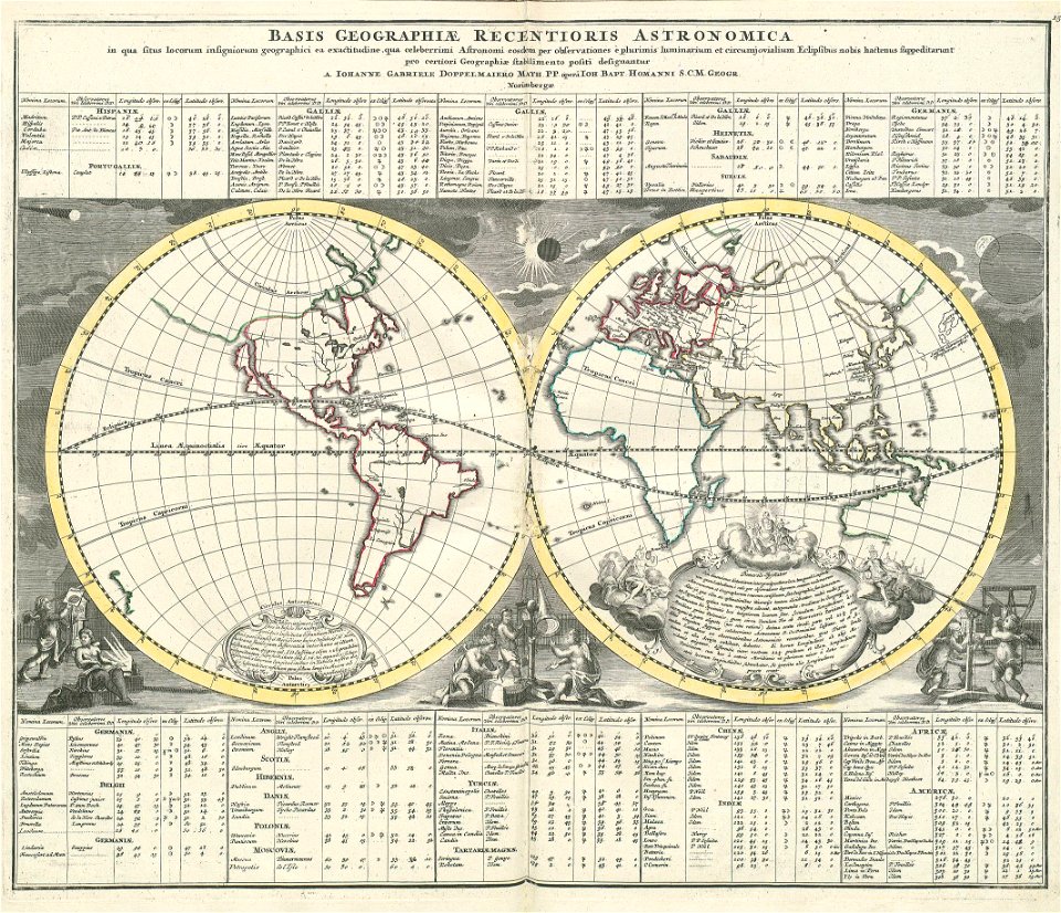
johann baptist homann
latin-language maps
david rumsey historical map collection
covens en mortier
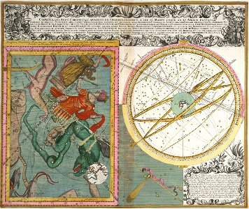
old celestial maps
maps with figures
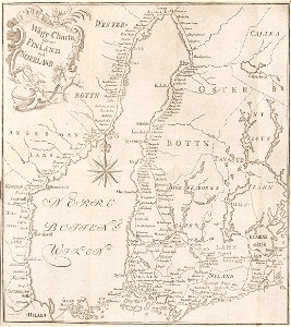
18th-century maps of finland
georg biurman
„atlas coelestis in quo mundus spectabilis“ by j.b. doppelmayr
double hemisphere world maps
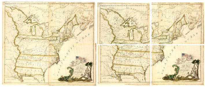
maps of the united states
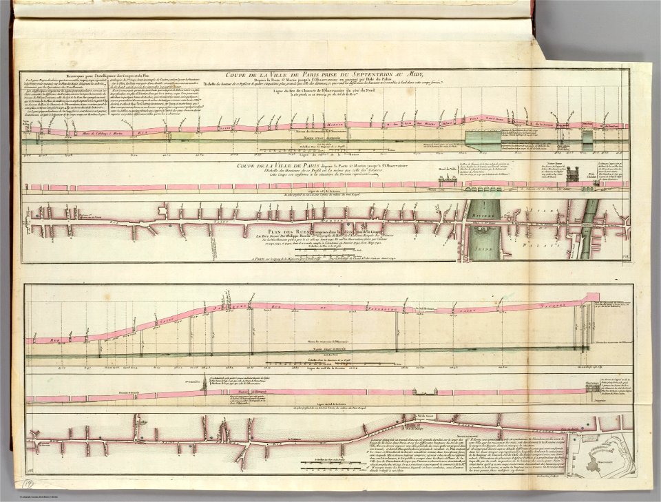
seine river in paris
old submaps of paris
french-language maps
1742 maps
old county maps of oxfordshire
bodleian maps collection
maps of bruges by basire
james basire
lawrence h. slaughter collection of english maps, charts, globes, books and atlases
nypl lionel pincus and princess firyal map division
maps by isaak tirion
old maps of haarlem
old maps of île saint-louis
maps of paris in the 1740s
old maps of île saint-louis
jean-baptiste scotin
chorographia britanniae (1741-1742)
18th-century maps of kent
chorographia britanniae (1741-1742)
18th-century maps of cornwall
chorographia britanniae (1741-1742)
18th-century maps of essex
chorographia britanniae (1741-1742)
18th-century maps of sussex
18th-century maps of nottinghamshire
chorographia britanniae (1741-1742)
chorographia britanniae (1741-1742)
18th-century maps of cambridgeshire
chorographia britanniae (1741-1742)
18th-century maps of middlesex
chorographia britanniae (1741-1742)
18th-century maps of monmouthshire
chorographia britanniae (1741-1742)
18th-century maps of westmorland
18th-century maps of huntingdonshire
chorographia britanniae (1741-1742)
chorographia britanniae (1741-1742)
18th-century maps of northumberland
chorographia britanniae (1741-1742)
18th-century maps of cumberland
chorographia britanniae (1741-1742)
18th-century maps of hampshire
chorographia britanniae (1741-1742)
18th-century maps of hertfordshire
chorographia britanniae (1741-1742)
18th-century maps of surrey
chorographia britanniae (1741-1742)
18th-century maps of staffordshire
chorographia britanniae (1741-1742)
18th-century maps of leicestershire
chorographia britanniae (1741-1742)
18th-century maps of devon
chorographia britanniae (1741-1742)
18th-century maps of rutland
chorographia britanniae (1741-1742)
18th-century maps of worcestershire
chorographia britanniae (1741-1742)
18th-century maps of cheshire
18th-century maps of norfolk, england
chorographia britanniae (1741-1742)
18th-century maps of herefordshire
old county maps of herefordshire
chorographia britanniae (1741-1742)
18th-century maps of suffolk
chorographia britanniae (1741-1742)
18th-century maps of warwickshire
chorographia britanniae (1741-1742)
18th-century maps of shropshire
chorographia britanniae (1741-1742)
18th-century maps of bedfordshire
chorographia britanniae (1741-1742)
18th-century maps of derbyshire
chorographia britanniae (1741-1742)
old county maps of county durham
chorographia britanniae (1741-1742)
18th-century maps of lincolnshire
chorographia britanniae (1741-1742)
18th-century maps of dorset
chorographia britanniae (1741-1742)
18th-century maps of yorkshire
18th-century maps of buckinghamshire
chorographia britanniae (1741-1742)
18th-century maps of gloucestershire
chorographia britanniae (1741-1742)
18th-century maps of northamptonshire
chorographia britanniae (1741-1742)
chorographia britanniae (1741-1742)
18th-century maps of berkshire
chorographia britanniae (1741-1742)
18th-century maps of somerset
chorographia britanniae (1741-1742)
18th-century maps of wiltshire
chorographia britanniae (1741-1742)
18th-century maps of lancashire
media contributed by university of illinois urbana-champaign university library
carte de barbarie, nigritie, guinée par guillaume delisle (1707)
chorographia britanniae (1741-1742)
bibliothèque nationale de france
environs de paris levés géométriquement by jean delagrive (1731-1742)
maps of paris from bibliothèque nationale de france
environs de paris levés géométriquement by jean delagrive (1731-1742)
maps of paris from bibliothèque nationale de france
environs de paris levés géométriquement by jean delagrive (1731-1742)
maps of paris from bibliothèque nationale de france
environs de paris levés géométriquement by jean delagrive (1731-1742)
maps of paris from bibliothèque nationale de france
environs de paris levés géométriquement by jean delagrive (1731-1742)
maps of paris from bibliothèque nationale de france
environs de paris levés géométriquement by jean delagrive (1731-1742)
maps of paris from bibliothèque nationale de france
environs de paris levés géométriquement by jean delagrive (1731-1742)
maps of paris from bibliothèque nationale de france
environs de paris levés géométriquement by jean delagrive (1731-1742)
maps of paris from bibliothèque nationale de france
environs de paris levés géométriquement by jean delagrive (1731-1742)
maps of paris from bibliothèque nationale de france
jean-fréderic phélypeaux
guillaume dheulland
maps in the rijksmuseum amsterdam
maps by isaak tirion
drawings in the stadsarchief amsterdam
drawings by jurriaan andriessen
french
maps
french
maps
french
maps
french
maps
french
maps
french
maps
french
maps
maps in the rijksmuseum amsterdam
maps by isaak tirion
islands
maps
18th-century maps of england and wales
chorographia britanniae (1741-1742)
18th-century maps of england and wales
chorographia britanniae (1741-1742)
chorographia britanniae (1741-1742)
1740s maps of wales
chorographia britanniae (1741-1742)
1740s maps of wales
old maps of berbice
hendrik de leth
18th-century maps of england and wales
chorographia britanniae (1741-1742)
18th-century maps of england and wales
chorographia britanniae (1741-1742)
john cleveley the elder
thomas milton
drawings in musée carnavalet
rue vivienne (paris)
prints by claes jansz. visscher (ii) in the rijksmuseum amsterdam
maps in the rijksmuseum amsterdam
prints published by claes jansz. visscher (ii) in the rijksmuseum amsterdam
maps in the rijksmuseum amsterdam
1 - 87 of 87
/ 1


![A Map of South Wales: West from London / T. Badeslade delin[eavit]; W.H. Toms Sculp[sit], 1741](https://cdn.creazilla.com/illustrations/10000319175/a-map-of-south-wales-west-from-london-t-badeslade-delineavit-wh-toms-sculpsit-1741-sm.webp)
![A Map of North Wales: N. West from London / T. Badeslade delin[eavit]; W.H. Toms Sculp[sit], 1741](https://cdn.creazilla.com/illustrations/10001551176/a-map-of-north-wales-n-west-from-london-t-badeslade-delineavit-wh-toms-sculpsit-1741-md.jpg)


