Log in
All resources
Create a design
157 Free Artworks of 1702 Maps
maps in the rijksmuseum amsterdam
les forces de l'europe, asie, afrique et amerique, ou description des principales villes, avec leurs fortifications
maps by carolus allard
anna beeck
abraham allard
portolan charts made in the 18th century
battle of vigo bay
eran laor cartographic collection
gerard valck
nicolaes visscher
prints in the rijksmuseum amsterdam
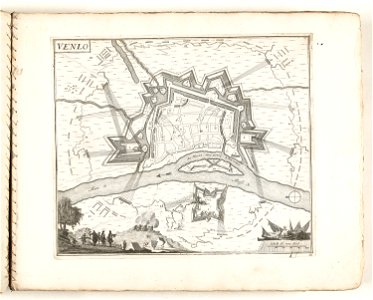
old maps of venlo
romeyn de hooghe
gerard valck
cartography
maps
french-language maps
gerard valck
maps in the rijksmuseum amsterdam
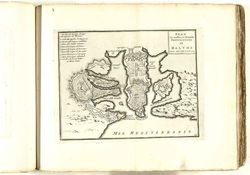
old maps of valletta
maps in the rijksmuseum amsterdam
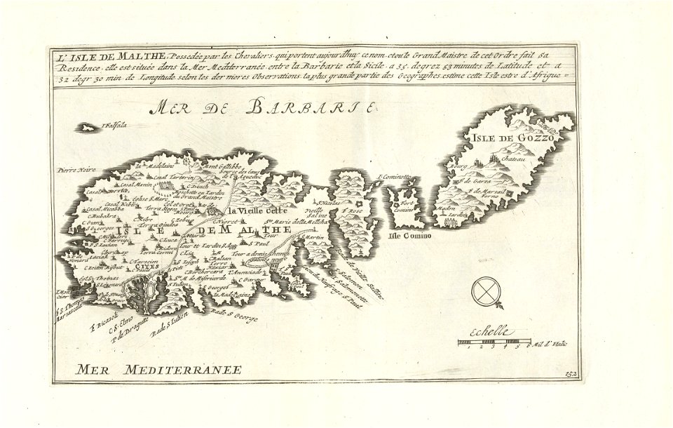
old maps of malta
1726
asie
1702 maps of france
1702 in guyenne
old maps of narva
1700 maps
maps of the duchy of courland and semigallia
maps of the great northern war
prints by abraham allard in the rijksmuseum amsterdam
maps in the rijksmuseum amsterdam
1730s maps of south carolina
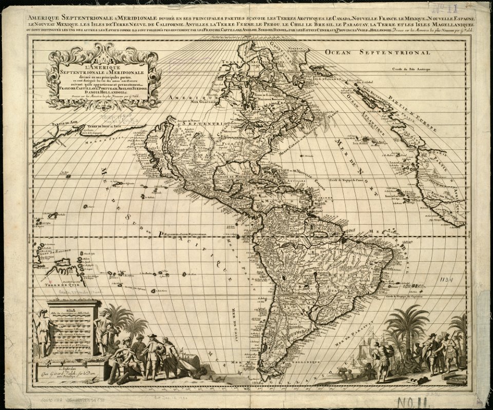
old maps of north america
18th-century maps of the indian ocean
18th-century maps of southeast asia
maps by daniel stoopendaal
biblical maps
maps of the electorate of cologne
maps made in the 18th century
media contributed by university of illinois urbana-champaign university library
1702 maps of africa
maps of nieuw nederland
nicolaes visscher ii
broadsheet prints from koninklijke bibliotheek - maps
broadsheet prints from koninklijke bibliotheek
carte des pays-bas catholiques by guillaume sanson
maps by alexis-hubert jaillot
vigo in the 18th century
1702 maps of spain
maps in the rijksmuseum amsterdam
maps by pieter mortier
anteckning om krigshändelserna i kurland
maps of the great northern war
maps made in the 17th century
old maps of upper austria
18th-century maps of veneto
1700s maps of slovenia
eran laor cartographic collection
cornelis de bruyn
maps by nicolaes visscher i
maps by daniel stoopendaal
maps made in the 17th century
old maps of alsace
maps of africa in the robert c. williams paper museum
1702 maps of africa
prints by abraham allard in the rijksmuseum amsterdam
1700s maps of spain
maps in the rijksmuseum amsterdam
maps by carolus allard
1667 sanson map of africa
1702 maps of africa
eran laor cartographic collection
1667 sanson map of africa
history prints in the rijksmuseum amsterdam
maps in the rijksmuseum amsterdam
history prints in the rijksmuseum amsterdam
maps in the rijksmuseum amsterdam
prints by abraham allard in the rijksmuseum amsterdam
maps in the rijksmuseum amsterdam
eran laor cartographic collection
johann ulrich krauß
cádiz in the 18th century
old maps of cádiz
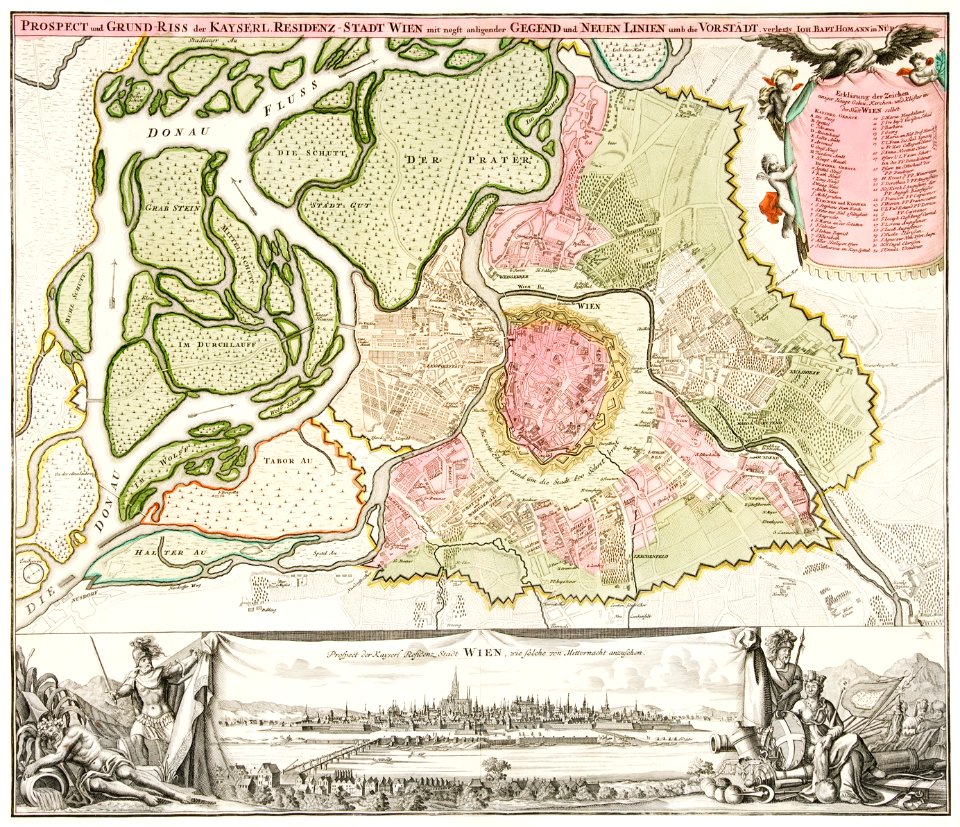
17th-century maps of vienna
maps by nicolaes visscher i
history prints in the rijksmuseum amsterdam
maps in the rijksmuseum amsterdam
prints by caspar luyken in the rijksmuseum amsterdam
maps in the rijksmuseum amsterdam
dutch 18th-century prints in the rijksmuseum amsterdam
symbols of roermond
les forces de l'europe, asie, afrique et amerique, ou description des principales villes, avec leurs fortifications
maps in the rijksmuseum amsterdam
cádiz in the 18th century
old maps of cádiz
les forces de l'europe, asie, afrique et amerique, ou description des principales villes, avec leurs fortifications
1702 maps of spain
prints of cartouches in the rijksmuseum amsterdam
maps in the rijksmuseum amsterdam
eran laor cartographic collection
johann ulrich krauß
les forces de l'europe, asie, afrique et amerique, ou description des principales villes, avec leurs fortifications
maps of the history of poitou
history prints in the rijksmuseum amsterdam
maps in the rijksmuseum amsterdam
etchings in the rijksmuseum amsterdam
maps in the rijksmuseum amsterdam
prints of cartouches in the rijksmuseum amsterdam
maps in the rijksmuseum amsterdam
les forces de l'europe, asie, afrique et amerique, ou description des principales villes, avec leurs fortifications
old maps of cádiz
maps in the rijksmuseum amsterdam
maps by carolus allard
maps by nicolaes visscher i
atlas van der hagen
etchings in the rijksmuseum amsterdam
carolus allard
maps in the rijksmuseum amsterdam
maps by carolus allard
prints by jan van call in the rijksmuseum amsterdam
maps in the rijksmuseum amsterdam
dutch 18th-century prints in the rijksmuseum amsterdam
old maps of roermond
prints by jan van call in the rijksmuseum amsterdam
maps in the rijksmuseum amsterdam
prints by caspar luyken in the rijksmuseum amsterdam
maps in the rijksmuseum amsterdam
prints by abraham allard in the rijksmuseum amsterdam
1726 maps of spain
eran laor cartographic collection
claes jansz. visscher (ii)
les forces de l'europe, asie, afrique et amerique, ou description des principales villes, avec leurs fortifications
old maps of perpignan
description de l'universe
alain manesson mallet
les forces de l'europe, asie, afrique et amerique, ou description des principales villes, avec leurs fortifications
portolan charts made in the 18th century
les forces de l'europe, asie, afrique et amerique, ou description des principales villes, avec leurs fortifications
portolan charts made in the 18th century
maps in the rijksmuseum amsterdam
maps by carolus allard
maps by jacques-nicolas bellin
1752 maps
holy roman empire
pierre mortier
les forces de l'europe, asie, afrique et amerique, ou description des principales villes, avec leurs fortifications
vigo in the 18th century
eran laor cartographic collection
claes jansz. visscher (ii)
fort knodsenburg
abraham allard
prints by jan van call in the rijksmuseum amsterdam
maps in the rijksmuseum amsterdam
maps in the rijksmuseum amsterdam
maps by gerard valck
eran laor cartographic collection
claes jansz. visscher (ii)
maps in the rijksmuseum amsterdam
maps by pieter mortier
les forces de l'europe, asie, afrique et amerique, ou description des principales villes, avec leurs fortifications
18th-century maps of grenoble
les forces de l'europe, asie, afrique et amerique, ou description des principales villes, avec leurs fortifications
madrid in the 1700s
les forces de l'europe, asie, afrique et amerique, ou description des principales villes, avec leurs fortifications
maps of longwy city walls
les forces de l'europe, asie, afrique et amerique, ou description des principales villes, avec leurs fortifications
maps of bayonne
les forces de l'europe, asie, afrique et amerique, ou description des principales villes, avec leurs fortifications
maps in the rijksmuseum amsterdam
les forces de l'europe, asie, afrique et amerique, ou description des principales villes, avec leurs fortifications
portolan charts made in the 18th century
les forces de l'europe, asie, afrique et amerique, ou description des principales villes, avec leurs fortifications
portolan charts made in the 18th century
les forces de l'europe, asie, afrique et amerique, ou description des principales villes, avec leurs fortifications
portolan charts made in the 18th century
les forces de l'europe, asie, afrique et amerique, ou description des principales villes, avec leurs fortifications
maps in the rijksmuseum amsterdam
maps in the rijksmuseum amsterdam
nicolaas listingh
les forces de l'europe, asie, afrique et amerique, ou description des principales villes, avec leurs fortifications
portolan charts made in the 18th century
les forces de l'europe, asie, afrique et amerique, ou description des principales villes, avec leurs fortifications
portolan charts made in the 18th century
les forces de l'europe, asie, afrique et amerique, ou description des principales villes, avec leurs fortifications
portolan charts made in the 18th century
les forces de l'europe, asie, afrique et amerique, ou description des principales villes, avec leurs fortifications
history of languedoc
maps in the rijksmuseum amsterdam
maps by gerard valck
maps in the rijksmuseum amsterdam
maps by gerard valck
les forces de l'europe, asie, afrique et amerique, ou description des principales villes, avec leurs fortifications
old maps of île de ré
les forces de l'europe, asie, afrique et amerique, ou description des principales villes, avec leurs fortifications
maps in the rijksmuseum amsterdam
les forces de l'europe, asie, afrique et amerique, ou description des principales villes, avec leurs fortifications
portolan charts made in the 18th century
eran laor cartographic collection
claes jansz. visscher (ii)
maps in the rijksmuseum amsterdam
maps by carolus allard
maps in the rijksmuseum amsterdam
abraham allard
les forces de l'europe, asie, afrique et amerique, ou description des principales villes, avec leurs fortifications
maps in the rijksmuseum amsterdam
les forces de l'europe, asie, afrique et amerique, ou description des principales villes, avec leurs fortifications
maps in the rijksmuseum amsterdam
les forces de l'europe, asie, afrique et amerique, ou description des principales villes, avec leurs fortifications
maps in the rijksmuseum amsterdam
1 - 100 of 157
Next page
/ 2