Log in
All resources
Create a design
101 Free Artworks of 1688 Maps
geographical illustrations by coronelli
1689 map of haarlem
1688 in haarlem
maps in the rijksmuseum amsterdam
olfert dapper
romeyn de hooghe
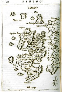
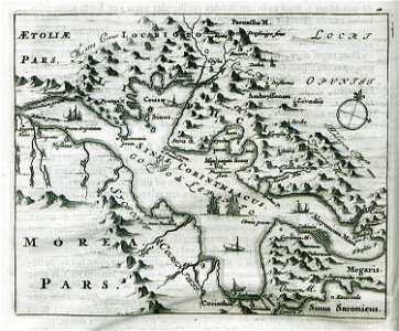
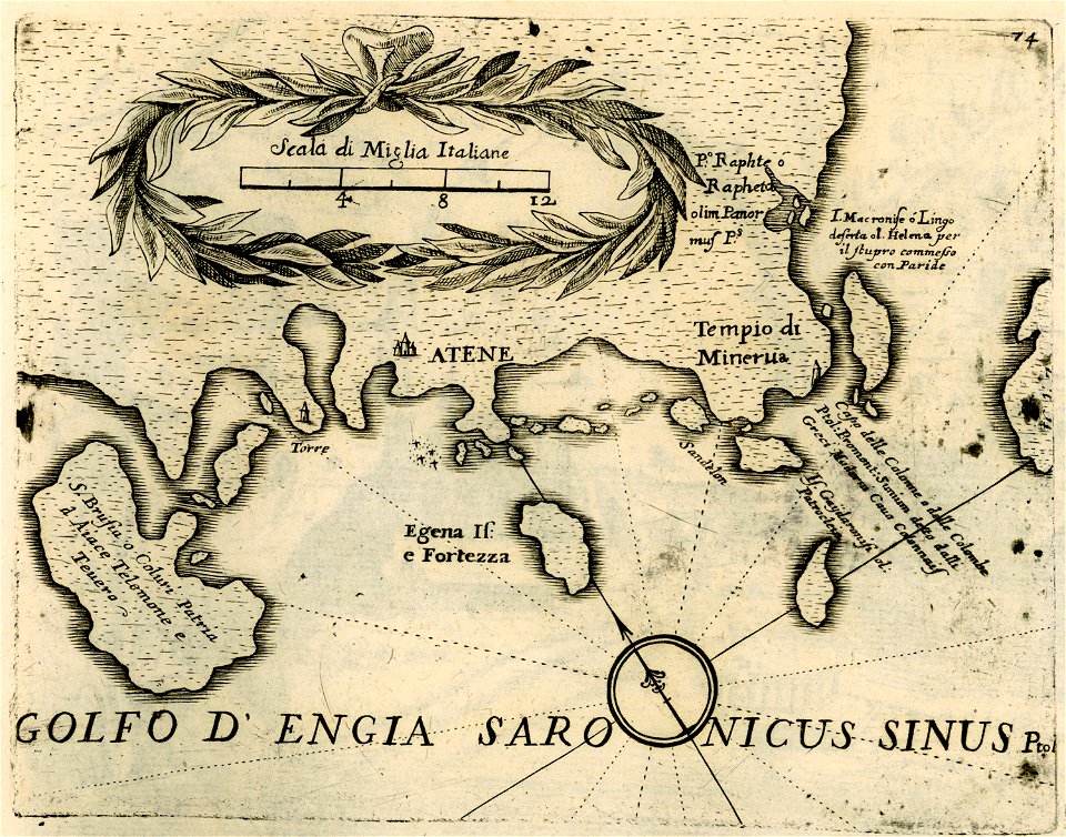
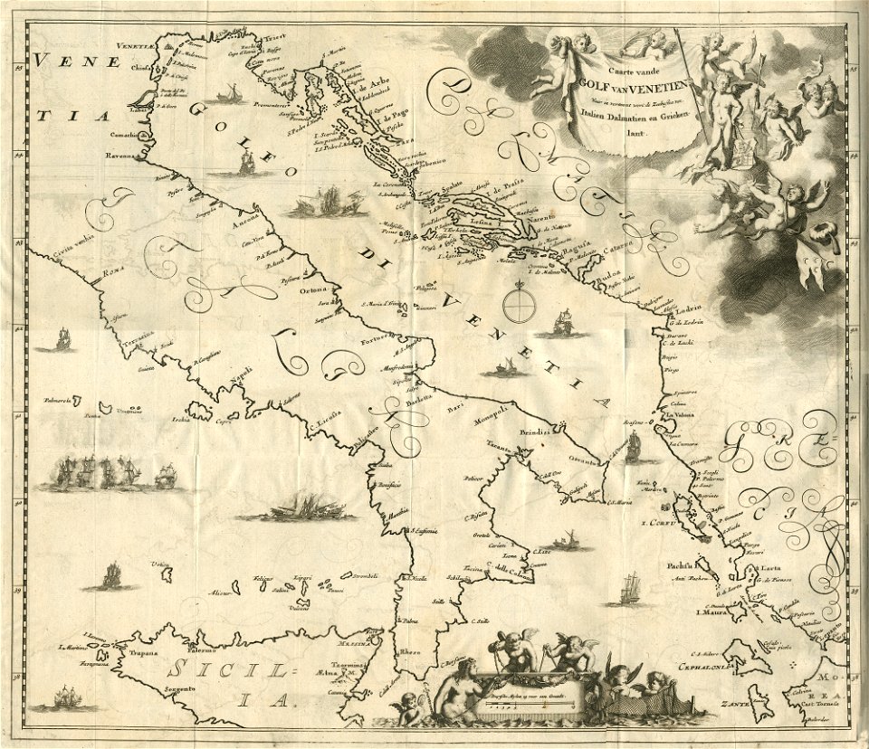
old maps of greece
prints by romeyn de hooghe in the rijksmuseum amsterdam
bibliothèque nationale de france
old maps of haarlem
old maps of the balkans
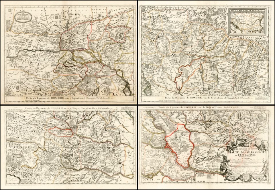
vincenzo coronelli
old maps of suriname
1688 maps
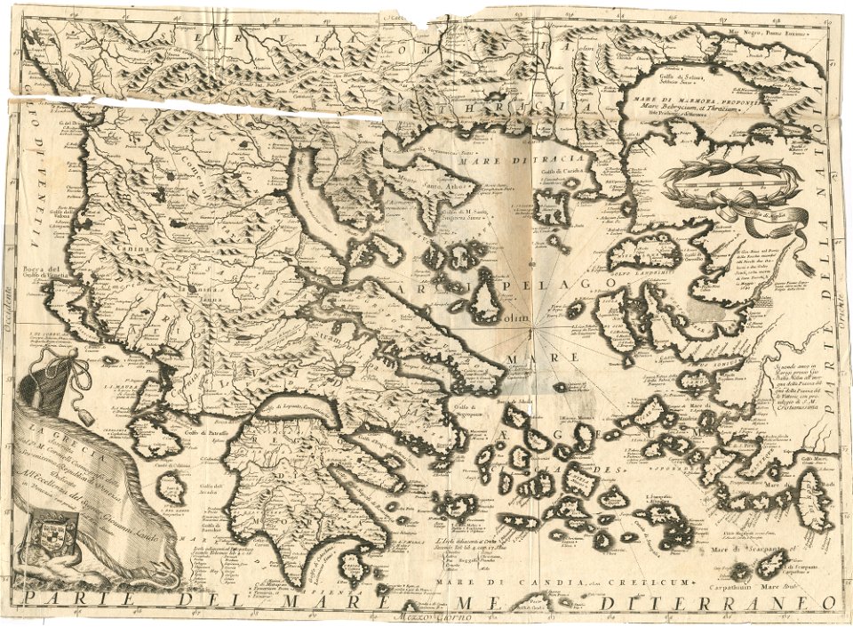
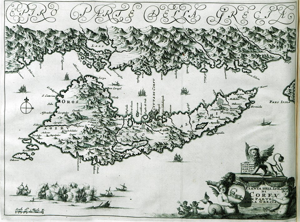
l'egeo redivivo (1688)
l'egeo redivivo (1688)
l'egeo redivivo (1688)
geographical illustrations by coronelli
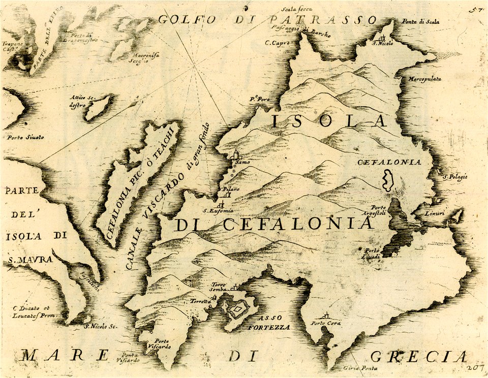
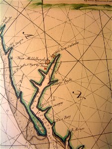
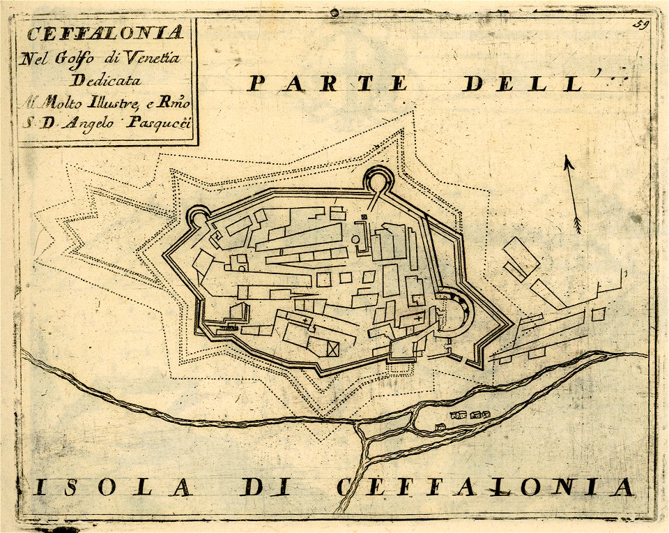
maps of kefalonia
geographical illustrations by coronelli
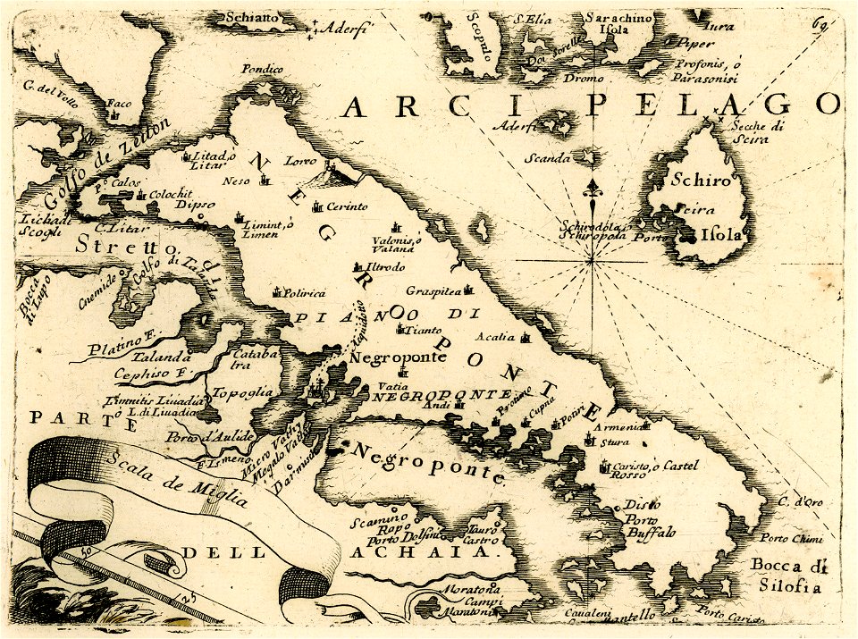
maps of euboea
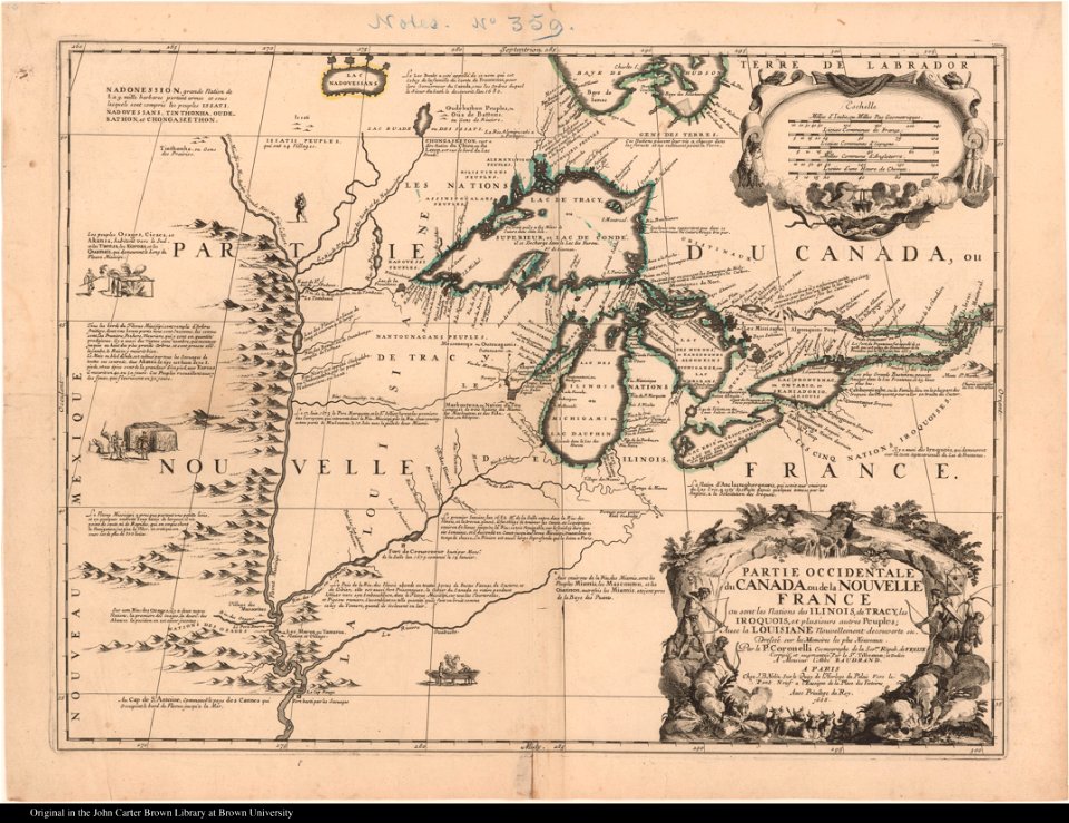
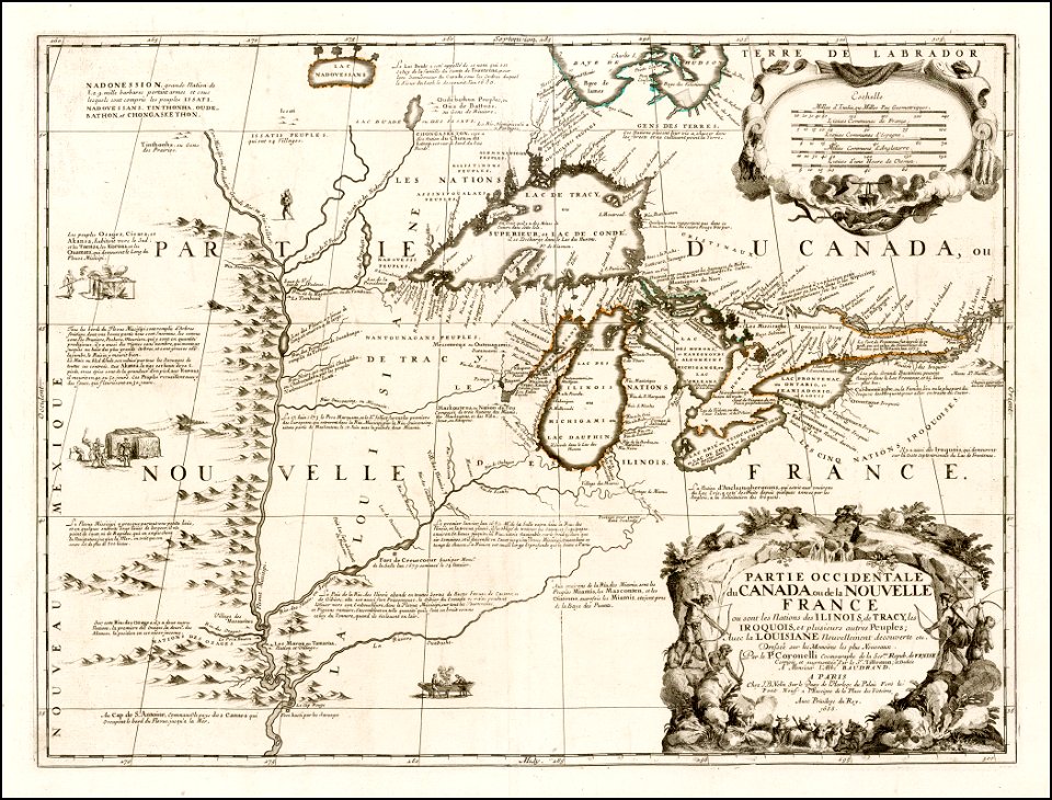
old maps of new france
maps by coronelli
old maps of new france
maps by coronelli
olfert dapper
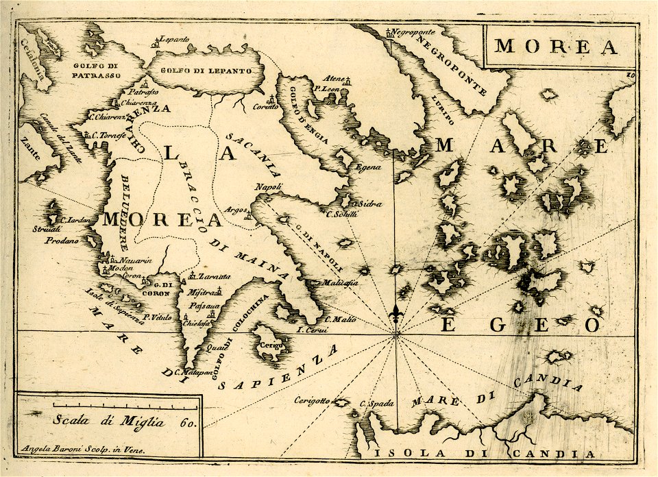
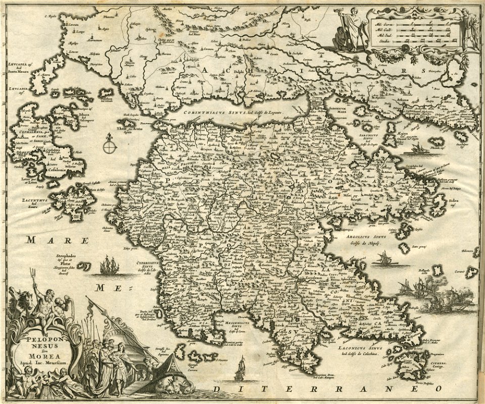
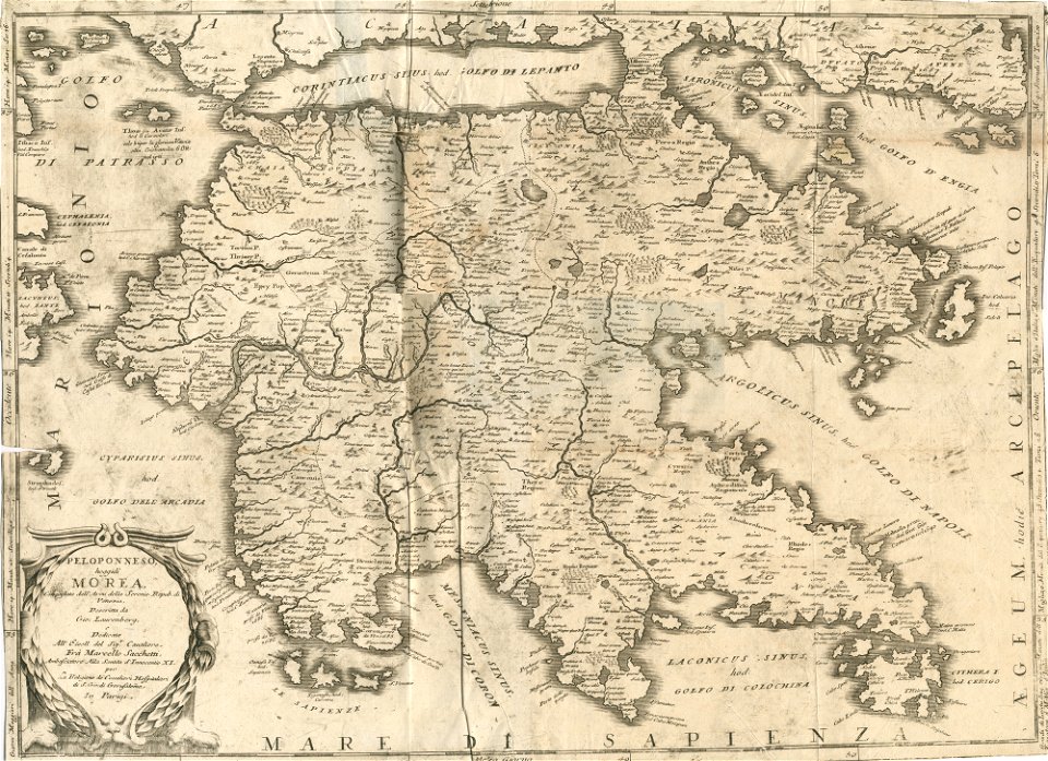
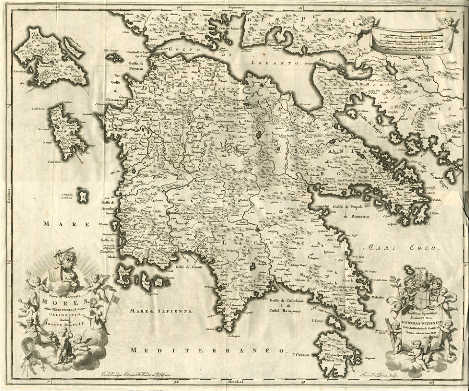
morea
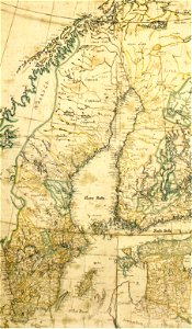
17th-century maps of finland
17th-century maps of estonia
geographical illustrations by coronelli
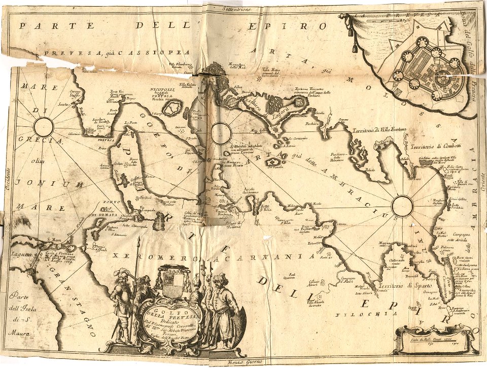
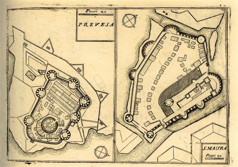
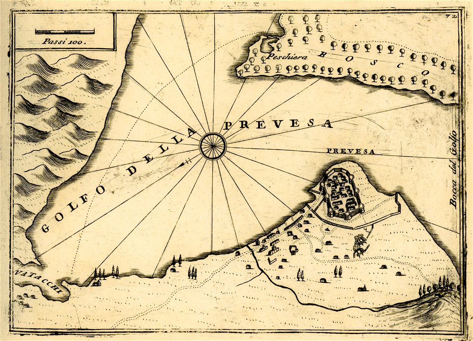
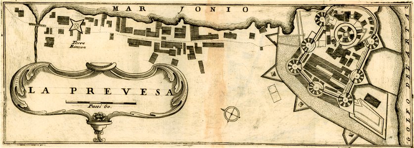
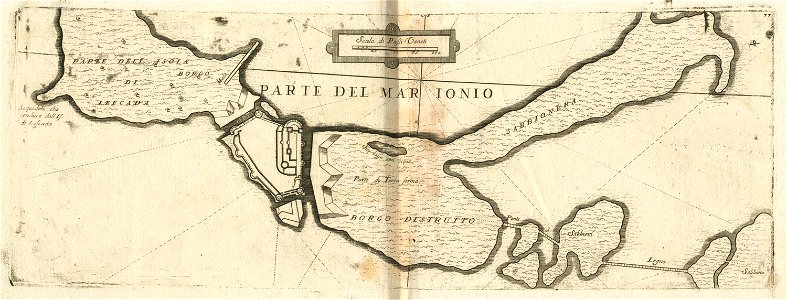
maps of preveza
geographical illustrations by coronelli
maps of lefkada
old maps of greece
olfert dapper
geographical illustrations by coronelli
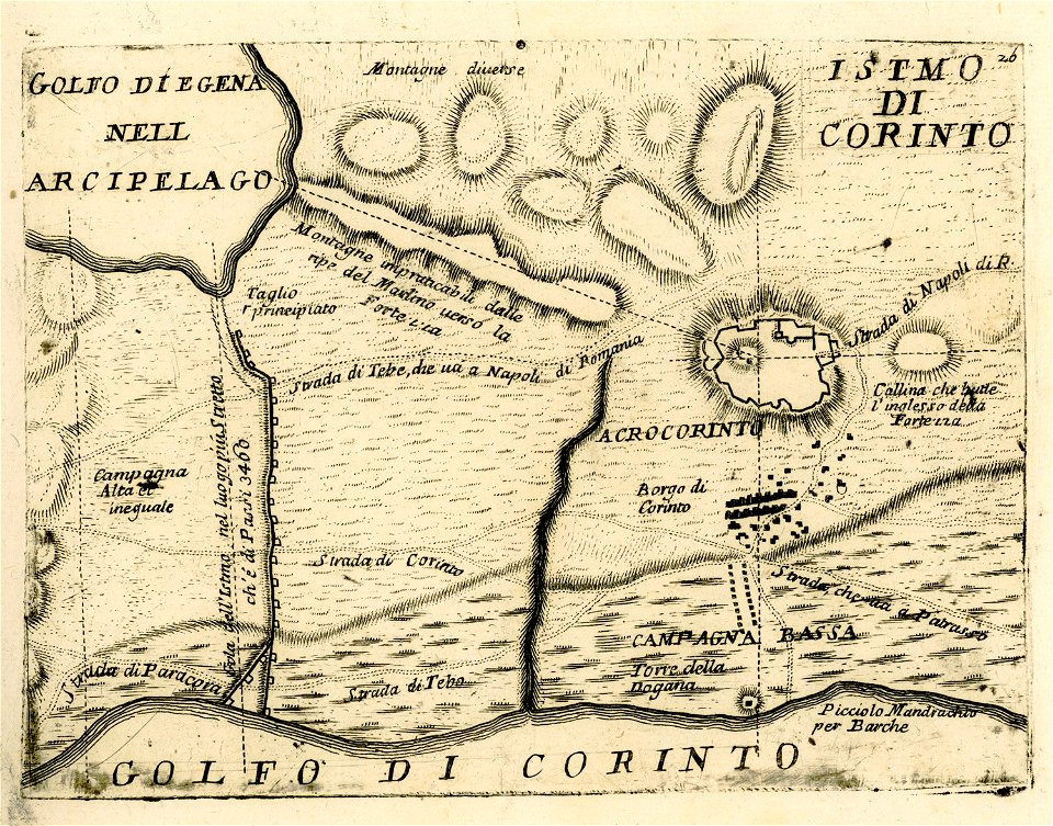
maps of ancient corinth
geographical illustrations by coronelli
old maps of the peloponnese
old maps of new france
maps by coronelli
geographical illustrations by coronelli
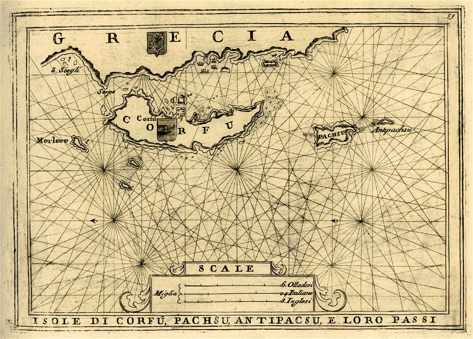
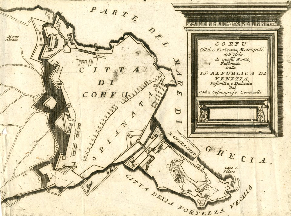
old maps of corfu
geographical illustrations by coronelli
geographical illustrations by coronelli
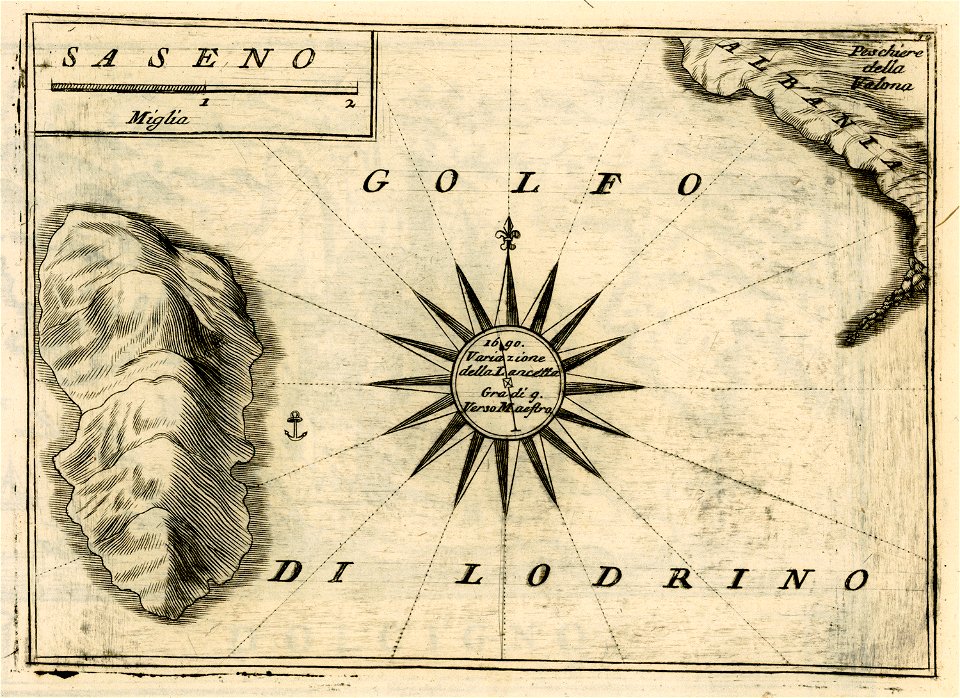
sazan
old maps of greece
olfert dapper
geographical illustrations by coronelli
maps of kefalonia
geographical illustrations by coronelli
maps of lefkada
geographical illustrations by coronelli
old maps of greece
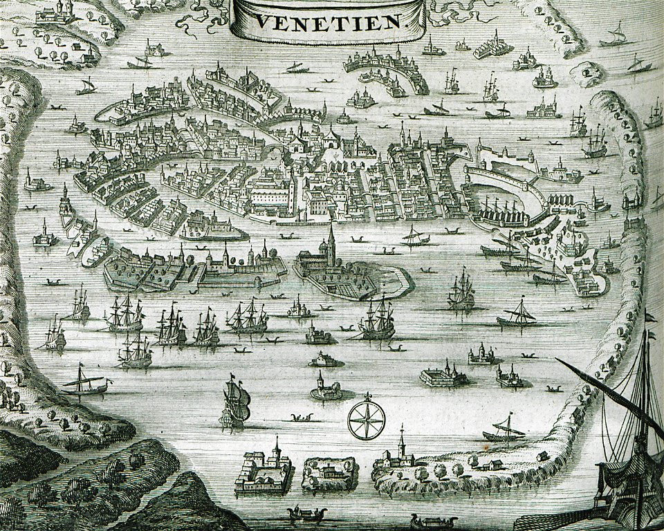
old maps of venice
venice in art
geographical illustrations by coronelli
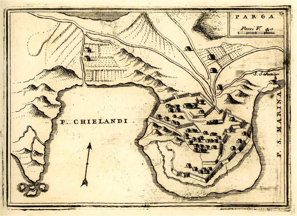
engravings of parga
geographical illustrations by coronelli
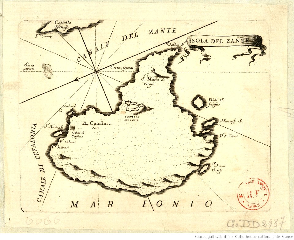
maps of zakynthos
geographical illustrations by coronelli
old maps of the peloponnese
old maps of greece
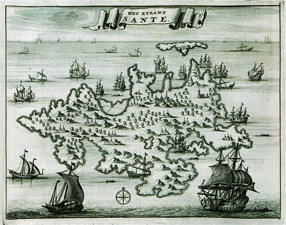
sant
geographical illustrations by coronelli
maps of preveza
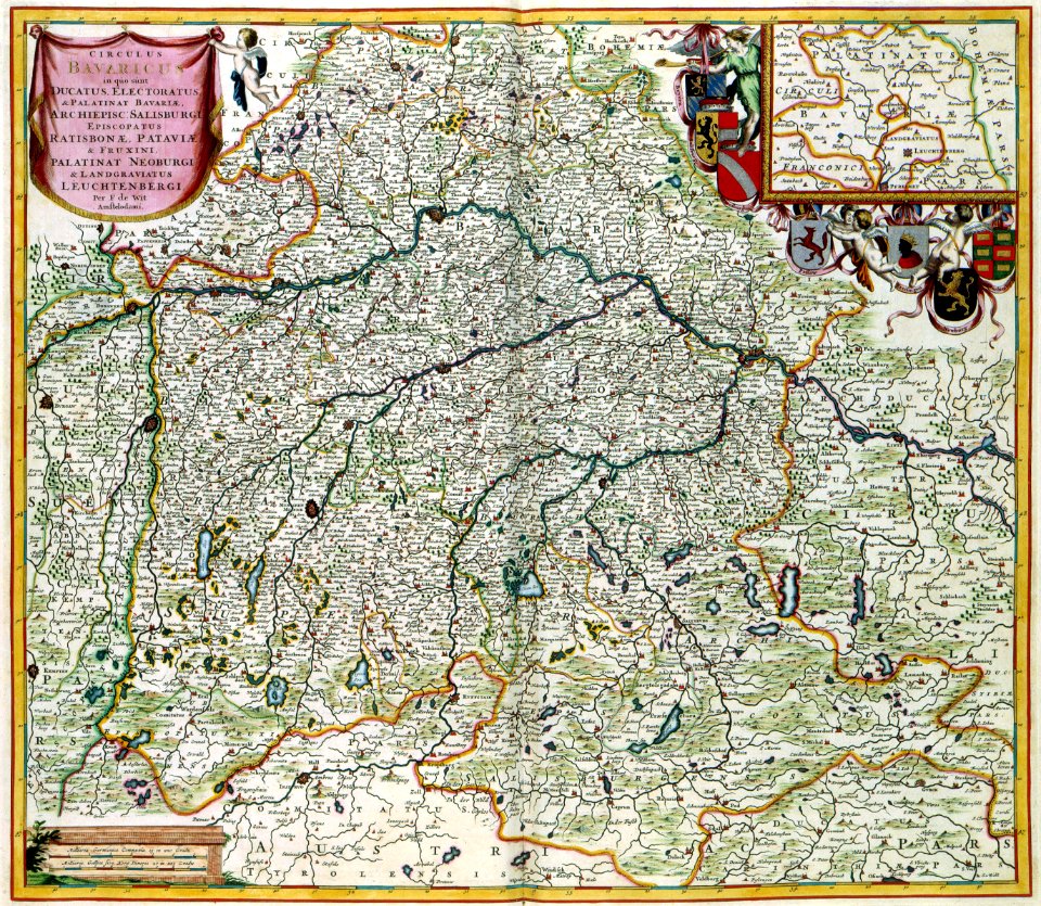
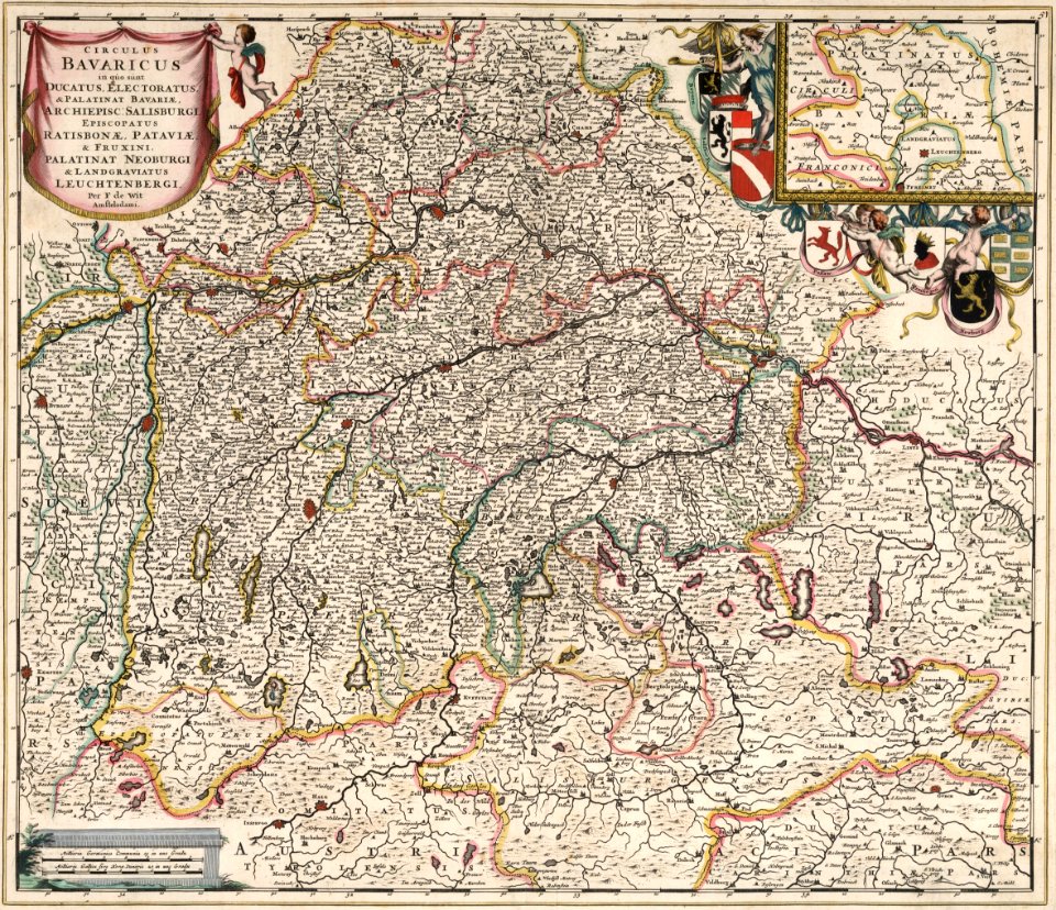
maps by frederick de wit
maps with cartouches
geographical illustrations by coronelli
geographical illustrations by coronelli
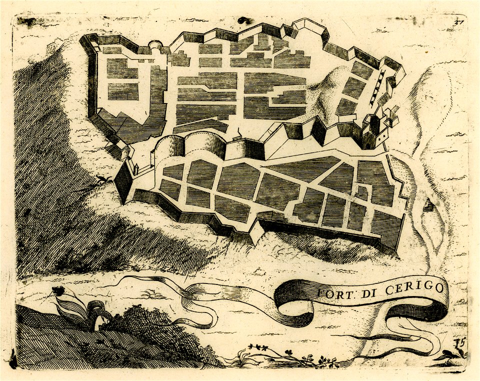
engravings of kythira
geographical illustrations by coronelli
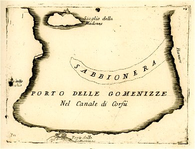
engravings of igoumenitsa
old maps of pomeroon
johannes van keulen
geographical illustrations by coronelli
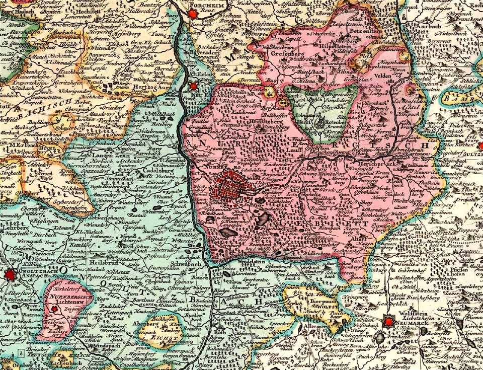
old maps of nuremberg
covens en mortier
david rumsey historical map collection
maps by frederick de wit
geographical illustrations by coronelli
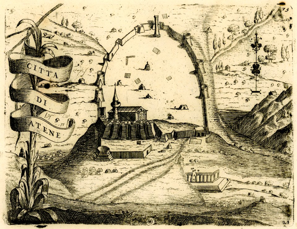
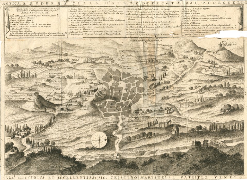
athens in the ottoman era
geographical illustrations by coronelli
athens in the ottoman era
geographical illustrations by coronelli
historical maps of kefalonia
geographical illustrations by coronelli
maps of icaria
old maps of greece
olfert dapper
geographical illustrations by coronelli
old maps of corfu
geographical illustrations by coronelli
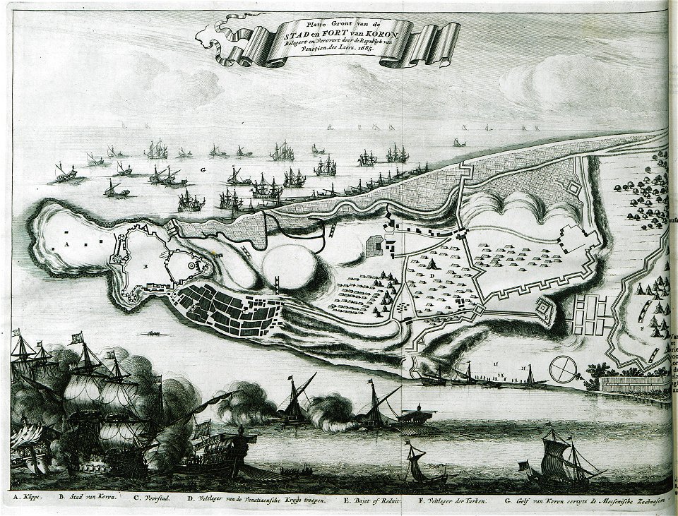
history of the dodecanese
geographical illustrations by coronelli
history of the dodecanese
geographical illustrations by coronelli
old maps of corfu
geographical illustrations by coronelli
maps of corfu town
geographical illustrations by coronelli
old maps of athens
old maps of greece
corfu
geographical illustrations by coronelli
maps of monemvasia
geographical illustrations by coronelli
history of the dodecanese
old maps of italy
olfert dapper
old maps of greece
olfert dapper
engravings by romeyn de hooghe
proveniershof, haarlem
old maps of cambridge
1690 maps of england
17th-century maps of the indian ocean
bodleian maps collection
old maps of lima
joseph mulder
1656 in berlin
1656 maps
maps by willem and johannes blaeu
1680s maps of indonesia
maps by willem and johannes blaeu
1680s maps of indonesia
pierre i lepautre
claude perrault
bakenesserkerk in art
1689 map of haarlem
maps of the course of the rhine by guillaume sanson
maps by nicolas sanson
1689 map of haarlem
vleeshal, haarlem
1689 map of haarlem
1688 in haarlem
grote kerk, haarlem
1689 map of haarlem
grote kerk, haarlem
1689 map of haarlem
stadhuis haarlem in art
1689 map of haarlem
pierre i lepautre
claude perrault
carriages in the 1680s
prints of haarlem
proveniershof, haarlem
1689 map of haarlem
kloveniersdoelen (haarlem)
1689 map of haarlem
maps in the rijksmuseum amsterdam
maps of texel
prints by romeyn de hooghe in the rijksmuseum amsterdam
maps in the rijksmuseum amsterdam
prints by romeyn de hooghe in the rijksmuseum amsterdam
maps in the rijksmuseum amsterdam
prints by romeyn de hooghe in the rijksmuseum amsterdam
maps in the rijksmuseum amsterdam
1689 map of haarlem
prinsenhof, haarlem
1689 map of haarlem
janskerk, haarlem
grote kerk, haarlem
1689 map of haarlem
1689 map of haarlem
vleeshal, haarlem
1689 map of haarlem
sint-jorisgilde
prints by romeyn de hooghe in the rijksmuseum amsterdam
old maps of haarlem
maps in the rijksmuseum amsterdam
isaac haringhuysen
prints by romeyn de hooghe
romeyn de hooghe
maps in the rijksmuseum amsterdam
isaac haringhuysen
les monts pyrénées, où sont remarques les passages de france en espagne dressé sur les mémoires les plus nouveaux - par le sr. sanson... - btv1b532269750
1688 maps of europe
prints by jan luyken in the rijksmuseum amsterdam
title pages in the rijksmuseum amsterdam
magazine fort, dublin
maps by john rocque
prints by romeyn de hooghe in the rijksmuseum amsterdam
maps in the rijksmuseum amsterdam
1696 maps of the caribbean
1690s maps of mexico
maps in the rijksmuseum amsterdam
barrels in etchings
prints by romeyn de hooghe in the rijksmuseum amsterdam
maps in the rijksmuseum amsterdam
prints of cartouches in the rijksmuseum amsterdam
maps in the rijksmuseum amsterdam
prints of cartouches in the rijksmuseum amsterdam
maps in the rijksmuseum amsterdam
prints of cartouches in the rijksmuseum amsterdam
maps in the rijksmuseum amsterdam
realism,symbolism,impressionism
bequest of simon emmering
maps in the rijksmuseum amsterdam
baroque
1689 map of haarlem
siege of haarlem
1689 map of haarlem
siege of haarlem
1 - 100 of 101
Next page
/ 2


![[The northern Indian Ocean by Joan Blaeu, 1688]](https://cdn.creazilla.com/illustrations/10000550971/the-northern-indian-ocean-by-joan-blaeu-1688-md.jpg)


