Log in
All resources
Create a design
117 Free Artworks of 1648 Maps
maps by willem and johannes blaeu
maps in the rijksmuseum amsterdam
baroque
maps made in the 17th century
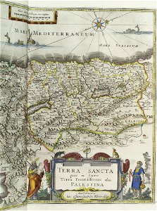
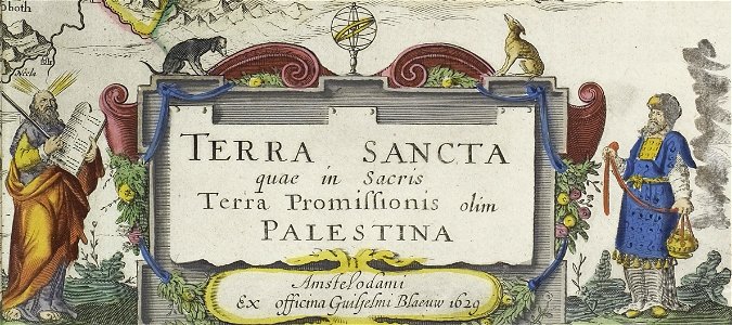
old maps of the tribes of israel
maps in the stadsarchief amsterdam
willem blaeu
new york public library
prints of cartouches in the rijksmuseum amsterdam
topographia franconiae (merian)
maps with cartouches
joan blaeu
maps in the national library of australia
matthäus merian
maps in the stadsarchief amsterdam
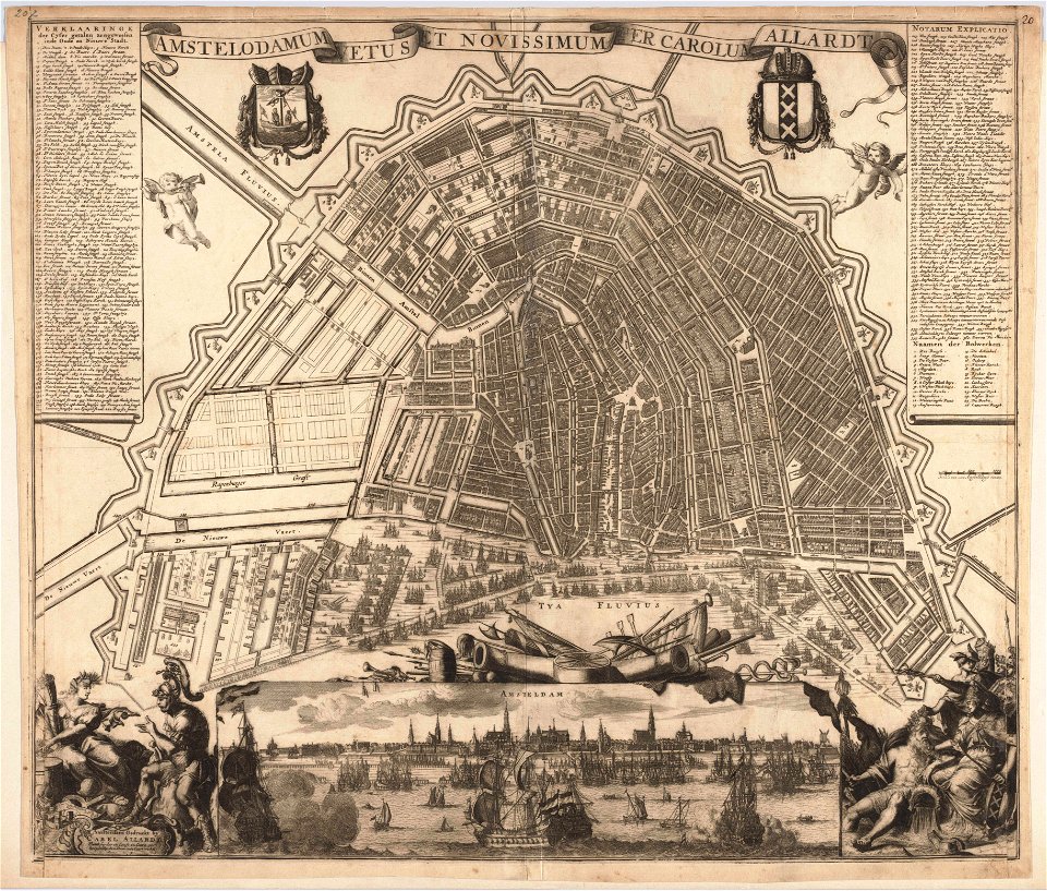
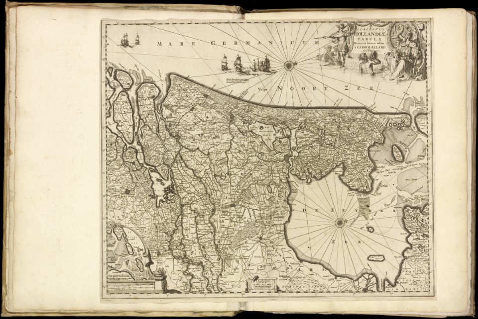
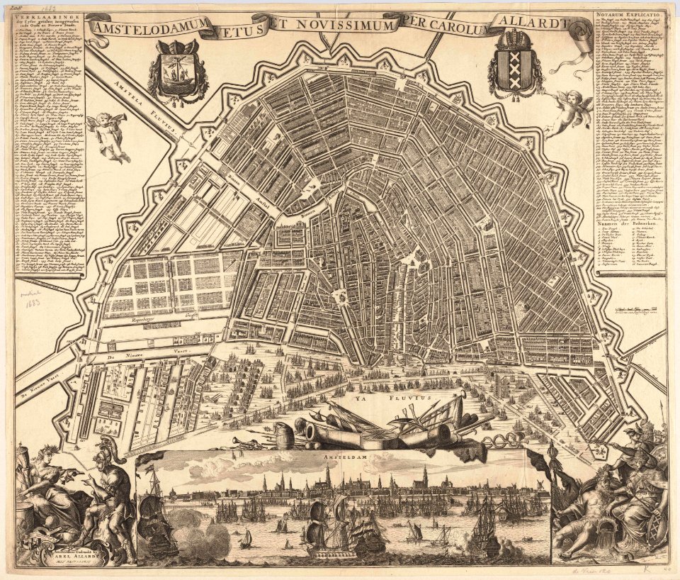
carolus allard
maps in the stadsarchief amsterdam
carolus allard
maps in the stadsarchief amsterdam
carolus allard
maps with cartouches
curonian
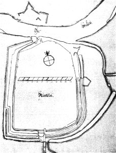
stadtbefestigung rinteln
maps of rinteln
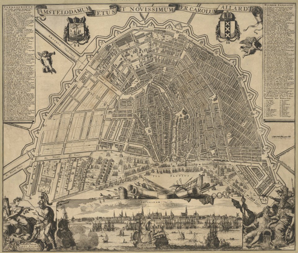
maps in the stadsarchief amsterdam
carolus allard
australia
maps
maps in the stadsarchief amsterdam
carolus allard
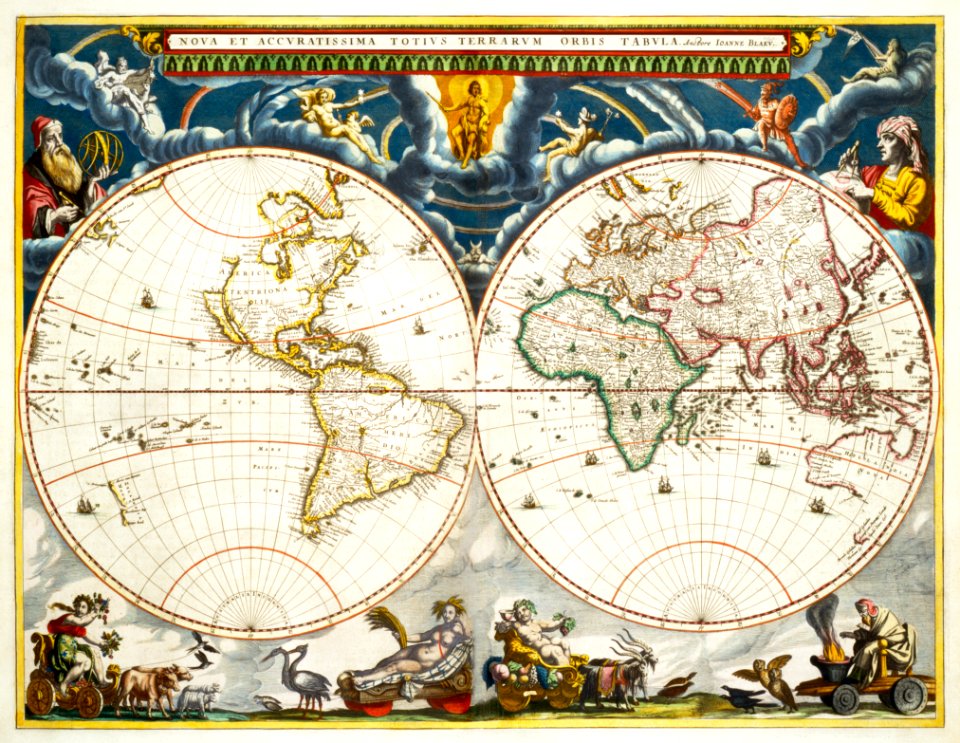
maps by willem and johannes blaeu
old maps of israel
maps by willem and johannes blaeu
maps made in the 17th century
maps by willem and johannes blaeu
maps made in the 17th century
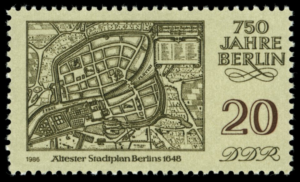
maps of the history of berlin
17th-century maps of berlin
maps by willem and johannes blaeu
maps made in the 17th century
maps by willem and johannes blaeu
maps made in the 17th century
maps with cartouches
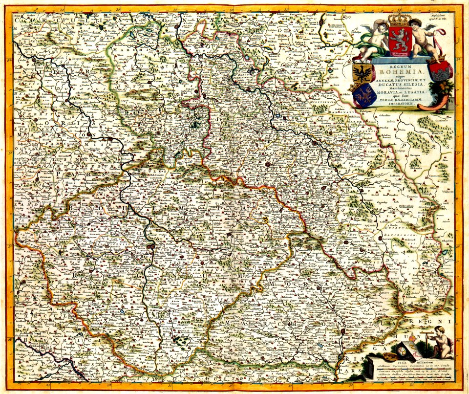
old maps of bohemia
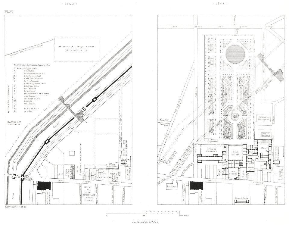
paris in the 16th century
lithographs of paris
old maps of the polish-lithuanian commonwealth
baroque
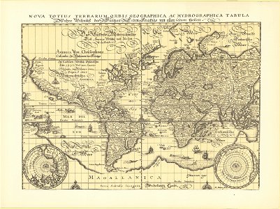
1640s maps of the world
1660s maps of the world
topographia franconiae (merian)
baroque
paintings by rembrandt in the rijksmuseum amsterdam
dutch golden age painting
nypl lionel pincus and princess firyal map division
geographical atlases
bodleian maps collection
leo belgicus
maps by willem and johannes blaeu
1648 maps of africa
maps by willem and johannes blaeu
maps made in the 17th century
maps by willem and johannes blaeu
maps made in the 17th century
old maps of deventer
schipbrug deventer
historisk atlas (stockholm, norstedt & söner, 1880)
maps of the history of scandinavia
joan blaeu
1648 maps
cartouches by willem and johannes blaeu
maps made in the 17th century
festung lichtenau
baroque
nypl collection of atlases, gazetteers, guidebooks and other books
nypl lionel pincus and princess firyal map division
maps by willem and johannes blaeu
maps made in the 17th century
maps by willem and johannes blaeu
maps made in the 17th century
maps by willem and johannes blaeu
maps made in the 17th century
maps by willem and johannes blaeu
topographia franconiae (merian)
baroque
wały jagiellońskie street in gdańsk
maps of gdańsk by braun & hogenberg
1665 maps of ukraine
1665 maps
old maps of schweinfurt
baroque
cartouches by willem and johannes blaeu
maps made in the 17th century
paintings in the museo correr
joseph heintz (ii)
topographia franconiae (merian)
baroque
old maps of smolensk
baroque
1665 maps of ukraine
1665 maps
maps by willem and johannes blaeu
maps made in the 17th century
1665 maps of ukraine
1665 maps
topographia franconiae (merian)
baroque
topographia franconiae (merian)
baroque
1665 maps of ukraine
1665 maps
cartouches by sanson family
topographia franconiae (merian)
baroque
1665 maps of ukraine
1665 maps
historic views of mainz
baroque
eran laor cartographic collection
joan blaeu
pieter verbiest (ii)
maps from gallica
maps in the stadsarchief amsterdam
claes jansz. visscher (ii)
maps in the stadsarchief amsterdam
carolus allard
maps in the stadsarchief amsterdam
maps by carolus allard
maps in the stadsarchief amsterdam
maps by carolus allard
maps by willem and johannes blaeu
1680s maps of brazil
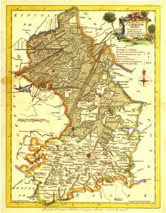
17th-century maps of carmarthenshire
17th-century maps of pembrokeshire
topographia franconiae (merian)
baroque
martinskirche (kassel)
baroque
17th-century maps of the spanish empire
maps of the spanish netherlands
old maps of the stations of the exodus
1650s maps of palestine
17th-century maps of the isle of man
maps by willem and johannes blaeu
maps by willem and johannes blaeu
old maps of westmorland
maps made in the 17th century
claes jansz. visscher (ii)
atlas maior, vol 1 (northern europe, norway, and denmark) - joan blaeu, 1667 - bl 114.h(star).1
1667 maps
maps in the rijksmuseum amsterdam
maps by willem and johannes blaeu
maps of bremen
maps of weser
maps in the rijksmuseum amsterdam
maps by willem and johannes blaeu
maps in the rijksmuseum amsterdam
maps by willem and johannes blaeu
maps in the rijksmuseum amsterdam
maps by willem and johannes blaeu
maps in the rijksmuseum amsterdam
maps by willem and johannes blaeu
maps in the rijksmuseum amsterdam
maps by willem and johannes blaeu
maps in the rijksmuseum amsterdam
willem blaeu
prints by claes jansz. visscher (ii) in the rijksmuseum amsterdam
siege of ostend
dillingen an der donau
baroque
eran laor cartographic collection
claes jansz. visscher (ii)
furniture in the rijksmuseum amsterdam
willem blaeu
maps in the rijksmuseum amsterdam
maps by willem and johannes blaeu
prints by claes jansz. visscher (ii) in the rijksmuseum amsterdam
maps in the rijksmuseum amsterdam
dutch baroque architecture
amsterdam in the 1900s
old maps of regensburg
baroque
magazine fort, dublin
maps by john rocque
pieter jansz. saenredam
grote kerk, haarlem
prints by claes jansz. visscher (ii) in the rijksmuseum amsterdam
siege of ostend
maps in the rijksmuseum amsterdam
maps by willem and johannes blaeu
maps in the rijksmuseum amsterdam
maps by gerard valck
1646 in haarlem
haarlemmerhout
nicolas sanson. “mappe-monde, ou carte generale du monde.”
map of the bosphorus strait by guillaume sanson (1665)
nicolas sanson. “mappe-monde, ou carte generale du monde.”
1667 map of madagascar by guillaume sanson
prints of cartouches in the rijksmuseum amsterdam
maps in the rijksmuseum amsterdam
prints published by claes jansz. visscher (ii) in the rijksmuseum amsterdam
maps in the rijksmuseum amsterdam
maps in the rijksmuseum amsterdam
maps by willem and johannes blaeu
prints of cartouches in the rijksmuseum amsterdam
maps in the rijksmuseum amsterdam
maps in the rijksmuseum amsterdam
maps by willem and johannes blaeu
1 - 100 of 117
Next page
/ 2


![[Map of the Netherlands as 'Leo Belgicus' by Nikolaus Visscher, 1648], Nicolaes Visscher](https://cdn.creazilla.com/illustrations/10000445798/map-of-the-netherlands-as-leo-belgicus-by-nikolaus-visscher-1648-nicolaes-visscher-md.jpg)


