Log in
All resources
Create a design
94 Free Artworks of 1620 Maps
maps in the rijksmuseum amsterdam
1620s maps of the netherlands
bibliothèque nationale de france
maps by pieter van der keere
miniature speed atlas (1627) pieter van den keere
pieter van den keere
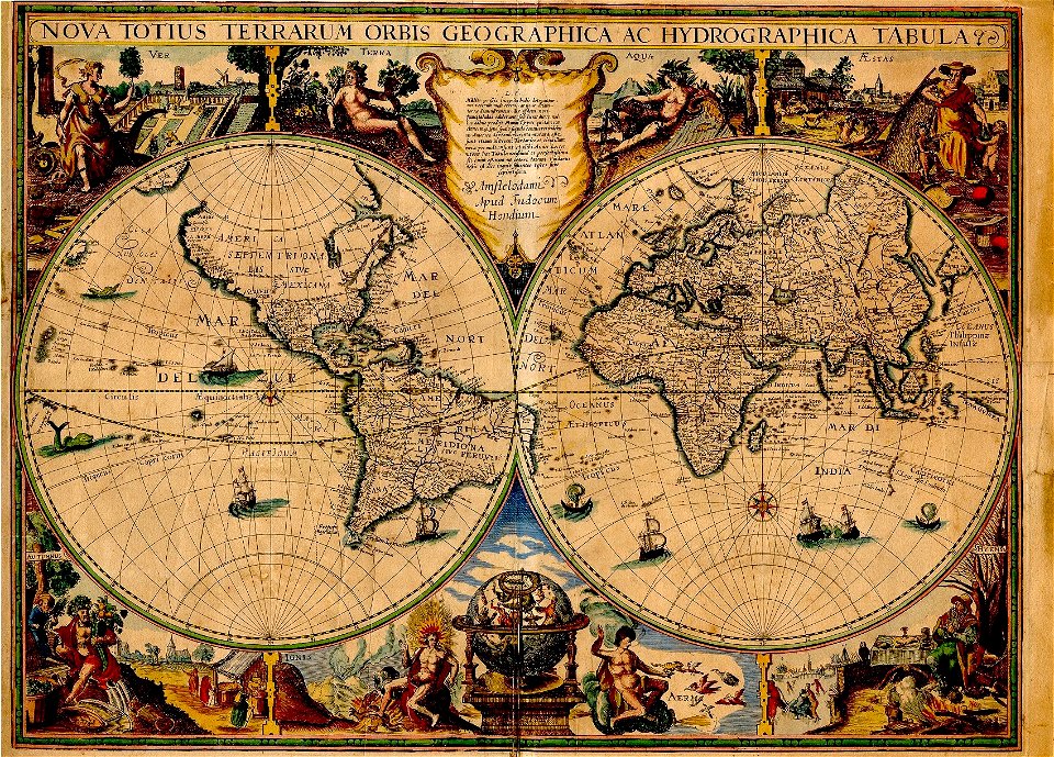
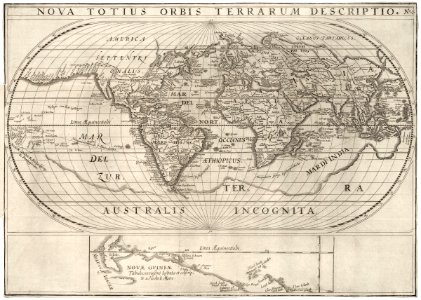
1620s maps of the world
prints published by claes jansz. visscher (ii) in the rijksmuseum amsterdam
maps by jodocus hondius
francis d'avignon
135th meridian east
tasman map
maps by jodocus hondius
prester john
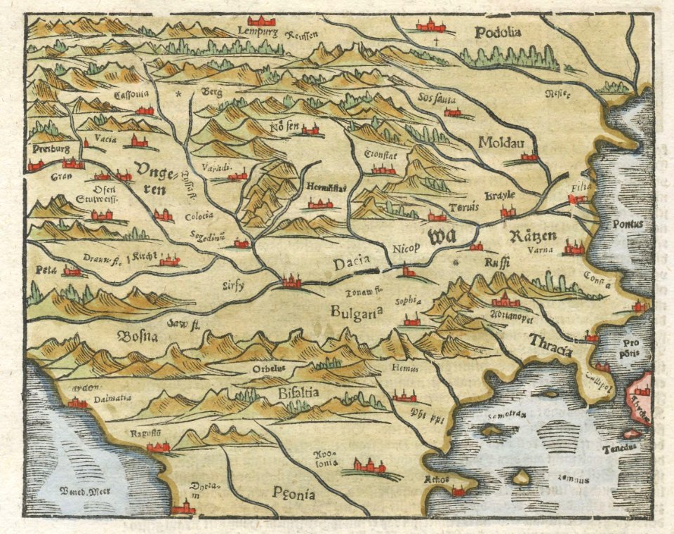
illustrations of cosmographia (münster)
latin-language maps
ogier gisleen van busbeke
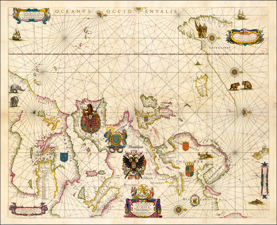
1620 maps of europe
images from the new york public library
francis d'avignon
francis d'avignon
george hayward
maps by sebastian münster
europa regina
francis d'avignon
george hayward
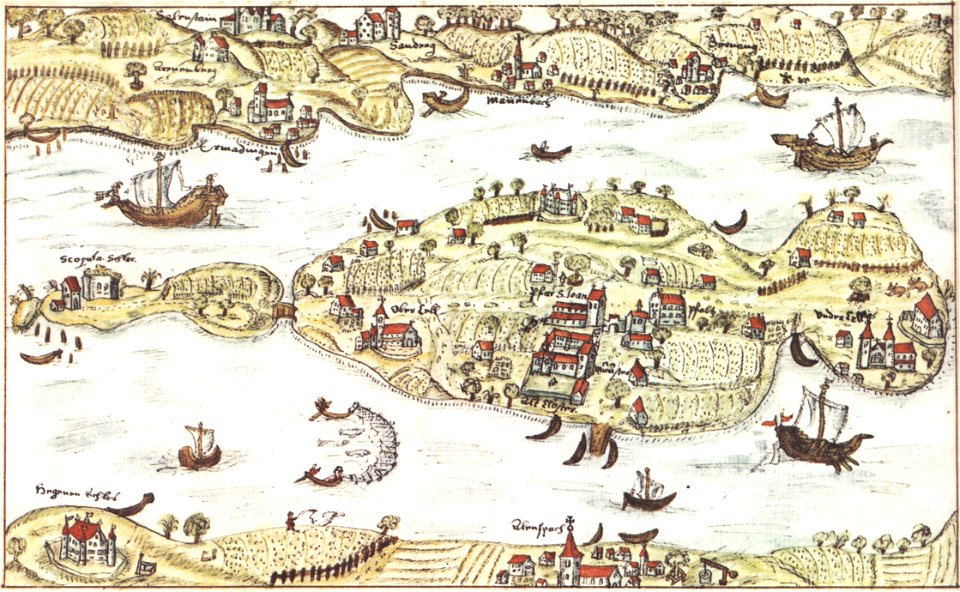
reichenau island
1627 maps
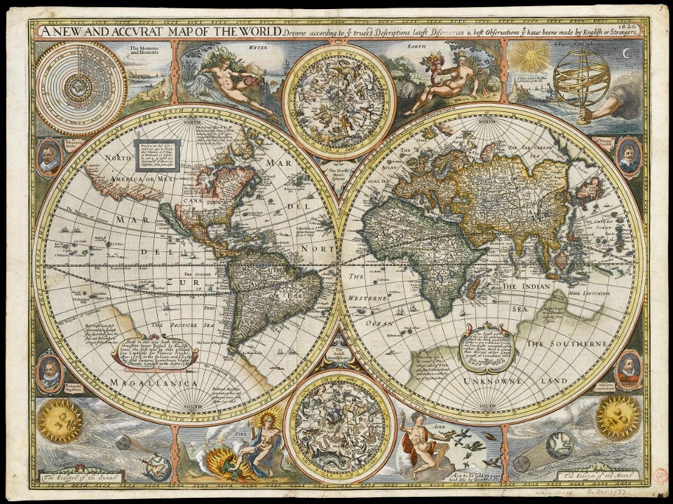
double hemisphere world maps
copper engraving
francis d'avignon
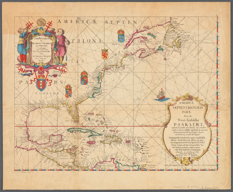
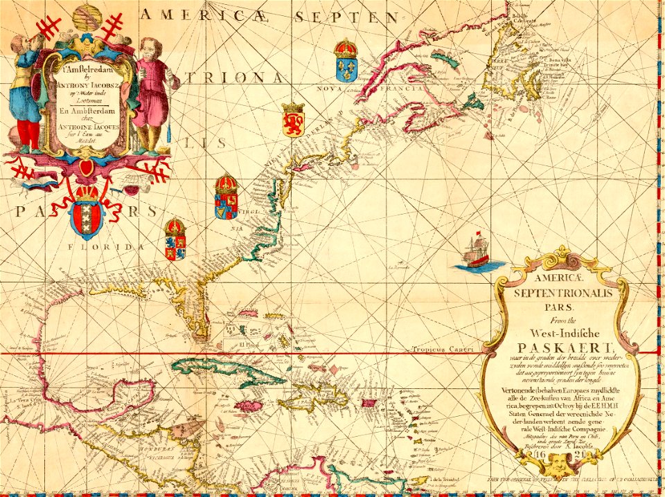
north america
collections of mart
engraving
1620s maps of the world
1621 maps
maps by jodocus hondius
samuel purchas
l'isole più famose del mondo
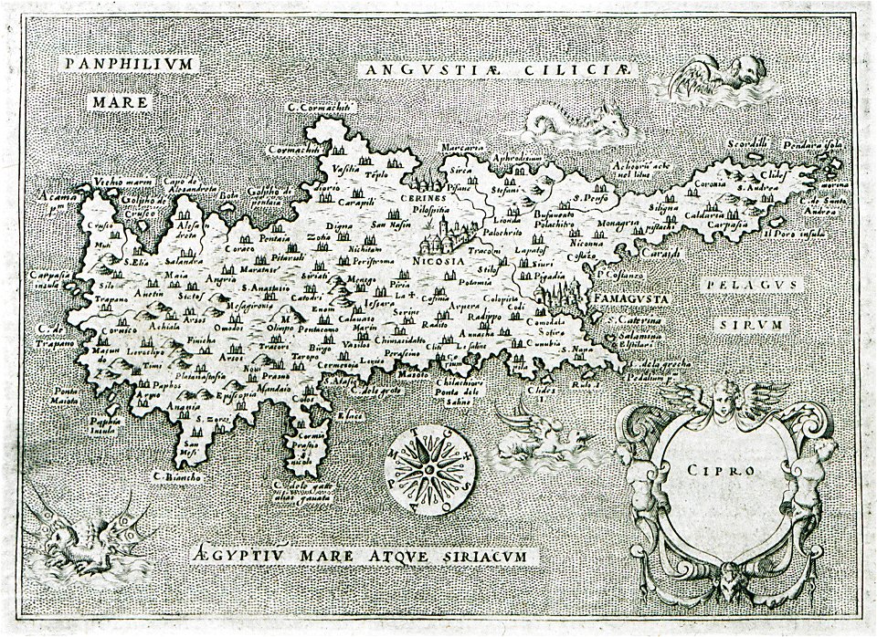
old maps of cyprus
l'isole più famose del mondo
historical maps of kefalonia
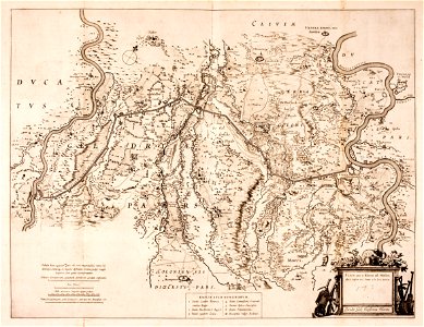
mannheim in the 17th century
maps of mannheim
portolan charts by willem and johannes blaeu
17th-century maps of europe
charts and maps of the royal museums greenwich
1626 maps
animal shape
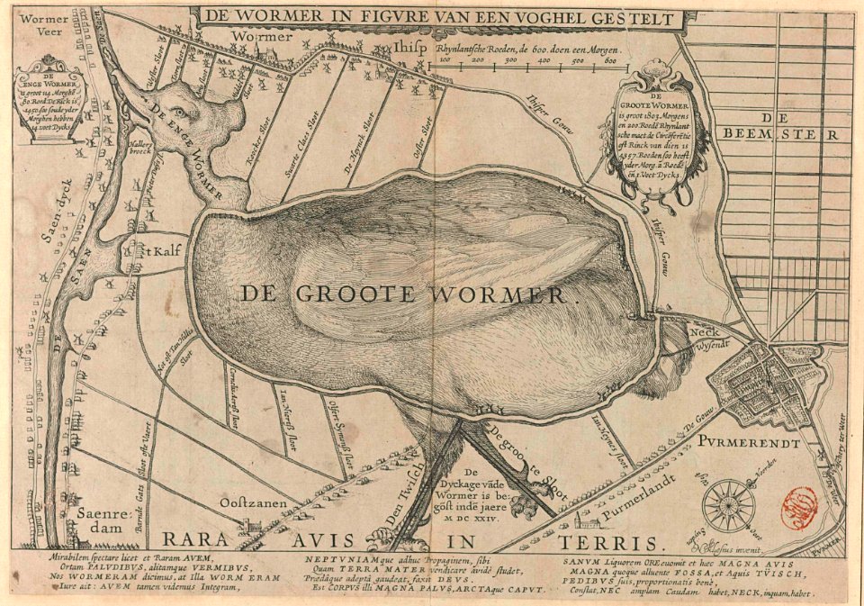
purmerend
charts and maps of the royal museums greenwich
1626 maps
charts and maps of the royal museums greenwich
1626 maps
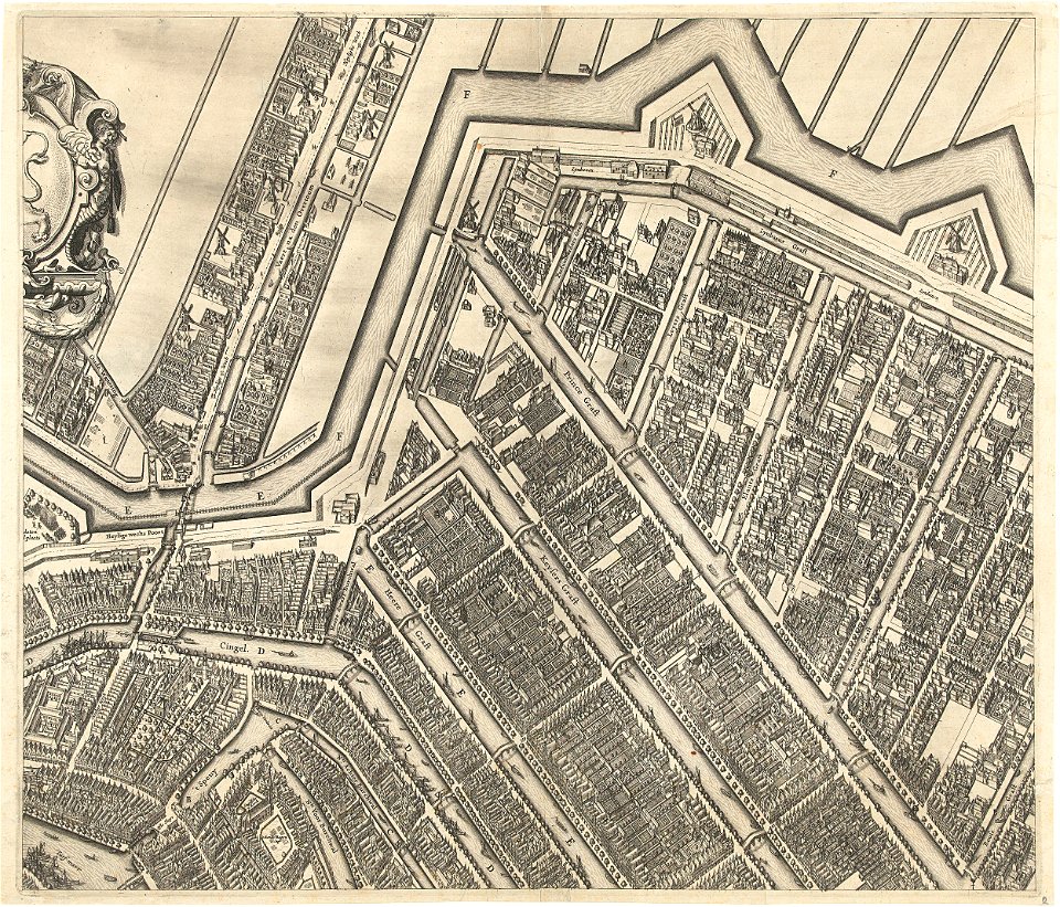
prinsengracht
amsterdam
prints from hugo de groot grollæ obsidio at the peace palace library
1620s maps of the netherlands
budapest
male
history of rheinberg
history of venlo
paintings of jugs
budapest
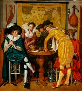
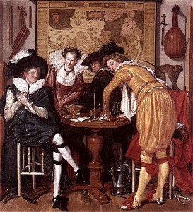
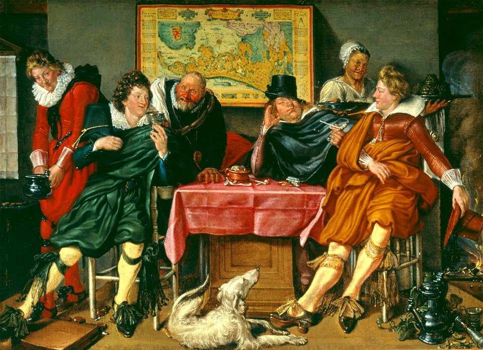
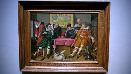
willem pietersz. buytewech
merry company paintings
people with fire in art
people with dog
maps of paris from the david rumsey historical map collection
maps of paris by caspar merian
media from accademia delle scienze di torino
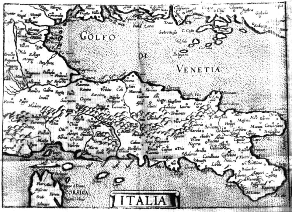
1620s maps of italy
17th-century maps of aisne
17th-century maps of oise
maps of paris from the david rumsey historical map collection
maps of paris by caspar merian
maps of paris from the david rumsey historical map collection
maps of paris by caspar merian
maps of bergamo city walls
maps in the museo correr
maps by willem and johannes blaeu
copper engravings
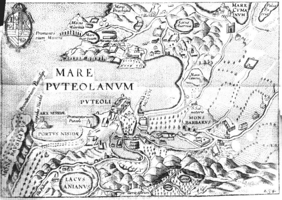
ager puteolanus, siue, prospectus eiusdem insigniores (1620)
ancient roman villas in campania
media from accademia delle scienze di torino
17th-century maps of rome
democritus by velazquez
baroque
maps of asia by mercator-hondius
maps of asia by mercator-hondius
1620s maps of france
old maps of provence
de wikisource book leaflet
old maps of bautzen
maps in the phoebus foundation
maps by pieter van der keere
paintings in the museo correr
gian battista arzenti
miniature speed atlas (1627) pieter van den keere
old county maps of anglesey
maps of eckernförde by braun & hogenberg
1620 in schleswig-holstein
palatinatus rheni (merian)
baroque
history of ortenburg
friedrich casimir
balthasar florisz. van berckenrode
eran laor cartographic collection
maps of lyon by braun & hogenberg
1620 works in rhône
17th-century maps of prussia
baroque
old maps of astypalaia
giacomo franco
maps of neuss by braun & hogenberg
maps of bonn by braun & hogenberg
maps of the palatinate of the rhine
pieter van der keere
1620s maps of the iberian peninsula
maps by willem and johannes blaeu
miniature speed atlas (1627) pieter van den keere
county maps of england by john speed
miniature speed atlas (1627) pieter van den keere
maps of wales by john speed
prints by claes jansz. visscher (ii) in the rijksmuseum amsterdam
siege of wesel 1620
17th-century maps of southeast asia
maps by jodocus hondius
history of the low countries
netherlands in the 1620s
miniature speed atlas (1627) pieter van den keere
1620s maps of wales
maps in the british museum
udenheim
maps of europe by mercator-hondius
ateliers bmb mercator
miniature speed atlas (1627) pieter van den keere
maps of scotland by john speed
maps of eckernförde by braun & hogenberg
frans hogenberg
eran laor cartographic collection
bernardino amico
atlas van der hagen (volume 4)
people with animals in art
eran laor cartographic collection
bernardino amico
military history of goa
theodor de bry
maps by pieter van der keere
17th-century maps of czechia
eberhard kieser
maps of barth
1620s maps of the netherlands
maps by pieter van der keere
miniature speed atlas (1627) pieter van den keere
old maps of the orkney islands
1620s maps of the netherlands
maps by pieter van der keere
maps of ancient italy by philipp clüver
maps of samnium
maps of barbary coast by mercator-hondius
capture of mahdia (1550)
maps in the rijksmuseum amsterdam
maps of texel
cartography
maps
maps of barbary coast by mercator-hondius
17th-century maps of amsterdam
1620s maps of the netherlands
cartography
maps
prints by claes jansz. visscher (ii) in the rijksmuseum amsterdam
siege of wesel 1620
portolan charts by willem and johannes blaeu
1620s maps of the atlantic ocean
maps in the rijksmuseum amsterdam
maps by willem and johannes blaeu
maps of znojmo by braun & hogenberg
jacob hoefnagel
maps in the rijksmuseum amsterdam
baroque
maps of ancient italy by philipp clüver
1620s maps of italy
françois de la pointe
1620s maps of france
pieter jansz. saenredam
grote kerk, haarlem
prints published by claes jansz. visscher (ii) in the rijksmuseum amsterdam
maps in the rijksmuseum amsterdam
dutch 17th-century prints in the rijksmuseum amsterdam
siege of groenlo 1627
lithographs in the rijksmuseum amsterdam
siege of 's-hertogenbosch
maps in the rijksmuseum amsterdam
siege of la rochelle (1627–1628)
1 - 94 of 94
/ 1


![Novesium vulgo Neus [...]; Verona, nunc Bonna [...]; Brula, vulgari idiomate Broell ante bellum; Sontina, Zunss Oppidum ad Rheni ripas [...], 1635](https://cdn.creazilla.com/illustrations/10000945882/novesium-vulgo-neus-verona-nunc-bonna-brula-vulgari-idiomate-broell-ante-bellum-sontina-zunss-oppidum-ad-rheni-ripas-1635-md.jpg)


![Titelblad] AFRICA](https://cdn.creazilla.com/illustrations/10000408184/titelblad-africa-sm.webp)


![Apuliae, Messapiae in qua Calabri ac Salentini et Lucaniae descriptio. 12; Bruti agri descriptio. 13 / auctore Phil[ippo] Cluverio; Henry le Roy fecit, 1624](https://cdn.creazilla.com/illustrations/10000682309/apuliae-messapiae-in-qua-calabri-ac-salentini-et-lucaniae-descriptio-12-bruti-agri-descriptio-13-auctore-phil-ippo-cluverio-henry-le-roy-fecit-1624-sm.jpg)


