Log in
All resources
Create a design
348 Free Artworks of 1588 Maps
engraving
city
belgium
ciudad
grabados
fondo antiguo
bélgica
libros del siglo xvi
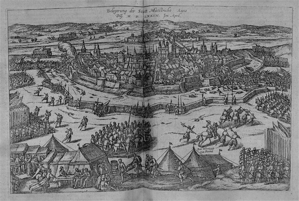
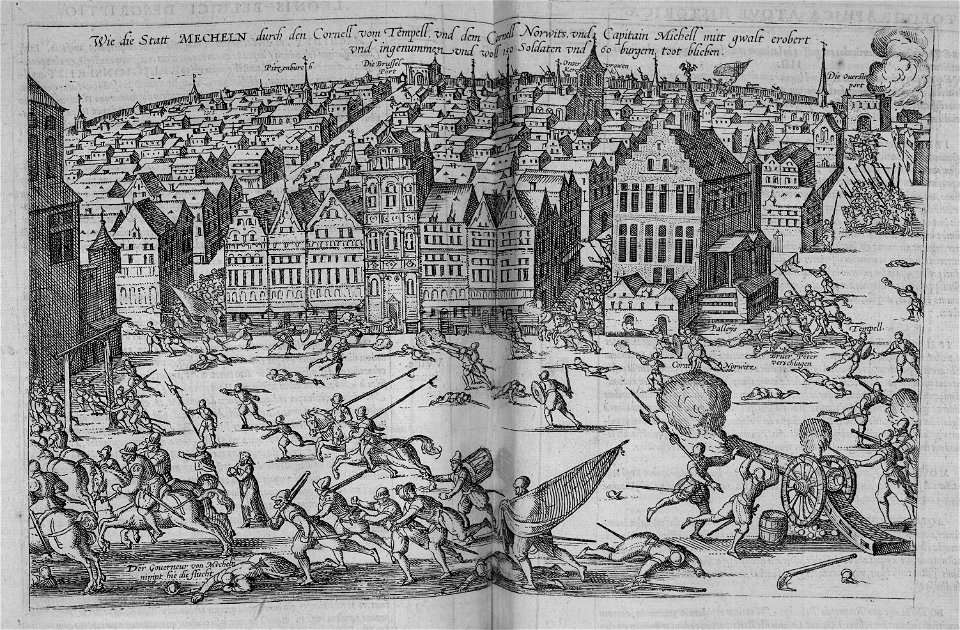
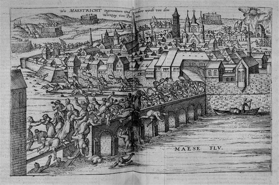
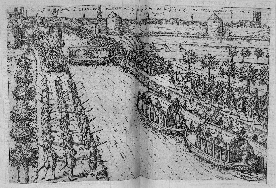
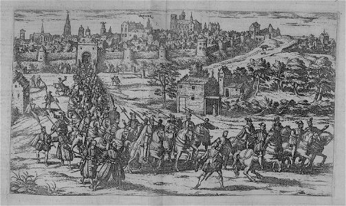
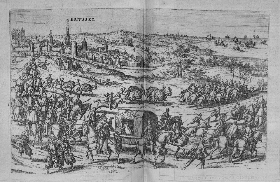
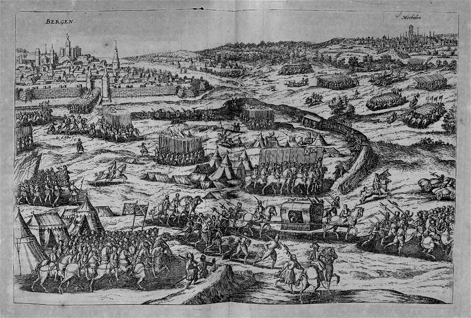
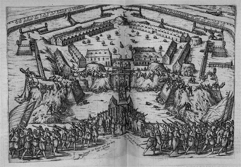
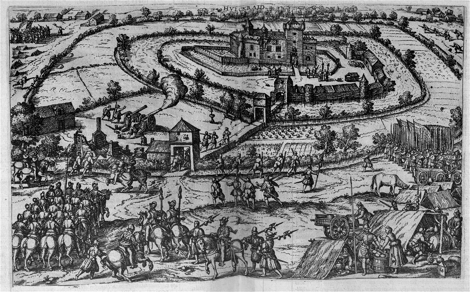
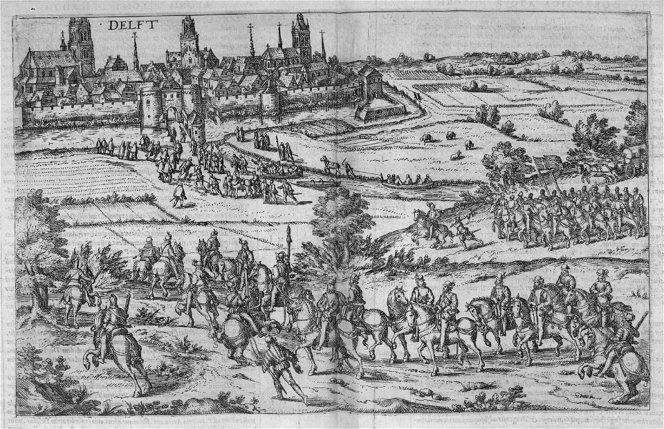
nouus de leone belgico..., 1588
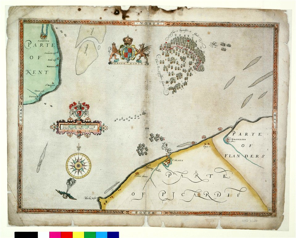
charts and maps of the royal museums greenwich
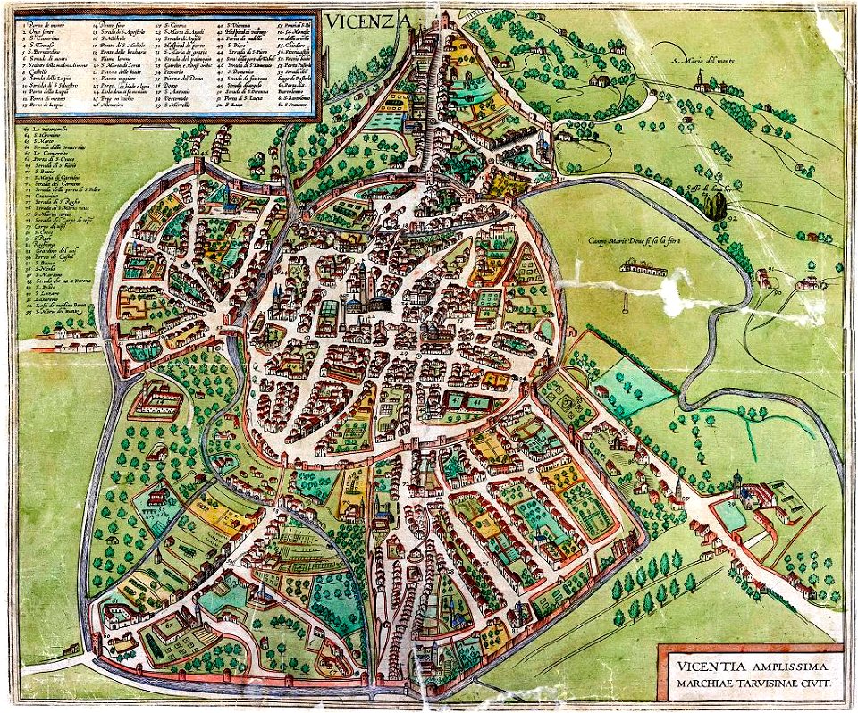
old maps of vicenza
braun & hogenberg
braun & hogenberg
georg braun
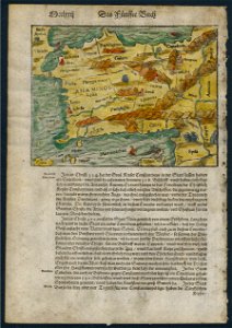
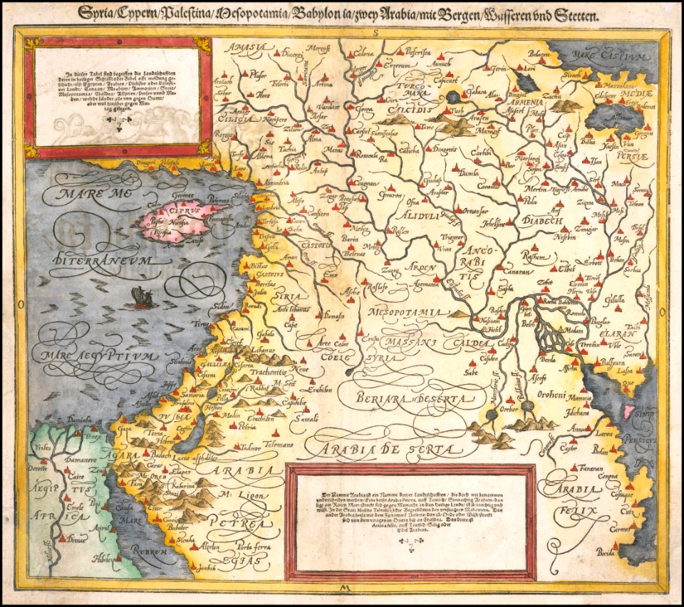
cosmographia (1588) by sebastian münster
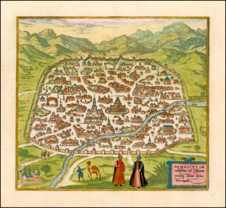
old maps of asia
charts and maps of the royal museums greenwich
1590 maps
illustrations of cosmographia (münster)
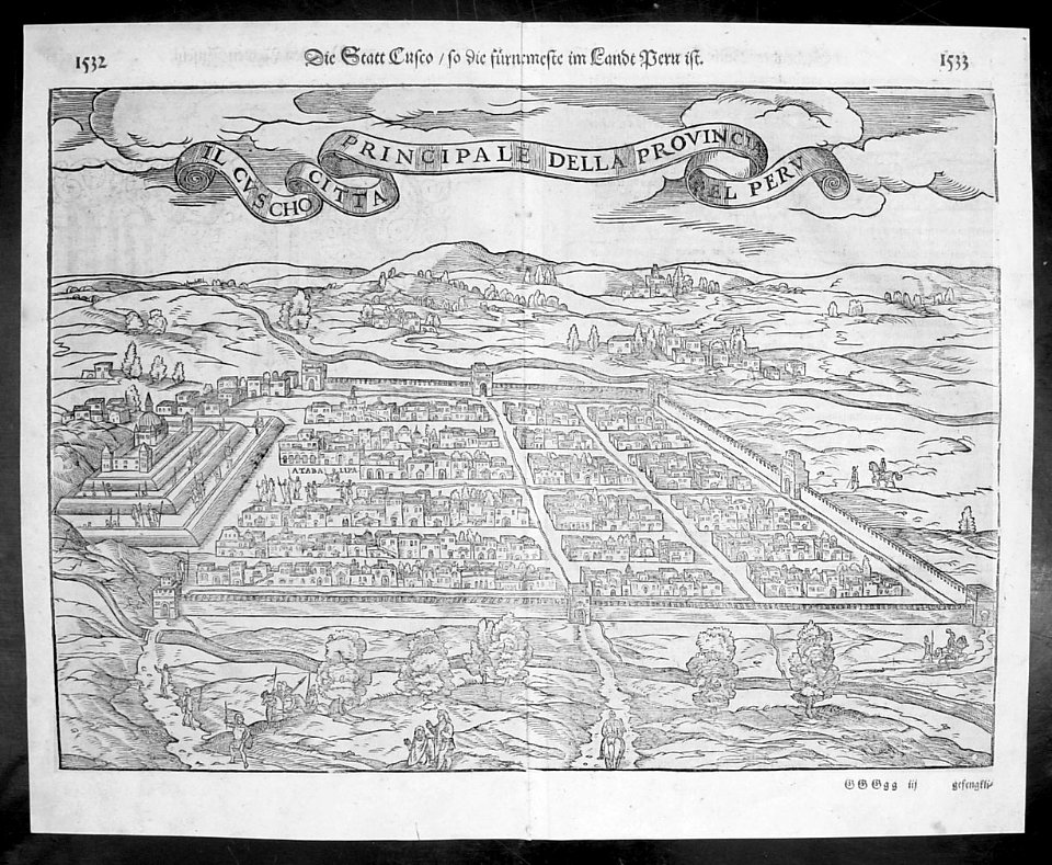
old maps of the viceroyalty of peru
maps with figures
frans hogenberg
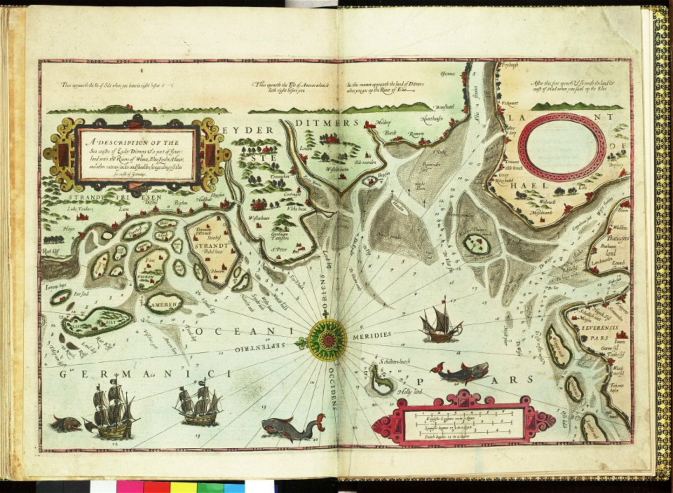
german bight
1588 maps
maps by sebastian münster
1588 maps
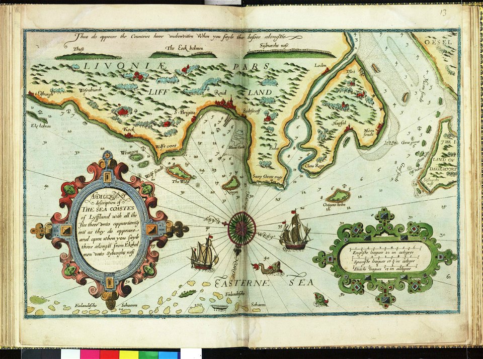
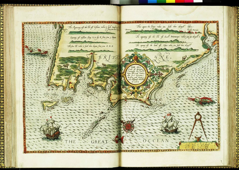
lucas janszoon waghenaer
1588 maps
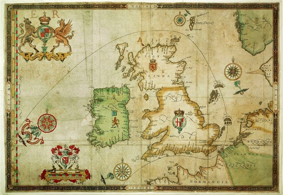
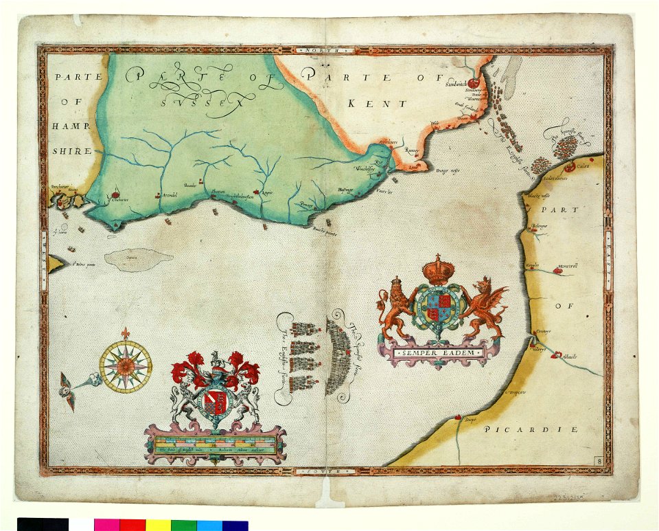
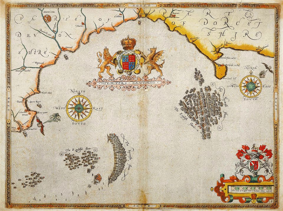
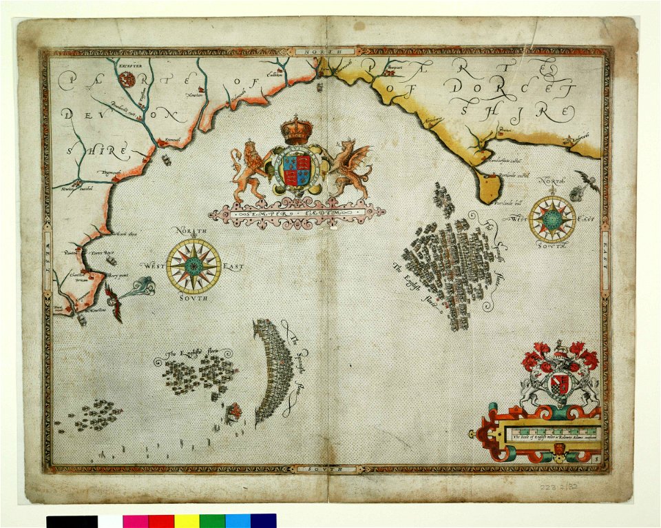
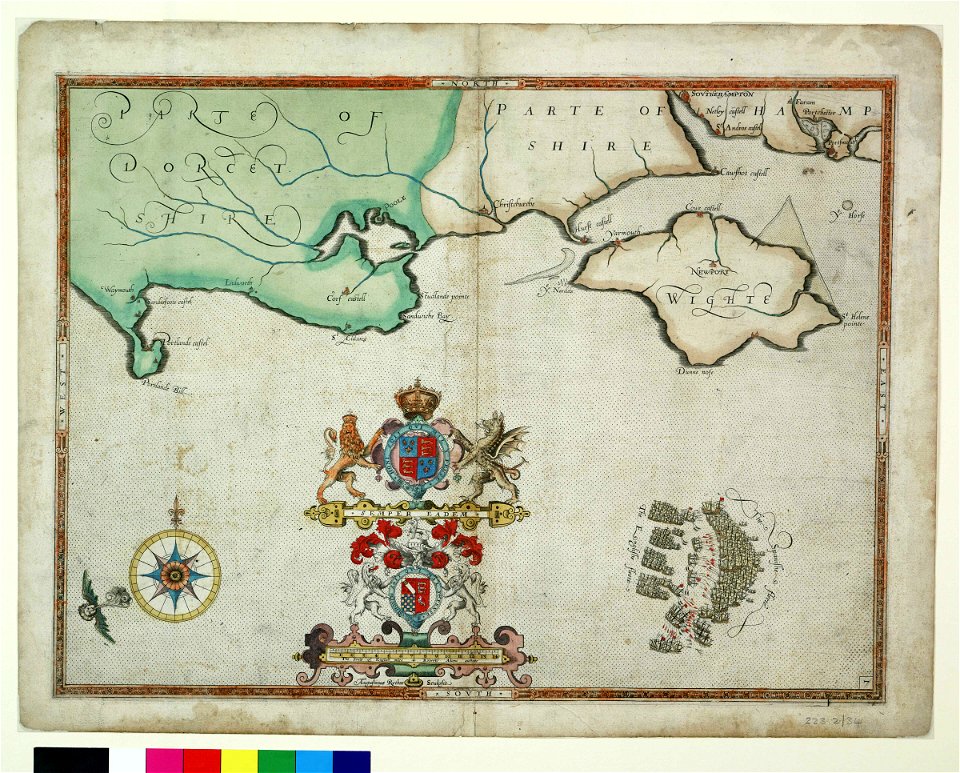
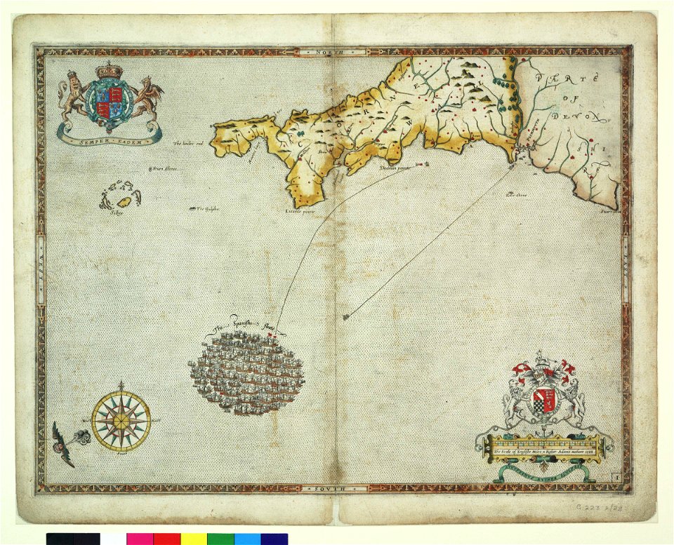
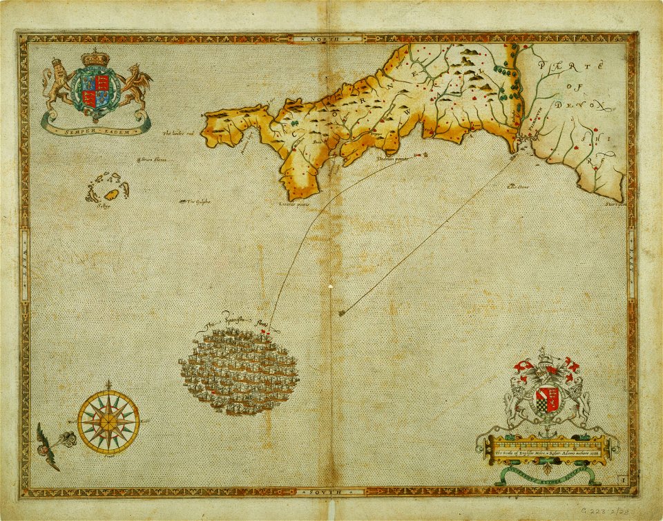
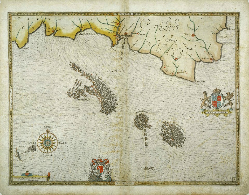
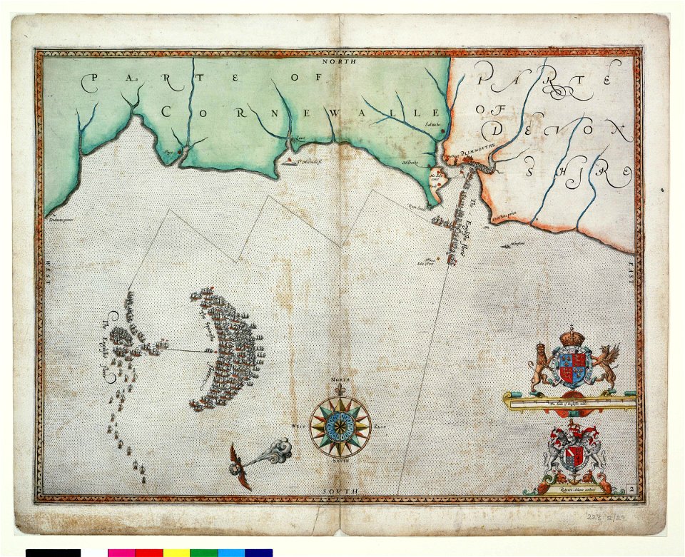
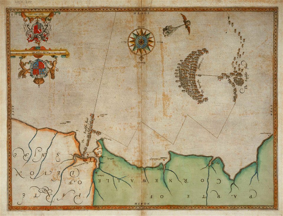
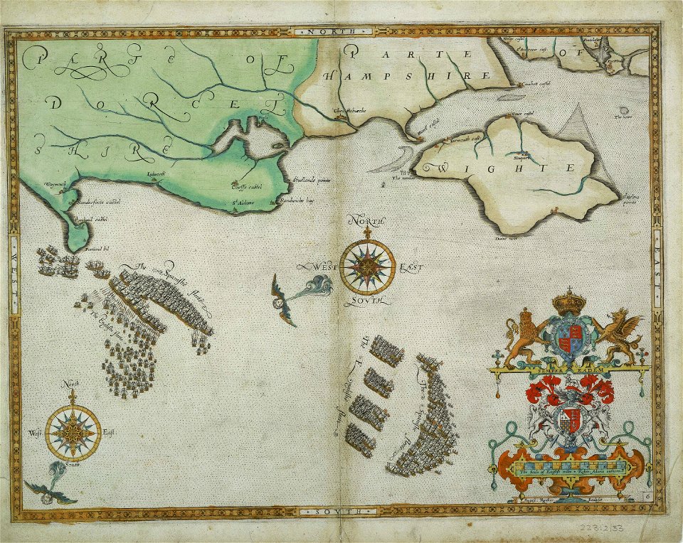
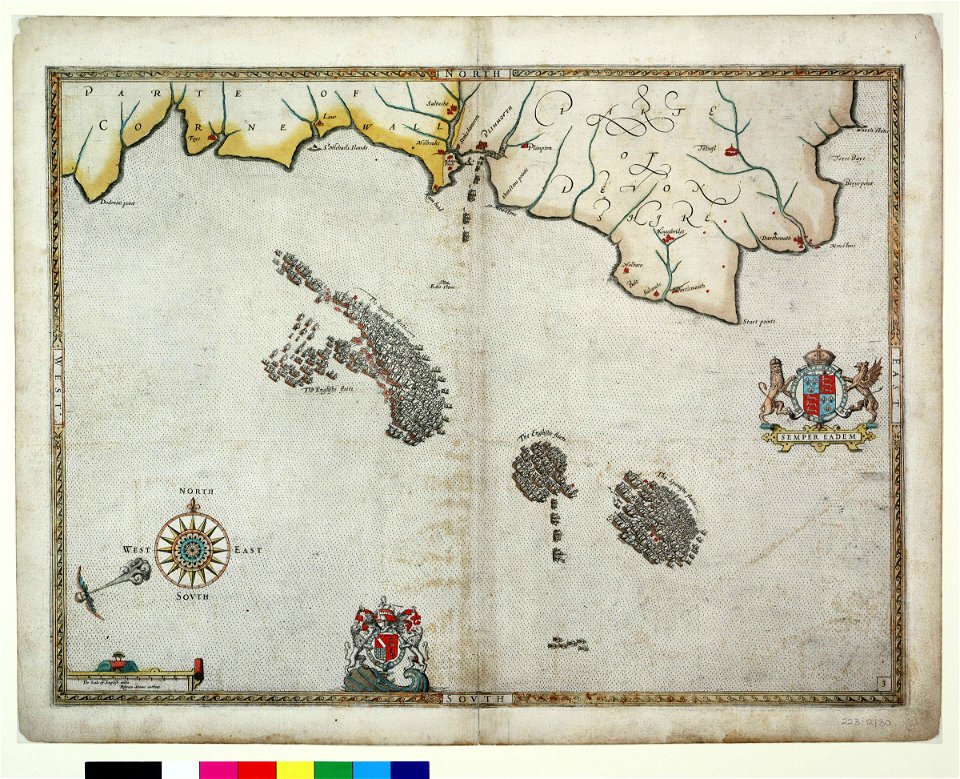
the track of the armada around britain and ireland
london
charts and maps of the royal museums greenwich
1590 maps
charts and maps of the royal museums greenwich
1590 maps
charts and maps of the royal museums greenwich
1590 maps
charts and maps of the royal museums greenwich
1590 maps
charts and maps of the royal museums greenwich
1590 maps
charts and maps of the royal museums greenwich
1590 maps
charts and maps of the royal museums greenwich
1590 maps
charts and maps of the royal museums greenwich
1590 maps
charts and maps of the royal museums greenwich
1590 maps
lucas janszoon waghenaer
1588 maps
charts and maps of the royal museums greenwich
1590 maps
charts and maps of the royal museums greenwich
1590 maps
charts and maps of the royal museums greenwich
1590 maps
charts and maps of the royal museums greenwich
lucas janszoon waghenaer
charts and maps of the royal museums greenwich
1590 maps
charts and maps of the royal museums greenwich
1590 maps
charts and maps of the royal museums greenwich
1590 maps
charts and maps of the royal museums greenwich
1590 maps
lucas janszoon waghenaer
1588 maps
charts and maps of the royal museums greenwich
1590 maps
charts and maps of the royal museums greenwich
lucas janszoon waghenaer
charts and maps of the royal museums greenwich
lucas janszoon waghenaer
maps in the staats- und universitätsbibliothek hamburg
daniel frese
maps of hamburg by braun & hogenberg
maps of hamburg-altstadt
maps of canterbury by braun & hogenberg
william smith (herald and playwright)
maps of arnsberg by braun & hogenberg
history of arnsberg
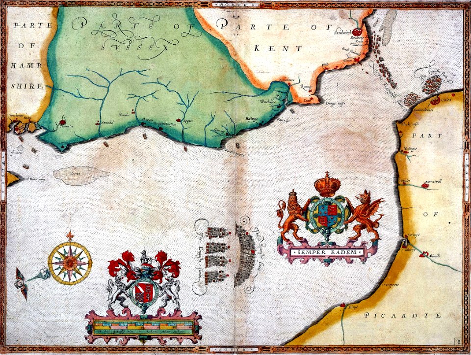
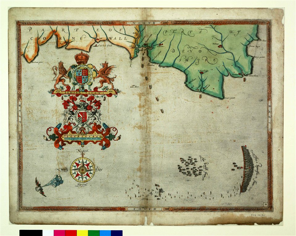
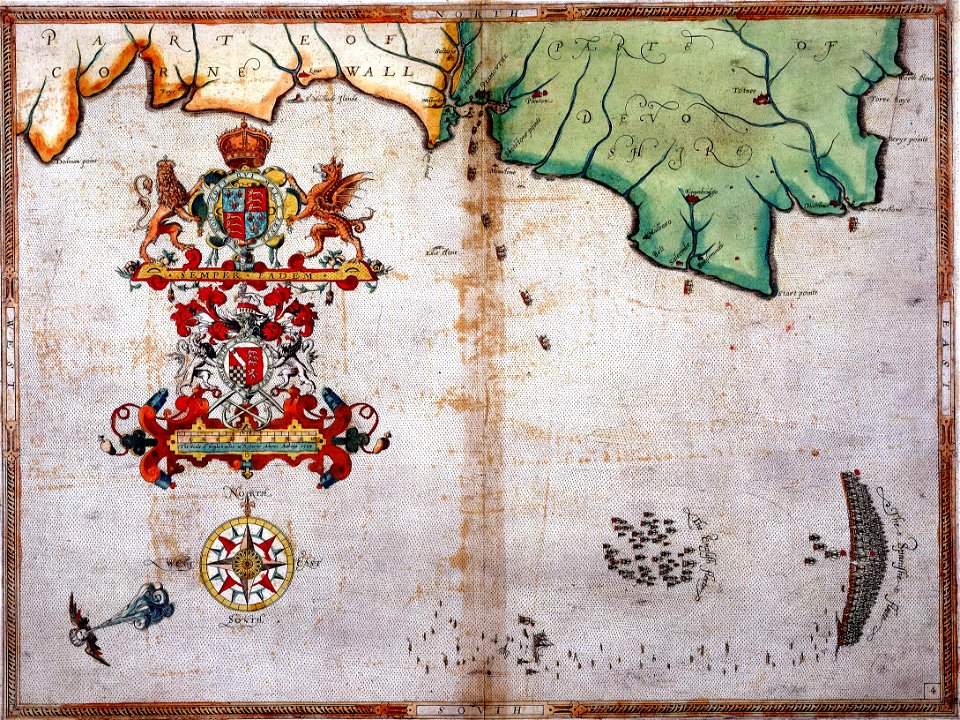
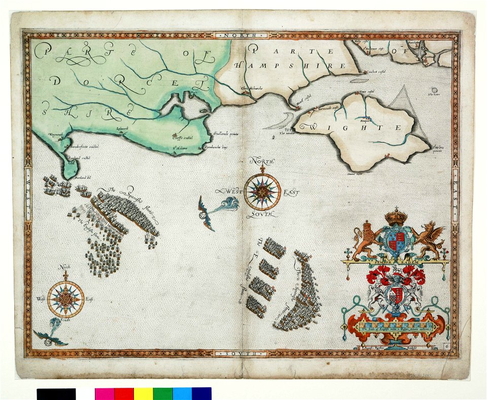
old maps of the coast of england
bodleian maps collection
hamburg in the 16th century
maps of hamburg-altstadt
maps of wachtendonk
frans hogenberg
dresden in the 1580s
leipzig in the 1580s
maps of bremen by braun & hogenberg
history of bremen cathedral
maps of hamburg-altstadt
1588 maps of hamburg
16th-century maps of amsterdam
lodovico guicciardini
flemish prints in the rijksmuseum amsterdam
maps of amersfoort by braun & hogenberg
maps of aalst by braun & hogenberg
cartouche (cartography)
maps of aalst by braun & hogenberg
coats of arms on maps
nederlandse en buitenlandse gebeurtenissen
album met 345 prenten van hogenberg
ceiling of the terrace of the geographical maps (uffizi gallery, florence)
ceiling of the terrace of the geographical maps (uffizi gallery, florence)
ceiling of the terrace of the geographical maps (uffizi gallery, florence)
ceiling of the terrace of the geographical maps (uffizi gallery, florence)
ceiling of the terrace of the geographical maps (uffizi gallery, florence)
ceiling of the terrace of the geographical maps (uffizi gallery, florence)
ceiling of the terrace of the geographical maps (uffizi gallery, florence)
mannerism
ceiling of the terrace of the geographical maps (uffizi gallery, florence)
ceiling of the terrace of the geographical maps (uffizi gallery, florence)
mannerism
print room of the university of antwerp
plattegrond van antwerpen
maps of bratislava by braun & hogenberg
maps of alexandria by braun & hogenberg
maps of bratislava by braun & hogenberg
eran laor cartographic collection
atlas ou representation du monde universel t. 2 (1633)
maps by jan janssonius
ceiling of the terrace of the geographical maps (uffizi gallery, florence)
mannerism
maps in the staats- und universitätsbibliothek hamburg
1588 maps of hamburg
prints by frans hogenberg in the rijksmuseum amsterdam
maps in the rijksmuseum amsterdam
prints by frans hogenberg in the rijksmuseum amsterdam
maps in the rijksmuseum amsterdam
maps in the staats- und universitätsbibliothek hamburg
maps of hamburg-altstadt
maps of gouda by braun & hogenberg
frans hogenberg
prints by frans hogenberg in the rijksmuseum amsterdam
maps in the rijksmuseum amsterdam
prints by frans hogenberg in the rijksmuseum amsterdam
maps in the rijksmuseum amsterdam
maps in the staats- und universitätsbibliothek hamburg
maps of hamburg-altstadt
expeditionis hispanorum in angliam vera descriptio anno domini mdlxxxviii
maps of the spanish armada
expeditionis hispanorum in angliam vera descriptio anno domini mdlxxxviii
maps of the spanish armada
maps
city
maps
city
maps
city
maps
city
maps
city
maps
city
maps
city
maps
city
maps
city
maps
city
maps
city
maps
city
maps
city
maps
city
maps
city
maps
city
maps
city
maps
city
maps
city
maps
city
maps
city
maps
city
maps
city
maps
city
maps
city
maps
city
maps
city
maps
city
1 - 100 of 348
Next page
/ 4


![Gerardi Mercatoris and I. Hondii Atlas or Representation of the Universal World, and of the Parts of It, Made in Tables and Very Ample Descriptions. [t. 2].](https://cdn.creazilla.com/illustrations/10001063637/gerardi-mercatoris-and-i-hondii-atlas-or-representation-of-the-universal-world-and-of-the-parts-of-it-made-in-tables-and-very-ample-descriptions-t-2-sm.webp)


![Hambvrgvm / [Georg Braun. Franz Hogenberg], Frans Hogenberg, circa 1590](https://cdn.creazilla.com/illustrations/10000942557/hambvrgvm-georg-braun-franz-hogenberg-frans-hogenberg-circa-1590-md.jpg)


![Hambvrgvm / [Georg Braun. Franz Hogenberg], Frans Hogenberg, circa 1590](https://cdn.creazilla.com/illustrations/10001490839/hambvrgvm-georg-braun-franz-hogenberg-frans-hogenberg-circa-1590-md.jpg)