Log in
All resources
Create a design
12 Free Images of Moluccas In The 17th Century
17th-century maps of the moluccas
nationaal archief
johannes nessel
1650s maps of indonesia
maps of the dutch east india company - indonesia
rapport van arnold de vlamingh van outshoorn
pen on paper
asia noviter delineata
media from atlas of mutual heritage on dutch east india company
ships on maps
asia noviter delineata
banda islands
media from atlas of mutual heritage on dutch east india company
ternate
maps by willem and johannes blaeu
maps by jodocus hondius
fort victoria (moluccas)
johannes nessel
media from atlas of mutual heritage on dutch east india company
1650s maps of indonesia
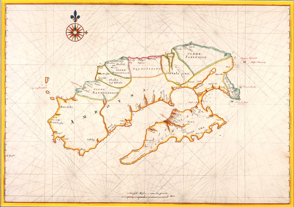
west seram regency
johannes nessel
west seram regency
johannes nessel
moluccas in the 17th century
asia noviter delineata
maps of the dutch east india company - indonesia
old maps of ambon
17th-century maps of the moluccas
latin-language maps
atlas ou representation du monde universel t. 2 (1633)
maps by hendrik hondius the younger
prints of cartouches in the rijksmuseum amsterdam
maps in the rijksmuseum amsterdam
1 - 12 of 12
/ 1


![Gerardi Mercatoris and I. Hondii Atlas or Representation of the Universal World, and of the Parts of It, Made in Tables and Very Ample Descriptions. [t. 2].](https://cdn.creazilla.com/illustrations/10000841463/gerardi-mercatoris-and-i-hondii-atlas-or-representation-of-the-universal-world-and-of-the-parts-of-it-made-in-tables-and-very-ample-descriptions-t-2-md.jpg)
