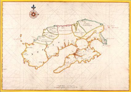
Map of the island of Ambon, Johannes Vingboons, circa 1665
Title in the leupe catalogue (na): kaart van amboina. Met loodingen. Particulars: the map is part of the vingboons atlas. The map has been mounted in a passe-partout. Cf. Österreichische nationalbibiothek, vienna, inv. Nr. Van der hem 40:13. Date: circa 1665. Dimensions: height: 67.5 cm (26.5 in); width: 47 cm (18.5 in). Medium: coloured drawing on paper. Collection: Nationaal Archief. AMH-5624-NA Map of the island of Ambon