Log in
All resources
Create a design
27,441 Free Images of Maps
africa in the 1890s
maps of africa
eran laor cartographic collection
maps from the earth and its inhabitants, vol. xii
maps from the earth and its inhabitants, vol. xiii
german renaissance,northern renaissance
geographia universalis (1545) in the british museum
paper
british museum
ptolemy
maps
flag
maps
flag
maps
flag
german renaissance,northern renaissance
ptolemy's 1st asian map
geographia universalis (1545) in the british museum
german renaissance,northern renaissance
geographia universalis (1545) in the british museum
german renaissance,northern renaissance
geographia universalis (1545) in the british museum
german renaissance,northern renaissance
maps of ancient israel by philippe de la rué
old maps of ancient israel
geographia universalis (1545) in the british museum
german renaissance,northern renaissance
geographia universalis (1545) in the british museum
german renaissance,northern renaissance
geographia universalis (1545) in the british museum
german renaissance,northern renaissance
geographia universalis (1545) in the british museum
german renaissance,northern renaissance
atlas van der hagen (volume 3)
atlas van der hagen
print room of the university of antwerp
lithographs of antwerp
new york and brooklyn, with jersey city and hoboken water front
maps in the library of congress
maps in the library of congress
birds-eye view of seattle, 1884
new york and brooklyn, with jersey city and hoboken water front
maps in the library of congress
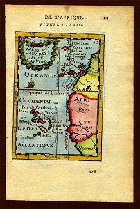
17th-century maps of the canary islands
description de l'universe
arnold's geographical handbook (1899)
1899 maps of spain
arnold's geographical handbook (1899)
1890s maps of england
the turkish empire in europe, asia and africa (1752)
history of gəncə
1890s maps of england
1890s maps of wales
arnold's geographical handbook (1899)
1899 maps of china
1750s maps of london
maps by isaak tirion
arnold's geographical handbook (1899)
maps of river clyde
arnold's geographical handbook (1899)
maps of the panama canal
maps from the mechanical curator collection available to georeference
maps from the mechanical curator collection
maps of the history of west bengal
ostend company
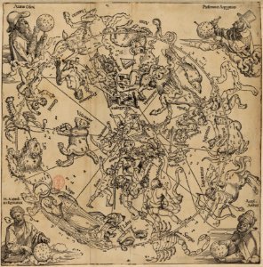
the northern hemisphere of the celestial globe by albrecht dürer
german renaissance
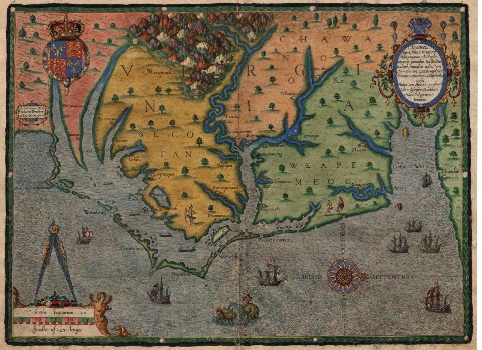
16th-century maps of virginia
theodor de bry
maps from the earth and its inhabitants, vol. x
20th-century double hemisphere world maps
maps by willem and johannes blaeu
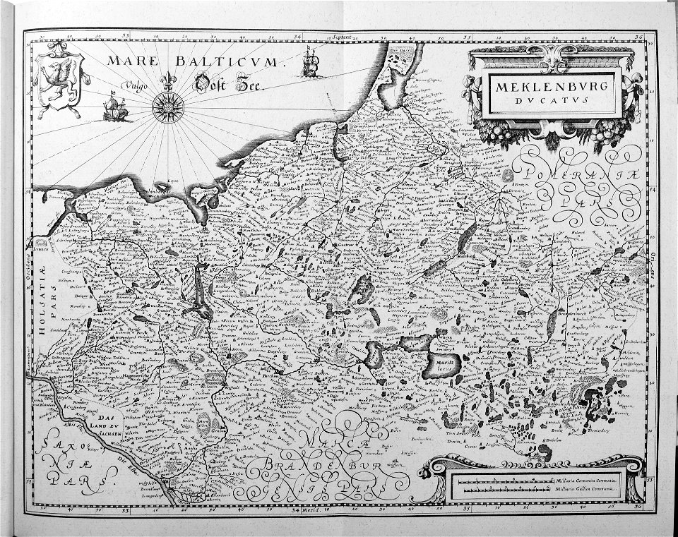
ducatus holsatiæ nova tabula
1600 world map by girolamo porro
leonardo cernoti
maps by willem and johannes blaeu
maps of woerden
1600 world map by girolamo porro
leonardo cernoti
maps of bremen by braun & hogenberg
bremen in the 16th century
maps by willem and johannes blaeu
17th-century maps of iceland
1600 world map by girolamo porro
leonardo cernoti
historical maps of crema
maps by pieter mortier
map of ghent by abraham casteleyn
abraham casteleyn
maps of bamberg by braun & hogenberg
st. martin (bamberg)
engravings of topographia saxoniae inferioris
baroque
the earth and its inhabitants, vol. vi: asia, vol. i
title pages of books about geography
eran laor cartographic collection
william hughes (geographer)
eran laor cartographic collection
alain manesson-mallet
eran laor cartographic collection
william hughes (geographer)
eran laor cartographic collection
william hughes (geographer)
eran laor cartographic collection
willem blaeu
eran laor cartographic collection
gerard de jode
eran laor cartographic collection
jacob van meurs
eran laor cartographic collection
willem blaeu
eran laor cartographic collection
english-language maps
eran laor cartographic collection
william hughes (geographer)
eran laor cartographic collection
william hughes (geographer)
eran laor cartographic collection
alain manesson-mallet
eran laor cartographic collection
cornelis de bruyn
eran laor cartographic collection
hendrik hondius the younger
eran laor cartographic collection
romanticism
maps in the national archives of sweden
erik dahlbergh
maps by pieter mortier
le neptune francois
old maps of enkhuizen
atlas van loon
maps of the hague by braun & hogenberg
1666 in the hague
british library - off the map alice collection - wonderland
british library - off the map alice collection
old maps of ulm
philipp renlin
sheet 18 of the turgot map of paris
sheet 19 of the turgot map of paris
media from regionaal archief alkmaar
maps of wieringerwaard
portolan charts by willem and johannes blaeu
old maps of friesland
maps from the earth and its inhabitants, vol. xii
africa in the 1890s
maps from the earth and its inhabitants, vol. xi
africa in the 1890s
maps from the earth and its inhabitants, vol. xii
africa in the 1890s
maps from the earth and its inhabitants, vol. xiii
maps of africa
maps from the earth and its inhabitants, vol. xiii
maps of africa
maps from the earth and its inhabitants, vol. xiii
africa in the 1890s
maps from the earth and its inhabitants, vol. xiii
africa in the 1890s
maps from the earth and its inhabitants, vol. xi
africa in the 1890s
maps from the earth and its inhabitants, vol. xiii
maps of africa
old maps of the dutch gold coast
willem cornelis van baarsel
maps from the earth and its inhabitants, vol. xi
africa in the 1890s
maps from the earth and its inhabitants, vol. xii
africa in the 1890s
maps from the earth and its inhabitants, vol. xii
africa in the 1890s
maps from the earth and its inhabitants, vol. xiii
africa in the 1890s
maps from the earth and its inhabitants, vol. xii
africa in the 1890s
maps from the earth and its inhabitants, vol. xiii
maps of africa
maps from the earth and its inhabitants, vol. xii
africa in the 1890s
maps from the earth and its inhabitants, vol. xi
africa in the 1890s
maps from the earth and its inhabitants, vol. xii
africa in the 1890s
africa in the 1890s
maps of africa
africa in the 1890s
maps of africa
maps from the earth and its inhabitants, vol. xii
africa in the 1890s
maps from the earth and its inhabitants, vol. xiii
africa in the 1890s
maps from the earth and its inhabitants, vol. xiii
africa in the 1890s
maps from the earth and its inhabitants, vol. xii
africa in the 1890s
maps from the earth and its inhabitants, vol. xiii
africa in the 1890s
maps from the earth and its inhabitants, vol. xii
africa in the 1890s
maps from the earth and its inhabitants, vol. xii
africa in the 1890s
maps from the earth and its inhabitants, vol. xiii
africa in the 1890s
maps from the earth and its inhabitants, vol. xiii
africa in the 1890s
maps from the earth and its inhabitants, vol. xiii
africa in the 1890s
maps from the earth and its inhabitants, vol. xii
africa in the 1890s
maps from the earth and its inhabitants, vol. xi
africa in the 1890s
9501 - 9600 of 27,441
Next page
/ 275