Log in
All resources
Create a design
27,441 Free Images of Maps
eran laor cartographic collection
latin-language maps
jodocus hondius ii, nova totius terrarum orbis geographica ac hydrographica tabula, 1636
world map
national library of israel
jodocus hondius ii
joan blaeu
bibliothèque nationale de france
frans hogenberg
maps with cartouches
praefectura paranambucae pars borealis, una cum praefectura de itâmaracâ
georg marggraf
maps by pieter van der keere
1600s maps of norway
description de l'universe
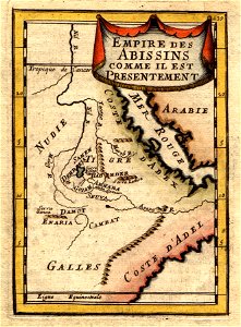
1680s maps of ethiopia
fra mauro map details
fra mauro map
images of places from encyclopædia britannica
maps of paris in the 1910s
manual of the corporation of the city of new york (1858)
battle of long island
maps of the league of nations
1929 maps of the world
old maps of visby
pehr arvid säve
maps of utrecht (city) city walls
old maps of utrecht (city)
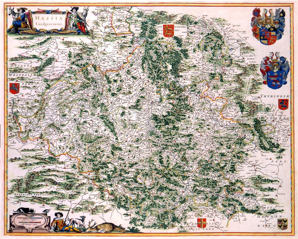
1770s maps of baden-württemberg
bishopric of constance
maps of utrecht (city) city walls
old maps of utrecht (city)
old maps of nijmegen
1664 maps
john rocque's 1746 map of london
maps of woolwich
1590s maps of the netherlands
1590s maps of belgium
eran laor cartographic collection
latin-language maps
maps of braunschweig by braun & hogenberg
eran laor cartographic collection
eran laor cartographic collection
latin-language maps
eran laor cartographic collection
maps of diu by braun & hogenberg
eran laor cartographic collection
latin-language maps
maps of haarlemmerhout
old maps of haarlem
maps by pieter mortier
indochina
black and white drawings of buildings
hope theatre
cartes de franz schrader
cayenne
old maps of geneva
baroque
maps by pieter mortier
old maps of asia
maps with cartouches
old maps of fujian
maps by nicolas sanson
jan van somer
old maps of portobelo
maps by emanuel bowen
19th-century maps of south holland
maps of veur
gemeente atlas van nederland - gelderland
netherlands in the 1860s
maps of portugal by fernando álvares seco
maps
old maps of great britain
1250s maps
17th-century maps of the mediterranean sea
copper engravings
maps of wissembourg by braun & hogenberg
eran laor cartographic collection
maps of wittenberg by braun & hogenberg
eran laor cartographic collection
old maps of the london borough of tower hamlets
districts of london
maps by john cary
1801 maps
cornelis de jode
1579 maps
maps of the dutch east india company - sri lanka
18th-century maps of sri lanka
nypl lionel pincus and princess firyal map division
geographical atlases
maps by isaak tirion
1751 maps
maps of the ottoman empire by mercator-hondius
eran laor cartographic collection
maps of the ottoman empire by mercator-hondius
eran laor cartographic collection
aerial views of amherst, massachusetts
town maps by l. r. burleigh
perusinus ac tifernas (galleria delle carte geografiche)
battle of lake trasimene
atlas van der hagen (volume 1)
atlas van der hagen
atlas maior, vol 11 (asia) - joan blaeu, 1667 - bl 114.h(star).11
1667 maps
atlas maior, vol 11 (asia) - joan blaeu, 1667 - bl 114.h(star).11
1667 maps
atlas maior, vol 11 (asia) - joan blaeu, 1667 - bl 114.h(star).11
1667 maps
old maps of limburg, netherlands
old maps of gelderland
gemeente atlas van nederland - south holland
1860s maps of south holland
1830s maps of the world
maps by daniel lizars
maps of kraków
planty
maps indicating exploration
royal geographical society
maps from the earth and its inhabitants, vol. vii
charles eugène perron
maps of the west-indische compagnie
maps showing 1629
fra mauro map details
1459 maps
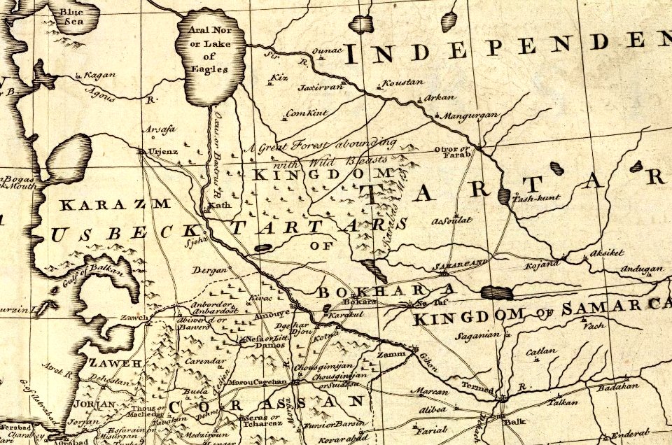
1747 persia map by emanuel bowen
details of old maps
maps from the earth and its inhabitants, vol. vi
maps of the history of the caucasus
1680s maps of the caucasus
description de l'universe
17th-century maps of the black sea
maps by willem and johannes blaeu
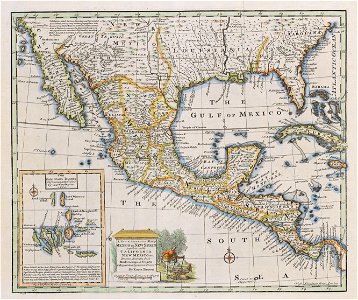
old maps of the viceroyalty of new spain
maps by emanuel bowen
1660s maps of pernambuco
1660s maps of brazil
maps of brazil by hendrik hondius
old maps of bahia
bears in art
1868 in art
petit atlas pittoresque des 48 quartiers de la ville de paris, david rumsey historical map collection
maps of paris from the david rumsey historical map collection
cornell: persuasive cartography: the pj mode collection
kellanova
1886 maps of georgia (u.s. state)
maps by henry wellge
old maps of the southern hemisphere
james cook (maps relating to)
engravings of hannover
wood engravings
maps of the ottoman empire by mercator-hondius
eran laor cartographic collection
old maps of groningen (province)
lordship of groningen
david rumsey historical map collection
1790s maps of the holy roman empire
maps by giacomo gastaldi
maps by gerard de jode
1747 persia map by emanuel bowen
details of old maps
maps of paris from the david rumsey historical map collection
maps of paris by caspar merian
19th-century maps of the sea of marmara
19th-century maps of the bosphorus
eran laor cartographic collection
ptolemy's 4th asian map
20th-century maps of illinois
curt teich postcard archives
maps of america by guillaume delisle (18th century)
1760s maps of the americas
guide joanne espagne et portugal-1915
1915 maps
the generall historie of virginia (john smith)
1624 books from london
ptolemy's 1st asian map
bologna ptolemy
17th-century maps of bohemia
1645 maps of austria
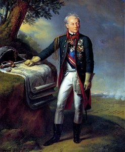
portrait paintings by carl von steuben
alexander suvorov in portraits
maps of colonial brazil
1510s maps of brazil
old county maps of staffordshire
old county maps of shropshire
14th-century illuminated manuscripts from spain
jong (ship)
maps by jodocus hondius
details of old maps
joan blaeu
ærø
old maps of the caucasus
guillaume sanson
seventeen provinces
1664 maps
jodocus hondius ii, nova totius terrarum orbis geographica ac hydrographica tabula, 1636
eran laor cartographic collection
jodocus hondius ii, nova totius terrarum orbis geographica ac hydrographica tabula, 1636
eran laor cartographic collection
jodocus hondius ii, nova totius terrarum orbis geographica ac hydrographica tabula, 1636
eran laor cartographic collection
jodocus hondius ii, nova totius terrarum orbis geographica ac hydrographica tabula, 1636
eran laor cartographic collection
jodocus hondius ii, nova totius terrarum orbis geographica ac hydrographica tabula, 1636
eran laor cartographic collection
jodocus hondius ii, nova totius terrarum orbis geographica ac hydrographica tabula, 1636
eran laor cartographic collection
jodocus hondius ii, nova totius terrarum orbis geographica ac hydrographica tabula, 1636
eran laor cartographic collection
jodocus hondius ii, nova totius terrarum orbis geographica ac hydrographica tabula, 1636
eran laor cartographic collection
1701 - 1800 of 27,441
Next page
/ 275