Log in
All resources
Create a design
87 Free Images of Maps Of The Gulf Of Mexico
ecosystems
usa
united states of america
ecosystem
geographical
geography
coast
florida
fl
texas
maps in the library of congress
old maps of florida
maps in the library of congress
old maps of florida
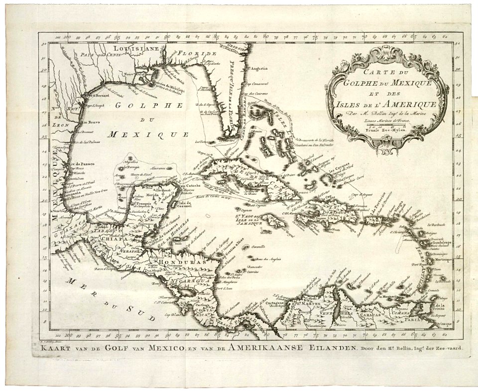
maps by jacques-nicolas bellin
1768
old maps of the gulf of mexico
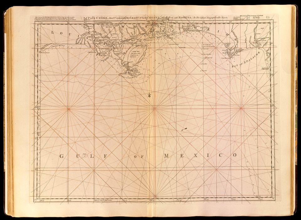
maps by thomas jefferys
nature
summer
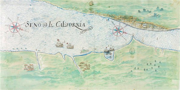
gulf of california
pictorial maps
maps of the gulf of mexico
maps of the gulf of mexico
maps of the gulf of mexico
maps of the gulf of mexico
maps of the gulf of mexico
maps of the gulf of mexico
maps of the gulf of mexico
maps of the gulf of mexico
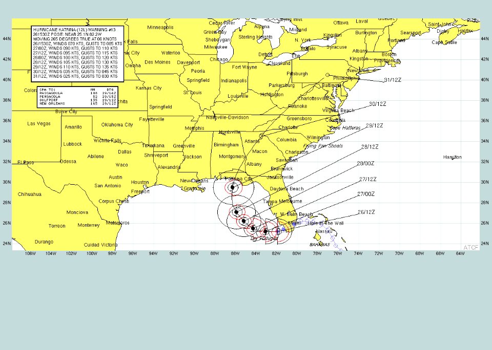
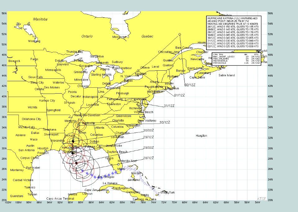
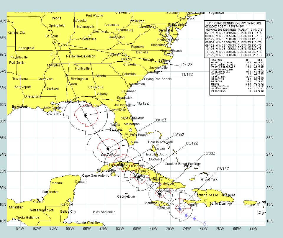
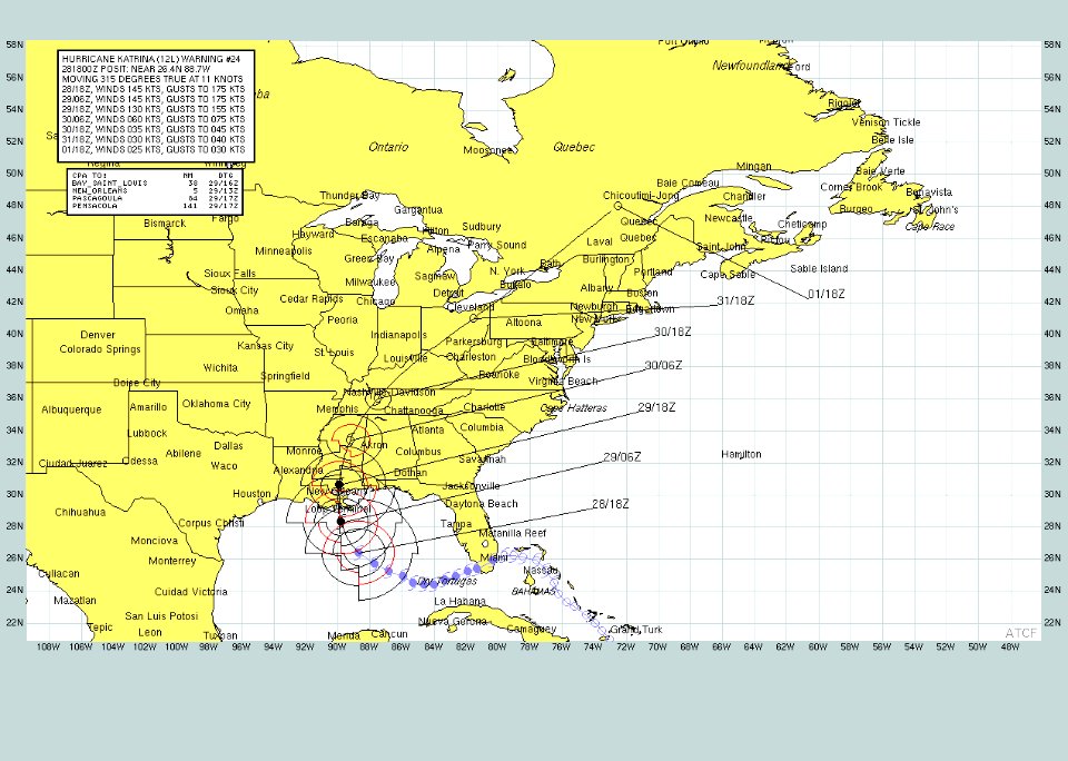
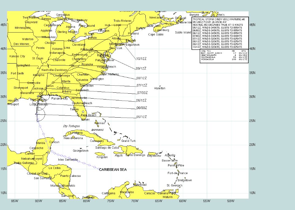
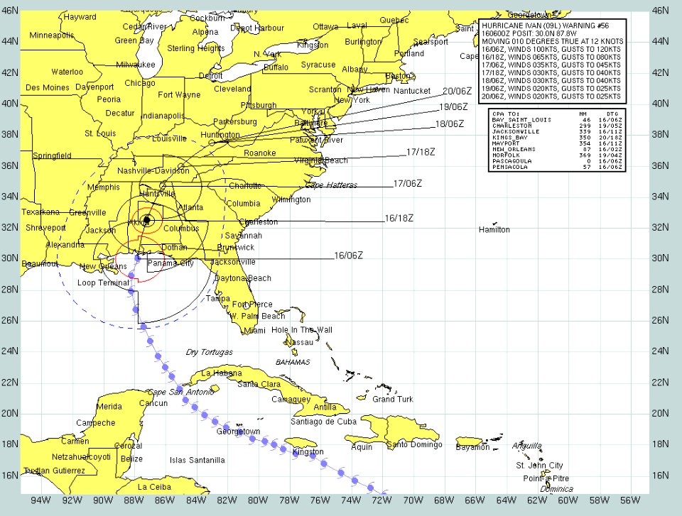
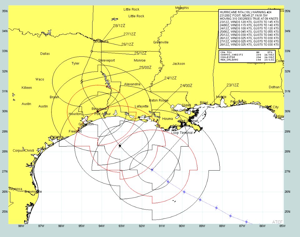
hurricane cindy (2005)
maps of the gulf of mexico
maps of the gulf of mexico
maps of the gulf of mexico
atlantic ocean
ecosystems
ecosystems
fl
ecosystems
alabama
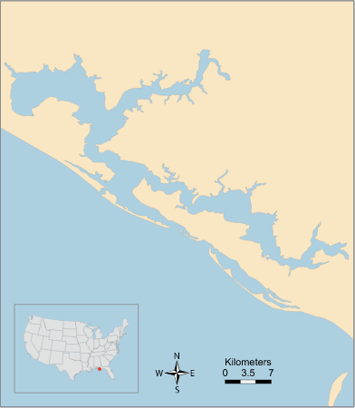
calcasieu
coast
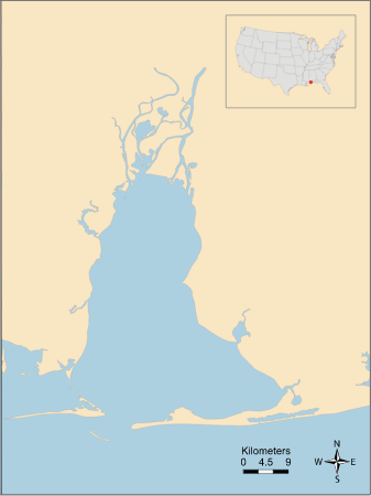
barrataria bay
barataria bay
ecosystems
coast
ecosystems
alabama
ecosystems
charlotte
ecosystems
fl
baffin bay
coast
1780s maps of the caribbean
maps in the british museum
ecosystems
fl
ecosystems
casey
ecosystems
gulf
ecosystems
east bay
ecosystems
gulf
apalachee bay
aucilla river
caloosahatchee river
ecosystems
choctawhatchee bay river
east
calcasieu lake
chenier
maps in the library of congress
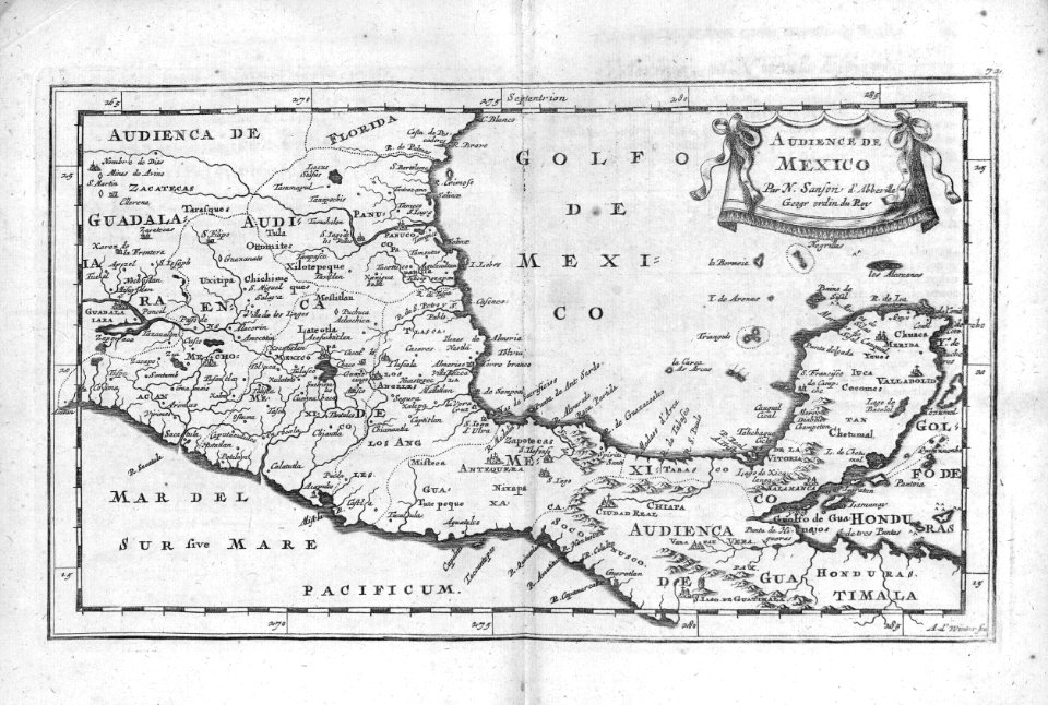
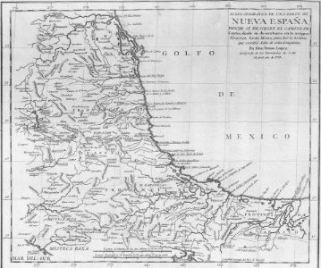
1750s maps of central america
1750s maps of central america
maps by tomas lopez
chokoloskee bay
coast
chokoloskee bay
coast
chandeleur islands
breton
juan de la cruz cano y olmedilla
1755 maps of north america
alapaha river
ecosystems
antonio river
antonio bay
apalachicola bay river
channel
atchafalaya bay
basin
borgne
chef
bosque river
brazos
christi bay
coast
borgne
chef
aransas bay
aransas
alabama
al
christi bay
aransas
alabama
al
maps by pieter mortier
maps from gallica
1750s maps of central america
maps by tomas lopez
1800s maps of the caribbean
charles picquet
aransas
bend
bolivar
coast
carancahua bay
coast
juan de la cruz cano y olmedilla
1750s maps of the caribbean
18th-century maps of north america
1708 maps of north america
juan de la cruz cano y olmedilla
maps by tomas lopez
juan de la cruz cano y olmedilla
maps by tomas lopez
mexico
maps
bibliothèque nationale de france
cartouches by tomas lópez
cartography
maps
bibliothèque nationale de france
maps by tomas lopez
maps in the library of congress
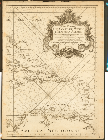
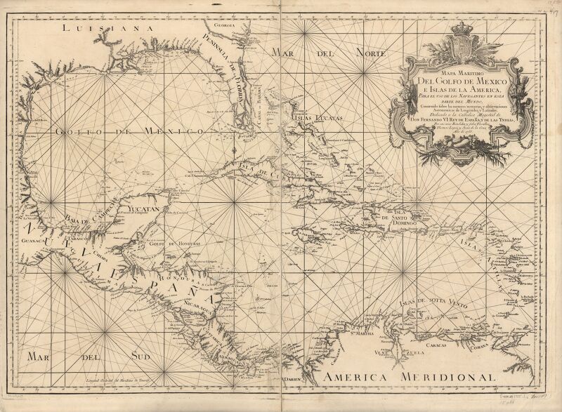
1750s maps of the caribbean
lawrence h. slaughter collection of english maps, charts, globes, books and atlases
nypl lionel pincus and princess firyal map division
1790s maps of central america
1790s maps of cuba
maps from university of amsterdam special collections
atlas der neederlanden
chicago and the midwest, newberry library
old maps of the mississippi river
lawrence h. slaughter collection of english maps, charts, globes, books and atlases
covens en mortier
1696 maps of the caribbean
1690s maps of mexico
old geological maps by jean-etienne guettard
jean étienne guettard
lawrence h. slaughter collection of english maps, charts, globes, books and atlases
covens en mortier
de nieuwe groote lichtende zee-fakkel (rijksmuseum)
maps in the rijksmuseum amsterdam
old geological maps by jean-etienne guettard
jean étienne guettard
carte du mexique et de la floride by guillaume delisle (1703)
bibliothèque nationale de france
maps by jean-baptiste bourguignon d'anville
1750s maps of the caribbean
historical
history
historical
history
historical
history
1740s maps of the americas
1747 maps of north america
1779 maps of the united states
1770s maps of the caribbean
1 - 87 of 87
/ 1


![Gulf of Mexico Map - *J. v. Schley & Bellin Marine Engraving*, Jakob van der Schley, [1773]](https://cdn.creazilla.com/illustrations/10000578116/gulf-of-mexico-map-j-v-schley-bellin-marine-engraving-jakob-van-der-schley-1773-md.jpg)