Log in
All resources
Create a design
53 Free Images of Maps Of New Guinea
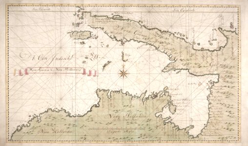
old maps of papua new guinea
maps connecting australia and new guinea
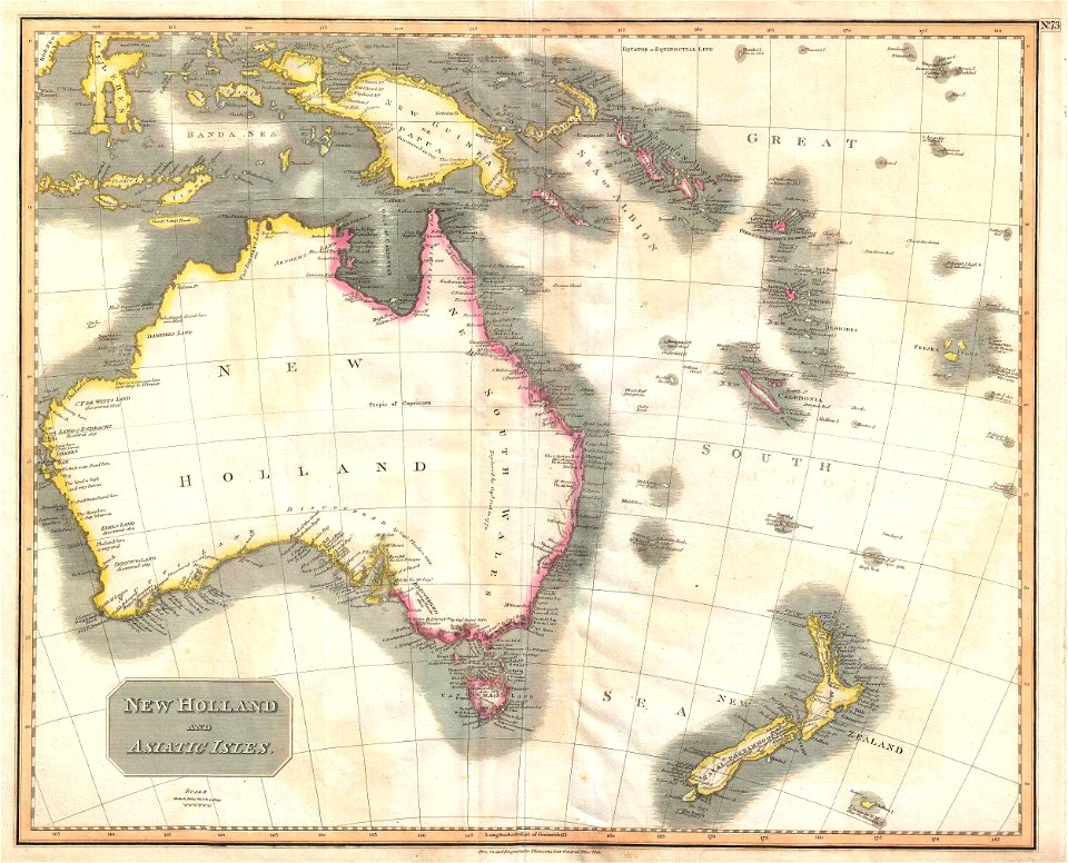
new holland (australia)
history
historical
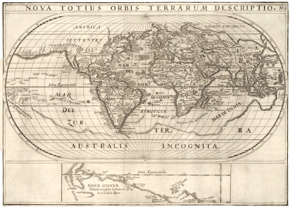
maps of the world without antarctica
old maps of new guinea
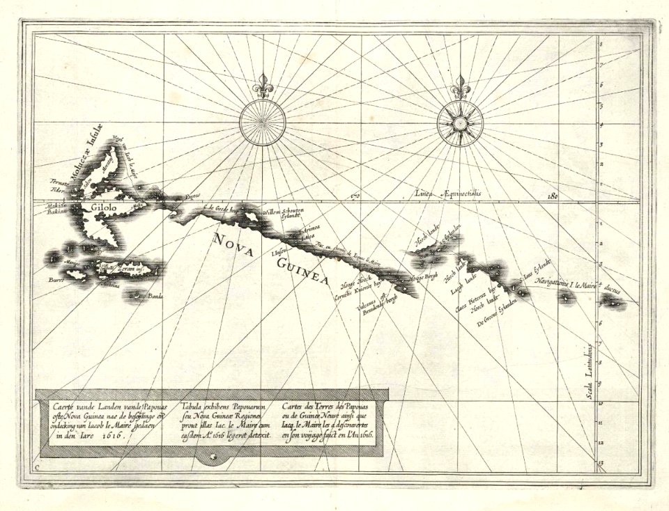
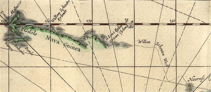
jacob le maire
willem schouten
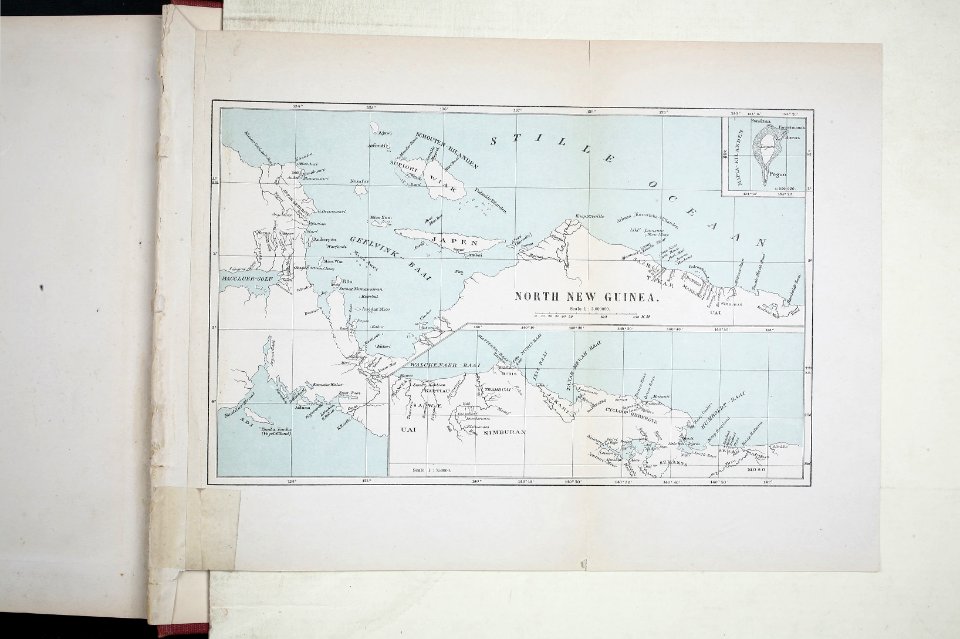
north new guinea expedition
135th meridian east
tasman map
old maps of papua new guinea
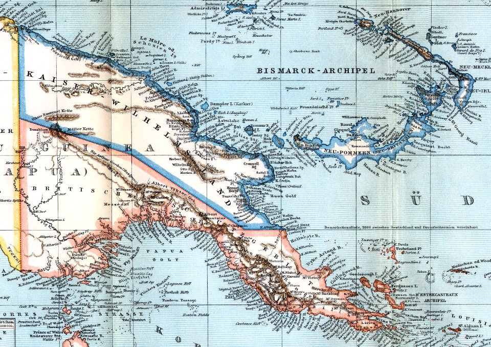
maps of german new guinea
old maps of the history of oceania
english-language maps
old maps of papua new guinea
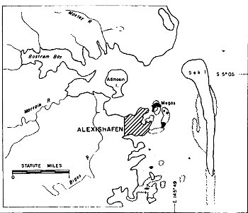
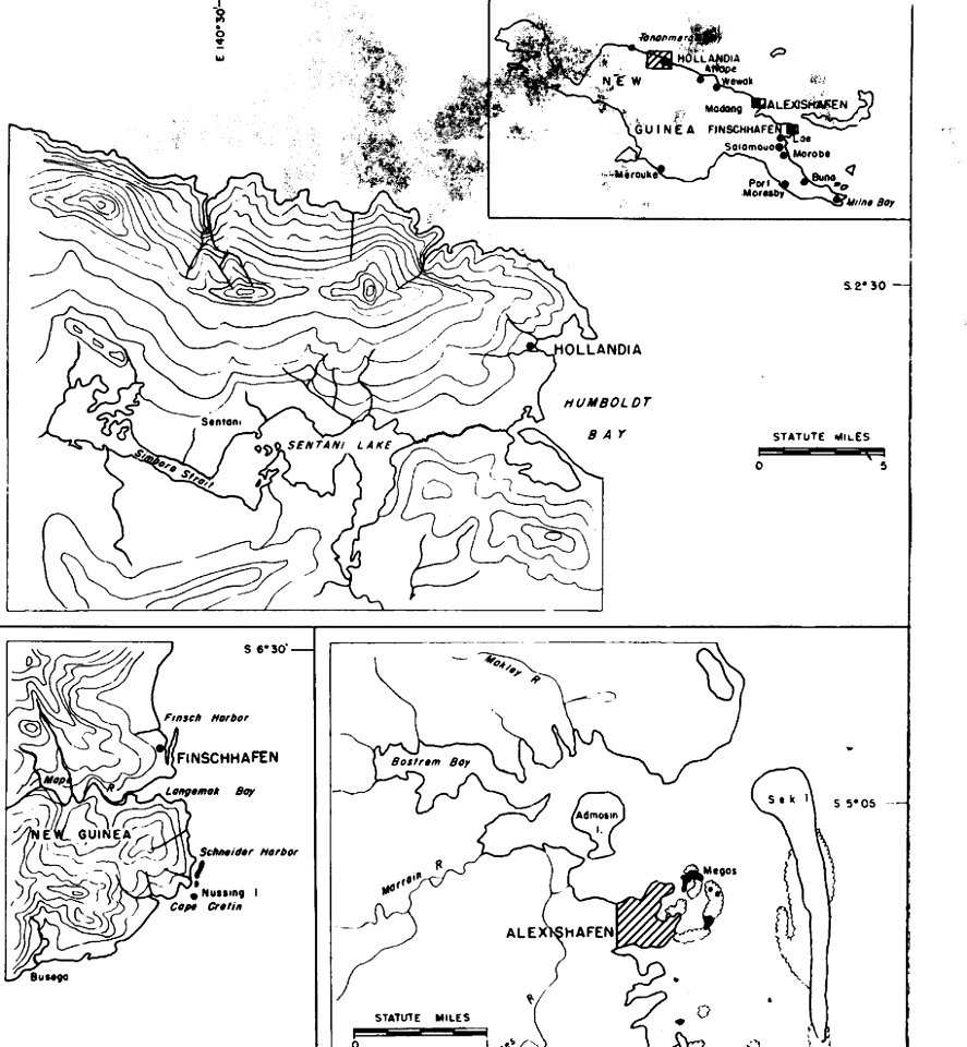
alexishafen
old maps of papua new guinea
maps of bougainville
maps in utrecht university library
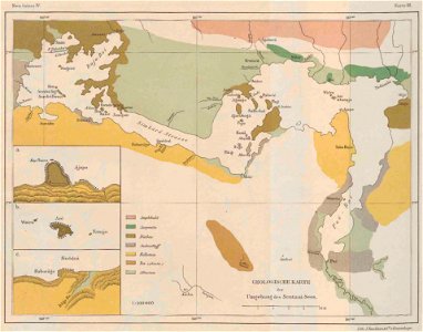
lake sentani
old maps of papua new guinea
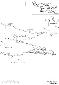
milne bay
new holland (australia)
1720s
military bases of the united states
old maps of papua new guinea
1620s maps of the world
1621 maps
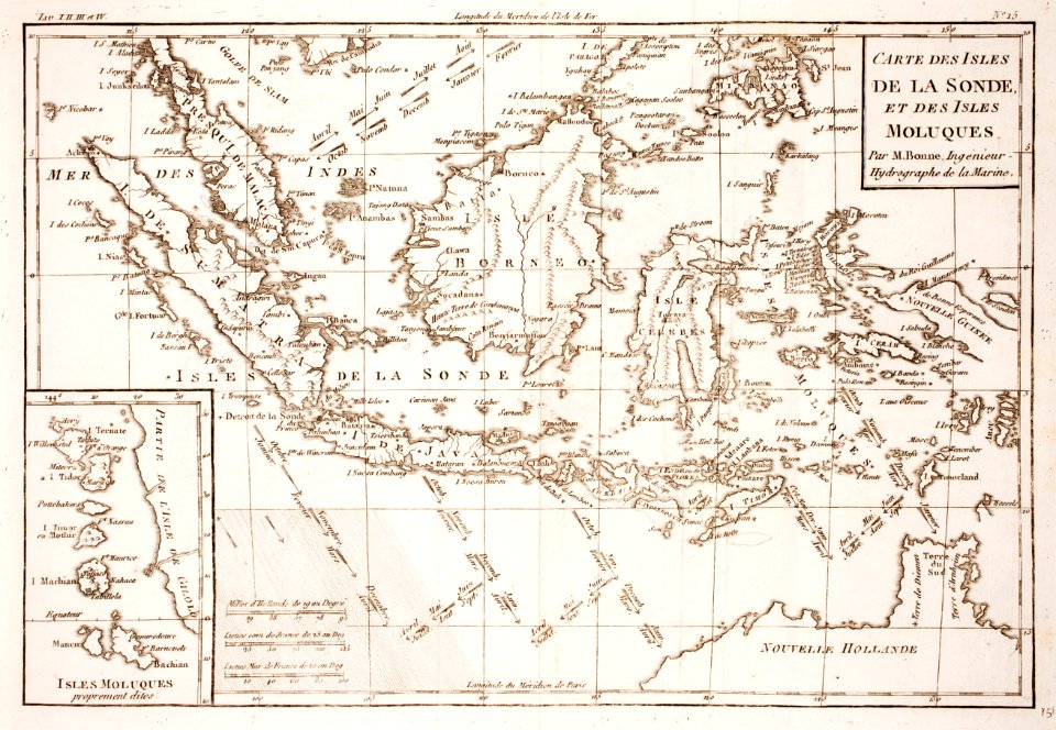
maps of the dutch east india company - indonesia
1616
maps in utrecht university library
north new guinea expedition
willem schouten
jacob le maire
old maps of papua new guinea
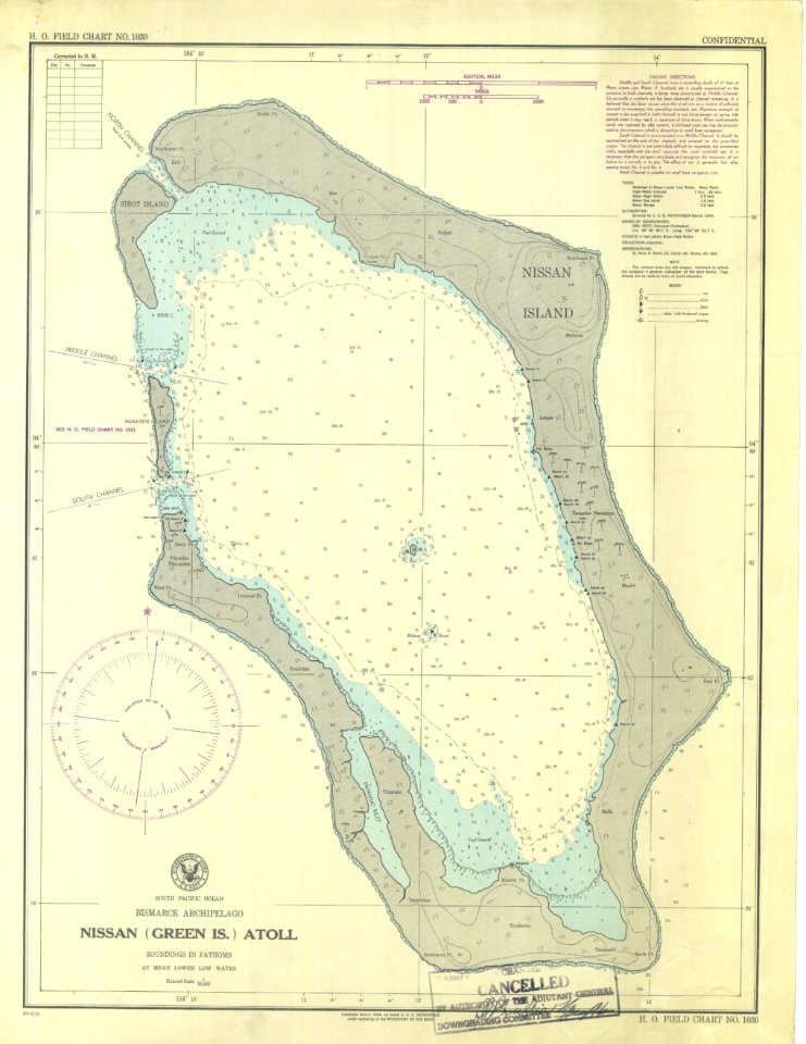
green island
old maps of papua new guinea
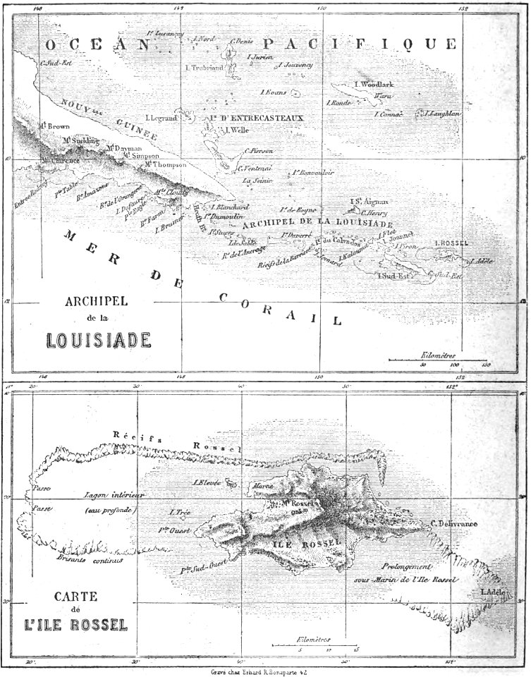
maps by alexandre vuillemin
18th-century maps of indonesia
maps of new guinea
19th-century maps of the malay archipelago
19th-century maps of southeast asia
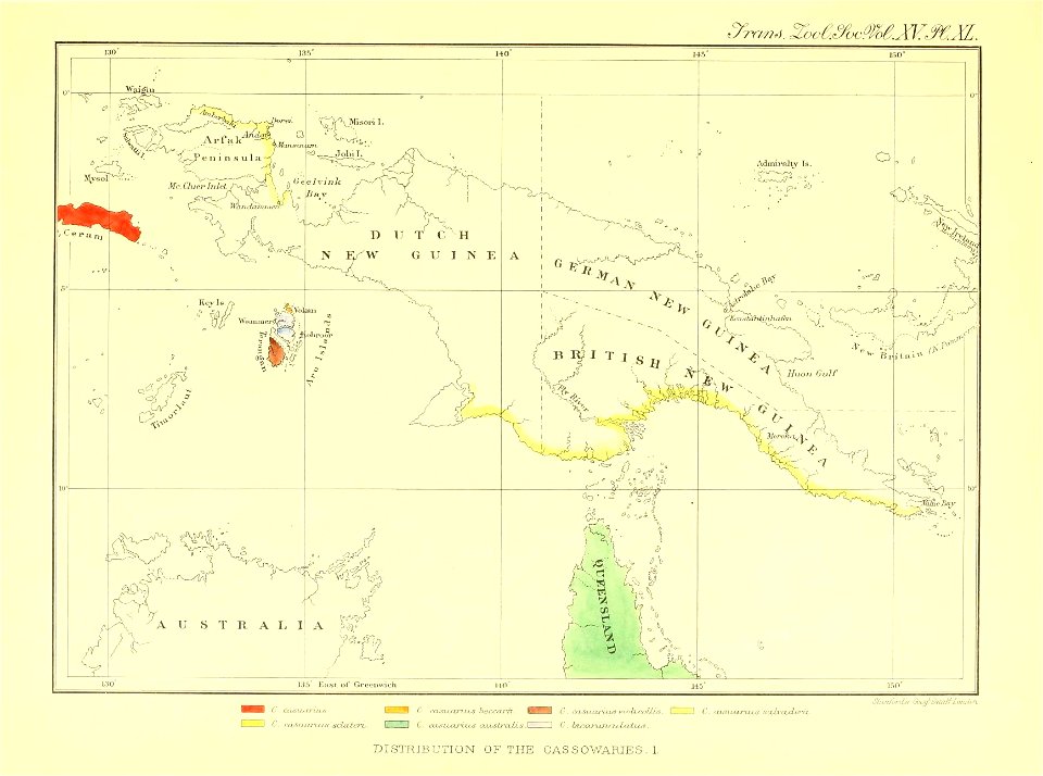
animals
mammals
animals
bird
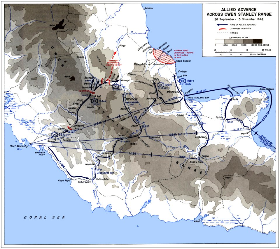
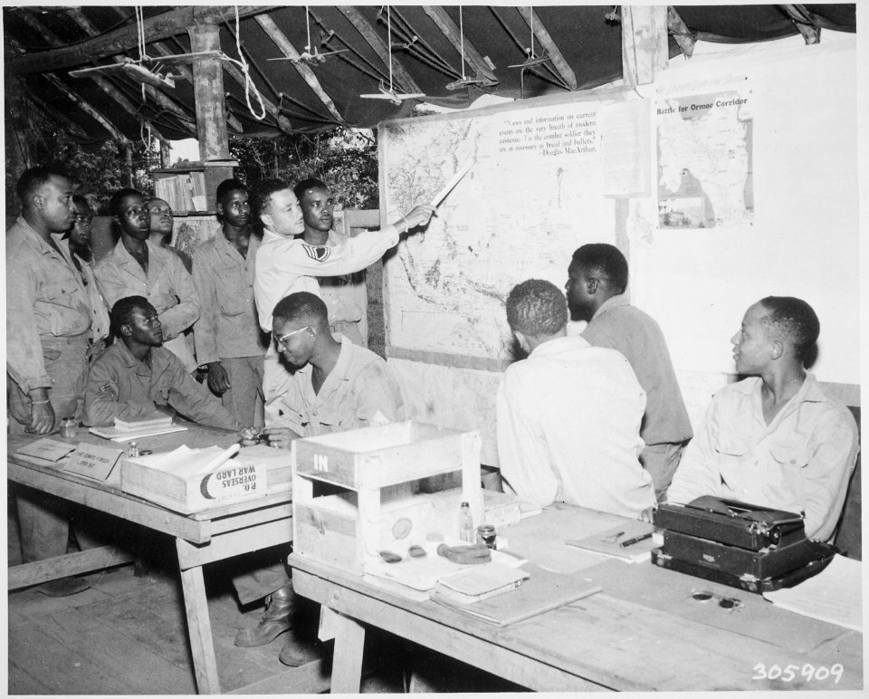
32nd infantry division (united states)
maps of the new guinea campaign
1640s maps of the world
1660s maps of the world
maps of the world with orthographic projection
maps of the world without antarctica
17th-century maps of the malay archipelago
archipelagus orientalis
18th-century double hemisphere world maps
1720s maps of the world
maps by guillaume delisle
philippe buache
british new guinea (1892)
ghosts & ghoulish scenes
australia
bird
19th-century maps of the malay archipelago
19th-century maps of southeast asia
historical
history
historical
history
1890s maps of the philippines
old maps of papua new guinea
1740s maps of the world
maps by emanuel bowen
papua new guinea
map
historical
history
maps of the malay archipelago by mercator-hondius
atlas of the great elector
archipelagus orientalis
17th-century maps of southeast asia
description de l'universe
maps of raja ampat regency
dutch-language maps
cartography
maps
18th-century maps of the indian ocean
18th-century maps of southeast asia
atlas of the great elector
archipelagus orientalis
the cruise of the marchesa (1889)
19th-century maps of new guinea
atlas sive cosmographicae (gerardus mercator, 1623)
maps of guinea by mercator-hondius
maps by john cary
1801 maps
carte de barbarie, nigritie, guinée par guillaume delisle (1707)
1718 maps of africa
18th-century maps of antarctica
1741 maps
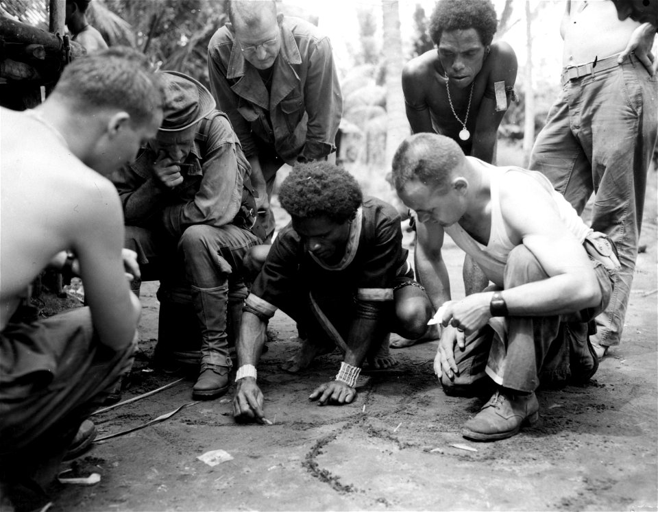
pacific theater
group portrait
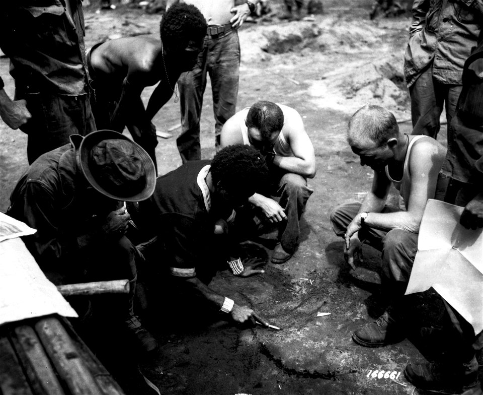
pacific theater
group portrait
atlas, ou représentation du monde universel et des parties d'icelui, faicte en tables et descriptions très amples et exactes, divisé en deux tomes. édition nouvelle... - btv1b53103889w
maps of guinea by mercator-hondius
navigantium atque itinerantium bibliotheca
1744 fleurons
historical
history
historical
history
carte de l'afrique françoise par guillaume delisle (1726)
philippe buache
1 - 53 of 53
/ 1