Log in
All resources
Create a design
122 Free Images of John Cary
maps by john cary
english-language maps
1799 maps
english-language maps of europe
1801 maps
maps in the british museum
paper
british museum
eran laor cartographic collection
cary's new itinerary (1815)
1805 maps of the united states
maps by john cary
19th-century maps of the malay archipelago
19th-century maps of southeast asia
maps by john cary
county of tyrol
maps by john cary
1806 maps of asia
1920 postcards of the united states
postcards of houlton, maine
maps by john cary
1799 maps
maps by john cary
1806 maps of asia
maps by john cary
1799 maps
1801 maps of europe
maps by john cary
maps by john cary
county of tyrol
1810s maps of the near east
maps by john cary
1800s maps of london
1801 in london
1810s maps of the near east
maps by john cary
1801 map of turkey in asia by john cary
1801 maps of the ottoman empire
maps by john cary
john cary
maps by john cary
1801 maps
maps by john cary
1799 maps
eran laor cartographic collection
john cary
maps by john cary
1836 maps
eran laor cartographic collection
john cary
maps by john cary
1799 maps
maps by john cary
1801 maps
maps by john cary
1799 maps
eran laor cartographic collection
john cary
eran laor cartographic collection
john cary
eran laor cartographic collection
john cary
eran laor cartographic collection
john cary
eran laor cartographic collection
john cary
eran laor cartographic collection
john cary
old maps of the history of oceania
maps by john cary
maps by john cary
1801 maps
19th-century maps of europe
maps by john cary
19th-century maps of europe
maps by john cary
maps by john cary
1796 maps
historical map collection
maps by john cary
maps by john cary
1799 maps
maps in the british museum
battle of fontenoy
cary's new itinerary (1815)
1810s maps of england
maps by john cary
1801 maps
maps by john cary
1799 maps
1800s maps of egypt
maps by john cary
english-language maps
maps by john cary
maps by john cary
1811 maps
1807 maps of canada
maps by john cary
maps by john cary
1799 maps
1800s maps of the iberian peninsula
maps by john cary
1800s maps of czechia
maps by john cary
1801 maps of germany
maps by john cary
maps in the british museum
maps by john cary
1780s maps of south america
maps in the british museum
19th-century maps of the ottoman empire
maps in the british museum
mary randolph (1727-1781)
john wollaston (painter)
maps by john cary
1801 maps
maps of territories in the lower saxony circle
maps by john cary
english-language maps of asia
maps by john cary
old maps of swabia
maps by john cary
1804 maps of europe
maps by john cary
1780s maps of the caribbean
maps in the british museum
maps in the british museum
1780s maps of france
maps by john cary
1799 maps
maps by john cary
1799 maps
maps by john cary
1799 maps
1800s maps of denmark
1801 maps of europe
maps by john cary
1801 maps
maps in the british museum
1780s maps of france
maps in the british museum
1780s maps of france
geological maps of england
william smith (geologist)
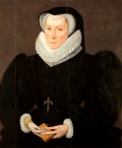
female portrait paintings by robert peake the elder
1590 portrait paintings of women
maps by john cary
1801 maps
maps in the british museum
maps of the irish sea
john o'brien (marine artist)
ships named scotia
19th-century maps of oxfordshire
bodleian maps collection
maps in the british museum
old maps of dunkerque
1799 maps of the russian empire
maps by john cary
maps by john cary
1799 maps
1800s maps of the americas
maps by john cary
1799 maps of italy
maps by john cary
1803 maps of the caribbean
maps by john cary
maps by john cary
1801 maps
1806 maps of the united states
maps by john cary
1806 maps of the united states
maps by john cary
1805 maps of the united states
maps by john cary
1807 maps of south america
maps by john cary
english-language maps
maps by john cary
1900 paintings by john singer sargent
impressionism
1821 maps of the united states
maps by john cary
iroquois (ship, 1886)
gaff rigged schooners
photographs by john s. johnston
sloops under sail
photographs by john s. johnston
gorilla (ship, 1889)
photographs by john s. johnston
gorilla (ship, 1889)
85 footers (nyyc rule)
puritan (ship, 1885)
19th-century maps of gloucestershire
old maps of cheltenham
cary's new itinerary (1815)
photographs by john s. johnston
sloops under sail
photographs by john s. johnston
banshee (ship, 1887)
19th-century maps of the isle of wight
cary's new itinerary (1815)
19th-century maps of middlesex
cary's new itinerary (1815)
19th-century maps of hampshire
cary's new itinerary (1815)
19th-century maps of somerset
cary's new itinerary (1815)
cary's new itinerary (1815)
19th-century maps of kent
1 - 100 of 122
Next page
/ 2