Log in
All resources
Create a design
23 Free Images of 17th Century Maps Of Andalusia
17th-century maps of venezuela
maps by hendrik hondius the younger
bibliothèque nationale de france
maps made in the 17th century
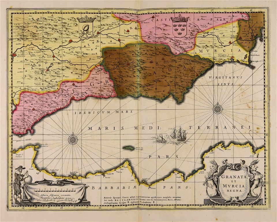
1660s maps of spain
henricus hondius ii
joan blaeu
gerard valck
maps by pieter schenk (i)
atlantis magni tomus quartus (biblioteca comunale di trento)
self-published work
pages with maps
maps made in the 17th century
gerard valck
maps made in the 17th century
gerard valck
old maps of venezuela
gerard valck
atlantis magni tomus quartus (biblioteca comunale di trento)
maps made in the 17th century
black and white
monochrome
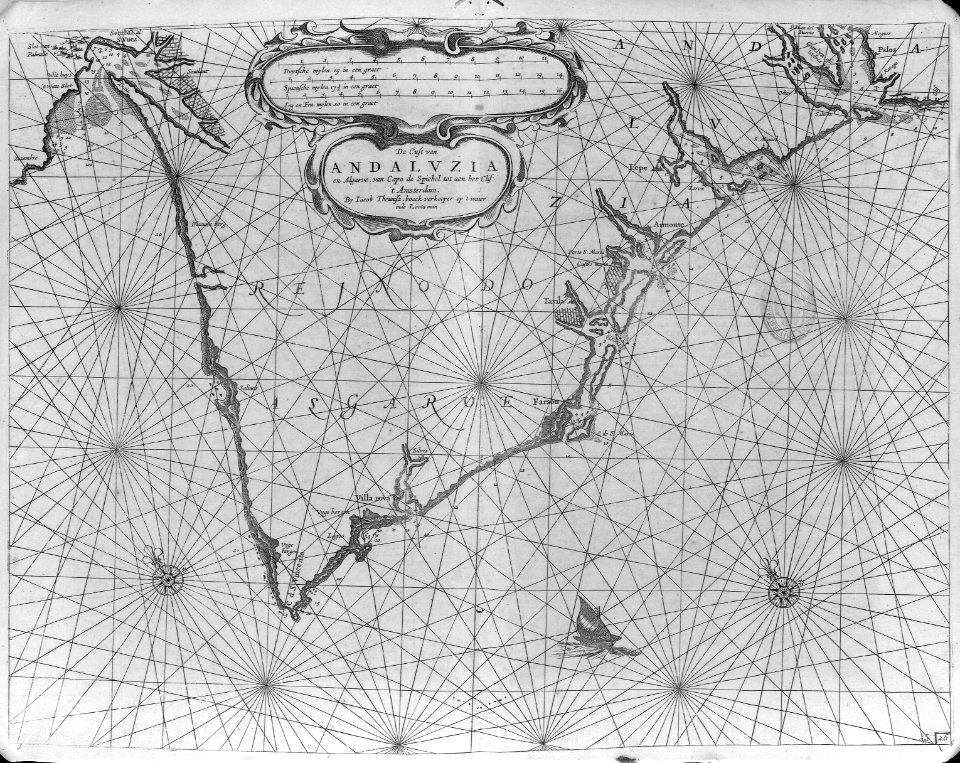
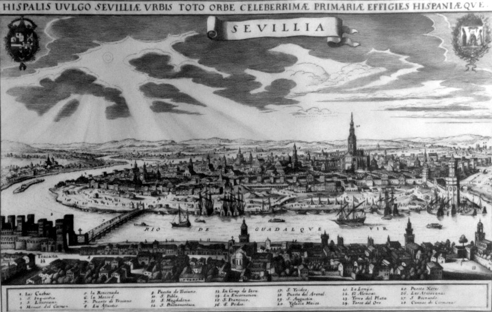
old maps of cádiz
1664 maps
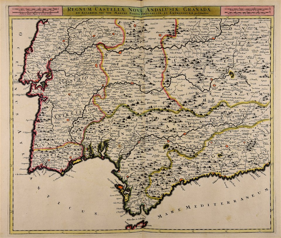
17th-century maps of andalusia
old maps of the alboran sea
andalusia in the 1610s
francisco heylan
old maps of trinidad and tobago
animals on maps
17th-century maps of trinidad and tobago
animals on maps
1660s maps of spain
1667 maps
1660s maps of spain
1667 maps
venezuela cum parte australi novae andalusiae - btv1b8596473x
maps by hendrik hondius the younger
old maps of trinidad and tobago
17th-century maps of venezuela
engravings by matthäus merian
baroque
1660s maps of spain
1667 maps
old maps of trinidad and tobago
17th-century maps of venezuela
maps of barcelona by braun & hogenberg
1645 in andalusia
venezuela cum parte australi novae andalusiae - (willem janszoon blaeu et joan blaeu) - btv1b8596474b
17th-century maps of venezuela
venezuela, cum parte australi novae andalusiae - btv1b53196851w
17th-century maps of venezuela
cartography
maps
juan francisco leonardo (1687) mapa del arzobispado de toledo
1680s maps of spain
1 - 23 of 23
/ 1


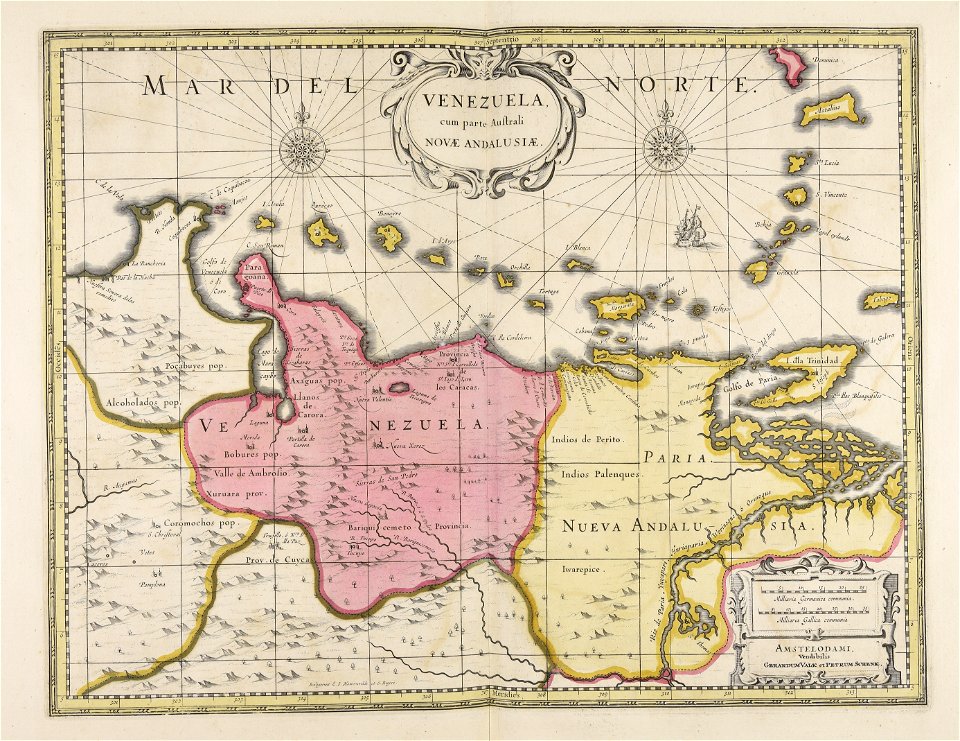


![Venezuela cum parte Australia Novae Andalusiae / [Willem Janszoon Blaeu et Joan Blaeu], Joan Blaeu, between 1638 and 1640](https://cdn.creazilla.com/illustrations/10000255596/venezuela-cum-parte-australia-novae-andalusiae-willem-janszoon-blaeu-et-joan-blaeu-joan-blaeu-between-1638-and-1640-md.jpg)