Log in
All resources
Create a design
20 Free Images of 17th Century Maps Of Venezuela
maps by hendrik hondius the younger
henricus hondius ii
bibliothèque nationale de france
old maps of trinidad and tobago
latin-language maps
17th-century maps of guyana
old maps of suriname
animals on maps
columbus memorial library
library of congress
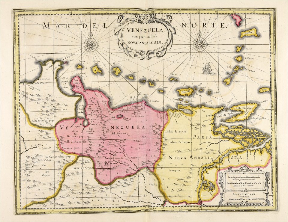
old maps of venezuela
gerard valck
old maps of the new kingdom of granada
17th-century maps of guyana
old maps of trinidad and tobago
animals on maps
17th-century maps of trinidad and tobago
animals on maps
venezuela cum parte australi novae andalusiae - btv1b8596473x
maps by hendrik hondius the younger
old maps of trinidad and tobago
17th-century maps of venezuela
old maps of trinidad and tobago
17th-century maps of venezuela
old maps of french guiana
1630s maps of brazil
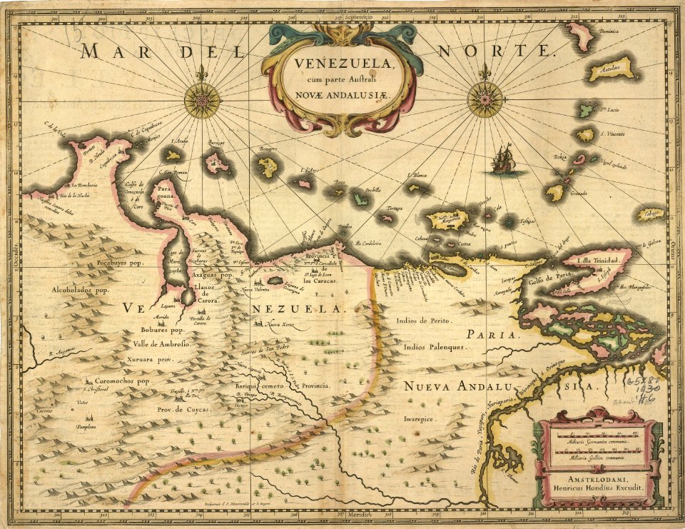
venezuela cum parte australi novae andalusiae - (willem janszoon blaeu et joan blaeu) - btv1b8596474b
17th-century maps of venezuela
venezuela, cum parte australi novae andalusiae - btv1b53196851w
17th-century maps of venezuela
maps in the british museum
jan claesz ten hoorn
maps of the caribbean by mercator-hondius
details of old maps
dutch 17th-century prints in the rijksmuseum amsterdam
maps in the rijksmuseum amsterdam
historical
history
17th-century maps of venezuela
johannes leupenius
atlas ou representation du monde universel t. 2 (1633)
maps by hendrik hondius the younger
de nieuwe groote lichtende zee-fakkel (rijksmuseum)
maps in the rijksmuseum amsterdam
maps by joachim bormeester
1680s maps of the world
maps by joachim bormeester
1685 maps
1696 maps of the caribbean
1690s maps of mexico
1 - 20 of 20
/ 1


![Venezuela cum parte Australia Novae Andalusiae / [Willem Janszoon Blaeu et Joan Blaeu], Joan Blaeu, between 1638 and 1640](https://cdn.creazilla.com/illustrations/10000255596/venezuela-cum-parte-australia-novae-andalusiae-willem-janszoon-blaeu-et-joan-blaeu-joan-blaeu-between-1638-and-1640-md.jpg)


![Gerardi Mercatoris and I. Hondii Atlas or Representation of the Universal World, and of the Parts of It, Made in Tables and Very Ample Descriptions. [t. 2].](https://cdn.creazilla.com/illustrations/10000416251/gerardi-mercatoris-and-i-hondii-atlas-or-representation-of-the-universal-world-and-of-the-parts-of-it-made-in-tables-and-very-ample-descriptions-t-2-sm.webp)


