Log in
All resources
Create a design
83 Free Images of 17th Century Maps Of Africa
bibliothèque nationale de france
cartography
engraving
chalcography
grabados
libros del siglo xvii
fondo antiguo
calcografía
cartografía
áfrica
17th-century maps of africa
1635
description de l'universe
1683 maps of africa
description de l'universe
1683 maps of africa
17th-century engravings
frans post
atlas van der hagen (volume 4)
maps with cartouches
rue de siam (brest
france
old maps of australia
maps with cartouches
atlas van der hagen (volume 4)
maps with cartouches
dutch 17th-century prints in the rijksmuseum amsterdam
old maps of africa
maps made in the 17th century
gerard valck
maps made in the 17th century
gerard valck
gerard valck
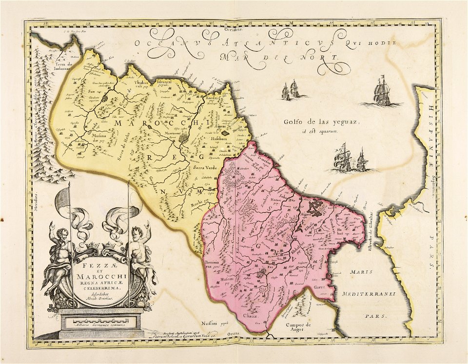
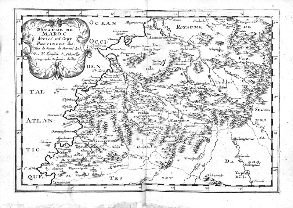
marocco
maps by frederick de wit
fredrik andersson
atlantis magni tomus quintus (biblioteca comunale di trento)
maps made in the 17th century
maps of abyssinia by mercator-hondius
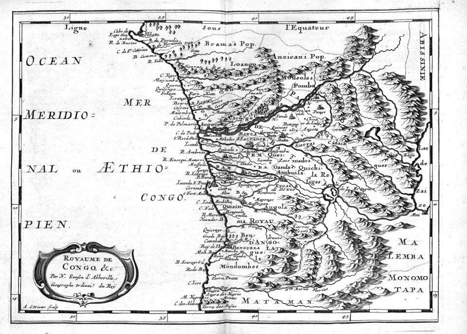
maps of the kingdom of kongo
atlas van der hagen (volume 4)
atlas van der hagen
17th-century maps of africa
maps from gallica
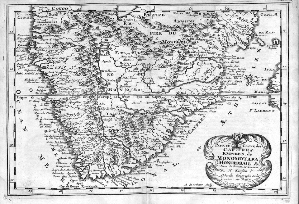
monomotapa
mutapa
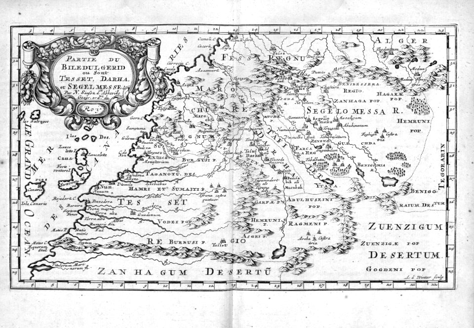
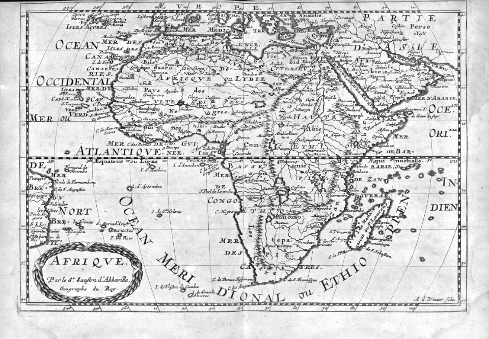
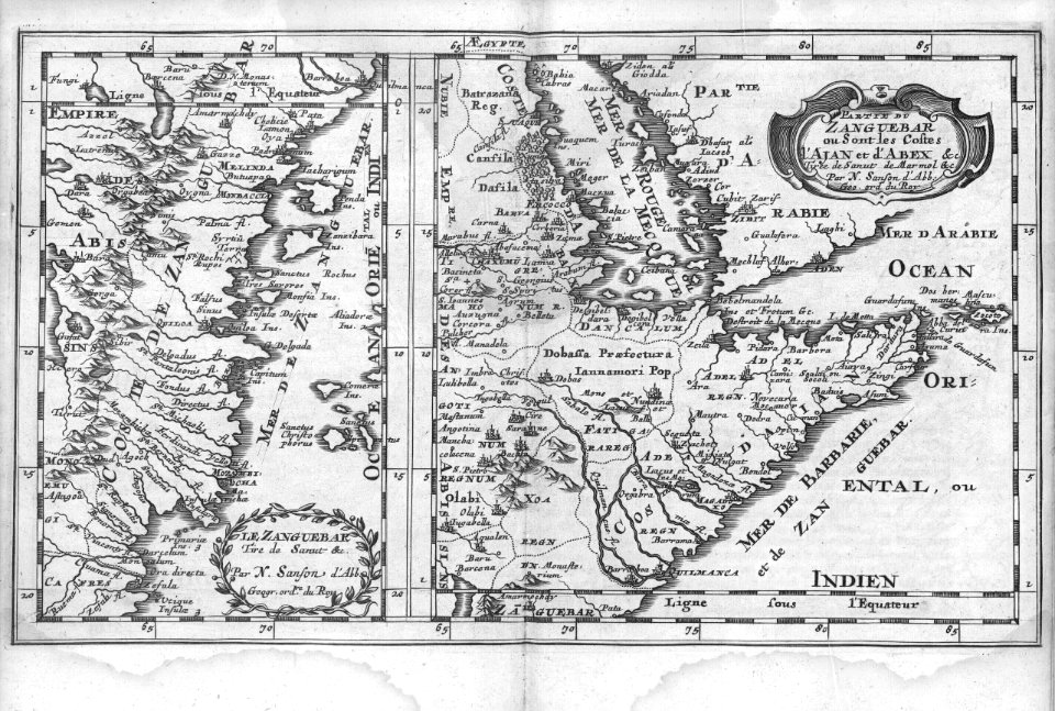
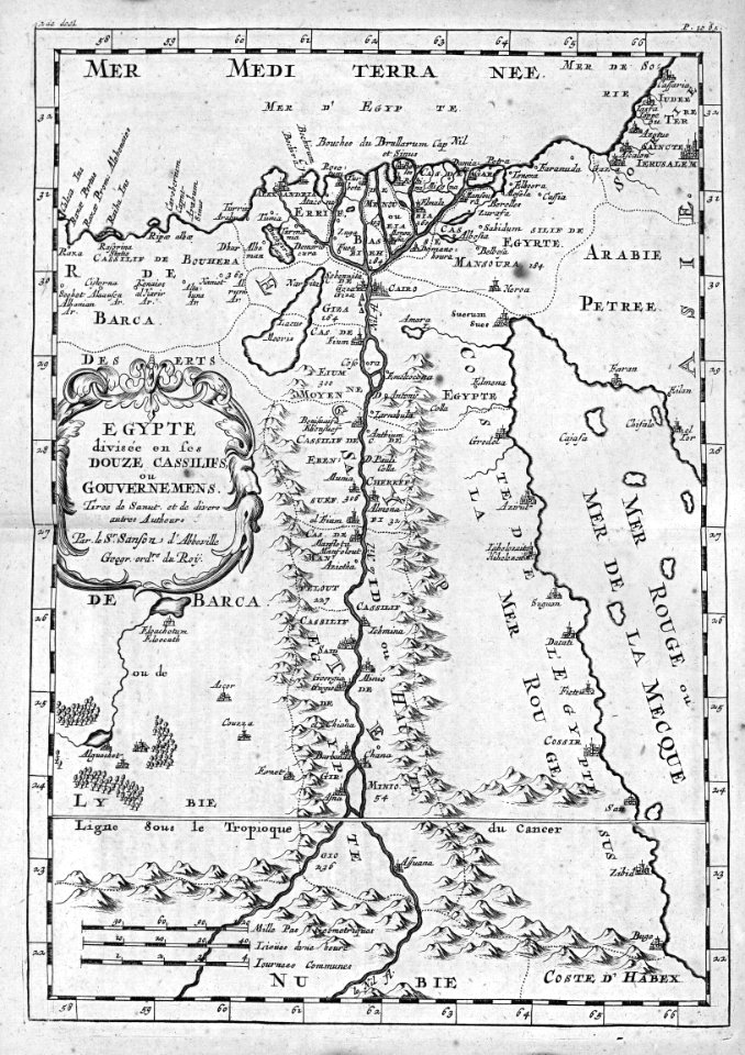
maps by nicolas sanson
jan van somer
maps by willem and johannes blaeu
17th-century images of algiers
maps of tunis and la goleta by braun & hogenberg
maps by willem and johannes blaeu
17th-century maps of the mediterranean sea
guillaume sanson
arnold van langren map of southwest africa
1600 maps of africa
atlas van der hagen (volume 4)
people with animals in art
maps by willem and johannes blaeu
1640 maps of africa
17th-century maps of africa
maps from gallica
maps by willem and johannes blaeu
1640 maps of africa
media contributed by university of illinois urbana-champaign university library
renaissance
17th-century maps of africa
carolus allard
carte de barbarie, nigritie, guinée par guillaume delisle (1707)
1718 maps of africa
atlas maior, vol 10 (spain and africa) - joan blaeu, 1667 - bl 114.h(star).10
1667 maps
media contributed by university of illinois urbana-champaign university library
1685 maps of africa
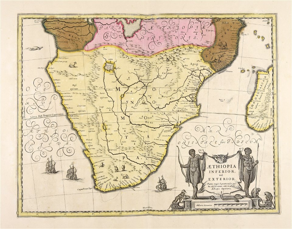
17th-century maps of southern africa
maps by willem and johannes blaeu
1660s maps of spain
1667 maps
maps by willem and johannes blaeu
1663 maps of africa
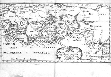
17th-century maps of west africa
1650 maps of africa
1660s maps of spain
1667 maps
maps made in the 17th century
africa settentrionale
frans post
baroque
17th-century people of africa
africa in the 1680s
description de l'universe
1683 maps of africa
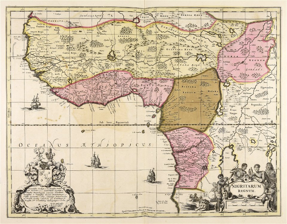
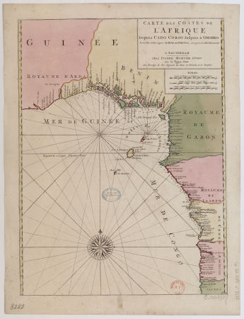
africa
maps
africa
maps
africa
maps
1660s maps of spain
1667 maps
africa
maps
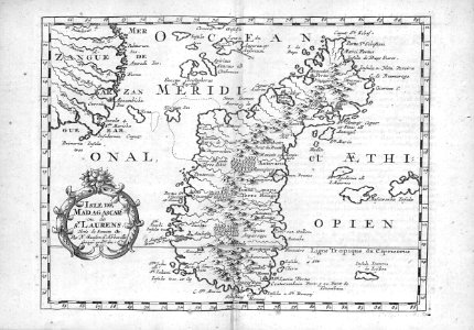
madagascar in the 17th century
description de l'universe
africa
maps
africa
maps
africa
maps
17th-century people of africa
africa in the 1680s
17th-century people of africa
africa in the 1680s
17th-century people of africa
africa in the 1680s
africa
maps
africa
maps
17th-century maps of the mediterranean sea
ships on maps
17th-century people of africa
africa in the 1680s
17th-century people of africa
africa in the 1680s
africa
maps
africa
maps
africa
maps
description de l'universe
1683 maps of africa
description de l'universe
1683 maps of africa
africa
maps
africa
maps
17th-century maps of the indian ocean
maps by willem and johannes blaeu
reverse sides from gallica
herman padtbrugge
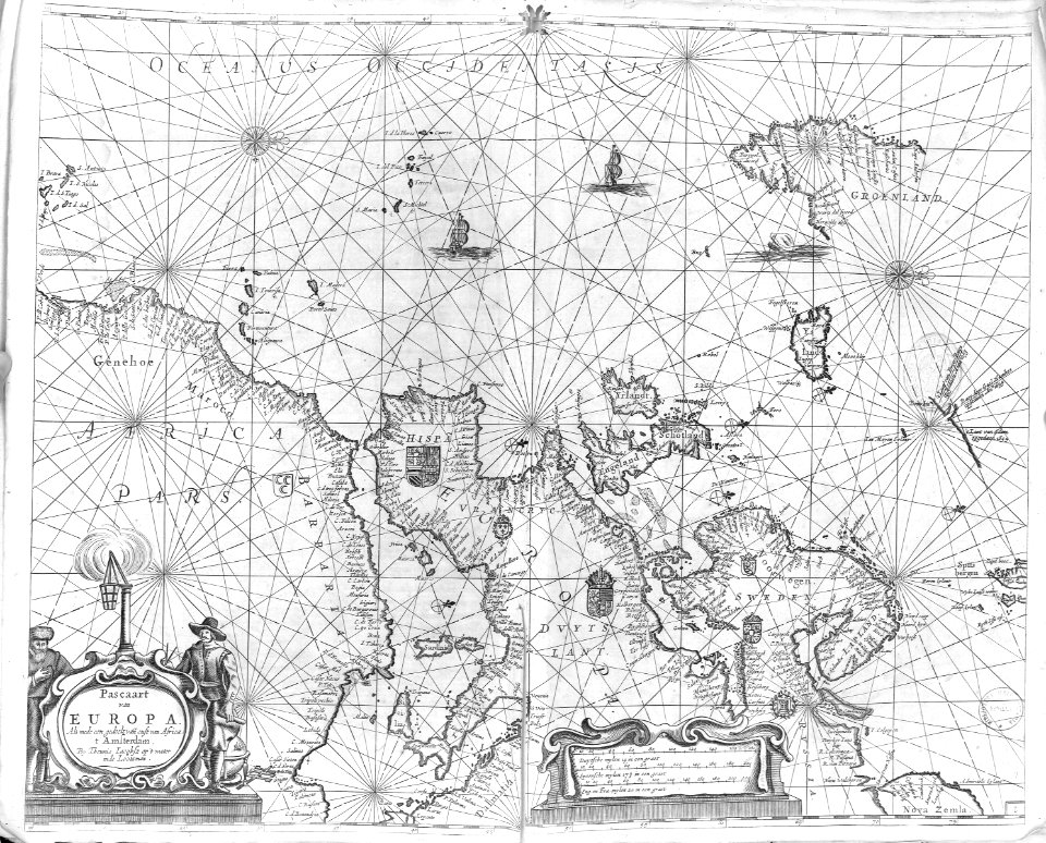
west-indische paskaert (doncker, 1660s)
herman padtbrugge
west-indische paskaert (doncker, 1660s)
herman padtbrugge
west-indische paskaert (doncker, 1660s)
herman padtbrugge
reverse sides from gallica
herman padtbrugge
reverse sides from gallica
herman padtbrugge
west-indische paskaert (doncker, 1660s)
herman padtbrugge
reverse sides from gallica
herman padtbrugge
1600 maps of africa
benjamin wright
1650s maps of the americas
1658 maps
maps of algiers by braun & hogenberg
algiers in the 17th century
maps in the rijksmuseum amsterdam
old maps of the ottoman empire
maps by joachim bormeester
1680s maps of the world
1740s maps of the world
maps by emanuel bowen
maps by joachim bormeester
1685 maps
dutch 17th-century prints in the rijksmuseum amsterdam
siege of breda 1624-1625
maps in the rijksmuseum amsterdam
works after adriaen van de velde
1 - 83 of 83
/ 1


![Titelblad] AFRICA](https://cdn.creazilla.com/illustrations/10000408184/titelblad-africa-sm.webp)


![Aethiopia inferior, vel exterior, partes magis septentrionales, quae hic desiderantur, vide in tabula Aethiopiae superioris / [Joan Blaeu], 1663](https://cdn.creazilla.com/illustrations/10000599277/aethiopia-inferior-vel-exterior-partes-magis-septentrionales-quae-hic-desiderantur-vide-in-tabula-aethiopiae-superioris-joan-blaeu-1663-md.jpg)


![Algerii Saracenorum urbis fortissimae, in Numidia Africae provincia structae, juxta Balearicos fluctus Maediterranei aequoris Hispaniam contra, Othomanor pri[n]cipu[m] imperio redactae, imago, between 1635 and 1640](https://cdn.creazilla.com/illustrations/10000616816/algerii-saracenorum-urbis-fortissimae-in-numidia-africae-provincia-structae-juxta-balearicos-fluctus-maediterranei-aequoris-hispaniam-contra-othomanor-principum-imperio-redactae-imago-between-1635-and-1640-md.jpg)


