Log in
All resources
Create a design
420 Free Artworks of Nautical
engraving
grabados
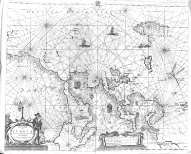
maps
cartography
nautical chart
map
chalcography
calcografía
cartografía
cartas náuticas
1690s maps of the caribbean
1690s maps of the americas
admiralty charts region r: usa and mexico west coasts
admiralty charts 1801-2000
admiralty charts region c: scotland
admiralty charts 1801-2000
halloween
animals
mammals
bird
nautical
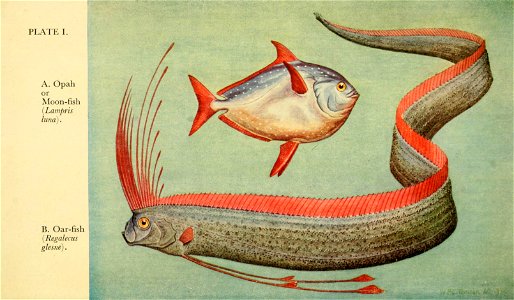
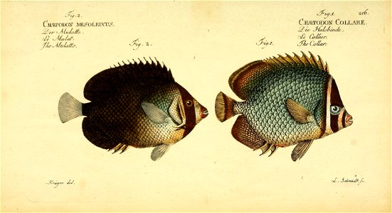
fish
1782 maps of the caribbean
maps by juan lopez
paintings in the nederlands scheepvaartmuseum
johannes huibert prins
nautical
fish
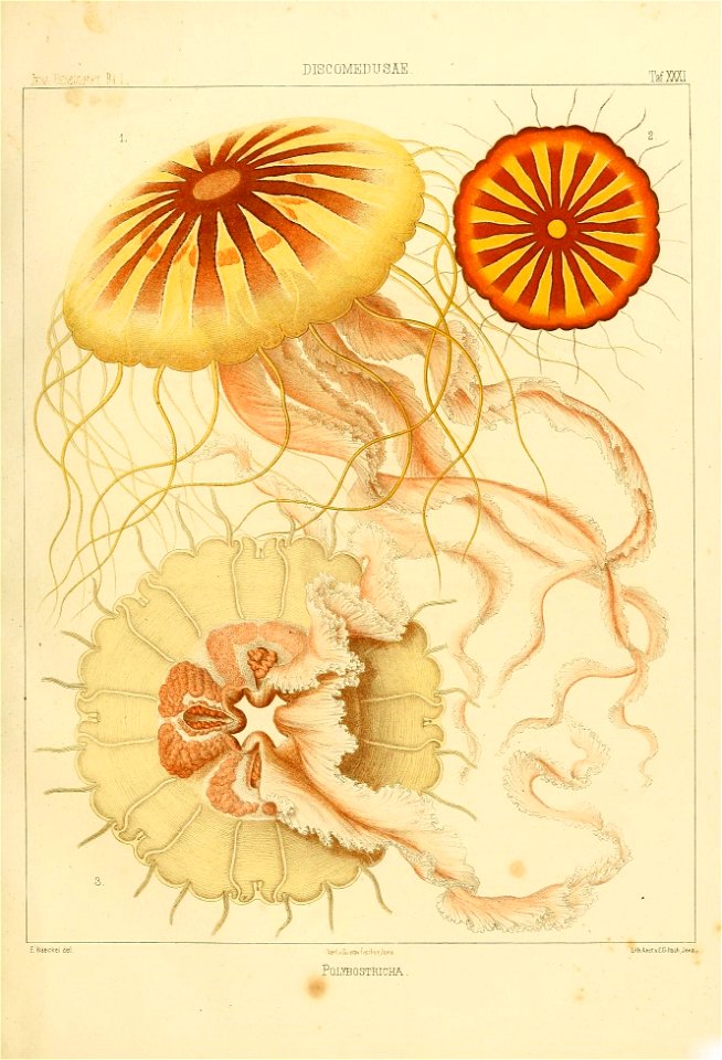
jellyfish
nautical
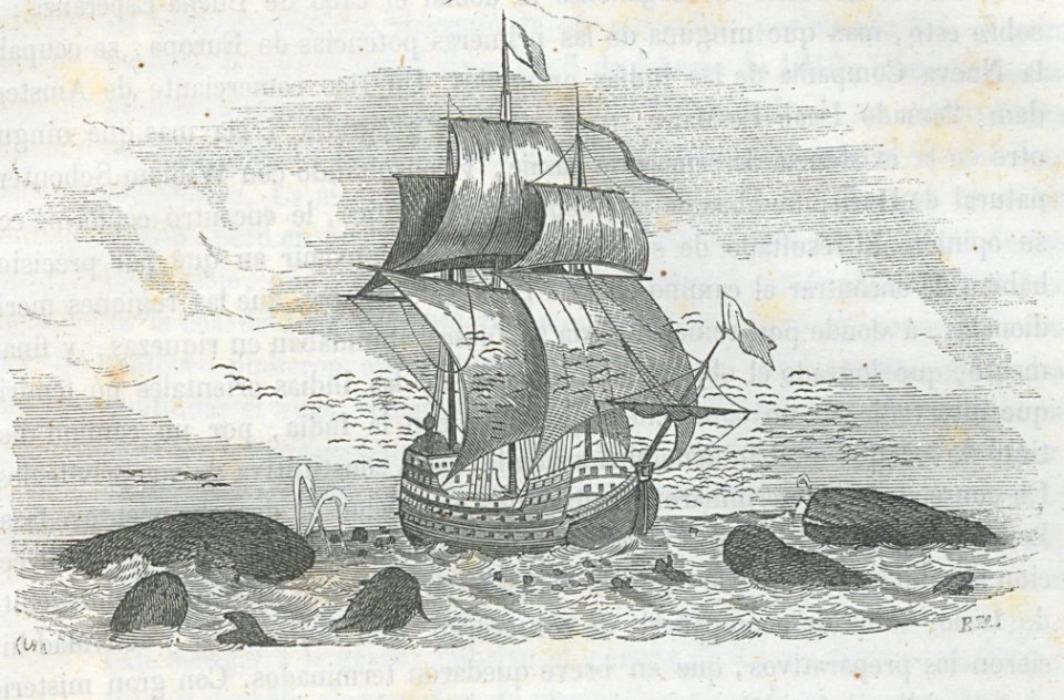
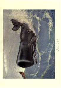
whale
fish
admiralty charts region u: north america east coast
admiralty charts 201-400
admiralty charts 1001-1200
avacha bay
john scott (painter)
ships named anne
history
travel
animals
nature
marine
boat
admiralty charts 2601-2800
blacksod bay
views from admiralty charts
richard brydges beechey
views from admiralty charts
richard brydges beechey
whale
fish
invertebrate
marine
admiralty charts region c: scotland
admiralty charts 2801-3000
views from admiralty charts
san francisco bay
bibliothèque nationale de france
maps by tomas lopez
18th-century french nautical charts
old maps of lemnos
admiralty charts 2001-2200
westport, county mayo
maps of san francisco bay
admiralty map details
nature
sea
carte du mexique et de la floride by guillaume delisle (1703)
bibliothèque nationale de france
philip island, norfolk island
views from admiralty charts
piscine de gerland (lyon)
stade de gerland
ocean
sea
admiralty charts region r: usa and mexico west coasts
admiralty charts 401-600
admiralty charts region c: scotland
admiralty charts 4001-
admiralty charts region b: england wales ireland english channel southern north sea
admiralty charts 1401-1600
admiralty charts region c: scotland
admiralty charts 2001-2200
nautical
fish
admiralty charts 1801-2000
preston, lancashire
prints by stefano della bella in the metropolitan museum of art
baroque
bibliothèque nationale de france
maps by tomas lopez
carte de l'isle de ceylan by guillaume delisle (1722)
bibliothèque nationale de france
admiralty charts region b: england wales ireland english channel southern north sea
admiralty charts 1001-1200
admiralty charts 1-200
skerries, dublin
prints, drawings and watercolours of the royal museums greenwich
fred s. cozzens
maps of the gambier islands
admiralty charts 1001-1200
sea life
fish
jellyfish
nautical
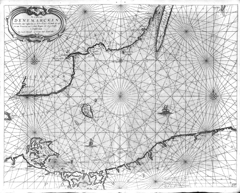
maps by pieter van der keere
ships on maps
carte de l'isle de ceylan by guillaume delisle (1722)
bibliothèque nationale de france
cartography
maps
1650s maps of the atlantic ocean
joan blaeu
boat
sea
cartography
maps
cartography
maps
admiralty charts region u: north america east coast
admiralty charts 201-400
admiralty charts region d: eastern north sea baltic norway iceland faroes svalbard
admiralty charts 3001-3400
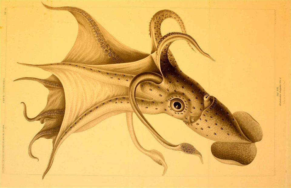
cephalopoda
ribes
cartography
maps
cartography
maps
admiralty charts 1801-2000
maps of tawi-tawi
admiralty charts 2401-2600
achill head
cartography
maps
cartography
maps
cartography
maps
whale
fish
cartography
maps
cartography
maps
cartography
maps
cartography
maps
cartography
maps
cartography
maps
cartography
maps
cartography
maps
cartography
maps
cartography
maps
admiralty charts region b: england wales ireland english channel southern north sea
admiralty charts 1401-1600
cartography
maps
cartography
maps
cartography
maps
cartography
maps
cartography
maps
travel
maps
travel
maps
cartography
maps
cartography
maps
cartography
maps
cartography
maps
cartography
maps
cartography
maps
cartography
maps
carte de barbarie, nigritie, guinée par guillaume delisle (1707)
bibliothèque nationale de france
maps by jean-baptiste bourguignon d'anville
1727 maps of africa
cartography
maps
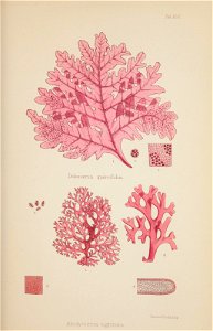
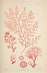
nautical
seaweed
nautical
ocean
prints by isaac cruikshank in the british museum
satirical prints in the british museum
admiralty charts region t: west indies and central america
admiralty charts 401-600
africa
maps
cartography
maps
201 - 300 of 420
Next page
/ 5