Log in
All resources
Create a design
57 Free Artworks of Maps With A Scale Of 1:100
maps in the library of congress
bibliothèque nationale de france
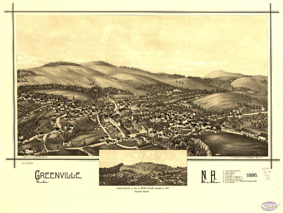
town maps by l. r. burleigh
l. r. burleigh
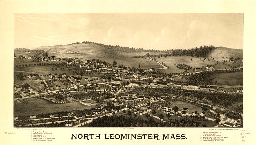
bird's eye view maps of massachusetts
bird's eye view maps of new york (state)
maps by claude joseph sauthier
claude joseph sauthier
maps of the course of the rhine by guillaume sanson
maps by jean-baptiste bourguignon d'anville
maps from the mechanical curator collection
000
history of antwerp
renaissance
maps in the library of congress
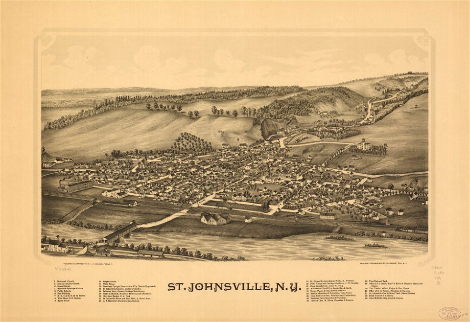
1888 maps of new york (state)
maps in the library of congress
1890 maps of new york (state)
maps in the library of congress
1889 maps of michigan
maps in the library of congress
1877 maps of the united states
maps in the library of congress
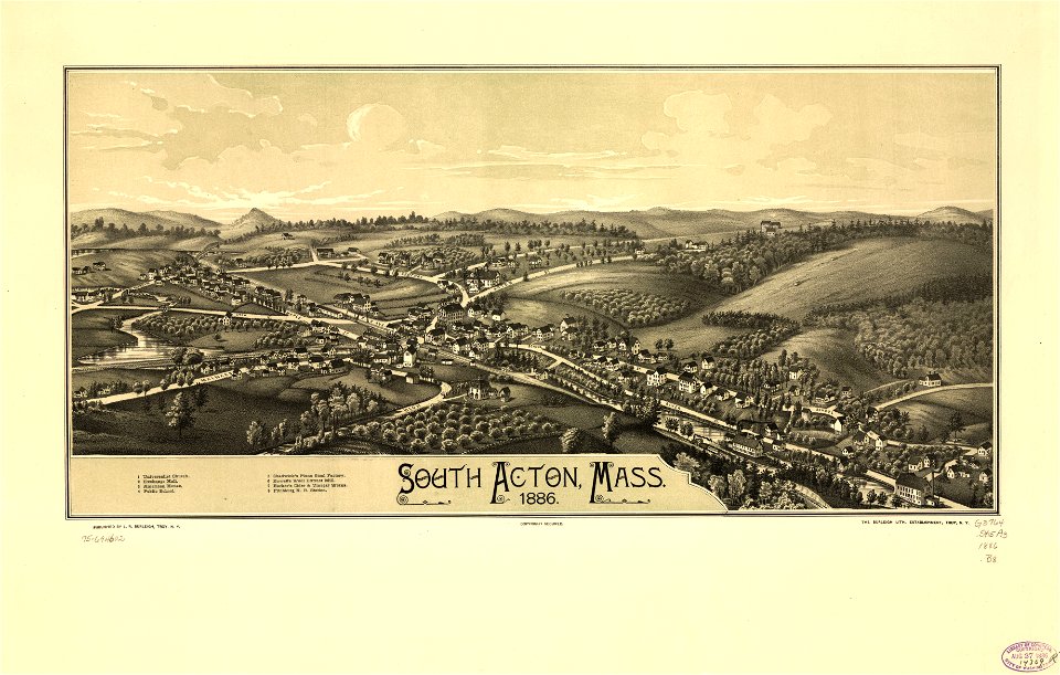
1887 maps of massachusetts
maps in the library of congress
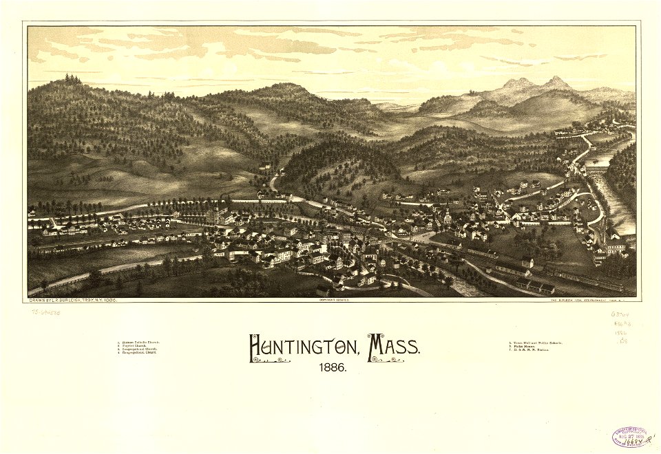
1886 maps of massachusetts
antoine-françois tardieu
pierre antoine tardieu
maps in the library of congress
1887 maps of massachusetts
maps in the library of congress
1880s maps of new hampshire
pierre antoine tardieu
maps from gallica
maps in the library of congress
1886 maps of massachusetts
maps in the library of congress
1887 maps of massachusetts
maps in the library of congress
1890 maps of new york (state)
maps in the library of congress
1886 maps of massachusetts
maps in the library of congress
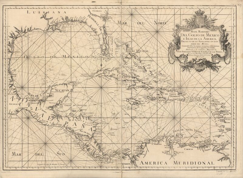
1750s maps of the caribbean
maps in the library of congress
1887 maps of new york (state)
maps of county armagh
1760s maps of ireland
maps of the course of the rhine by guillaume sanson
bibliothèque nationale de france
maps of the course of the rhine by guillaume sanson
maps by nicolas sanson
maps in the library of congress
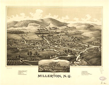
millerton, new york
maps in the library of congress
1886 maps of new hampshire
maps of the course of the rhine by guillaume sanson
bibliothèque nationale de france
maps in the library of congress
1747 maps of new jersey
1750s maps of california
1705 maps of california
a topographical map of the county of berks (1761)
bibliothèque nationale de france
a topographical map of the county of berks (1761)
bibliothèque nationale de france
maps from university of amsterdam special collections
atlas der neederlanden
maps from university of amsterdam special collections
atlas der neederlanden
maps from university of amsterdam special collections
atlas der neederlanden
maps in the library of congress
1773 maps of the united states
maps by jean-baptiste bourguignon d'anville
1727 maps of africa
maps in the library of congress
1760 maps of north america
maps in the library of congress
1718 maps of north america
maps in the library of congress
1777 maps of new york (state)
map of the circle of the rhineland by sanson
1670s maps of rhineland-palatinate
18th-century maps of western europe
1754 maps of europe
1762 maps of north america
maps by tomas lopez
van langren map of southeast asia
1595 maps of asia
maps in the library of congress
1776 maps
hendrik van langren map of south asia
1595 maps of asia
maps of the course of the rhine by guillaume sanson
maps by nicolas sanson
maps in the library of congress
1763 maps of north america
1750s maps of north america
solomon bolton
1630s maps of ethiopia
1635 maps of africa
maps in the library of congress
1752 maps of north america
maps of abyssinia by mercator-hondius
bibliothèque nationale de france
a plan of the operations of the king's army under the command of general sr. william howe, k.b. in new york and east new jersey, against the american forces commanded by general washington, from the 12th. of october, to the 28th. of november 1776
maps in the library of congress
maps in the library of congress
1776 maps of new jersey
a plan of the operations of the king's army under the command of general sr. william howe, k.b. in new york and east new jersey, against the american forces commanded by general washington, from the 12th. of october, to the 28th. of november 1776
maps in the library of congress
16th-century maps of le havre
ferrando bertelli
maps by willem and johannes blaeu
1640 maps of africa
maps in the library of congress
1777 maps of north america
17th-century maps of west africa
1650 maps of africa
potsdam in the 1770s
old maps of potsdam
maps by jean-baptiste bourguignon d'anville
1750s maps of the caribbean
1 - 57 of 57
/ 1


![Abla de Grace / [Ferrando Bertelli], Ferrando Bertelli, 1568](https://cdn.creazilla.com/illustrations/10001599324/abla-de-grace-ferrando-bertelli-ferrando-bertelli-1568-sm.jpg)


