Log in
All resources
Create a design
26,489 Free Artworks of Map
description de l'universe
alain manesson mallet
bibliothèque nationale de france
eran laor cartographic collection
latin-language maps
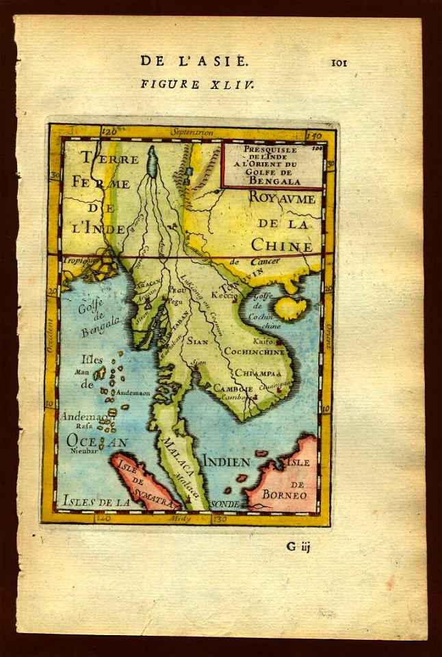
17th-century maps of southeast asia
maps by willem and johannes blaeu
paper
british museum
old maps of africa
description de l'universe
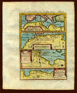
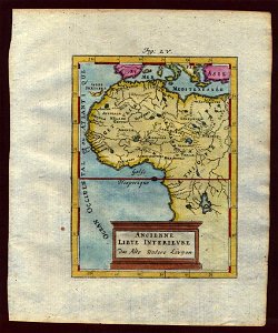
1683 maps of africa
description de l'universe
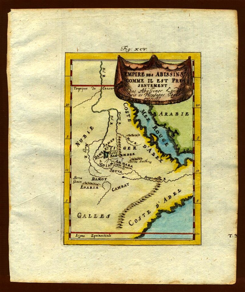
1680s maps of ethiopia
18th-century maps of southeast asia
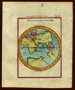
description de l'universe
description de l'universe
1710s maps of africa
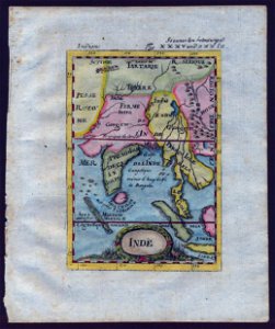
17th-century maps of southeast asia
description de l'universe
description de l'universe
old maps of africa
description de l'universe
1680s maps of africa
18th-century maps of southeast asia
description de l'universe
old maps of the eastern hemisphere
description de l'universe
description de l'universe
1719 maps of africa
description de l'universe
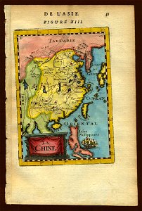
1680s maps of china
17th-century maps of southeast asia
description de l'universe
description de l'universe
1680s maps of africa
18th-century maps of southeast asia
description de l'universe
17th-century maps of southeast asia
description de l'universe
17th-century maps of southeast asia
description de l'universe
17th-century maps of southeast asia
description de l'universe
17th-century maps of southeast asia
description de l'universe
description de l'universe
old maps of africa
description de l'universe
1680s maps of africa
description de l'universe
old maps of africa
description de l'universe
old maps of iceland
description de l'universe
old maps of africa
maps of cambridge by braun & hogenberg
cambridge castle
old maps of ischia (island)
giulio jasolino
maps of the iberian peninsula by guillaume delisle
eran laor cartographic collection
history of the low countries
netherlands in the 1620s
atlas de jacoubet, bibliothèque historique de la ville de paris
proletarian literature
atlas vingboons
1665
17th-century maps of england and wales
maps by jodocus hondius
maps by matthäus merian
baroque
maps of the history of jerusalem
1830s maps showing history
old maps of auvergne
1660s maps of france
old maps of folegandros
old maps of sikinos
17th-century maps of southern africa
maps by willem and johannes blaeu
maps in the staats- und universitätsbibliothek hamburg
latin-language book pages
backs of postcards in curt teich postcard archives
postcards of muncie, indiana
eran laor cartographic collection
giovanni maria cassini
eran laor cartographic collection
richard william seale
eran laor cartographic collection
jan goeree
engravings by romeyn de hooghe
engravings by jan luyken
eran laor cartographic collection
jacob peeters
eran laor cartographic collection
giovanni maria cassini
eran laor cartographic collection
giovanni maria cassini
maps of görlitz by braun & hogenberg
eran laor cartographic collection
maps of gdańsk by braun & hogenberg
eran laor cartographic collection
grote of sint-bartholomeüskerk (schoonhoven)
old maps of schoonhoven
maps of algiers by braun & hogenberg
eran laor cartographic collection
maps from the earth and its inhabitants, vol. xiii
africa in the 1890s
corfu in the 16th century
1564 maps
illustrations from the english at the north pole by riou and montaut
orientalist painting
maps from the earth and its inhabitants, vol. xiii
africa in the 1890s
eran laor cartographic collection
latin-language maps
maps of paris from bibliothèque nationale de france
plan de roussel
maps of genoa by braun & hogenberg
maps in the british museum
maps of amsterdam by braun & hogenberg
eran laor cartographic collection
algiers in the 19th century
old maps of algiers
geographia universalis (1545) in the british museum
german renaissance,northern renaissance
geographia universalis (1545) in the british museum
german renaissance,northern renaissance
geographia universalis (1545) in the british museum
german renaissance,northern renaissance
old maps of yosemite valley
john e. weyss
maps in the rijksmuseum amsterdam
old maps of franeker
bibliothèque nationale de france
guillaume sanson
bibliothèque nationale de france
guillaume sanson
architecture by michelangelo buonarroti
high renaissance,renaissance painting
high renaissance,renaissance
a map of imola (rcin 912284)
place du panthéon on maps
rue soufflot (paris)
turgot map of paris – derivative files
hôtel d'armenonville
backs of postcards in curt teich postcard archives
1600 world map by girolamo porro
leonardo cernoti
maps of constantinople by braun & hogenberg
1570s maps of istanbul
maps from the earth and its inhabitants, vol. vii
1884 maps of taiwan
heresies of sea power (fred t. jane)
fred t. jane
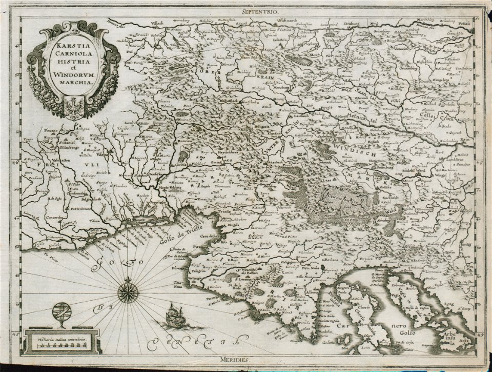
17th-century maps of slovenia
baroque
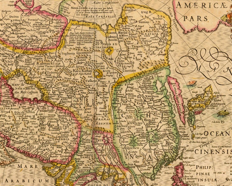
maps of asia by mercator-hondius
details of old maps
maps from the earth and its inhabitants, vol. xiii
africa in the 1890s
historical images of lucknow
edward weller
16th-century maps of amsterdam
amsterdam in the 1590s
historical images of lucknow
edward weller
historical images of lucknow
edward weller
historical images of lucknow
edward weller
bruxella nobilissima brabantiae civitas an° 1640
port of brussels
birdcraft (1903, macmillan company)
illustrations of birds
cartouches by sanson family
pierre mariette i
1780s maps of the americas
1787 maps
old maps of the republic of genoa
maps by willem and johannes blaeu
the british monarchy (1743)
maps in the british museum
1770s maps of the americas
1775 maps
maps in the library of congress
1770s maps showing history
maps of the history of franche-comté
18th-century maps of bourgogne
17th-century maps of crete
old maps of candia
maps of vangiones by sanson
1670s maps of hesse
topographischer atlas der schweiz
maps of glaciers of switzerland
carte de partie de lithuanie (north belarus, polazk) by nicolas sanson
cartouches by sanson family
sanborn fire insurance map from ashtabula, ashtabula county, ohio
1909 maps of ohio
topographischer atlas der schweiz
maps of glaciers of switzerland
maps of the holy land by mercator-hondius
maps in the library of congress
maps of wales by humphrey llwyd
theatrum orbis terrarum
crystal palace in sydenham
victorian architecture
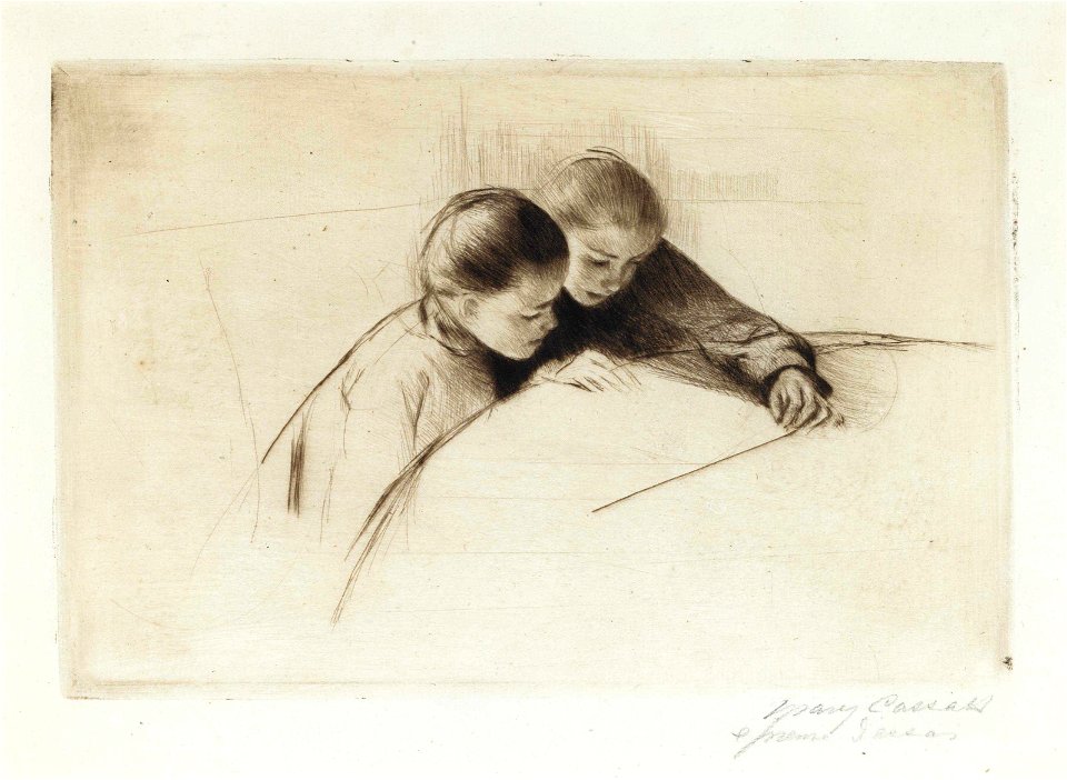
1890 works by mary cassatt
impressionism
9101 - 9200 of 26,489
Next page
/ 265