Log in
All resources
Create a design
26,489 Free Artworks of Map
maps from the earth and its inhabitants, vol. iv
maps from the earth and its inhabitants, vol. xiii
bibliothèque nationale de france
maps from the earth and its inhabitants, vol. vii
africa in the 1890s
people of africa in the 1990s
maps of africa
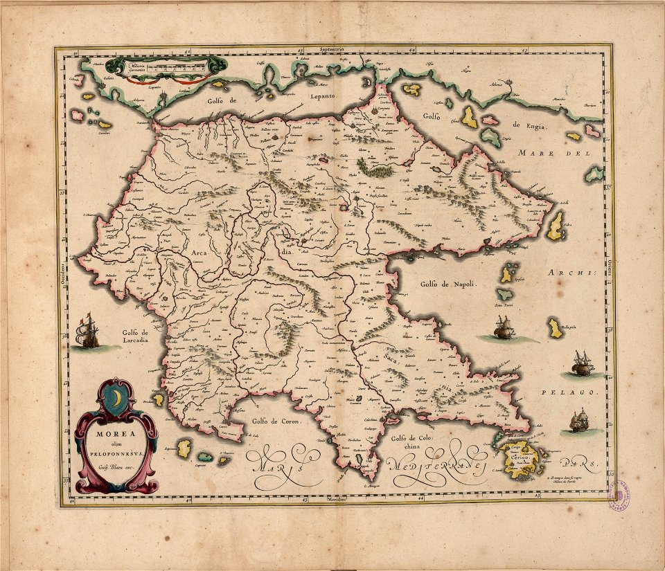
maps by willem and johannes blaeu
maps from the earth and its inhabitants, vol. xi
maps from the earth and its inhabitants, vol. xvi
africa and its inhabitants, vol. ii
charles eugène perron
maps from the earth and its inhabitants, vol. xiii
africa in the 1890s
diagrams of krkonoše mute signs
němé značky krkonoš
maps from the earth and its inhabitants, vol. xiii
africa in the 1890s
maps from the earth and its inhabitants, vol. xiii
africa in the 1890s
maps of arras by braun & hogenberg
maps of arras city walls
john rocque's 1746 map of london
marlborough house, london
maps of franeker by braun & hogenberg
maps by jacob van deventer
maps of bourgogne (duchy) by gerardus mercator
1630s maps of france
maps of milan by braun & hogenberg
baroque
atlas vingboons
1665
anteckning om krigshändelserna i kurland
maps of the great northern war
1860s maps of georgia (u.s. state)
maps in the library of congress
old maps of north holland
zaandam
maps of goa by linschoten
philippus baldaeus
maps in the library of congress
1877 maps of the united states
maps of rotterdam by braun & hogenberg
maps of delft by braun & hogenberg
17th-century maps of the strait of magellan
maps by jodocus hondius
old maps of whole wales (alone)
1640s maps of wales
map of the german empire by louis stanislas d'arcy de la rochette
cartouches by louis stanislas d'arcy de la rochette
map of the german empire by louis stanislas d'arcy de la rochette
cartouches by louis stanislas d'arcy de la rochette
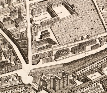
turgot map of paris – derivative files
musketeers of the guard
maps of oudenaarde city walls
old maps of oudenaarde
maps of cologne by braun & hogenberg
coats of arms from cologne
maps of utrecht (city) city walls
old maps of utrecht (city)
old maps of sas van gent
sassevaart
engravings of topographia palatinatus rheni
baroque
maps by giacomo gastaldi
cornelis de jode
maps by willem and johannes blaeu
copper engravings
bibliothèque municipale de reims, rès. g 152
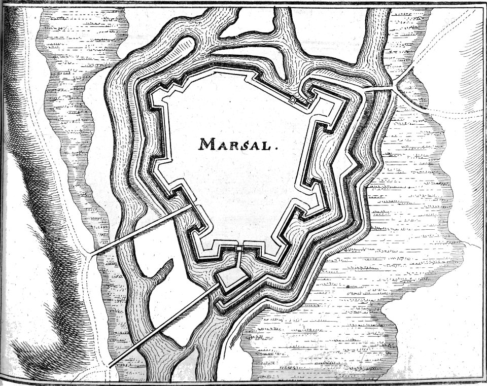
old maps of marsal
bibliothèque municipale de reims, rès. g 153
1656 maps
maps of liège by johannes blaeu - derivative files
abbaye du val des écoliers de liège
illustrations from the mysterious island by jules férat
maps of the mysterious island
17th-century celestial maps
bodleian maps collection
17th-century celestial maps
bodleian maps collection
bibliothèque municipale de reims, rès. g 153
old maps of berry
maps of bouchain city walls
old maps of bouchain
old maps of düsseldorf
zoopark düsseldorf
eran laor cartographic collection
giovanni maria cassini
gemeente atlas van nederland - south holland
maps of maasdam
17th-century maps of maastricht
siege of maastricht (1632)
1782 maps of the caribbean
maps by juan lopez
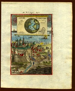
description de l'universe
1710s maps of the world
description de l'universe
geography in the 1680s
maps from géographie illustrée de la france et de ses colonies
maps of loiret
maps in the stadsarchief amsterdam
18th-century maps of amsterdam
maps from the earth and its inhabitants, vol. vii
19th-century maps of korea
maps from the earth and its inhabitants, vol. xiii
19th-century maps of namibia
maps from the earth and its inhabitants, vol. xv
19th-century maps of central america
maps from the earth and its inhabitants, vol. iv
portskewett
maps from the earth and its inhabitants, vol. iii
maps of the sava watercourse system
maps from the earth and its inhabitants, vol. xi
roads in tunisia
maps from the earth and its inhabitants, vol. xi
maps indicating exploration
maps from the earth and its inhabitants, vol. xvi
ethnographic maps of north america
maps from the earth and its inhabitants, vol. xvi
19th-century maps of jamaica
maps from the earth and its inhabitants, vol. iv
charts of plymouth sound
maps from the earth and its inhabitants, vol. iv
queensferry crossing
1870s maps of venezuela
1878 in venezuela
maps from the earth and its inhabitants, vol. vi
topographic maps of asia
maps from the earth and its inhabitants, vol. xvii
old maps of washington, d.c.
maps from the earth and its inhabitants, vol. iv
firth of inverness
maps from the earth and its inhabitants, vol. iv
romney marsh
maps from the earth and its inhabitants, vol. iv
maps of dumbartonshire
maps from the earth and its inhabitants, vol. vi
topographic maps of asia
maps from the earth and its inhabitants, vol. vii
provinces of japan
maps of the districts of the canton of bern
biel/bienne (administrative district)
maps from the earth and its inhabitants, vol. xi
oases of libya
maps from the earth and its inhabitants, vol. xiv
maps of voyages
maps from the earth and its inhabitants, vol. xvii
linguistic maps of north america
novi belgii, atlas maior
maps of new england
maps from the earth and its inhabitants, vol. iv
19th-century double hemisphere world maps
maps from the earth and its inhabitants, vol. iv
peterborough
rivers of the western cape
maps of the western cape
maps from the earth and its inhabitants, vol. xiii
1878 maps of africa
maps from the earth and its inhabitants, vol. vii
linguistic maps of chinese languages
maps from the earth and its inhabitants, vol. iv
19th-century maps of derbyshire
maps from the earth and its inhabitants, vol. iv
cirencester
maps of rivers of south sudan
sobat river
maps from the earth and its inhabitants, vol. x
khedivate of egypt
maps from the earth and its inhabitants, vol. iv
huddersfield
maps from the earth and its inhabitants, vol. v
maps of the north atlantic
maps from the earth and its inhabitants, vol. xiii
19th-century maps of madagascar
lawrence h. slaughter collection of english maps, charts, globes, books and atlases
de nieuwe en onbekende weereld
maps from the earth and its inhabitants, vol. iv
milford haven
maps from the earth and its inhabitants, vol. iv
rhins of galloway
maps from the earth and its inhabitants, vol. x
john hanning speke
maps from the earth and its inhabitants, vol. iv
sewers in london
maps from the earth and its inhabitants, vol. xvi
19th-century maps of mexico city
maps from the earth and its inhabitants, vol. xiii
old maps of luanda
maps from the earth and its inhabitants, vol. iv
eddystone rocks, devon
maps from the earth and its inhabitants, vol. xiv
exploration of australia
maps from the earth and its inhabitants, vol. v
ringkjøbing
maps from the earth and its inhabitants, vol. vi
maps of kerch
maps from the earth and its inhabitants, vol. xviii
south america in the 19th century
maps from the earth and its inhabitants, vol. iv
lowestoft
maps from the earth and its inhabitants, vol. xiii
maps of journeys
maps from the earth and its inhabitants, vol. vii
charles eugène perron
mining in south africa
maps of vaal river
maps from the earth and its inhabitants, vol. iv
snaith
maps from the earth and its inhabitants, vol. xvii
linguistic maps of north america
7001 - 7100 of 26,489
Next page
/ 265