Log in
All resources
Create a design
78 Free Artworks of 18th Century Maps Of Spain
bibliothèque nationale de france
maps of spain by tomas lopez
18th-century maps of andalusia
18th-century maps of the canary islands
1761 maps of spain
1761 in andalusia
1780 maps of spain
maps in the rijksmuseum amsterdam
maps by tomas lopez
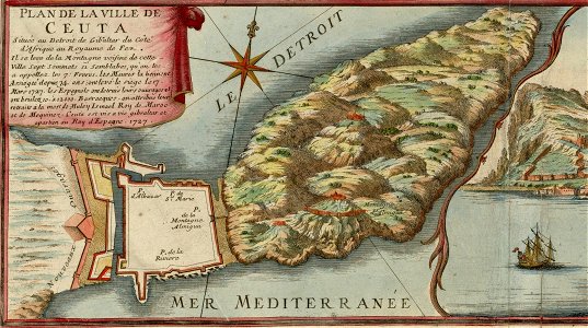
old maps of the strait of gibraltar
18th-century maps of gibraltar
spain in the 1750s
18th-century maps of puerto rico
18th-century maps of cuba
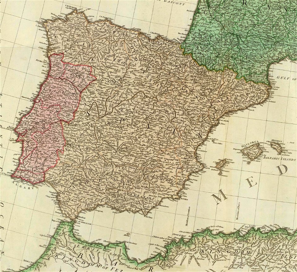
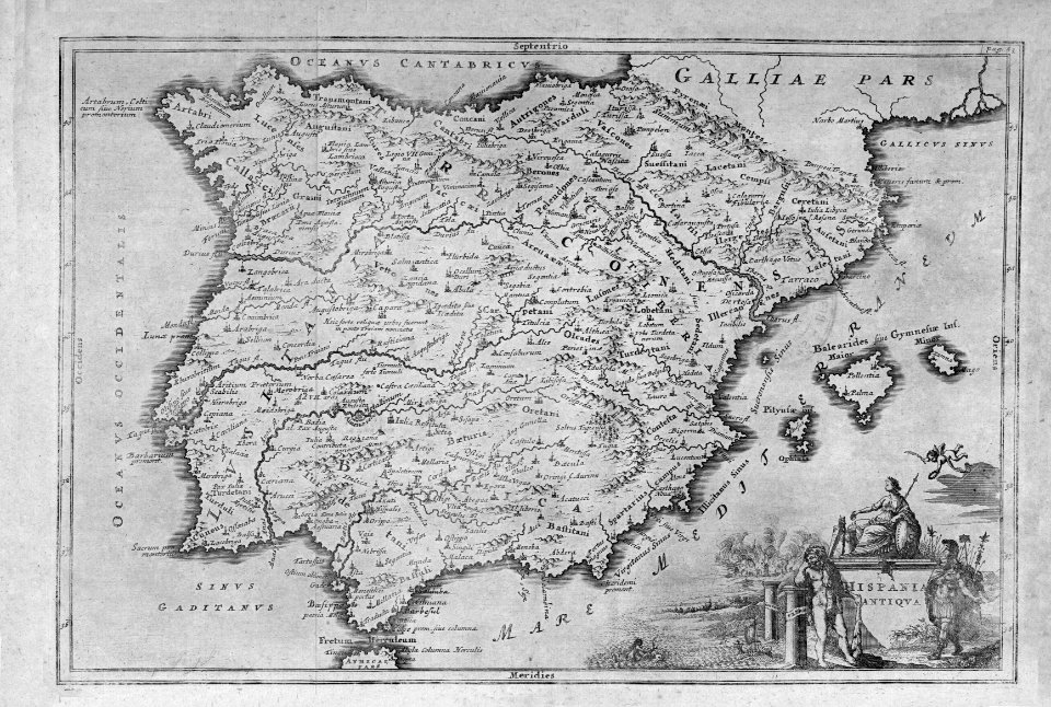
old maps of the iberian peninsula
1780s maps of spain
spain in the 1720s
nicolas de fer
maps made in the 18th century
johann baptist homann
spanish empire
madrid
preparatory portrait studies
1786 oil on canvas paintings
portrait paintings of sitting men with legs crossed
inkwells in art
antonio carnicero
rococo
maps of spain by tomas lopez
history of el bierzo
old maps of seville
1788 maps of spain
old maps of the bay of gibraltar
18th-century maps of gibraltar
old maps of seville
1788 maps
andalusia in the 18th century
los palacios y villafranca
carta hydrographica y chorographica de las yslas filipinas
baroque painting
portrait paintings of charles iv of spain
genaro boltri
18th-century maps of the canary islands
maps of spain by tomas lopez
18th-century maps of the canary islands
maps of spain by tomas lopez
18th-century maps of the canary islands
maps of spain by tomas lopez
maps of spain by tomas lopez
1779 maps of spain
maps of spain by tomas lopez
old maps of lanzarote
maps of spain by tomas lopez
1761 maps of spain
atlas geographico del reyno de españa e islas adjacentes (1757)
1757 maps of spain
maps of spain by tomas lopez
1780 maps of spain
maps of spain by tomas lopez
1780 maps of spain
old maps of the strait of gibraltar
1762 maps of spain
18th-century maps of the iberian peninsula
maps in the rijksmuseum amsterdam
la rioja (spain) in the 18th century
old maps of la rioja (spain)
maps of spain by tomas lopez
1773 maps of spain
maps of spain by tomas lopez
1773 maps of spain
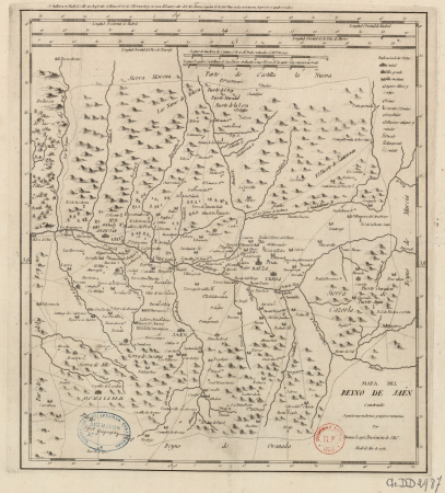
maps of the kingdom of jaén (crown of castile)
maps of spain by tomas lopez
maps of the kingdom of córdoba (crown of castile)
maps of spain by tomas lopez
maps of spain by tomas lopez
old maps of gran canaria
old maps of the bay of gibraltar
18th-century maps of gibraltar
maps of the kingdom of seville
maps of spain by tomas lopez
maps of the kingdom of córdoba (crown of castile)
maps of spain by tomas lopez
maps of the kingdom of seville
maps of spain by tomas lopez
maps of the kingdom of seville
maps of spain by tomas lopez
maps of the kingdom of seville
maps of spain by tomas lopez
maps of the basque autonomous community
1770 maps of spain
nieuwe en beknopte hand-atlas (1754)
old maps of the strait of gibraltar
maps of the kingdom of córdoba (crown of castile)
maps of spain by tomas lopez
maps of spain by tomas lopez
1761 maps of spain
maps of spain by tomas lopez
1761 maps of spain
mapa del principado de cataluña (1776)
18th-century maps of catalonia
18th-century maps of catalonia
daniel de la feuille
atlas géographique des quatre parties du monde (delisle)
18th-century maps of the iberian peninsula
maps of the world with orthographic projection
maps of the world without antarctica
vigo in the 18th century
1702 maps of spain
1780s maps of portugal
maps by tomas lopez
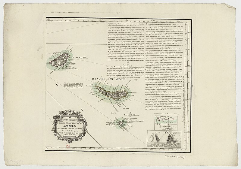
18th-century maps of the azores
1780s maps of portugal
prints by jan luyken in the rijksmuseum amsterdam
maps in the rijksmuseum amsterdam
maps of spain by tomas lopez
18th-century maps of madrid
maps of the history of morocco
empire of morocco
cartography
maps
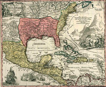
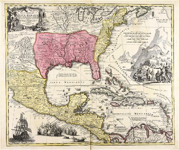
18th-century maps of central america
1760s maps of the caribbean
cartography
maps
18th-century maps of gibraltar
maps by tomas lopez
maps by jean-baptiste bourguignon d'anville
18th-century maps of western europe
atlas geographico del reyno de españa e islas adjacentes (1757)
18th-century maps of madrid
maps published by hendrik de leth
algiers in the 18th century
old maps of the strait of gibraltar
hendrik de leth
atlas geographico del reyno de españa e islas adjacentes (1757)
18th-century maps of andalusia
atlas geographico del reyno de españa e islas adjacentes (1757)
18th-century maps of catalonia
18th-century maps of the british isles
armada tapestries
18th-century maps of the british isles
armada tapestries
18th-century maps of western europe
1754 maps of europe
18th-century maps of the iberian peninsula
maps in the rijksmuseum amsterdam
old maps of the strait of gibraltar
hendrik de leth
daniel de la feuille
1708 maps
1760s maps of the americas
jean janvier
1779 maps of the united states
1770s maps of the caribbean
old maps of the strait of gibraltar
maps in the rijksmuseum amsterdam
maps in the rijksmuseum amsterdam
old maps of algeria
viage á constantinopla, en el año de 1784 (1790)
18th-century maps of malta
1740s maps of the americas
1747 maps of north america
etchings in the rijksmuseum amsterdam
maps in the rijksmuseum amsterdam
de nieuwe groote lichtende zee-fakkel (rijksmuseum)
prints by jan luyken in the rijksmuseum amsterdam
1 - 78 of 78
/ 1