Log in
All resources
Create a design
49 Free Artworks of 1871 Maps
maps in the library of congress
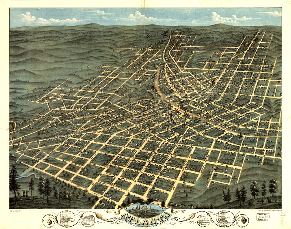
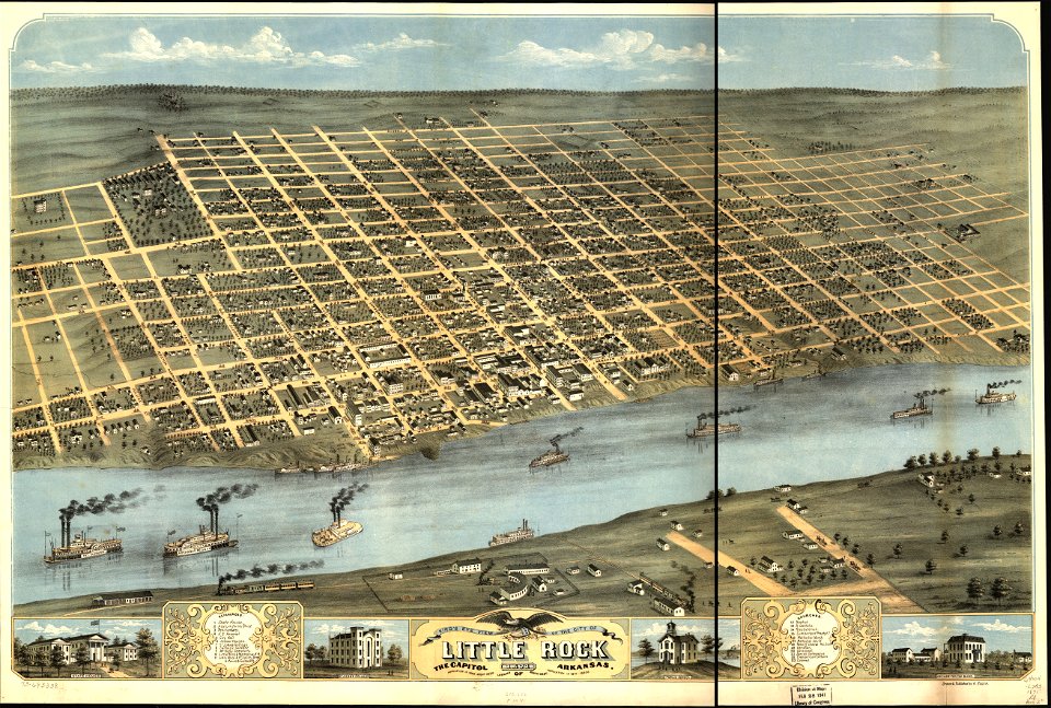
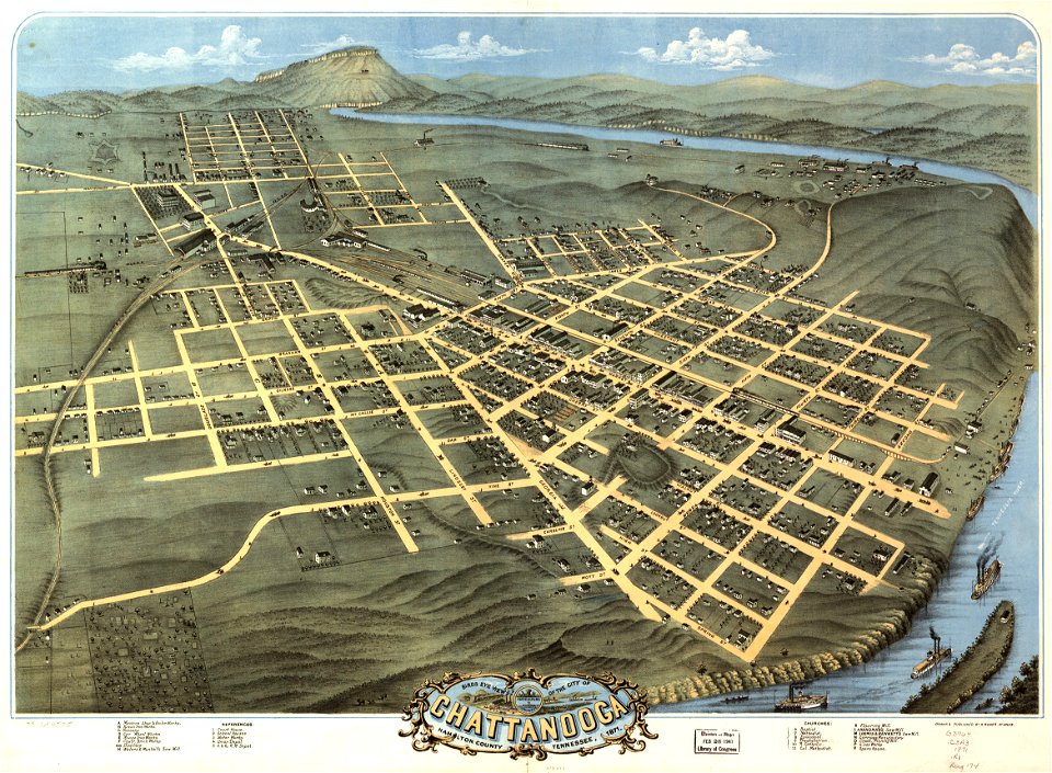
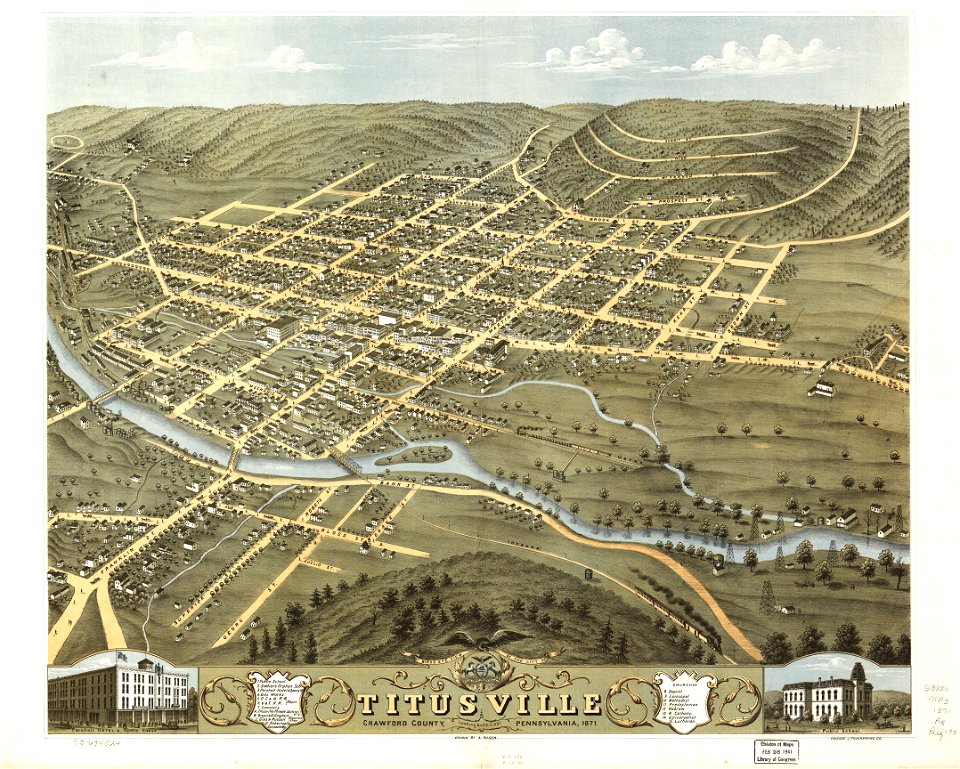
albert ruger
jacob kuyper
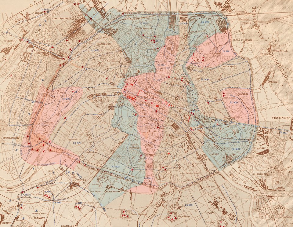
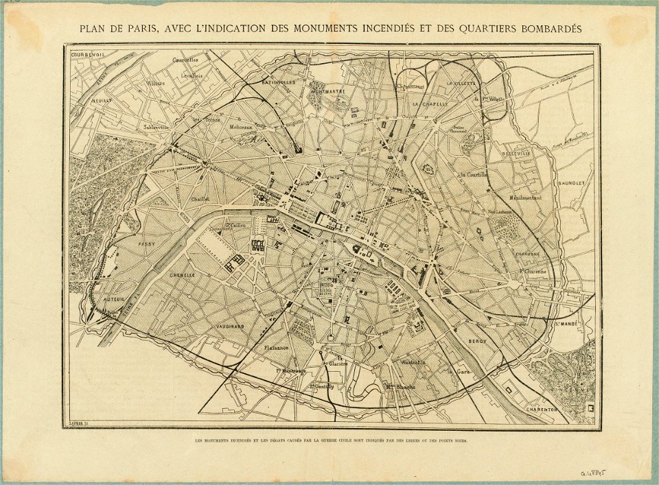
1871 in paris
locator maps of the harbour of rotterdam
gemeente atlas van nederland - south holland
details of old maps, defaced
details of old maps of the netherlands
old maps of fortifications in paris
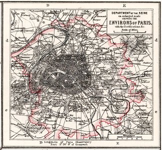
maps of paris in the 1870s
maps of paris from the norman b. leventhal map center
siege of paris, 1870-1871
maps of paris in the 1870s
1871 in paris
maps in the library of congress
albert ruger
maps in the library of congress
albert ruger
maps in the library of congress
albert ruger
maps in the library of congress
albert ruger
maps in the library of congress
old maps of pennsylvania
maps in the library of congress
old maps of pennsylvania
maps in the library of congress
albert ruger
maps in the library of congress
albert ruger
maps in the library of congress
albert ruger
maps of paris in the 1870s
1871 in paris
maps in the library of congress
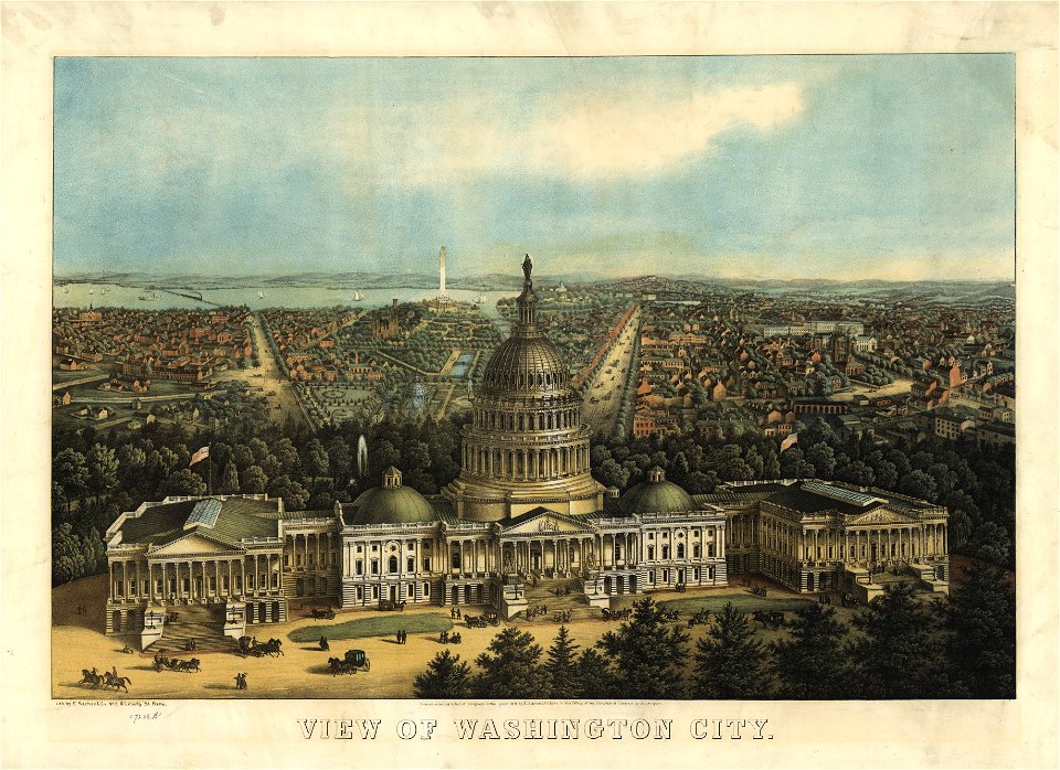
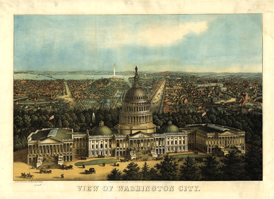
united states capitol in art
maps in the library of congress
united states capitol in art
maps showing 19th-century history
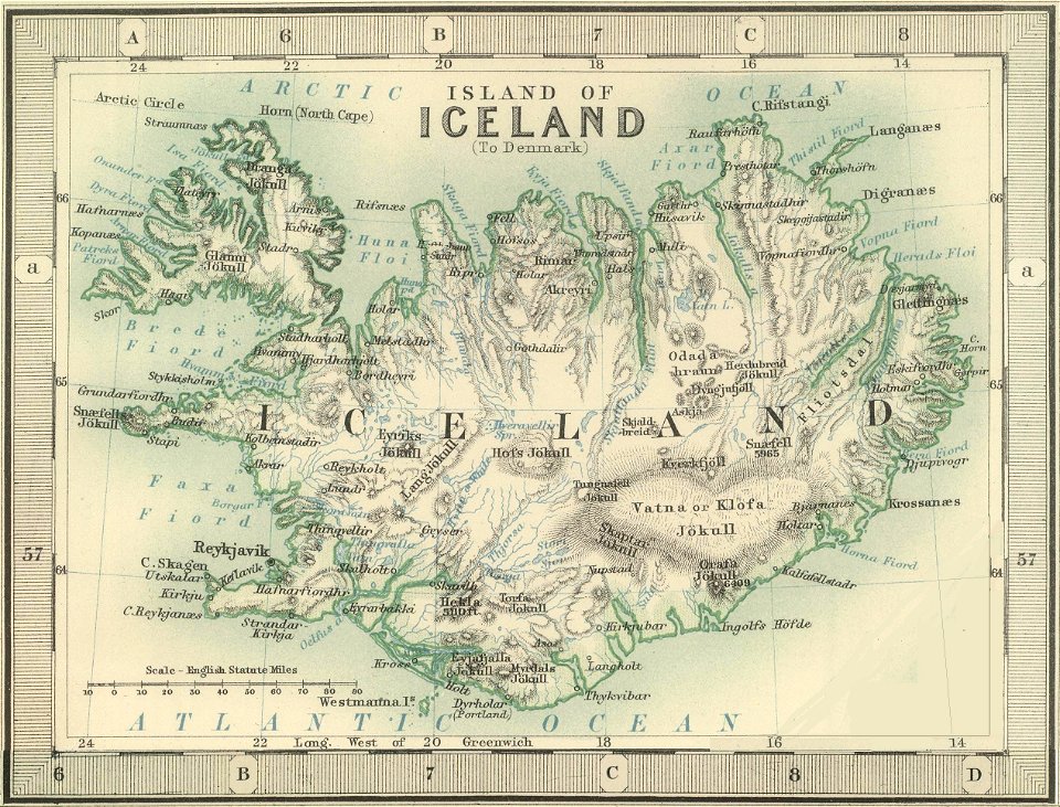
old maps of iceland
1900s maps of paris
1906 in paris
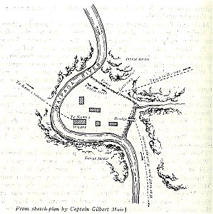
military history of new zealand
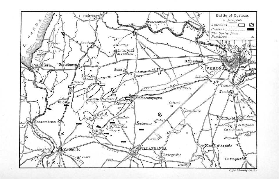
maps of battles
printing
1848
maps from the mechanical curator collection available to georeference
maps from the mechanical curator collection
maps in the biblioteca nacional do brasil
joinville
printing
1863
locator maps of the harbour of rotterdam
glashaven (canal in rotterdam)
everett d. graff collection of western americana
maps by g. w. & c. b. colton & co.
senefelderstraße 45 (stuttgart)
theodor von landauer
chicago and the midwest, newberry library
great chicago fire of 1871
chicago and the midwest, newberry library
great chicago fire of 1871
offizieller katalog der münchener jahres-ausstellung 1896 im kgl. glaspalast
moritz von schwind
locator maps of the harbour of rotterdam
maps of scheepvaartkwartier
locator maps of the harbour of rotterdam
zalmhaven (rotterdam)
eran laor cartographic collection
english-language maps
maps of novaya zemlya
1590s maps
the gazetteer of scotland (1838)
william home lizars
old maps of the franco-prussian war
alfred quesnay de beaurepaire
science
maps
1870s maps of berlin
1871 in berlin
the gazetteer of scotland (1838)
edinburgh in art
history of the american civil war (1871)
battle of hampton roads
history of the american civil war (1871)
battle of hampton roads
gemeente atlas van nederland - groningen
old maps of delfzijl
landscape
maps
paintings by nicolaas pieneman in the rijksmuseum amsterdam
jan jacob rochussen
schetsboek met 98 bladen, by johannes tavenraat
manuscripts in the rijksmuseum amsterdam
prison de la roquette
old maps of paris
across the sub-arctics of canada, a journey of 3,200 miles by canoe and snow shoe through the hudson bay region (1908)
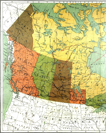
old maps of canada
1910s maps of south america
the birds of south america
birds-eye view of seattle, 1884
lithograph
across the sub-arctics of canada, a journey of 3,200 miles by canoe and snow shoe through the hudson bay region (1908)
arthur heming
maps of the captaincy general of cuba
maps of the history of florida
old maps of the viceroyalty of new spain
the spanish borderlands
1 - 49 of 49
/ 1