Log in
All resources
Create a design
17 Free Images of Old Maps Of Mauritius
atlas - voyage pittoresque à l'île-de-france, au cap de bonne-espérance et à l'île de ténériffe (1812) by milbert
maps from the mechanical curator collection
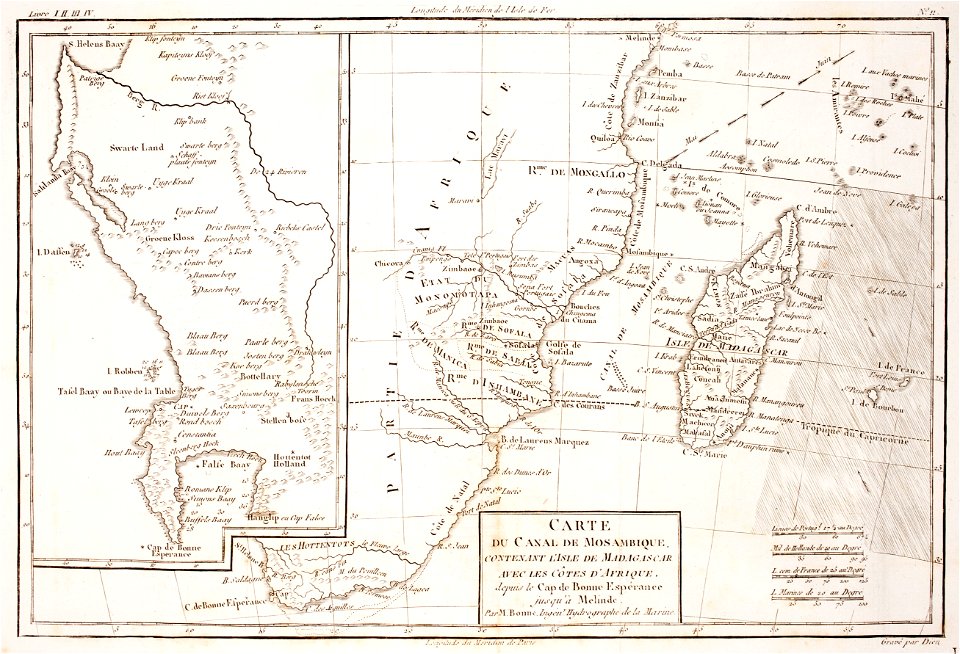
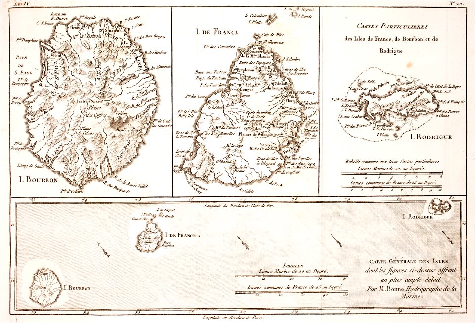
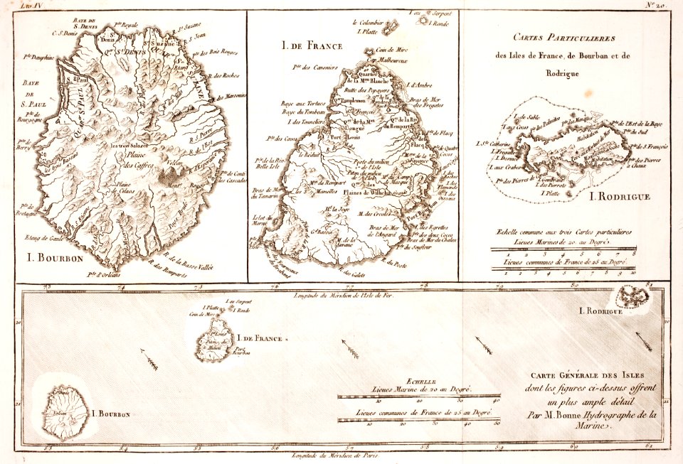
prints from bonne atlas de toutes les parties at the peace palace library
maps of rodrigues island
1812 maps of africa
maps of the comoros
maps of mauritius island
maps of réunion
maps of the cape peninsula
old maps of south africa
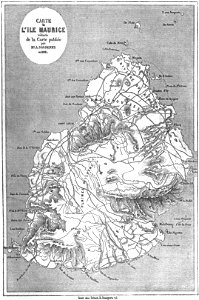
old maps of mauritius
robert surcouf
prints from bonne atlas de toutes les parties at the peace palace library
maps of the comoros
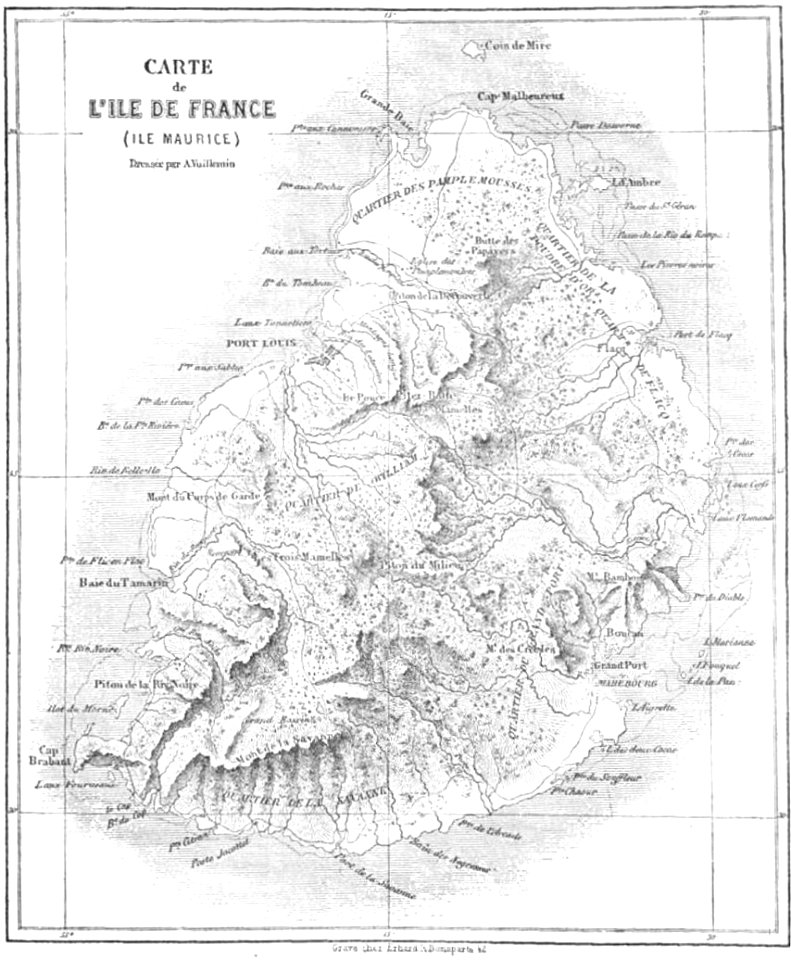
maps by alexandre vuillemin
old maps of mauritius
maps of the west-indische compagnie
1665
volume 7 of le tour du monde
old maps of mauritius
prints from bonne atlas de toutes les parties at the peace palace library
maps of rodrigues island
atlas - voyage pittoresque à l'île-de-france, au cap de bonne-espérance et à l'île de ténériffe (1812) by milbert
maps from the mechanical curator collection
maps from the mechanical curator collection available to georeference
maps from the mechanical curator collection
atlas - voyage pittoresque à l'île-de-france, au cap de bonne-espérance et à l'île de ténériffe (1812) by milbert
maps from the mechanical curator collection
atlas - voyage pittoresque à l'île-de-france, au cap de bonne-espérance et à l'île de ténériffe (1812) by milbert
maps from the mechanical curator collection
atlas - voyage pittoresque à l'île-de-france, au cap de bonne-espérance et à l'île de ténériffe (1812) by milbert
maps from the mechanical curator collection
atlas - voyage pittoresque à l'île-de-france, au cap de bonne-espérance et à l'île de ténériffe (1812) by milbert
maps from the mechanical curator collection
maps of rodrigues island
old maps of mauritius
maps from the earth and its inhabitants, vol. xiv
old maps of mauritius
historical
history
historical
history
prints by claes jansz. visscher (ii) in the rijksmuseum amsterdam
siege of breda 1624-1625
1 - 17 of 17
/ 1