Log in
All resources
Create a design
17 Free Images of Old Maps Of Kent
old county maps of kent
maps from the earth and its inhabitants, vol. iv
18th-century maps of kent
old maps of dover, kent
19th-century maps of kent
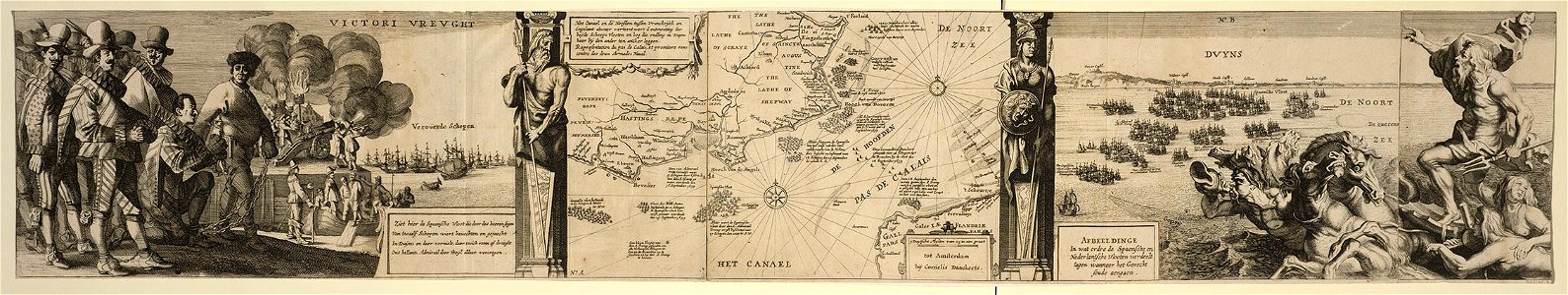
cornelis danckerts (i)
battle of the downs
prints in the royal collection of the united kingdom
the antiquities of england and wales (1773)
paper
cornelis danckerts (i)
battle of the downs
maps made in the 17th century
gerard valck
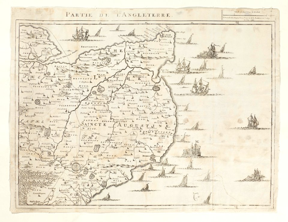
sutton
kent
cornelis danckerts (i)
battle of the downs
maps in the royal collection of the united kingdom
1746
maps in skokloster castle
old maps of kent
atlas maior, vol 5 (england) - joan blaeu, 1667 - bl 114.h(star).5
17th-century maps of kent
18th-century maps of kent
old county maps of kent
chorographia britanniae (1741-1742)
18th-century maps of kent
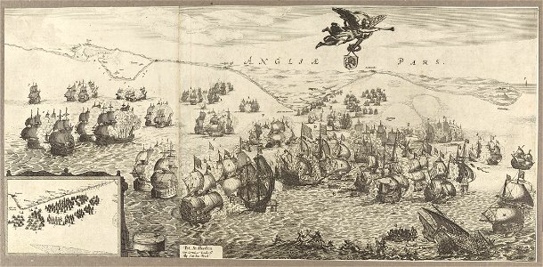
frans hogenberg
spanish armada
the antiquities of england and wales (1773)
1784 fleurons
the british monarchy (1743)
maps in the british museum
maps from the earth and its inhabitants, vol. iv
old maps of dover, kent
maps from the earth and its inhabitants, vol. iv
19th-century maps of kent
expeditionis hispanorum in angliam vera descriptio anno domini mdlxxxviii
maps of the spanish armada
maps from the earth and its inhabitants, vol. iv
old maps of hastings, england
maps from the earth and its inhabitants, vol. iv
old maps of hastings, england
1 - 17 of 17
/ 1