Log in
All resources
Create a design
9 Free Images of Old Maps Of Brooklyn, New York City
brooklyn bridge – city hall (irt lexington avenue line)
city hall (irt lexington avenue line)
old maps of the new york city subway
rail track loops
rail track diagrams
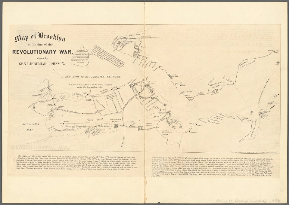
battle of long island
manual of the corporation of the city of new york (1858)
maps from valentine's manual
old maps of lower manhattan
george hayward
manual of the corporation of the city of new york (1858)
battle of long island
brooklyn bridge – city hall (irt lexington avenue line)
city hall (irt lexington avenue line)
manual of the corporation of the city of new york (1858)
battle of long island
old maps of manhattan, new york city
jasper danckaerts
old maps of manhattan, new york city
croton aqueduct
brooklyn bridge – city hall (irt lexington avenue line)
the street railway journal (1904)
maps in the library of congress
1850 maps of new york (state)
brooklyn bridge – city hall (irt lexington avenue line)
city hall (irt lexington avenue line)
old maps of brooklyn, new york city
john douglas woodward
1 - 9 of 9
/ 1