Log in
All resources
Create a design
83 Free Images of Maps Of Pomerania
history
historical
old maps of pomerania province
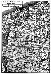
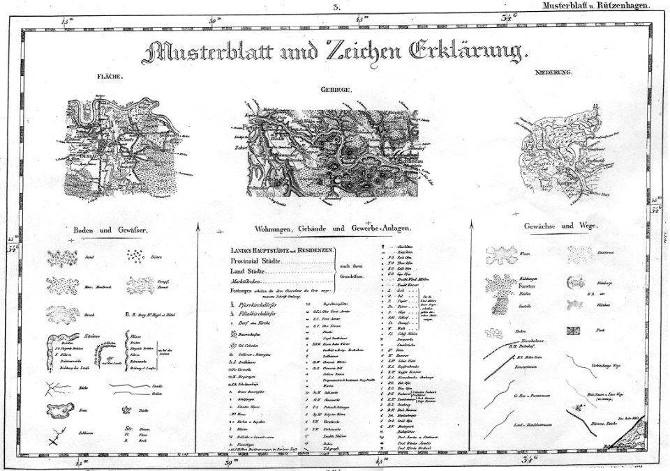
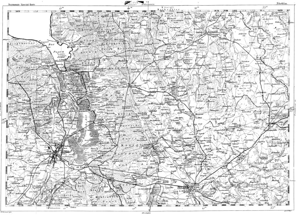
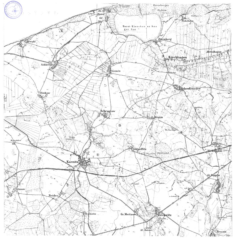
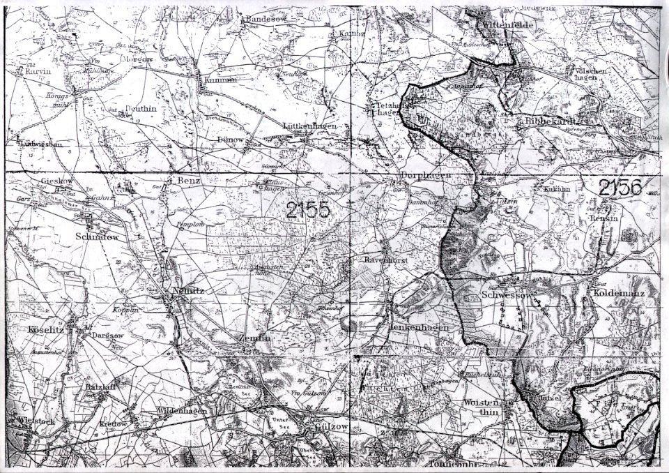
messtischblatt
old maps of pomerania
reymann maps
maps of west pomeranian voivodeship
pages with maps
cc-zero
cuisine of kashubia and pomerania
maps with cartouches
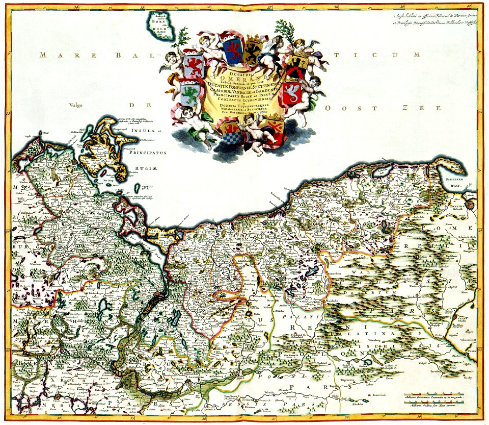
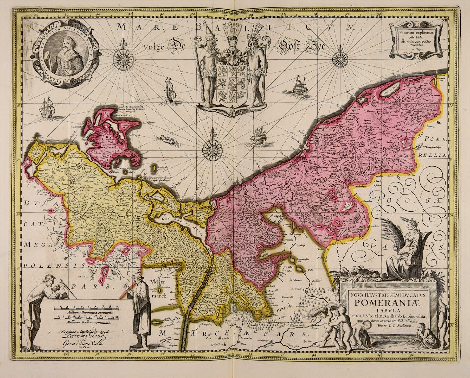
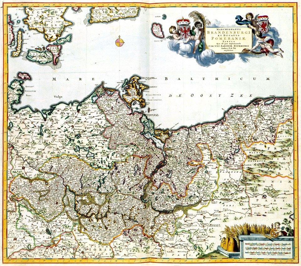
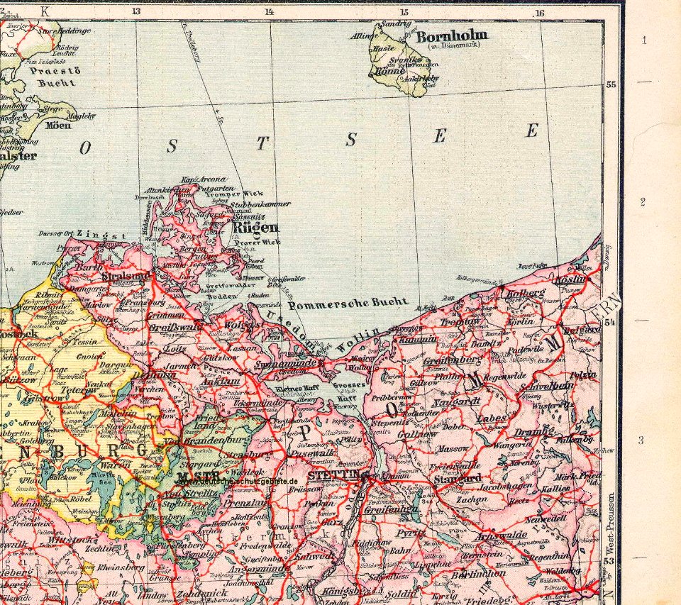
pomerania
maps made in the 17th century
gerard valck
western pomerania
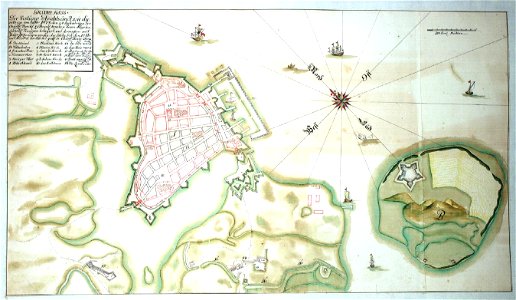
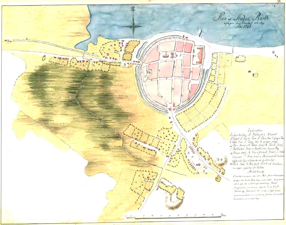
maps of stralsund
old maps of pomerania province
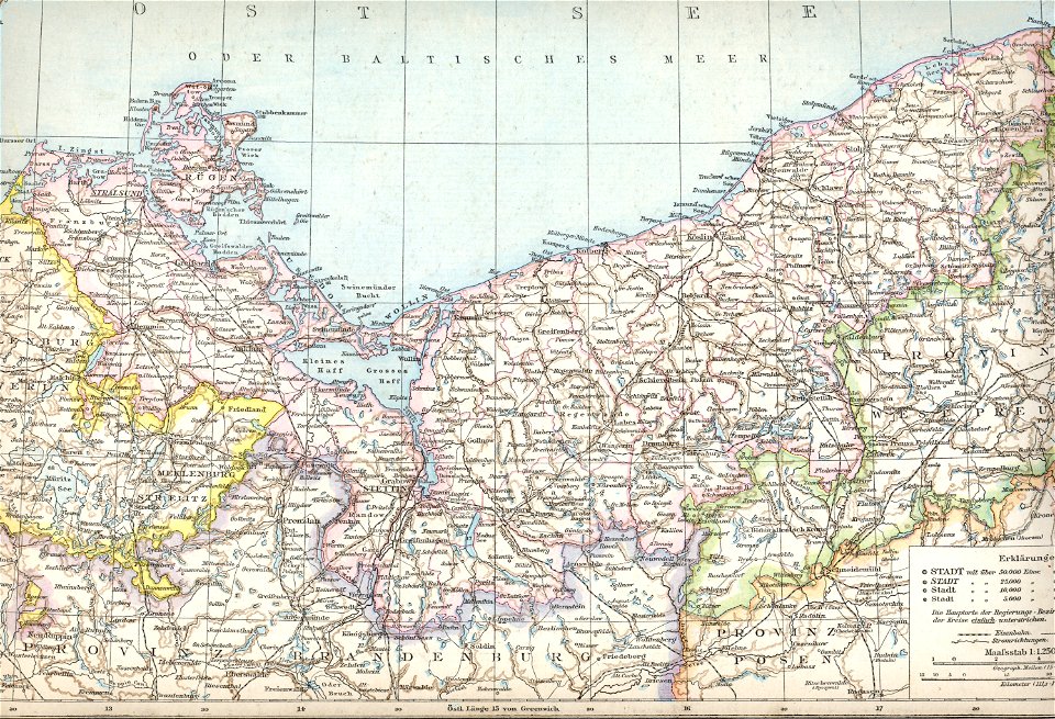
1880 maps
old maps of pomerania
maps with cartouches
17th-century maps of pomerania
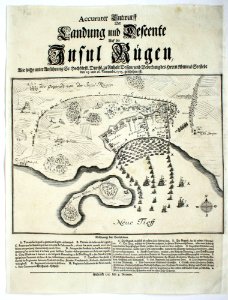
old maps of rügen
old maps of pomerania
history of barth
old maps of pomerania
rudens
media contributed by agad presented in former polska.pl portal
old maps of pomerania
uploaded with vicuñauploader
pages with maps
maps in skokloster castle
erik lernestål
maps in skokloster castle
engraved maps
maps in skokloster castle
erik lernestål
self-published work
pages with maps
waffle
food
waffle
food
self-published work
pages with maps
plate
food
old maps of rügen
prussian columns
plate
food
whipped cream
waffle
17th-century maps of pomerania
old maps of rügen
17th-century maps of pomerania
coats of arms on maps
17th-century maps of pomerania
coats of arms on maps
daniel friedrich sotzmann
old maps of pomerania
maps of barth by braun & hogenberg
duchy of pomerania
old maps of western pomerania
coats of arms on maps
maps of the history of denmark
old maps of scandinavia
maps by john cary
1801 maps
nicolaes visscher ii
maps from gallica
maps by john cary
1799 maps
coats of arms on maps
atlas novus (blaeu)
grenzkarte der preussischen, russischen und oestreichischen monarchien (1796)
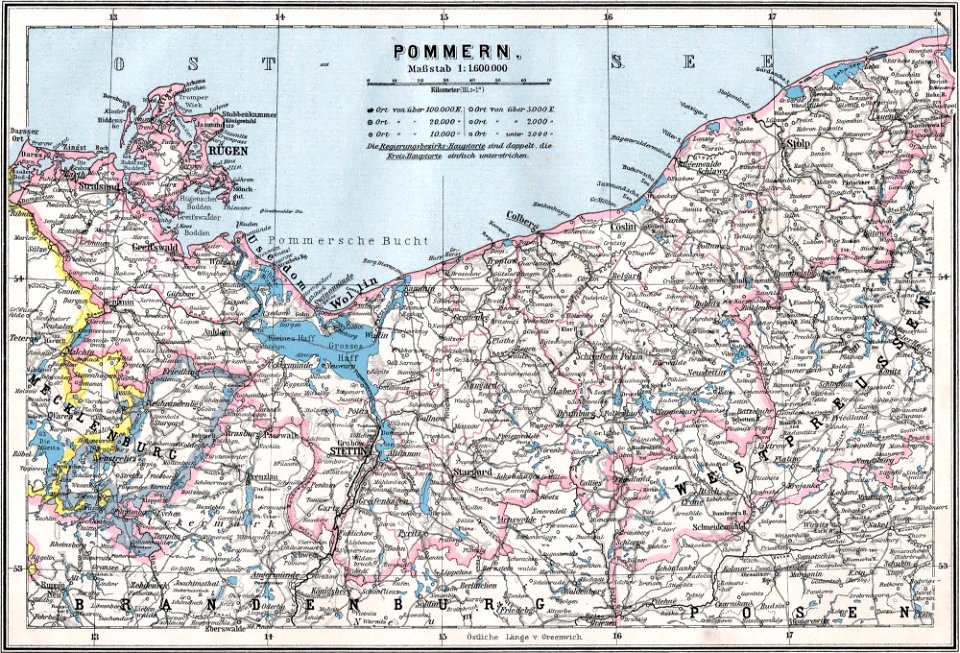
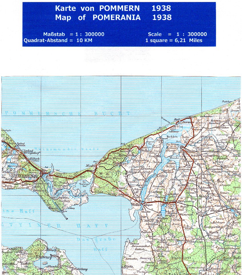
maps of pomerania province
atlas maior, vol 3 (germany) - joan blaeu, 1667 - bl 114.h(star).3
copper engraving print
historical
history
historical
history
historical
history
cartography
maps
historical
history
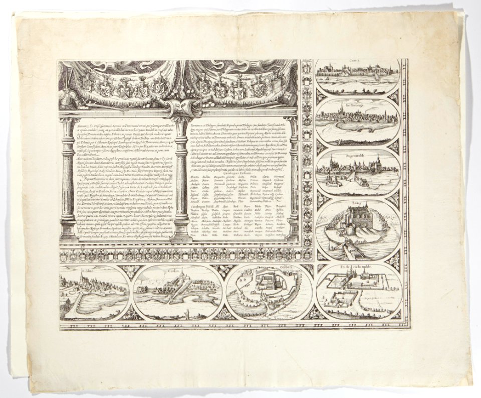
greifswald in the 17th century
old maps of greifswald
historical
history
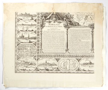
sanson maps of the circles of germany
bibliothèque nationale de france
historical
history
historical
history
historical
history
historical
history
sanson maps of the circles of germany
bibliothèque nationale de france
historical
history
historical
history
historical
history
historical
history
historical
history
géographie générale; physique, politique et économique (1876)
19th-century maps of pomerania
historical
history
1801 maps of germany
maps by john cary
festung berlin
baroque
maps of brandenburg and pomerania by gerardus mercator
atlas sive cosmographicae (gerardus mercator, 1623)
historical
history
1800s maps of denmark
1801 maps of europe
historical
history
maps of brandenburg and pomerania by gerardus mercator
atlas sive cosmographicae (gerardus mercator, 1630)
historical
history
historical
history
historical
history
historical
history
historical
history
historical
history
historical
history
historical
history
historical
history
historical
history
historical
history
le duché de poméranie compris sous le cercle de la haute-saxe divisé suivant qu'il est présentement partagé entre la couronne de suède et l'eslecteur de brandebourg, où sont les duchés de... - btv1b53202543b
sanson maps of the circles of germany
historical
history
historical
history
historical
history
historical
history
historical
history
historical
history
atlas ou representation du monde universel t. 2 (1633)
nicolaes visscher i
david rumsey historical map collection
old maps of the holy roman empire
david rumsey historical map collection
1794 maps of the holy roman empire
david rumsey historical map collection
1790s maps of the holy roman empire
1 - 83 of 83
/ 1


![Gerardi Mercatoris and I. Hondii Atlas or Representation of the Universal World, and of the Parts of It, Made in Tables and Very Ample Descriptions. [t. 2]., Nicolaes Visscher](https://cdn.creazilla.com/illustrations/10000298847/gerardi-mercatoris-and-i-hondii-atlas-or-representation-of-the-universal-world-and-of-the-parts-of-it-made-in-tables-and-very-ample-descriptions-t-2-nicolaes-visscher-sm.webp)


