Log in
All resources
Create a design
1,027 Free Images of Chart
frederick william beechey
bibliothèque nationale de france
maps by frederick william beechey
a new chart of the gulf of st. laurence (1790)
le neptune francois
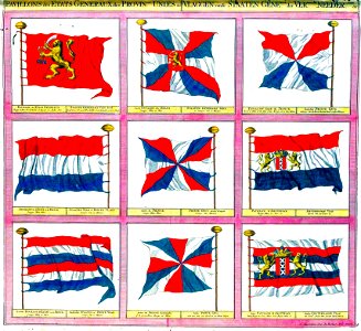
flag charts
national library of portugal
john outhett
18th-century french nautical charts
joseph roux
kantharos harbour (piraeus)
maps of piraeus
media contributed by the frick collection
naïve art
admiralty charts region b: england wales ireland english channel southern north sea
admiralty charts 1001-1200
18th-century french nautical charts
red and yellow
le neptune francois
flag charts
eran laor cartographic collection
tranquillo mollo
eran laor cartographic collection
tranquillo mollo
18th-century french nautical charts
old maps of thessaloniki
admiralty charts region d: eastern north sea baltic norway iceland faroes svalbard
admiralty charts 3001-3400
admiralty charts region r: usa and mexico west coasts
admiralty charts 401-600
a & c black general atlas of the world
1850s maps of the world
eran laor cartographic collection
tranquillo mollo
postcard production
color charts
admiralty charts 2001-2200
westport, county mayo
charts and maps of the royal museums greenwich
1777 maps of new york (state)
admiralty charts region r: usa and mexico west coasts
admiralty charts 1801-2000
bohnenberger (crater)
beaumont (crater)
postcard production
color charts
svg calligraphy
calligraphy
charts and maps of the royal museums greenwich
1590 maps
lawrence h. slaughter collection of english maps, charts, globes, books and atlases
maps of nieuw nederland
admiralty charts 2601-2800
blacksod bay
16th-century maps of guyana
old maps of french guiana
postcard production
color charts
old maps of the tuamotus
old maps of polynesia
admiralty charts region t: west indies and central america
admiralty charts 401-600
philip island, norfolk island
views from admiralty charts
18th-century french nautical charts
old maps of lesbos
woodcuts by albrecht dürer in the national gallery of art
german renaissance
the northern hemisphere of the celestial globe by albrecht dürer
german renaissance
mountain height comparison diagrams
andriveau-goujon
views from admiralty charts
richard brydges beechey
cetus (constellation) in art
uranometria
cartouches by willem and johannes blaeu
dutch-language maps
rejang alphabet
alphabet charts
rhyme? and reason?
admiralty charts 1-200
skerries, dublin
admiralty charts 2401-2600
achill head
admiralty charts 1001-1200
avacha bay
eran laor cartographic collection
willem albert bachiene
atlas vingboons
1665
eran laor cartographic collection
willem albert bachiene
chicago and the midwest, newberry library
dill pickle club
chicago and the midwest, newberry library
dill pickle club
temperature-entropy diagrams
carnot cycle
le neptune francois
flag charts
le neptune francois
flag charts
a voyage to abyssinia, and travels into the interior of that country, executed under the orders of the british government in the years 1809 & 1810
john outhett
decorative arts in the louvre - room 564
academic art,rococo revival
le neptune francois
flag charts
le neptune francois
flag charts
avatar (2009 film)
avengers: endgame
views from admiralty charts
richard brydges beechey
maps of cresques family
abraham cresques
admiralty charts 1801-2000
preston, lancashire
voyages and travels to india, ceylon, the red sea, abyssinia, and egypt, vol. 2
henry cooper (engraver)
admiralty charts 1801-2000
maps of tawi-tawi
views from admiralty charts
san francisco bay
maps by claude joseph sauthier
old maps of new york (state)
gilbert-gabriel andriveau-goujon
sigismond himely
18th-century french nautical charts
old maps of lemnos
french presidential election (1974)
romanticism,orientalism
le neptune francois
flag charts
bolyai (crater)
eötvös (crater)
maps of cresques family
abraham cresques
18th-century maps of the mediterranean sea
1745 maps
maps of the gambier islands
admiralty charts 1001-1200
sturm und drang,weimar classicism,age of enlightenment
johann wolfgang von goethe
photographs in the museum of modern art
johann palisa
maps in the library of congress
1750s maps of central america
bodleian maps collection
1610s maps of the world
a voyage to abyssinia, and travels into the interior of that country, executed under the orders of the british government in the years 1809 & 1810
john outhett
a voyage to abyssinia, and travels into the interior of that country, executed under the orders of the british government in the years 1809 & 1810
john outhett
a voyage to abyssinia, and travels into the interior of that country, executed under the orders of the british government in the years 1809 & 1810
john outhett
maps of the turks and caicos islands
1782 maps of the caribbean
chicago and the midwest, newberry library
dill pickle club
the works of j. w. von goethe
pd-scan (pd-scan/pd)
architectural drawings in the yale center for british art
frederick mackenzie
carl friedrich naumann
history of saxony
maps by william home lizars
1810s maps of the world
sharonov (lunar crater)
spencer jones (crater)
the royal navy, a history from the earliest times to present by w. laird clowes
johannes ruysch
a voyage to abyssinia, and travels into the interior of that country, executed under the orders of the british government in the years 1809 & 1810
john outhett
history of saxony
mining in germany
naples, biblioteca nazionale manuscripts
maps of cresques family
chicago and the midwest, newberry library
dill pickle club
charts and maps of the royal museums greenwich
german renaissance
18th-century maps of the baltic sea
1770s maps of sweden
a new chart of the gulf of st. laurence (1790)
bibliothèque nationale de france
a new chart of the gulf of st. laurence (1790)
bibliothèque nationale de france
a new chart of the gulf of st. laurence (1790)
bibliothèque nationale de france
a new chart of the gulf of st. laurence (1790)
bibliothèque nationale de france
a new chart of the gulf of st. laurence (1790)
bibliothèque nationale de france
a new chart of the gulf of st. laurence (1790)
bibliothèque nationale de france
a new chart of the gulf of st. laurence (1790)
bibliothèque nationale de france
a new chart of the gulf of st. laurence (1790)
bibliothèque nationale de france
maps in the library of congress
battle of cherbourg (1864)
meyer's ornament
cross symbols
meyer's ornament
cross symbols
maps in the museo correr
francesco de cesanis
201 - 300 of 1,027
Next page
/ 11