Log in
All resources
Create a design
11 Free Images of 17th Century Maps Of The Malay Archipelago
17th-century maps of southeast asia
maps by willem and johannes blaeu
17th-century maps of south asia
bibliothèque nationale de france
western australia
european maritime exploration of australia
new holland (australia)
melchisédech thévenot
17th-century maps of the indian ocean
135th meridian east
tasman map
old maps of australia
western australia
van langren map of southeast asia
1619 maps of asia
maps of the malay archipelago by mercator-hondius
17th-century maps of the malay archipelago
archipelagus orientalis
asiae nova descriptio, by pieter van der keere
17th-century maps of southeast asia
maps by willem and johannes blaeu
1638 maps of asia
17th-century maps of the malay archipelago
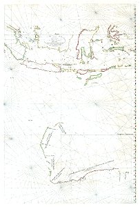
tresor des cartes geographiques (1659)
maps by willem and johannes blaeu
laurens reael
atlas ou representation du monde universel t. 2 (1633)
17th-century maps of southeast asia
maps in the rijksmuseum amsterdam
17th-century maps of south asia
1 - 11 of 11
/ 1


![Treasure of geographical maps of the main states of the universe [...], 1659](https://cdn.creazilla.com/illustrations/10000757788/treasure-of-geographical-maps-of-the-main-states-of-the-universe-1659-md.jpg)

![Gerardi Mercatoris and I. Hondii Atlas or Representation of the Universal World, and of the Parts of It, Made in Tables and Very Ample Descriptions. [t. 2].](https://cdn.creazilla.com/illustrations/10000597422/gerardi-mercatoris-and-i-hondii-atlas-or-representation-of-the-universal-world-and-of-the-parts-of-it-made-in-tables-and-very-ample-descriptions-t-2-md.jpg)
