Log in
All resources
Create a design
36 Free Images of 1783 Maps Of France
bibliothèque nationale de france
atlas géographique des quatre parties du monde (delisle)
maps of spain by tomas lopez
1783 maps of spain
old maps of the province of salamanca
old maps of the province of soria
maps by tomas lopez
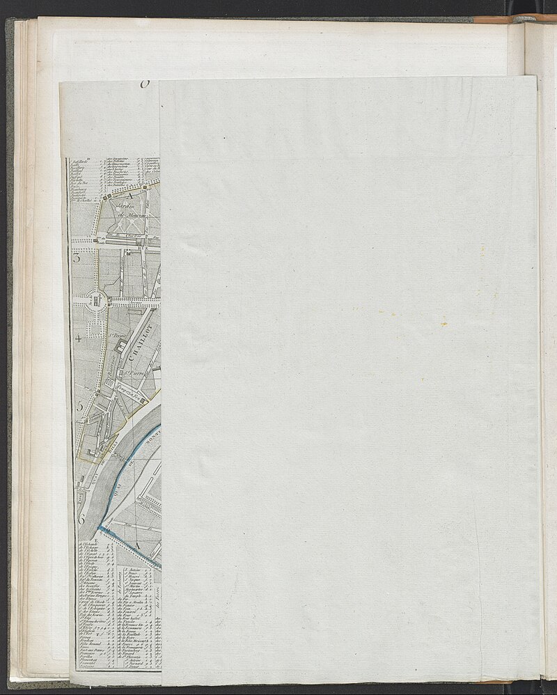
maps of paris from bibliothèque nationale de france
1780s maps of paris
maps of paris in the 1780s
maps of paris from bibliothèque nationale de france
maps of paris by jean lattré
maps of paris from bibliothèque nationale de france
nouveau plan de paris by louis brion de la tour
maps of spain by tomas lopez
1783 maps of spain
maps of spain by tomas lopez
1783 maps of spain
maps of spain by tomas lopez
1783 maps of spain
maps of spain by tomas lopez
1783 maps of spain
1780s maps of cuba
maps by juan lopez
maps of spain by tomas lopez
1783 maps of spain
maps of spain by tomas lopez
1783 maps of spain
maps of spain by tomas lopez
1783 maps of spain
maps of spain by tomas lopez
1783 maps of spain
atlas géographique des quatre parties du monde (delisle)
18th-century maps of the iberian peninsula
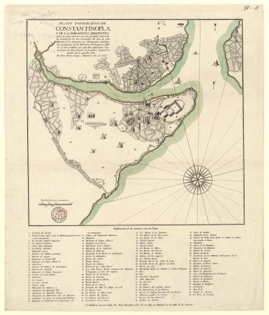
istanbul in the 1780s
maps by tomas lopez
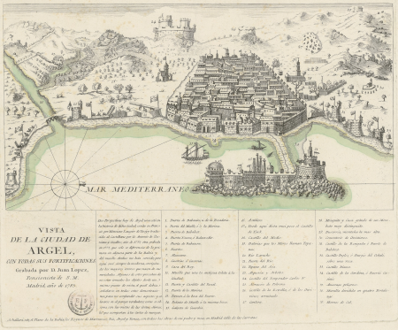
old maps of algiers
maps by juan lopez
first manned hydrogen balloon flight by jacques charles
benoît louis prévost
map of the circle of lower saxony by sanson
bibliothèque nationale de france
map of the circle of bavaria by sanson
bibliothèque nationale de france
atlas géographique des quatre parties du monde (delisle)
18th-century double hemisphere world maps
first manned hydrogen balloon flight by jacques charles
benoît louis prévost
maps of italy by sanson and cordier
bibliothèque nationale de france
bibliothèque nationale de france
maps by tomas lopez
atlas géographique des quatre parties du monde (delisle)
18th-century maps of france
bibliothèque nationale de france
maps by tomas lopez
bibliothèque nationale de france
cartouches by tomas lópez
atlas géographique des quatre parties du monde (delisle)
folded maps
atlas géographique des quatre parties du monde (delisle)
18th-century maps of africa
atlas géographique des quatre parties du monde (delisle)
maps of paris by guillaume delisle
atlas géographique des quatre parties du monde (delisle)
map of italy by guillaume delisle (1700)
atlas géographique des quatre parties du monde (delisle)
18th-century maps of the world
atlas géographique des quatre parties du monde (delisle)
folded maps
atlas géographique des quatre parties du monde (delisle)
map of europe by guillaume delisle (1700)
bibliothèque nationale de france
cartouches by tomas lópez
atlas géographique des quatre parties du monde (delisle)
map of scandinavia by guillaume de l'isle (1706)
atlas géographique des quatre parties du monde (delisle)
map of scandinavia by guillaume de l'isle (1706)
plano de la bahia de argel situada en la costa de africa - explicacion del ataque que executo en esta bahia el ex.mo señor don antonio barcelo, siendo su mayor general el capitan de navio don joseph... - btv1b53238422p
maps by tomas lopez
1779 maps of the united states
1770s maps of the caribbean
1 - 36 of 36
/ 1